The Table
Encyclopedia
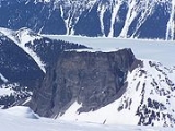
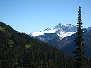
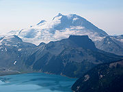
The Table, sometimes called Table Mountain, is a 2021 metres (6,630.6 ft) high flow-dominated andesite
tuya
located 4 kilometres (2 mi) south of Garibaldi Lake
, 15 kilometres (9 mi) northeast of Cheekye
and 5 kilometres (3 mi) north of Mount Garibaldi
, British Columbia
, Canada. It rises over 530 metres (1,738.8 ft) above the surface of Garibaldi Lake
, which lies less than 1 kilometre (0.621372736649807 mi) to the north.
The Table is almost impossible to climb because sections of the volcano have collapsed, creating steep and exceptionally rotten rock walls on all sides. The Teacup Handle on the west edge is an especially interesting feature. The Table has probably not been climbed since 1983.
 The Table is part of the Garibaldi Lake volcanic field, a volcanic field
that includes a group of nine small andesitic stratovolcano
es and basaltic andesite
vents formed during the early Holocene
. This in turn is part of the Garibaldi Volcanic Belt
and of the Cascade Volcanic Arc
that run from southwestern British Columbia to northern California
caused by subduction
of the Juan de Fuca Plate
and Explorer Plate
under the North American Plate
at the Cascadia subduction zone
.
Canadian geologist Bill Mathews
proposed in 1951 that The Table formed when magma
intruded into and melted a vertical pipe in the overlying Cordilleran Ice Sheet
. The partially molten mass of hornblende-phyric andesite cooled as a large block, with gravity flattening its upper surface. Horizontal columns occur at numerous locations along the periphery of the mass. The absence of glacial erosion of the tuya suggests that it erupted during the early Holocene
, just prior to the disappearance of the ice sheet. Similar formations can be found in the Wells Gray-Clearwater volcanic field
, the Northern Cordilleran Volcanic Province
and elsewhere in the Garibaldi Volcanic Belt.
and in Stargate: The Ark of Truth
in which it is the site of the village where the Ark was hidden. The title sequence of the film features The Table, with a graphics overlay of the village superimposed on it, as well as an aerial tour of the Mount Garibaldi
and Tantalus Range
area.

Andesite
Andesite is an extrusive igneous, volcanic rock, of intermediate composition, with aphanitic to porphyritic texture. In a general sense, it is the intermediate type between basalt and dacite. The mineral assemblage is typically dominated by plagioclase plus pyroxene and/or hornblende. Magnetite,...
tuya
Tuya
A tuya is a type of distinctive, flat-topped, steep-sided volcano formed when lava erupts through a thick glacier or ice sheet. They are somewhat rare worldwide, being confined to regions which were covered by glaciers and also had active volcanism during the same time period.-Formation:Tuyas are...
located 4 kilometres (2 mi) south of Garibaldi Lake
Garibaldi Lake
The Garibaldi Lake volcanic field is a volcanic field, located in British Columbia, Canada. It was formed by a group of nine small andesitic stratovolcanoes and basaltic andesite vents in the scenic Garibaldi Lake area immediately north of Mount Garibaldi was formed during the late Pleistocene and...
, 15 kilometres (9 mi) northeast of Cheekye
Cheekye
Cheekye is an unincorporated locality on the Cheakamus River just upstream from its confluence with its parent stream, the Squamish, and just north of Brackendale, British Columbia, which is part of the District of Squamish, British Columbia, Canada....
and 5 kilometres (3 mi) north of Mount Garibaldi
Mount Garibaldi
Mount Garibaldi is a potentially active stratovolcano in the Sea to Sky Country of British Columbia, north of Vancouver, Canada. Located in the southernmost Coast Mountains, it is one of the most recognized peaks in the South Coast region, as well as British Columbia's best known volcano...
, British Columbia
British Columbia
British Columbia is the westernmost of Canada's provinces and is known for its natural beauty, as reflected in its Latin motto, Splendor sine occasu . Its name was chosen by Queen Victoria in 1858...
, Canada. It rises over 530 metres (1,738.8 ft) above the surface of Garibaldi Lake
Garibaldi Lake
The Garibaldi Lake volcanic field is a volcanic field, located in British Columbia, Canada. It was formed by a group of nine small andesitic stratovolcanoes and basaltic andesite vents in the scenic Garibaldi Lake area immediately north of Mount Garibaldi was formed during the late Pleistocene and...
, which lies less than 1 kilometre (0.621372736649807 mi) to the north.
The Table is almost impossible to climb because sections of the volcano have collapsed, creating steep and exceptionally rotten rock walls on all sides. The Teacup Handle on the west edge is an especially interesting feature. The Table has probably not been climbed since 1983.
Geology

Volcanic field
A volcanic field is an area of the Earth's crust that is prone to localized volcanic activity. They usually contain 10 to 100 volcanoes, such as cinder cones and are usually in clusters. Lava flows may also occur...
that includes a group of nine small andesitic stratovolcano
Stratovolcano
A stratovolcano, also known as a composite volcano, is a tall, conical volcano built up by many layers of hardened lava, tephra, pumice, and volcanic ash. Unlike shield volcanoes, stratovolcanoes are characterized by a steep profile and periodic, explosive eruptions...
es and basaltic andesite
Basaltic andesite
Basaltic andesite is a black volcanic rock containing about 55% silica. Minerals in basaltic andesite include olivine, augite and plagioclase. Basaltic andesite can be found in volcanoes around the world, including in Central America and the Andes of South America. Basaltic andesite is common in...
vents formed during the early Holocene
Holocene
The Holocene is a geological epoch which began at the end of the Pleistocene and continues to the present. The Holocene is part of the Quaternary period. Its name comes from the Greek words and , meaning "entirely recent"...
. This in turn is part of the Garibaldi Volcanic Belt
Garibaldi Volcanic Belt
The Garibaldi Volcanic Belt, also called the Canadian Cascade Arc, is a northwest-southeast trending volcanic chain in the Pacific Ranges of the Coast Mountains that extends from Watts Point in the south to the Ha-Iltzuk Icefield in the north. This chain of volcanoes is located in southwestern...
and of the Cascade Volcanic Arc
Cascade Volcanoes
The Cascade Volcanoes are a number of volcanoes in a volcanic arc in western North America, extending from southwestern British Columbia through Washington and Oregon to Northern California, a distance of well over 700 mi ...
that run from southwestern British Columbia to northern California
California
California is a state located on the West Coast of the United States. It is by far the most populous U.S. state, and the third-largest by land area...
caused by subduction
Subduction
In geology, subduction is the process that takes place at convergent boundaries by which one tectonic plate moves under another tectonic plate, sinking into the Earth's mantle, as the plates converge. These 3D regions of mantle downwellings are known as "Subduction Zones"...
of the Juan de Fuca Plate
Juan de Fuca Plate
The Juan de Fuca Plate, named after the explorer of the same name, is a tectonic plate, generated from the Juan de Fuca Ridge, and subducting under the northerly portion of the western side of the North American Plate at the Cascadia subduction zone...
and Explorer Plate
Explorer Plate
The Explorer Plate is an oceanic tectonic plate beneath the Pacific Ocean off the west coast of Vancouver Island, Canada.The eastern boundary of the Explorer Plate is being slowly subducted under the North American Plate, to which it may eventually accrete owing to the slow rate of subduction...
under the North American Plate
North American Plate
The North American Plate is a tectonic plate covering most of North America, Greenland, Cuba, Bahamas, and parts of Siberia, Japan and Iceland. It extends eastward to the Mid-Atlantic Ridge and westward to the Chersky Range in eastern Siberia. The plate includes both continental and oceanic crust...
at the Cascadia subduction zone
Cascadia subduction zone
The Cascadia subduction zone is a subduction zone, a type of convergent plate boundary that stretches from northern Vancouver Island to northern California. It is a very long sloping fault that separates the Juan de Fuca and North America plates.New ocean floor is being created offshore of...
.
Canadian geologist Bill Mathews
Bill Mathews
William Henry Mathews was a Canadian geologist, volcanologist, engineer, and professor. He is considered a pioneer in the study of subglacial eruptions and volcano-ice interactions in North America...
proposed in 1951 that The Table formed when magma
Magma
Magma is a mixture of molten rock, volatiles and solids that is found beneath the surface of the Earth, and is expected to exist on other terrestrial planets. Besides molten rock, magma may also contain suspended crystals and dissolved gas and sometimes also gas bubbles. Magma often collects in...
intruded into and melted a vertical pipe in the overlying Cordilleran Ice Sheet
Cordilleran Ice Sheet
The Cordilleran ice sheet was a major ice sheet that covered, during glacial periods of the Quaternary, a large area of North America. This included the following areas:*Western Montana*The Idaho Panhandle...
. The partially molten mass of hornblende-phyric andesite cooled as a large block, with gravity flattening its upper surface. Horizontal columns occur at numerous locations along the periphery of the mass. The absence of glacial erosion of the tuya suggests that it erupted during the early Holocene
Holocene
The Holocene is a geological epoch which began at the end of the Pleistocene and continues to the present. The Holocene is part of the Quaternary period. Its name comes from the Greek words and , meaning "entirely recent"...
, just prior to the disappearance of the ice sheet. Similar formations can be found in the Wells Gray-Clearwater volcanic field
Wells Gray-Clearwater volcanic field
The Wells Gray-Clearwater volcanic field, also called the Clearwater Cone Group, is a potentially active monogenetic volcanic field in east-central British Columbia, Canada, located approximately north of Kamloops. It is situated in the Cariboo Mountains of the Columbia Mountains and on the...
, the Northern Cordilleran Volcanic Province
Northern Cordilleran volcanic province
The Northern Cordilleran Volcanic Province , formerly known as the Stikine Volcanic Belt, is a geologic province defined by the occurrence of Miocene to Holocene volcanoes in the Pacific Northwest of North America...
and elsewhere in the Garibaldi Volcanic Belt.
In film
The Table is featured in Agent Cody BanksAgent Cody Banks
Agent Cody Banks is an American action comedy film directed by Harald Zwart. Its story follows the adventures of the 15-year-old title character, played by Frankie Muniz, who has to finish his chores, avoid getting grounded, and save the world by going undercover for the CIA as a James Bond type...
and in Stargate: The Ark of Truth
Stargate: The Ark of Truth
Stargate: The Ark of Truth is a 2008 Canadian-American military science fiction film written and directed by Robert C. Cooper. The film is the conclusion of Stargate SG-1 Ori arc, and picks up after the SG-1 series finale, but takes place before the fourth season of Stargate Atlantis. The Ark of...
in which it is the site of the village where the Ark was hidden. The title sequence of the film features The Table, with a graphics overlay of the village superimposed on it, as well as an aerial tour of the Mount Garibaldi
Mount Garibaldi
Mount Garibaldi is a potentially active stratovolcano in the Sea to Sky Country of British Columbia, north of Vancouver, Canada. Located in the southernmost Coast Mountains, it is one of the most recognized peaks in the South Coast region, as well as British Columbia's best known volcano...
and Tantalus Range
Tantalus Range
The Tantalus Range is a small but spectacular subrange of the Pacific Ranges of the Coast Mountains in southern British Columbia, Canada. The range is well-known to travellers to and from the ski resort at Whistler as the stunning vista on the highway to the resort from Squamish.To Sḵwxwú7mesh,...
area.
See also

- Cascade VolcanoesCascade VolcanoesThe Cascade Volcanoes are a number of volcanoes in a volcanic arc in western North America, extending from southwestern British Columbia through Washington and Oregon to Northern California, a distance of well over 700 mi ...
- Garibaldi Volcanic BeltGaribaldi Volcanic BeltThe Garibaldi Volcanic Belt, also called the Canadian Cascade Arc, is a northwest-southeast trending volcanic chain in the Pacific Ranges of the Coast Mountains that extends from Watts Point in the south to the Ha-Iltzuk Icefield in the north. This chain of volcanoes is located in southwestern...
- List of volcanoes in Canada
- Volcanism of Canada
- Volcanism of Western CanadaVolcanism of Western CanadaVolcanism of Western Canada produces lava flows, lava plateaus, lava domes, cinder cones, stratovolcanoes, shield volcanoes, submarine volcanoes, calderas, diatremes and maars, along with examples of more less common volcanic forms such as tuyas and subglacial mounds.-Volcanic belts:*Anahim...

