
Taquaral de Goiás
Encyclopedia
| Taquaral de Goiás | |
|---|---|
| State | Goiás Goiás Goiás is a state of Brazil, located in the central part of the country. The name Goiás comes from the name of an indigenous community... |
| Area: | 201.3 km² |
| Population: | 3,404 (IBGE 2007) |
| Elevation: | 769 m above sea level |
| Postcode (CEP): | 76640-000 |
| IBGE statistical microregion: | Anápolis Microregion Anápolis Microregion The Anápolis Microregion is a region of central Goiás state, Brazil, including municipalities surrounding the city of Anápolis. For a map see *Population: 517,221 inhabitants *Cities: 19*Total Area: 8,386.80 km²... |
| Became a city: | 1963 |
| Distance to Goiânia Goiânia -Climate:The city has a tropical wet and dry climate with an average temperature of . There's a wet season, from October to April, and a dry one, from May to September. Annual rainfall is around 1,520 mm.... : |
95 km |
| Website: | none |
| Coordinates | 16°02′45"S 49°34′17"W |
Town
A town is a human settlement larger than a village but smaller than a city. The size a settlement must be in order to be called a "town" varies considerably in different parts of the world, so that, for example, many American "small towns" seem to British people to be no more than villages, while...
and municipality
Municipality
A municipality is essentially an urban administrative division having corporate status and usually powers of self-government. It can also be used to mean the governing body of a municipality. A municipality is a general-purpose administrative subdivision, as opposed to a special-purpose district...
in central Goiás
Goiás
Goiás is a state of Brazil, located in the central part of the country. The name Goiás comes from the name of an indigenous community...
state, Brazil
Brazil
Brazil , officially the Federative Republic of Brazil , is the largest country in South America. It is the world's fifth largest country, both by geographical area and by population with over 192 million people...
.
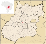
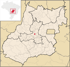
Location
Taquaral is located approximately 100 km. northwest of regional center, AnápolisAnápolis
Anápolis is the third largest city in the State of Goiás in Brazil. It lies in the center of a rich agricultural region and has become a leader in food processing and pharmaceutical plants.-Location and population:...
. It is 22 km. west of Santa Rosa de Goiás
Santa Rosa de Goiás
Santa Rosa de Goiás is a small town and municipality in central Goiás state, Brazil.-Location:Santa Rosa is located 78 km. northwest of the regional center, Anápolis. It is approximately half the distance between Taquaral de Goiás and Petrolina de Goiás. Highway connections are made from...
and 25 km. east of Itaberaí
Itaberaí
Itaberaí is a small city and municipality in central Goiás state, Brazil. Itaberaí is a large producer of agricultural products including corn, rice, soybeans, tomatoes, and sugarcane.-Location:...
. Highway connections from Goiânia
Goiânia
-Climate:The city has a tropical wet and dry climate with an average temperature of . There's a wet season, from October to April, and a dry one, from May to September. Annual rainfall is around 1,520 mm....
are made by state highway GO-070 from Goiânia
Goiânia
-Climate:The city has a tropical wet and dry climate with an average temperature of . There's a wet season, from October to April, and a dry one, from May to September. Annual rainfall is around 1,520 mm....
north to Goianira
Goianira
Goianira is a small city and municipality in central Goiás state, Brazil, located 32 kilometers northwest of the state capital, Goiânia. The population was 24,110 in a total area of 200.4 km² . Goianira is becoming a major producer of shoes.Goianira is four kilometers east of highway BR-457 /...
, past Inhumas
Inhumas
Inhumas is a small city and municipality in central Goiás state, Brazil. The population was 47,361 in a total area of 613.3 km²...
, and Itauçu
Itauçu
Itauçu is a small town and municipality in central Goiás state, Brazil.-Location:Itauçu is located 64 km. northwest of the state capital, Goiânia and is part of the Anápolis Microregion...
and then GO-154 for 16 kilometers. See Sepin for all the state connections.
Neighboring municipalities are Itaberaí
Itaberaí
Itaberaí is a small city and municipality in central Goiás state, Brazil. Itaberaí is a large producer of agricultural products including corn, rice, soybeans, tomatoes, and sugarcane.-Location:...
, Itaguari
Itaguari
Itaguari is a small town and municipality in central Goiás state, Brazil.-Location and Connections:The distance to the state capital is 109 km., while the distance to the regional center is 116 km....
, Santa Rosa de Goiás
Santa Rosa de Goiás
Santa Rosa de Goiás is a small town and municipality in central Goiás state, Brazil.-Location:Santa Rosa is located 78 km. northwest of the regional center, Anápolis. It is approximately half the distance between Taquaral de Goiás and Petrolina de Goiás. Highway connections are made from...
, and Itauçu
Itauçu
Itauçu is a small town and municipality in central Goiás state, Brazil.-Location:Itauçu is located 64 km. northwest of the state capital, Goiânia and is part of the Anápolis Microregion...
Demographics
- Population density: 16.90 inhab/km² (2007)
- Total population in 2007: 3,404
- Total population in 1980: 9,154
- Population growth rate: -0.37% for 1996/2007
- Urban population: 2,698
- Rural population: 706 (4,431 in 1980)
The economy
The economy is based on subsistence agriculture, cattle raising, services, public administration, and small transformation industries. Formerly there were nickel and manganese mines in the area but these have run out. There are several small clothing industries in the town. In the economic sector there were 33 industrial units in 2007 and 29 retail commerce units. There were 288 automobiles registered in 2007.The cattle herd had 25,700 head (5,700 milk cows)in 2006, while the main crops cultivated were pineapple, rice, bananas, coffee, beans, manioc, corn , tomatoes, and soybeans.
Agricultural data 2006
- Number of Farms: 357
- Total area: 16,481 ha
- Area of permanent crops: 273 ha.
- Area of perennial crops: 807 ha.
- Area of natural pasture: 11,156 ha
- Area of woodland and forests: 3,117 ha.
- Persons dependent on farming: 800
- Farms with tractors: 20
- Number of tractors: 25 IBGE
Health and education
In 2006 there were 2 schools with 968 students. The adult literacy rate was 84.6% (2000) (national average was 86.4%). In the health sector there were 2 small hospitals with 41 beds (2007). The infant mortality rate was 28.84 (2000) (national average was 33.On the Municipal Human Development Index
Human Development Index
The Human Development Index is a composite statistic used to rank countries by level of "human development" and separate "very high human development", "high human development", "medium human development", and "low human development" countries...
Taquaral de Goiás scored 0.726 (2000) giving it a state ranking of 158 (out of 242 municipalities)
and a national ranking of 2,506 (out of 5,507 municipalities). For the complete list see frigoletto.com.br
See also
- List of municipalities in Goiás
- Microregions of Goiás