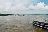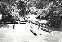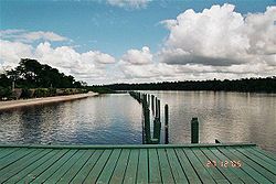
Suriname River
Encyclopedia

Suriname
Suriname , officially the Republic of Suriname , is a country in northern South America. It borders French Guiana to the east, Guyana to the west, Brazil to the south, and on the north by the Atlantic Ocean. Suriname was a former colony of the British and of the Dutch, and was previously known as...
. Its sources are located in the Guiana Highlands on the border between the Wilhelmina Mountains and the Eilerts de Haan Mountains
Eilerts de Haan Mountains
Eilerts de Haan Mountains is a mountain range in Sipaliwini District, Suriname, located at around . It is a southern part of Wilhelmina Mountains and is maximum 986 m high....
(where it is known as the Gran Rio
Gran Rio
Gran Rio is a river of Suriname. From Djumu onwards it is known as the Suriname River.-References:*Rand McNally, The New International Atlas, 1993....
). The river flows below the reservoir along Brokopondo
Brokopondo
Brokopondo is a capital town of the Brokopondo District, Suriname. It is located on the west shore of the Suriname river, just north of the Afobaka dam. Brokopondo can be reached via the road from Paranam to Afobaka. There's a granite monument made by sculptor Jo Rens, displaying two men: one...
, Berg en Dal, the migrant communities Klaaskreek
Klaaskreek
Klaaskreek is a resort in Suriname, located in the Brokopondo District. Its population at the 2004 census was 1,317. Located northeast of Brokopondo, the main town in Reinsdorp. In 2007, a technical training centre in biological agriculture was established at Klaaskreek to teach locals about...
and Nieuw-Lombé, Jodensavanne
Jodensavanne
Jodensavanne was an attempt to establish an autonomous Jewish territory in Suriname, South America.Jodensavanne is located in Para District, about 50 km south of the capital Paramaribo, on the Suriname River....
, Carolina
Carolina, Suriname
Carolina is a resort in Suriname, located in the Para District. Its population at the 2004 census was 220.-References:...
, Ornamibo and Domburg, before reaching the capital Paramaribo
Paramaribo
Paramaribo is the capital and largest city of Suriname, located on banks of the Suriname River in the Paramaribo District. Paramaribo has a population of roughly 250,000 people, more than half of Suriname's population...
on the left bank and Meerzorg
Meerzorg
Meerzorg is a town in Suriname, located on the eastern bank of the Suriname River, directly opposite the capital Paramaribo. Its population at the 2004 census was 8,115. Since 2000 it has been connected to Paramaribo by the Jules Wijdenbosch Bridge, named after the former President Jules...
on the right bank. At Nieuw-Amsterdam
Nieuw Amsterdam, Suriname
Nieuw Amsterdam is the capital of the Commewijne District in Suriname. It is a small coastal town situated at the confluence of the Suriname River and Commewijne River, just across from Paramaribo, the country's capital. Its population at the 2004 census was 5,489, with around 1,200 people living...
it is joined by the Commewijne
Commewijne River
Commewijne River is a river in northern Suriname .It originates in the hills of the Commewijne District and flows northwards until it receives the meandering Cottica River from the right and then runs westward until it unites with the south-north running Suriname River at Nieuw Amsterdam...
and immediately thereafter at the sandspit Braamspunt it flows into the Atlantic Ocean
Atlantic Ocean
The Atlantic Ocean is the second-largest of the world's oceanic divisions. With a total area of about , it covers approximately 20% of the Earth's surface and about 26% of its water surface area...
.
The river has several sets of rapids as well as a few dams, the largest of which is the Afobakadam. The river's flow is interrupted by the Brokopondo Reservoir
Brokopondo Reservoir
The Brokopondo Reservoir, officially named Professor Doctor Ingenieur W. J. van Blommestein Meer, and also called the Brokopondostuwmeer, is a large reservoir in the South American country Suriname. It is named after the Surakarta-born Dutch hydrological engineer Willem Johan van Blommestein...
, which therefore divides the river into two sections. The upstream section runs almost entirely through the Sipaliwini district
Sipaliwini District
Sipaliwini is the largest district of Suriname, located in the south. Sipaliwini does not have a regional capital as it is directly administered by the national government in Paramaribo...
, and the downstream section runs through the Brokopondo
Brokopondo District
Brokopondo is a district of Suriname. Its capital city is Brokopondo; other towns include Brownsweg and Kwakoegron.The district has a population of 8,340, and an area of 7,364 square kilometres....
, Para
Para District
Para is a district of Suriname, in the north. Para's capital city is Onverwacht, with other towns including Paranam, Sabana and Zanderij.Para has a population of 15,120 and an area of 5,393 km²....
, Commewijne
Commewijne District
Commewijne is a district of Suriname, located on the right bank of the Suriname River. Commewijne's capital city is Nieuw Amsterdam. Alliance is another major town.The district has a population of 25,200 and an area of 2,353 km²....
, Wanica
Wanica District
Wanica is a district of Suriname, in the northeast. Wanica's capital city is Lelydorp.Wanica has a population of near 76,320 and an area of 444 km²...
and Paramaribo
Paramaribo District
Paramaribo is a district of Suriname, encompassing the city of Paramaribo and the surrounding area.Paramaribo district has a population of 213,840 and an area 183 km²....
districts.
Navigation
For importImport
The term import is derived from the conceptual meaning as to bring in the goods and services into the port of a country. The buyer of such goods and services is referred to an "importer" who is based in the country of import whereas the overseas based seller is referred to as an "exporter". Thus...
and export
Export
The term export is derived from the conceptual meaning as to ship the goods and services out of the port of a country. The seller of such goods and services is referred to as an "exporter" who is based in the country of export whereas the overseas based buyer is referred to as an "importer"...
, the Suriname is by far the most important river in the country. Not only do all vessels carrying bauxite
Bauxite
Bauxite is an aluminium ore and is the main source of aluminium. This form of rock consists mostly of the minerals gibbsite Al3, boehmite γ-AlO, and diaspore α-AlO, in a mixture with the two iron oxides goethite and hematite, the clay mineral kaolinite, and small amounts of anatase TiO2...
, aluminum oxide and aluminum depart from Suriname via the river, nearly all vessels carrying materials vital for Suriname enter the country at Braamspunt in order to offload their cargoes in the harbours of Paramaribo (immediately south of the city centre), or the harbours of Smalkalden and Paranam
Paranam
Paranam is a town in the Para District, Suriname. It is located at around ....
– approximately 30 km from Paramaribo – which are vital for the aluminum industry. During the Second World War
World War II
World War II, or the Second World War , was a global conflict lasting from 1939 to 1945, involving most of the world's nations—including all of the great powers—eventually forming two opposing military alliances: the Allies and the Axis...
, the 6,000 tonne North German Lloyd cargo ship Goslar was scuttled in the Suriname in order to prevent it from falling into Allied
Allies
In everyday English usage, allies are people, groups, or nations that have joined together in an association for mutual benefit or to achieve some common purpose, whether or not explicit agreement has been worked out between them...
hands. The wreck has never been removed and remains visible in the middle of the river .)
Bridges
In 2000, the Jules Wijdenbosch BridgeJules Wijdenbosch Bridge
The Jules Wijdenbosch Bridge , also called Suriname bridge, is a bridge over the Suriname river between the capital city Paramaribo and Meerzorg in the Commewijne District. The bridge is part of the East-West Link, and is named after former president Jules Wijdenbosch...
at Paramaribo was officially opened by the President, who had commissioned construction of the bridge and after whom it is named. The bridge permits access to the eastern part of the country.
At Carolina
Carolina, Suriname
Carolina is a resort in Suriname, located in the Para District. Its population at the 2004 census was 220.-References:...
, approximately 50 km South of Paramaribo, a wooden bridge crosses the river.
Recreation

Beach
A beach is a geological landform along the shoreline of an ocean, sea, lake or river. It usually consists of loose particles which are often composed of rock, such as sand, gravel, shingle, pebbles or cobblestones...
has been created along the Suriname River. The adjoining strip of water has been protected with nets to allow swimming in the Piranha
Piranha
A piranha or piraña is a member of family Characidae in order Characiformes, an omnivorous freshwater fish that inhabits South American rivers. In Venezuela, they are called caribes...
infested waters. As a result of this and associated recreation facilities, White Beach is a popular weekend destination.

