
Suitland Parkway
Encyclopedia
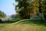
The Suitland Parkway is a parkway
in Washington, D.C.
, and Prince George's County, Maryland
, maintained by the U.S. National Park Service
. Conceived in 1937, it was built during World War II to provide a road connection between military facilities in the Washington, D.C., metropolitan area, and opened on December 9, 1944. It connected Camp Springs (now Andrews Air Force Base
) in Prince George's County with Bolling Air Force Base
and the Pentagon
.
The Suitland Parkway is 9.35 miles (15 km) long. Its eastern terminus is at Pennsylvania Avenue
(Maryland Route 4
), just outside the Capital Beltway
and near Andrews Air Force Base
. Its western terminus is at Interstate 295
and the northbound approach to the Frederick Douglass Memorial Bridge
.
The parkway is listed on the National Register of Historic Places
. It is also part of the National Highway System
. The eastern half was a two-lane limited-access road, and the western half a four-lane divided limited-access road. In the early 1990s the eastern half was doubled in size to match the western half.
in Prince George's County
. No left turns are allowed from Suitland Pkwy at Naylor Rd. Full interchanges are provided at Alabama Ave SE, Branch Ave (Maryland Route 5
), Silver Hill Rd (Maryland Route 458
), Suitland Rd, and the Andrews Air Force Base
North Gate. Additional on-ramps are provided eastbound from Sumner Rd SE near Martin Luther King Ave in D.C., and from Maryland Route 337
. An additional westbound off-ramp to Sheridan Rd SE in D.C. is also provided. There is no direct access between Suitland Parkway and the I-95/I-495 Capital Beltway
. One unsignalized at-grade intersection exists at Meadowview Dr (between Silver Hill Rd and Suitland Rd).
border.
Parkway
The term parkway has several distinct principal meanings and numerous synonyms around the world, for either a type of landscaped area or a type of road.Type of landscaped area:...
in Washington, D.C.
Washington, D.C.
Washington, D.C., formally the District of Columbia and commonly referred to as Washington, "the District", or simply D.C., is the capital of the United States. On July 16, 1790, the United States Congress approved the creation of a permanent national capital as permitted by the U.S. Constitution....
, and Prince George's County, Maryland
Prince George's County, Maryland
Prince George's County is a county located in the U.S. state of Maryland, immediately north, east, and south of Washington, DC. As of 2010, it has a population of 863,420 and is the wealthiest African-American majority county in the nation....
, maintained by the U.S. National Park Service
National Park Service
The National Park Service is the U.S. federal agency that manages all national parks, many national monuments, and other conservation and historical properties with various title designations...
. Conceived in 1937, it was built during World War II to provide a road connection between military facilities in the Washington, D.C., metropolitan area, and opened on December 9, 1944. It connected Camp Springs (now Andrews Air Force Base
Andrews Air Force Base
Joint Base Andrews is a United States military facility located in Prince George's County, Maryland. The facility is under the jurisdiction of the United States Air Force 11th Wing, Air Force District of Washington ....
) in Prince George's County with Bolling Air Force Base
Bolling Air Force Base
Joint Base Anacostia-Bolling is a military installation, located in Southeast Washington, D.C., established on 1 October 2010 in accordance with congressional legislation implementing the recommendations of the 2005 Base Realignment and Closure Commission...
and the Pentagon
The Pentagon
The Pentagon is the headquarters of the United States Department of Defense, located in Arlington County, Virginia. As a symbol of the U.S. military, "the Pentagon" is often used metonymically to refer to the Department of Defense rather than the building itself.Designed by the American architect...
.
The Suitland Parkway is 9.35 miles (15 km) long. Its eastern terminus is at Pennsylvania Avenue
Pennsylvania Avenue
Pennsylvania Avenue is a street in Washington, D.C. that joins the White House and the United States Capitol. Called "America's Main Street", it is the location of official parades and processions, as well as protest marches...
(Maryland Route 4
Maryland Route 4
Maryland Route 4 is a state highway in the U.S. state of Maryland. The state highway runs from MD 5 in Leonardtown north to Southern Avenue at the Washington, D.C. border, past which the highway continues as Pennsylvania Avenue...
), just outside the Capital Beltway
Interstate 495 (Capital Beltway)
Interstate 495 is a Interstate Highway that surrounds the United States' capital of Washington, D.C., and its inner suburbs in adjacent Maryland and Virginia. I-495 is widely known as the Capital Beltway or simply the Beltway, especially when the context of Washington, D.C., is clear...
and near Andrews Air Force Base
Andrews Air Force Base
Joint Base Andrews is a United States military facility located in Prince George's County, Maryland. The facility is under the jurisdiction of the United States Air Force 11th Wing, Air Force District of Washington ....
. Its western terminus is at Interstate 295
Interstate 295 (District of Columbia)
Interstate 295 in the U.S. state of Maryland and in Washington, D.C. is a spur route connecting I-95/I-495 and Maryland Route 210 on the Potomac River to Interstate 695 in downtown Washington.-Route description:Although I-295 technically begins at the Capital Beltway , a pair of mainline...
and the northbound approach to the Frederick Douglass Memorial Bridge
Frederick Douglass Memorial Bridge
The Frederick Douglass Memorial Bridge, otherwise known as the South Capitol Street Bridge, carries South Capitol Street over the Anacostia River in Washington, D.C. It was constructed in 1950 and named after abolitionist Frederick Douglass...
.
The parkway is listed on the National Register of Historic Places
National Register of Historic Places
The National Register of Historic Places is the United States government's official list of districts, sites, buildings, structures, and objects deemed worthy of preservation...
. It is also part of the National Highway System
National Highway System (United States)
The National Highway System is a network of strategic highways within the United States, including the Interstate Highway System and other roads serving major airports, ports, rail or truck terminals, railway stations, pipeline terminals and other strategic transport facilities.Individual states...
. The eastern half was a two-lane limited-access road, and the western half a four-lane divided limited-access road. In the early 1990s the eastern half was doubled in size to match the western half.
Access Points
Traffic signals exist at Firth Sterling Ave and Stanton Rd in D.C., and at Naylor Rd, Forestville Rd, and Maryland Route 4Maryland Route 4
Maryland Route 4 is a state highway in the U.S. state of Maryland. The state highway runs from MD 5 in Leonardtown north to Southern Avenue at the Washington, D.C. border, past which the highway continues as Pennsylvania Avenue...
in Prince George's County
Prince George's County, Maryland
Prince George's County is a county located in the U.S. state of Maryland, immediately north, east, and south of Washington, DC. As of 2010, it has a population of 863,420 and is the wealthiest African-American majority county in the nation....
. No left turns are allowed from Suitland Pkwy at Naylor Rd. Full interchanges are provided at Alabama Ave SE, Branch Ave (Maryland Route 5
Maryland Route 5
Maryland Route 5 is a long state highway that runs north–south in the U.S. state of Maryland. The highway runs from Point Lookout in St. Mary's County north to the Washington, D.C. border in Suitland, Prince George's County....
), Silver Hill Rd (Maryland Route 458
Maryland Route 458
Maryland Route 458 is a state highway in the U.S. state of Maryland. Known as Silver Hill Road, the route runs from Maryland Route 5 in Hillcrest Heights north to Walker Mill Road in District Heights.-Route description:...
), Suitland Rd, and the Andrews Air Force Base
Andrews Air Force Base
Joint Base Andrews is a United States military facility located in Prince George's County, Maryland. The facility is under the jurisdiction of the United States Air Force 11th Wing, Air Force District of Washington ....
North Gate. Additional on-ramps are provided eastbound from Sumner Rd SE near Martin Luther King Ave in D.C., and from Maryland Route 337
Maryland Route 337
Maryland Route 337, Allentown Road, is a short road in Prince George's county, Maryland. It begins at its intersection with Maryland Route 5 and ends at MD Route 4, going east through the communities of Camp Springs and Forestville...
. An additional westbound off-ramp to Sheridan Rd SE in D.C. is also provided. There is no direct access between Suitland Parkway and the I-95/I-495 Capital Beltway
Interstate 495 (Capital Beltway)
Interstate 495 is a Interstate Highway that surrounds the United States' capital of Washington, D.C., and its inner suburbs in adjacent Maryland and Virginia. I-495 is widely known as the Capital Beltway or simply the Beltway, especially when the context of Washington, D.C., is clear...
. One unsignalized at-grade intersection exists at Meadowview Dr (between Silver Hill Rd and Suitland Rd).
Bicycle/Pedestrian Access
There are no paved shoulders along the road, although some locations have a grassy-type shoulder. There is a poorly maintained bicycle and jogging path along the north (westbound) side of the Parkway within D.C.. It begins at the intersection of Sheridan and Pomeroy Roads, Southeast, and runs along the highway to near the Southern Ave overpass on the D.C./Prince George's CountyPrince George's County, Maryland
Prince George's County is a county located in the U.S. state of Maryland, immediately north, east, and south of Washington, DC. As of 2010, it has a population of 863,420 and is the wealthiest African-American majority county in the nation....
border.
External links
- Suitland Parkway, Prince George's County, Inventory No.: PG:76A-22, including photo in 1990, at Maryland Historical Trust website
- Suitland Parkway, from the National Park Service