Stirling, South Australia
Encyclopedia
Stirling is a town located in the Adelaide Hills
. It is administered by the Adelaide Hills Council
. Its population is about 2500, though the town has largely merged with neighbouring townships such as Crafers
and Aldgate
. The towns closely surrounding it are: Aldgate, Crafers, Bridgewater and Heathfield. Out of those five, Stirling is one of the most popular to live in, (although Aldgate has more population and is a larger area.) This is because Stirling has a large main street and has more specific shops.
growing and market gardening
to satisfy the demand of the expanding city of Adelaide
, whose centre is only 15 kilometres from Stirling. It was also developed as a residence for Englishmen who could not cope with Adelaide's hot summers. Today, farming has declined as more of the region has been urbanised, with many Stirling residents commuting to Adelaide daily.
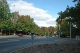
Owing to the wet and mild climate, many deciduous
trees have been imported from Europe
, and these are a major tourist attraction in the autumn. Other tourist sites include the nearby Belair National Park
and Cleland Conservation Park
.

Owing to its location near Mount Lofty
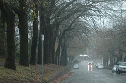
, Stirling is the wettest place in South Australia, receiving an average of 1200 millimetres (47 inches) of rain per year - more than twice the average of Adelaide. Between May and August, the average monthly rainfall is as high as 155 millimetres (over 6 inches), and in June 1916, over 450 millimetres fell. Mean summer temperatures are about 5 °C (9 °F) lower than in Adelaide, which may explain why Stirling was recommended as a residence for English migrants, whilst winters are distinctly fresh, with average maxima of 11 °C (52 °F).
The Australian Bureau of Meteorology stopped the collection of weather data at Stirling from the 1980s onward. Weather recording instruments were removed from the grounds of Australia Post's Stirling office following a commercial dispute between these two Australian government organisations.
and in the federal Division of Mayo
. The local council is the Adelaide Hills Council
(formerly Stirling Council) in the Mt Lofty and Manoah wards.
In 2006, the Adelaide Hills Council
stepped up efforts to relocate the station to Crafers
, against the wants of the volunteers. The council proposed the move in order to sell the land currently inhabited by the CFS station on Avenue road, to fund a new Library. However, in mid 2006 the council elected to sell the land the fire station was on to SAFECOM (The government organisation which owns all Fire Service assets). The new Library started construction anyway, in early 2007 and was completed the following year.
Adelaide Hills
The Adelaide Hills are part of the Mount Lofty Ranges, east of the city of Adelaide in the state of South Australia. It is unofficially centred on the largest town in the area, Mount Barker, which has a population of around 29,000 and is also one of Australia's fastest growing towns.- History :The...
. It is administered by the Adelaide Hills Council
Adelaide Hills Council
Adelaide Hills Council was established in 1997 by the amalgamation of four smaller district councils...
. Its population is about 2500, though the town has largely merged with neighbouring townships such as Crafers
Crafers, South Australia
The town of Crafers is located in the Adelaide Hills to the southeast of Adelaide, South Australia. Although technically considered to be an outer suburb of Adelaide, with many residents commuting to the city to work, locals consider Crafers to be more a suburb of the nearby township of Stirling.-...
and Aldgate
Aldgate, South Australia
Aldgate is a South Australian town located 21 kilometres south-east of Adelaide, in the Adelaide Hills.The town of Aldgate was supposedly named in 1882 after the local hotel the Aldgate Pump, which was named by Richard D. Hawkins, who had additionally opened the nearby Crafers Inn...
. The towns closely surrounding it are: Aldgate, Crafers, Bridgewater and Heathfield. Out of those five, Stirling is one of the most popular to live in, (although Aldgate has more population and is a larger area.) This is because Stirling has a large main street and has more specific shops.
History
Founded in 1888, Stirling grew rapidly as a result of the expansion of appleApple
The apple is the pomaceous fruit of the apple tree, species Malus domestica in the rose family . It is one of the most widely cultivated tree fruits, and the most widely known of the many members of genus Malus that are used by humans. Apple grow on small, deciduous trees that blossom in the spring...
growing and market gardening
Market gardening
A market garden is the relatively small-scale production of fruits, vegetables and flowers as cash crops, frequently sold directly to consumers and restaurants. It is distinguishable from other types of farming by the diversity of crops grown on a small area of land, typically, from under one acre ...
to satisfy the demand of the expanding city of Adelaide
Adelaide
Adelaide is the capital city of South Australia and the fifth-largest city in Australia. Adelaide has an estimated population of more than 1.2 million...
, whose centre is only 15 kilometres from Stirling. It was also developed as a residence for Englishmen who could not cope with Adelaide's hot summers. Today, farming has declined as more of the region has been urbanised, with many Stirling residents commuting to Adelaide daily.
Owing to the wet and mild climate, many deciduous
Deciduous
Deciduous means "falling off at maturity" or "tending to fall off", and is typically used in reference to trees or shrubs that lose their leaves seasonally, and to the shedding of other plant structures such as petals after flowering or fruit when ripe...
trees have been imported from Europe
Europe
Europe is, by convention, one of the world's seven continents. Comprising the westernmost peninsula of Eurasia, Europe is generally 'divided' from Asia to its east by the watershed divides of the Ural and Caucasus Mountains, the Ural River, the Caspian and Black Seas, and the waterways connecting...
, and these are a major tourist attraction in the autumn. Other tourist sites include the nearby Belair National Park
Belair National Park
Belair National Park is a national park in South Australia , 13 km south of Adelaide, covering an 835ha area. It was proclaimed in 1891 and was the first National Park in South Australia, second in Australia and the tenth in the world...
and Cleland Conservation Park
Cleland Conservation Park
Cleland Conservation Park is a conservation park in the Adelaide Hills, South Australia. from Adelaide City centre. Cleland Conservation Park conserves a significant area of natural bushland on the Adelaide Hills face and includes the internationally popular Cleland Wildlife Park and the popular...
.
Climate

Owing to its location near Mount Lofty
Mount Lofty
Mount Lofty is the highest point in the Mount Lofty Ranges. It is located about 15km east of the centre of the city of Adelaide in South Australia and gives unrivalled panoramic views of the city and the Adelaide plains and foothills. It was first climbed by a European when explorer Collet Barker...
, Stirling is the wettest place in South Australia, receiving an average of 1200 millimetres (47 inches) of rain per year - more than twice the average of Adelaide. Between May and August, the average monthly rainfall is as high as 155 millimetres (over 6 inches), and in June 1916, over 450 millimetres fell. Mean summer temperatures are about 5 °C (9 °F) lower than in Adelaide, which may explain why Stirling was recommended as a residence for English migrants, whilst winters are distinctly fresh, with average maxima of 11 °C (52 °F).
The Australian Bureau of Meteorology stopped the collection of weather data at Stirling from the 1980s onward. Weather recording instruments were removed from the grounds of Australia Post's Stirling office following a commercial dispute between these two Australian government organisations.
Government
Stirling is located in the state electorate of HeysenElectoral district of Heysen
Heysen is an electoral district of the House of Assembly in the Australian state of South Australia. It is named after Sir Hans Heysen, a prominent South Australian landscape artist. It is a 616 km² electoral district stretching from residential suburbs in the east and southeast of Adelaide...
and in the federal Division of Mayo
Division of Mayo
The Division of Mayo is an Australian Electoral Division located in the hills, east of Adelaide, South Australia and currently includes the towns of Victor Harbor, Lobethal, Mount Barker, Strathalbyn, Woodside and Kingscote....
. The local council is the Adelaide Hills Council
Adelaide Hills Council
Adelaide Hills Council was established in 1997 by the amalgamation of four smaller district councils...
(formerly Stirling Council) in the Mt Lofty and Manoah wards.
Culture
A prominent landmark in Stirling is the historical Stirling Theatre, home to the Hills Musical Company, Stirling Players and Hills Youth Theatre. Stirling also has a strong affinity with books and has been referred to as South Australia's 'Book Village'. This relates to the close proximity of varied book venues Chapter Two Books, Matilda Bookshop, The Hut Book Shed and the Coventry Memorial Library.Fire Service
The Stirling community is protected from fire, road crash and Hazardous Materials by the Stirling Country Fire Service Volunteers.In 2006, the Adelaide Hills Council
Adelaide Hills Council
Adelaide Hills Council was established in 1997 by the amalgamation of four smaller district councils...
stepped up efforts to relocate the station to Crafers
Crafers, South Australia
The town of Crafers is located in the Adelaide Hills to the southeast of Adelaide, South Australia. Although technically considered to be an outer suburb of Adelaide, with many residents commuting to the city to work, locals consider Crafers to be more a suburb of the nearby township of Stirling.-...
, against the wants of the volunteers. The council proposed the move in order to sell the land currently inhabited by the CFS station on Avenue road, to fund a new Library. However, in mid 2006 the council elected to sell the land the fire station was on to SAFECOM (The government organisation which owns all Fire Service assets). The new Library started construction anyway, in early 2007 and was completed the following year.

