
.gif)
State Highway 7 (Oklahoma)
Encyclopedia
Oklahoma
Oklahoma is a state located in the South Central region of the United States of America. With an estimated 3,751,351 residents as of the 2010 census and a land area of 68,667 square miles , Oklahoma is the 28th most populous and 20th-largest state...
. This lengthy highway connects many towns in Oklahoma's "Little Dixie
Little Dixie (Oklahoma)
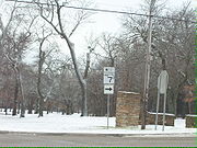
Little Dixie is the name given to the southeast region of Oklahoma, which is heavily influenced by southern "Dixie" culture, as it was settled chiefly by Southerners seeking a start in new lands following the American Civil War...
" area. It runs from Interstate 44 in Lawton
Lawton, Oklahoma
The city of Lawton is the county seat of Comanche County, in the U.S. state of Oklahoma. Located in the southwestern region of Oklahoma approximately southwest of Oklahoma City, it is the principal city of the Lawton Oklahoma Metropolitan Statistical Area...
to U.S. 69/US-75 in Atoka
Atoka, Oklahoma
Atoka is a city in Atoka County, Oklahoma, United States. The population was 3,052 at the 2010 census. It is the county seat of Atoka County.-Geography:Atoka is located at ....
.
Route description
From its western terminus at the interchange with Interstate 44 and Lee Boulevard in LawtonLawton, Oklahoma
The city of Lawton is the county seat of Comanche County, in the U.S. state of Oklahoma. Located in the southwestern region of Oklahoma approximately southwest of Oklahoma City, it is the principal city of the Lawton Oklahoma Metropolitan Statistical Area...
, SH-7 is a multilane highway. It runs due east from Lawton for ten miles (16 km) before intersecting State Highway 65 in the unincorporated community of Pumpkin Center
Pumpkin Center, Comanche County, Oklahoma
Pumpkin Center is an unincorporated community in Comanche County, Oklahoma. It is located at the intersection of State Highway 7 and State Highway 65, about 10 miles east of Lawton, Oklahoma in the southwestern portion of the state....
. It continues due east for 14 more miles on a straight stretch of highway only very slight curves, bypassing the town of Central High
Central High, Oklahoma
Central High is a town in Stephens County, Oklahoma, United States. The population was 954 at the 2000 census.-Geography:Central High is located at ....
, before meeting US-81 north of Duncan
Duncan, Oklahoma
Duncan is a city in Stephens County, Oklahoma, United States. The population was 23,431 at the 2010 census. It is the county seat of Stephens County.The official birthdate of the town is considered to be when the first train arrived there on June 27, 1892...
.
SH-7 and US-81 overlap for 6 miles (9.7 km) through Duncan
Duncan, Oklahoma
Duncan is a city in Stephens County, Oklahoma, United States. The population was 23,431 at the 2010 census. It is the county seat of Stephens County.The official birthdate of the town is considered to be when the first train arrived there on June 27, 1892...
, after which the state highway splits off to the east once again, still as a multilane highway, though it falls to a two-lane road after a few miles. Next the highway passes through the town of Velma
Velma, Oklahoma
Velma is a town in Stephens County, Oklahoma, United States. The population was 664 at the 2000 census.-Geography:Velma is located at .According to the United States Census Bureau, the town has a total area of , all of it land....
before meeting State Highway 76
State Highway 76 (Oklahoma)
State Highway 76, also referred to as SH-76 or OK-76, is a highway maintained by the U.S. state of Oklahoma. It is 110.7 miles long. It runs north–south through central Oklahoma, beginning at Jimtown Road just north of the Red River and ending north of Newcastle at SH-37...
in Ratliff City
Ratliff City, Oklahoma
Ratliff City is a town in Carter County, Oklahoma, United States. The population was 131 at the 2000 census. Ratliff City was named for Ollie Ratliff, owner of a local garage...
. The southern section of SH-74
State Highway 74 (Oklahoma)
State Highway 74, usually abbreviated as SH-74 or OK-74 is the numbering of two different highways maintained by the U.S. state of Oklahoma. These highways were once a single major north–south route, connecting Oklahoma City to more rural parts of the state...
, which roughly mirrors SH-76's path, has its southern terminus at SH-7 seven miles (11 km) later, near Tatums
Tatums, Oklahoma
Tatums is a town in Carter County, Oklahoma, United States. The population was 172 at the 2000 census. It is part of the Ardmore, Oklahoma Micropolitan Statistical Area.-Geography:Tatums is located at ....
.
After crossing Interstate 35, SH-7 becomes a multilane highway once again. Three miles later, it meets US-77 near Davis
Davis, Oklahoma
Davis is a city in Garvin and Murray counties in the U.S. state of Oklahoma. The population was 2,610 at the 2000 census. Davis is the home of the 1979, 1986, 1990, and 1995 Oklahoma State Football Championship teams...
. On the other side of Davis, SH-7 is the northern terminus of SH-110
State Highway 110 (Oklahoma)
State Highway 110, often abbreviated as SH-110 or OK-110, is a two-lane road maintained by the U.S. state of Oklahoma. It is long, connecting SH-7 at its northern end to Dougherty at its southern end. Along the way, it serves the western side of the Lake of the Arbuckles and the Chickasaw National...
, a connector route to the town of Dougherty
Dougherty, Oklahoma
Dougherty is a town in Murray County, Oklahoma, United States. The population was 224 at the 2000 census.-Geography:Dougherty is located at ....
. Two miles west of Sulphur, the highway connects to the southern terminus of the Chickasaw Turnpike
Chickasaw Turnpike
The Chickasaw Turnpike is a short two-lane toll road that is located in the rural south central region of the U.S. state of Oklahoma. It stretches for from west of Sulphur to just south of Ada. The Oklahoma Turnpike Authority owns, maintains, and collects tolls on the turnpike...
, a toll highway to Ada
Ada, Oklahoma
Ada is a city in and the county seat of Pontotoc County, Oklahoma, United States. The population was 16,008 at the 2000 census. As of 2009, the city population was estimated at 17,019....
. After passing through Sulphur
Sulphur, Oklahoma
Sulphur is a city in Murray County, Oklahoma, United States. The population was 4,794 at the 2000 census. It is the county seat of Murray County.-Geography:Sulphur is located at ....
(where it has a brief concurrency with US-177), SH-7 travels six more miles, where it meets Highway 1
State Highway 1 (Oklahoma)
State Highway 1, sometimes abbreviated as SH-1 or OK-1, is a highway maintained by the U.S. state of Oklahoma. It travels through the southeastern part of the state, nicknamed Little Dixie. Because Oklahoma uses odd numbers for east and west highways State Highway 1, sometimes abbreviated as SH-1...
.
For ten miles (16 km), SH-7 and SH-1 overlap, through the town of Mill Creek
Mill Creek, Oklahoma
Mill Creek is a town in Johnston County, Oklahoma, United States. The population was 340 at the 2000 census.-Geography:Mill Creek is located at .According to the United States Census Bureau, the town has a total area of , all of it land.-Demographics:...
. This concurrency ends three miles (5 km) south of Mill Creek, where it serves the unincorporated community of Reagan and the Slippery Falls Boy Scout Ranch. It shares a one-mile (1.6 km) three-route concurrency with US-377/SH-99
State Highway 99 (Oklahoma)
State Highway 99, also referred to as SH-99 or OK-99, is a north–south state highway through central Oklahoma. It runs from the Texas border at Lake Texoma to the Kansas border near Lake Hulah. It is long. The highway overlaps US-377 for over half its length.SH-99 links up with K-99 after...
. Thirteen miles east of the concurrency, it serves the town of Wapanucka, Oklahoma
Wapanucka, Oklahoma
Wapanucka is a town in Johnston County, Oklahoma, United States. The population was 445 at the 2000 census.-Geography:Wapanucka is located at ....
, where it intersects SH-48
State Highway 48 (Oklahoma)
State Highway 48 is a state highway in eastern Oklahoma that runs nearly from Bryan County to Pawnee County. SH-48 has one lettered spur in Johnston County.-Route description:...
. Seventeen miles later, it ends at US-75 in Atoka
Atoka, Oklahoma
Atoka is a city in Atoka County, Oklahoma, United States. The population was 3,052 at the 2010 census. It is the county seat of Atoka County.-Geography:Atoka is located at ....
.
History
SH-7 is a former border to border east–west state highway across southern Oklahoma whose western terminus was at the TexasTexas
Texas is the second largest U.S. state by both area and population, and the largest state by area in the contiguous United States.The name, based on the Caddo word "Tejas" meaning "friends" or "allies", was applied by the Spanish to the Caddo themselves and to the region of their settlement in...
border west of Hollis
Hollis, Oklahoma
-Additional information:Hollis is a close-knit community which only has one stoplight at the corner of Highway 62 and Highway 30, the only two main highways that pass through the town. It features the Hollis Municipal Airport located north of the town on Highway 30 and the Hollis Livestock...
and eastern terminus at the Arkansas
Arkansas
Arkansas is a state located in the southern region of the United States. Its name is an Algonquian name of the Quapaw Indians. Arkansas shares borders with six states , and its eastern border is largely defined by the Mississippi River...
border east of Broken Bow
Broken Bow, Oklahoma
Broken Bow is a city in McCurtain County, Oklahoma, United States. The population was 4,230 at the 2000 census. It is named after Broken Bow, Nebraska, the former hometown of the city's founders, the Dierks brothers.-History:...
. SH-7's route was truncated on its eastern and western sections during the 1960s and 1970s as those were concurrent with US-62 between the Texas border and Lawton
Lawton, Oklahoma
The city of Lawton is the county seat of Comanche County, in the U.S. state of Oklahoma. Located in the southwestern region of Oklahoma approximately southwest of Oklahoma City, it is the principal city of the Lawton Oklahoma Metropolitan Statistical Area...
and with US-70 between Broken Bow and the Arkansas border. The eastern portion of SH-7 that was concurrent with US-70 between Broken Bow and the Arkansas border was truncated in 1963 to its junction with US-70 in Broken Bow. The western section of SH-7 concurrent with US-62 from Lawton to the Texas border was truncated in 1970, when the highway's western terminus was pushed back to the intersection of Cache Road (US-62) and Sheridan Road in Lawton, and a few miles further back in 2003 to its current terminus at Interstate 44 in east Lawton.
Along still-intact sections of SH-7, major route changes through the years include a relocation in Duncan
Duncan, Oklahoma
Duncan is a city in Stephens County, Oklahoma, United States. The population was 23,431 at the 2010 census. It is the county seat of Stephens County.The official birthdate of the town is considered to be when the first train arrived there on June 27, 1892...
during the early 1950s, when the original route along Main Street through the downtown area was moved south of the business district along Bois D'Arc Avenue from US-81 eastward to tie in with the original Main Street route on Duncan's east side, which became SH-7 Alternate and now designated as SH-7 Business. In 1969, the main Bois D'Arc Avenue alignment in Duncan was relocated slightly to the south and the rerouting continued for some 20 miles (32.2 km) from the SH-7/SH-7 Business junction to Velma
Velma, Oklahoma
Velma is a town in Stephens County, Oklahoma, United States. The population was 664 at the 2000 census.-Geography:Velma is located at .According to the United States Census Bureau, the town has a total area of , all of it land....
on a new and straighter alignment (including both multi-lane divided highway and two-lane roadway) that bypassed the old SH-7 alignment through the oil fields of eastern Stephens County along with the town of Velma. In the 1980s, the new SH-7 was extended east of Velma past the small community of County Line on the Stephens–Carter county line to west of Ratliff City
Ratliff City, Oklahoma
Ratliff City is a town in Carter County, Oklahoma, United States. The population was 131 at the 2000 census. Ratliff City was named for Ollie Ratliff, owner of a local garage...
in Carter County.
By 1985, the eastern terminus of SH-7 was pushed back to its intersection with SH-3 and US-69/75 in Atoka
Atoka, Oklahoma
Atoka is a city in Atoka County, Oklahoma, United States. The population was 3,052 at the 2010 census. It is the county seat of Atoka County.-Geography:Atoka is located at ....
when SH-7 was again truncated and lost its concurrency with SH-3 from Atoka to Broken Bow.
Spurs
SH-7 has two spur routes:- SH-7B, also signed as Business SH-7, is the original alignment of SH-7 through Duncan.
- SH-7D is a 3.5 miles (5.6 km) spur to the town of BromideBromide, OklahomaBromide is a town in Coal and Johnston counties in the U.S. state of Oklahoma. The population was 163 at the 2000 census.-Geography:Bromide is located at ....
.