

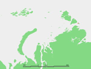
Starokadomsky Island
Encyclopedia
Laptev Sea
The Laptev Sea is a marginal sea of the Arctic Ocean. It is located between the northern coast of Siberia, the Taimyr Peninsula, Severnaya Zemlya and the New Siberian Islands. Its northern boundary passes from the Arctic Cape to a point with co-ordinates of 79°N and 139°E, and ends at the Anisiy...
, Russian Arctic.
It is located off the southeastern end of the Severnaya Zemlya
Severnaya Zemlya
Severnaya Zemlya is an archipelago in the Russian high Arctic at around . It is located off mainland Siberia's Taymyr Peninsula across the Vilkitsky Strait...
archipelago and northeast of the Taymyr Peninsula
Taymyr Peninsula
The Taymyr Peninsula is a peninsula in the Far North of Russia, in the Siberian Federal District, that forms the northernmost part of mainland Eurasia and Asia...
. Maly Taymyr Island
Maly Taymyr Island
Maly Taymyr Island is an island in the Laptev Sea, Russian Arctic.It is located off the southeastern end of the Severnaya Zemlya archipelago and northeast of the Taymyr Peninsula and has a smaller island, Starokadomsky Island, close by on its northwestern side.The area of Maly Taymyr Island is and...
lies on its southeastern side, separated by a 6 km wide sound.
The maximum length of Starokadomsky Island is 18 km and its maximum width only 7 km. It is surrounded by narrow beach ridges and swales. The small detached islands off Starokadomsky's northern end are known as Mayskiye Ostrova.
Ostrov Vesenniy is the easternmost one.
The Vilkitsky Strait
Vilkitsky Strait
Vilkitsky Strait is a strait between the Taimyr Peninsula and Bolshevik Island in the Severnaya Zemlya archipelago. The strait connects the Kara and Laptev Seas. The length of the Vilkitsky Strait is 104 km, the width – approx. 55 km, and the depth – between 32 and 210 m. It is...
runs south of Starokadomsky and Maly Taymyr. Its waters, as well as the waters surrounding the two islands, are covered with pack ice during the long and bitter winters. There are many ice floes even in the short summer, between June and September.
Starokadomsky Island belongs to the Krasnoyarsk Krai
Krasnoyarsk Krai
Krasnoyarsk Krai is a federal subject of Russia . It is the second largest federal subject after the Sakha Republic, and Russia's largest krai, occupying an area of , which is 13% of the country's total territory. The administrative center of the krai is the city of Krasnoyarsk...
administrative division of the Russian Federation and is part of the Great Arctic State Nature Reserve
Great Arctic State Nature Reserve
The Great Arctic State Nature Reserve is a nature reserve in Krasnoyarsk Krai, Russia...
– the largest nature reserve of Russia and one of the biggest in the world.
Starokadomsky Island was discovered by Boris Vilkitsky
Boris Vilkitsky
Boris Andreyevich Vilkitsky was a Russian hydrographer and surveyor. He was the son of Andrey Ippolitovich Vilkitsky....
in 1913. It was named after Dr. Leonid Starokadomsky, one of the leaders of the Arctic Ocean Hydrographic Expedition.