
St. Johns, Arizona
Encyclopedia
St. Johns is the county seat
of Apache County, Arizona
, United States. It is located along U.S. Route 180
, mostly west of where that highway intersects with U.S. Route 191
. According to 2006 Census Bureau estimates, the population of the city was 3,538.
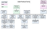
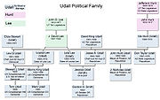
. In 1880 a group of Mormons lead by David King Udall
settled on the land and named the place Salem.
St. Johns has been the county seat for almost all of the county's history. When the county was created on February 24, 1879, Snowflake
was designated the county seat. After the first election in fall 1879, county government was set up in St. Johns, though it was moved again in 1880, to Springerville
; in 1882 St. Johns again became the county seat, and it has remained so ever since.
One of the city's schoolchildren, an eight-year-old boy, was in the news in November 2008 when he was charged with two counts of premeditated murder
, accused of killing his father and another man with a .22-caliber rifle
.
in northeast Arizona
. According to the United States Census Bureau
, the city has a total area of 6.6 square miles (17.1 km²), all of it land.
, and 3.49% from two or more races. Hispanic or Latino of any race were 23.19% of the population.
There were 989 households out of which 44.3% had children under the age of 18 living with them, 66.7% were married couples living together, 10.8% had a female householder with no husband present, and 18.6% were non-families. 15.9% of all households were made up of individuals and 6.2% had someone living alone who was 65 years of age or older. The average household size was 3.19 and the average family size was 3.55.
In the city the age distribution of the population shows 35.5% under the age of 18, 8.4% from 18 to 24, 24.0% from 25 to 44, 21.7% from 45 to 64, and 10.4% who were 65 years of age or older. The median age was 31 years. For every 100 females there were 101.2 males. For every 100 females age 18 and over, there were 100.1 males.
The median income for a household in the city was $35,215, and the median income for a family was $37,478. Males had a median income of $38,477 versus $24,009 for females. The per capita income
for the city was $13,331. About 12.5% of families and 15.3% of the population were below the poverty line, including 18.2% of those under age 18 and 10.8% of those age 65 or over.
Isaacson Building,
Lower Zuni River Archeological District,
Lyman Lake Rock Art Site, and
Rattlesnake Point Pueblo.
St. Johns is near the Placerias Quarry, the site where dozens of Placerias
fossils were discovered in 1930 by Charles Camp and Samuel Welles, of the University of California, Berkeley
.
St. Johns is along the shortest and most scenic route from Phoenix to Albuquerque, New Mexico
. Within an hour's drive from St. John's are Apache-Sitgreaves National Forest
, Petrified Forest National Park
, the Painted Desert
, and Lyman Lake State Park, as well as Indian reservation
s such as the Navajo Nation
, Fort Apache Indian Reservation
, San Carlos Apache Indian Reservation
, and Zuni Indian Reservation
.
. The city is served by Coronado Elementary School, St. Johns Middle School, and St. Johns High School
. The city is home to the St Johns Center of Northland Pioneer College
.
County seat
A county seat is an administrative center, or seat of government, for a county or civil parish. The term is primarily used in the United States....
of Apache County, Arizona
Apache County, Arizona
-2010:Whereas according to the 2010 U.S. Census Bureau:*23.3% White*0.2% Black*72.9% Native American*0.3% Asian*0.0% Native Hawaiian or Pacific Islander*2.0% Two or more races*1.3% Other races*5.8% Hispanic or Latino -2000:...
, United States. It is located along U.S. Route 180
U.S. Route 180
U.S. Route 180 is an east–west United States highway. Like many three-digit routes, US 180 no longer meets its "parent", US 80. US 80 was decommissioned west of Mesquite, Texas, and was replaced in Texas by Interstate 20 and Interstate 10. The highway's eastern terminus is in Hudson Oaks,...
, mostly west of where that highway intersects with U.S. Route 191
U.S. Route 191
U.S. Route 191 is a spur of U.S. Route 91 that has two branches. The southern branch runs for 1,465 miles from Douglas, Arizona on the Mexican border to the southern part of Yellowstone National Park. The northern branch runs for 440 miles from the northern part of Yellowstone National Park to...
. According to 2006 Census Bureau estimates, the population of the city was 3,538.
History
St. Johns was first settled in 1873 by the Barth Brothers. They were bought out in 1879 by Ammon M. TenneyAmmon M. Tenney
Ammon Meshach Tenney was an American Mormon missionary and colonizer in Arizona, New Mexico and Mexico, who taught the message of The Church of Jesus Christ of Latter-day Saints to such peoples as the Zunis and the Isleta Pueblos, baptizing hundreds...
. In 1880 a group of Mormons lead by David King Udall
David King Udall
David King Udall, Sr. was a representative to the Arizona Territorial Legislature and the founder of the Udall political family. His great-grandsons Mark and Tom currently represent the Colorado and New Mexico in the United States Senate, respectively.-Childhood years:David King Udall was born in...
settled on the land and named the place Salem.
St. Johns has been the county seat for almost all of the county's history. When the county was created on February 24, 1879, Snowflake
Snowflake, Arizona
Snowflake is a town in Navajo County, Arizona, United States. It was founded in 1878 by Erastus Snow and William Jordan Flake, Mormon pioneers and colonizers. According to 2006 Census Bureau estimates, the population of the town is 4,958....
was designated the county seat. After the first election in fall 1879, county government was set up in St. Johns, though it was moved again in 1880, to Springerville
Springerville, Arizona
Springerville is a town in Apache County, Arizona, United States within the White Mountains. Its postal ZIP code is 85938. According to 2006 Census Bureau estimates, the population of the town is 1,956.Springerville sits at an elevation of 6,974 feet...
; in 1882 St. Johns again became the county seat, and it has remained so ever since.
One of the city's schoolchildren, an eight-year-old boy, was in the news in November 2008 when he was charged with two counts of premeditated murder
Premeditated murder
Premeditated murder is the crime of wrongfully causing the death of another human being after rationally considering the timing or method of doing so, in order to either increase the likelihood of success, or to evade detection or apprehension.State laws in the United States vary as to definitions...
, accused of killing his father and another man with a .22-caliber rifle
.22 Long Rifle
The .22 Long Rifle rimfire cartridge is a long established variety of ammunition, and in terms of units sold is still by far the most common in the world today. The cartridge is often referred to simply as .22 LR and various rifles, pistols, revolvers, and even some smoothbore shotguns have...
.
Geography
St. Johns is located at 34°30′7"N 109°22′18"W (34.501921, -109.371543), in the White MountainsWhite Mountains (Arizona)
The White Mountains of Arizona are a mountain range and mountainous region in the eastern part of the state, near the border with New Mexico; it is a continuation from the west of the Arizona transition zone–Mogollon Rim, with the Rim ending in western New Mexico...
in northeast Arizona
Northeast Arizona
Northeast Arizona is a region of the U.S. state of Arizona commonly including Apache County and Navajo County. Some notable towns there are St. Johns, Eagar, Holbrook, Show Low, Winslow, Window Rock, Fort Defiance, Ganado, Chinle, and Kayenta....
. According to the United States Census Bureau
United States Census Bureau
The United States Census Bureau is the government agency that is responsible for the United States Census. It also gathers other national demographic and economic data...
, the city has a total area of 6.6 square miles (17.1 km²), all of it land.
Demographics
As of the census of 2000, there were 3,269 people, 989 households, and 805 families residing in the city. The population density was 494.8 people per square mile (190.9/km²). There were 1,392 housing units at an average density of 210.7 per square mile (81.3/km²). The racial makeup of the city was 80.48% White, 0.37% African American, 6.24% Native American, 0.28% Asian, 0.03% Pacific Islander, 9.12% from other racesRace (United States Census)
Race and ethnicity in the United States Census, as defined by the Federal Office of Management and Budget and the United States Census Bureau, are self-identification data items in which residents choose the race or races with which they most closely identify, and indicate whether or not they are...
, and 3.49% from two or more races. Hispanic or Latino of any race were 23.19% of the population.
There were 989 households out of which 44.3% had children under the age of 18 living with them, 66.7% were married couples living together, 10.8% had a female householder with no husband present, and 18.6% were non-families. 15.9% of all households were made up of individuals and 6.2% had someone living alone who was 65 years of age or older. The average household size was 3.19 and the average family size was 3.55.
In the city the age distribution of the population shows 35.5% under the age of 18, 8.4% from 18 to 24, 24.0% from 25 to 44, 21.7% from 45 to 64, and 10.4% who were 65 years of age or older. The median age was 31 years. For every 100 females there were 101.2 males. For every 100 females age 18 and over, there were 100.1 males.
The median income for a household in the city was $35,215, and the median income for a family was $37,478. Males had a median income of $38,477 versus $24,009 for females. The per capita income
Per capita income
Per capita income or income per person is a measure of mean income within an economic aggregate, such as a country or city. It is calculated by taking a measure of all sources of income in the aggregate and dividing it by the total population...
for the city was $13,331. About 12.5% of families and 15.3% of the population were below the poverty line, including 18.2% of those under age 18 and 10.8% of those age 65 or over.
Attractions
St. Johns is home to the Apache County Historical Society Museum and has four National Register of Historic Places:Isaacson Building,
Lower Zuni River Archeological District,
Lyman Lake Rock Art Site, and
Rattlesnake Point Pueblo.
St. Johns is near the Placerias Quarry, the site where dozens of Placerias
Placerias
Placerias was a dicynodont that lived during the late Carnian age of the Triassic Period...
fossils were discovered in 1930 by Charles Camp and Samuel Welles, of the University of California, Berkeley
University of California, Berkeley
The University of California, Berkeley , is a teaching and research university established in 1868 and located in Berkeley, California, USA...
.
St. Johns is along the shortest and most scenic route from Phoenix to Albuquerque, New Mexico
Albuquerque, New Mexico
Albuquerque is the largest city in the state of New Mexico, United States. It is the county seat of Bernalillo County and is situated in the central part of the state, straddling the Rio Grande. The city population was 545,852 as of the 2010 Census and ranks as the 32nd-largest city in the U.S. As...
. Within an hour's drive from St. John's are Apache-Sitgreaves National Forest
Apache-Sitgreaves National Forest
The Apache-Sitgreaves National Forest is a United States National Forest which runs along the Mogollon Rim and the White Mountains in east-central Arizona and extending into New Mexico, USA. Both forests are managed as one unit by USDA Forest Service from the forest headquarters in Springerville,...
, Petrified Forest National Park
Petrified Forest National Park
Petrified Forest National Park is a United States national park in Navajo and Apache counties in northeastern Arizona. The park's headquarters are about east of Holbrook along Interstate 40 , which parallels a railroad line, the Puerco River, and historic U.S. Route 66, all crossing the park...
, the Painted Desert
Painted Desert, Arizona
The Painted Desert is a area of badlands located in Northern Arizona in the United States. The Arizona desert stretches from the Grand Canyon National Park into the Petrified Forest National Park and runs roughly astride and just north of the Little Colorado and the Puerco Rivers...
, and Lyman Lake State Park, as well as Indian reservation
Indian reservation
An American Indian reservation is an area of land managed by a Native American tribe under the United States Department of the Interior's Bureau of Indian Affairs...
s such as the Navajo Nation
Navajo Nation
The Navajo Nation is a semi-autonomous Native American-governed territory covering , occupying all of northeastern Arizona, the southeastern portion of Utah, and northwestern New Mexico...
, Fort Apache Indian Reservation
Fort Apache Indian Reservation
The Fort Apache Indian Reservation is an Indian reservation in Arizona, United States, encompassing parts of Navajo, Gila, and Apache counties. It is home to the federally recognized White Mountain Apache Tribe of the Fort Apache Reservation, a Western Apache tribe. It has a land area of 2,627.608...
, San Carlos Apache Indian Reservation
San Carlos Apache Indian Reservation
The San Carlos Apache Indian Reservation, in southeastern Arizona, United States, was established in 1871 as a reservation for the Chiricahua Apache tribe. It was referred to by some as "Hell's Forty Acres," due to a myriad of dismal health and environmental conditions.-Formation:President U.S....
, and Zuni Indian Reservation
Zuni Indian Reservation
The Zuni Indian Reservation is the homeland of the Zuni tribe of Native Americans. It lies in the Zuni River valley and is located primarily in McKinley and Cibola counties in western New Mexico, about west of Albuquerque. There are also several smaller non-contiguous sections in Apache County,...
.
Notable residents
- Rex E. LeeRex E. LeeRex Edwin Lee from St. Johns, Arizona was a Constitutional lawyer, a law clerk for former U.S. Supreme Court Justice Byron White, and the United States Solicitor General under the Reagan administration. He argued 59 cases before the U.S. Supreme Court...
: U.S. Solicitor General - Brady UdallBrady UdallBrady Udall is an American novelist. In 2010, he was appointed Writer-in-Residence of Idaho, a position he will hold until 2013.-Biography:Udall grew up in a large Mormon family in St. Johns, Arizona. He graduated from Brigham Young University and later attended the Iowa Writers' Workshop at the...
: Writer - David King UdallDavid King UdallDavid King Udall, Sr. was a representative to the Arizona Territorial Legislature and the founder of the Udall political family. His great-grandsons Mark and Tom currently represent the Colorado and New Mexico in the United States Senate, respectively.-Childhood years:David King Udall was born in...
: Politician - Mo UdallMo UdallMorris King "Mo" Udall was an American politician who served as a U.S. Representative from Arizona from May 2, 1961 to May 4, 1991...
: Politician - Stewart UdallStewart UdallStewart Lee Udall was an American politician. After serving three terms as a congressman from Arizona, he served as Secretary of the Interior from 1961 to 1969, under Presidents John F. Kennedy and Lyndon B...
: Politician - Morris Udall: Politician
Primary and secondary schools
St. Johns is served by the St. Johns Unified School DistrictSt. Johns Unified School District
St. Johns Unified School District is a school district headquartered in St. Johns, Arizona.The district's schools include Coronado Elementary School, St. Johns Middle School, and St. Johns High School.-External links:*...
. The city is served by Coronado Elementary School, St. Johns Middle School, and St. Johns High School
St. Johns High School (Arizona)
St. Johns High School is a high school in St. Johns, Arizona. It is the only high school under the jurisdiction of the St. Johns Unified School District, which also includes Coronado Elementary School and a middle school....
. The city is home to the St Johns Center of Northland Pioneer College
Northland Pioneer College
Northland Pioneer College is a regionally accredited, publicly supported, comprehensive community college serving a large and diverse area in Navajo County, Arizona...
.
Public libraries
The Apache County Library District has its headquarters facility and the St. Johns Public Library in St. Johns.See also
- The Church of Jesus Christ of Latter-day Saints in ArizonaThe Church of Jesus Christ of Latter-day Saints in ArizonaAs of October 2010, The Church of Jesus Christ of Latter-day Saints reported 381,235 members in 794 Congregations in Arizona, with 4 missions and 3 temples.-Mormon Battalion:...
External links
- City of St. Johns
- St Johns Regional Chamber of CommerceChamber of commerceA chamber of commerce is a form of business network, e.g., a local organization of businesses whose goal is to further the interests of businesses. Business owners in towns and cities form these local societies to advocate on behalf of the business community...