

U.S. Route 180
Encyclopedia
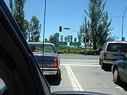
U.S. Route 180 is an east–west United States highway. Like many three-digit routes, US 180 no longer meets its "parent", US 80. US 80 was decommissioned west of Mesquite, Texas
, and was replaced in Texas
by Interstate 20
and Interstate 10
. The highway's eastern terminus is in Hudson Oaks, Texas
, (west of Fort Worth
, near Weatherford
) at an intersection with Interstate 20
. Its western terminus is unclear. Signage at an intersection with State Route 64 in Tusayan, Arizona
40 miles (64 km) northwest of Flagstaff
indicates that the route ends at SR 64, which is consistent with the AASHTO U.S. Highway logs. However, many maps continue the US 180 designation to the south rim of the Grand Canyon
at Grand Canyon Village
.
|AZ
|292
|470
|-
|NM (Southwest)
|248
|399
|-
|TX (Trans-Pecos)
|146
|235
|-
|NM (Southeast)
|110
|180
|-
|TX (Northwest)
|339
|546
|-
|Total
|1135
|1827
|}
Four National Parks can be accessed on the highway, Grand Canyon National Park
, Petrified Forest National Park
, Guadalupe Mountains National Park
, and Carlsbad Caverns National Park
. It also passes through the San Francisco Peaks
, the highest mountains in Arizona.
 In Flagstaff
, US 180 is concurrent
with Interstate 40 Business, U.S. Route 89, and historic U.S. Route 66 for a short distance through the city. US 180 joins the former routing of Route 66 in the center of Flagstaff and follows the roadway to where it merges with Interstate 40 east of the city. From the western terminus of the overlap, the intersection with eastbound Interstate 40 is two miles (3 km) to the east, and the intersection with westbound Interstate 40 and with Interstate 17 is three miles (5 km) to the southwest.
Route 180 shares numbering with Interstate 40 from Flagstaff, Arizona
, to Holbrook, Arizona
, but briefly splits itself going through Winslow, Arizona
, past Standin' on the Corner Park
. In Winslow, both the Interstate Highway and two parallel city streets are signed US 180.
US 180 follows Interstate 40 Business in Holbrook, Arizona
and follows South Navajo Boulevard. Shortly after following South Navajo Boulevard, however, US 180 follows a South-Southeast route, running by the Petrified Forest National Park
and continuing South-Southeast to and through a small branch of the Zuni Indian Reservation
, to St. Johns, Apache County, Arizona where it meets U.S. Route 191. After meeting up with US 191, US 180 continues south to the town of Eagar, Arizona
where the two routes enter the Apache National Forest
and finally split at the town of Alpine, Arizona
, roughly 4–6 miles from the Arizona-New Mexico border.
from just East of Alpine, Arizona
, US 180 continues south until Silver City, New Mexico
. From Silver City, US 180 travels just east for roughly 4–6 miles, meeting up with State Roads 90 and 152. US 180 now travels southeast for roughly 50 miles (80.5 km) to Deming, New Mexico
where US 180 meets up with Interstate 10
. From Deming, US 180 follows Interstate 10
through Las Cruces, New Mexico
and enters Texas
at Anthony, New Mexico
. The route is concurrent with Interstate 10 through the west and central portions of El Paso, Texas
and separates from I-10 at Paisano Drive, joining U.S. Route 62
. US 62/180 is concurrent with Montana Avenue in East Central El Paso (after the intersection with Paisano Drive). US 62/180 then travels east, going past the spur RM 2775
(which goes north to Hueco Tanks
) through the southern end of the Guadalupe Mountains National Park
(90 miles east of El Paso), and past the southern face of Guadalupe Peak
(the highest point in Texas) towards New Mexico
and Carlsbad Caverns National Park
. Continuing though Carlsbad, New Mexico
, US 180 and US 62 travels toward Texas
running through Hobbs, New Mexico
, and exiting New Mexico just east of Hobbs.
US 180 is now a divided highway west of Carlsbad where it used to be a two lane highway until around 2008. US 180 is a divided highway in the entire state whereas before it was only divided east of Carlsbad. Speed Limit is 65 west and 70 east of Carlsbad to about 15 miles west of Hobbs.
 After re-entering Texas from just east of Hobbs, New Mexico, US 180 splits from US 62 at Seminole, Texas
. US 180 continues eastward running through the towns of:
Lamesa
, Gail
, Snyder
, Roby
, Anson
, Albany
, and Breckenridge
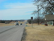
. For the last portion of its length, the road runs through the scenic Palo Pinto Mountains
, exiting them at Metcalf Gap
. Towns in this final portion include Palo Pinto
, Mineral Wells
and Cool
.
US 180 comes into contact with Interstate 20 just east of Weatherford, Texas
and ends in Hudson Oaks, Texas
.
In Texas, US 180 intersects U.S. Highway 385, U.S. Highway 87, U.S. Highway 84, U.S. Highway 83, U.S. Highway 277, U.S. Highway 283, U.S. Highway 183, U.S. Highway 281, and Interstate 20.
, established in 1931. It ran between Springerville, Arizona
and Holbrook, Arizona
, and replaced the former west end of U.S. Route 70
. In 1935, US 260 was extended eastward to U.S. Route 80
near Deming, New Mexico
. In 1962, US 260 entire route became part of a western extension of US 180.
Mesquite, Texas
Mesquite is a city located within the Dallas/Ft.Worth area of Texas. As of the 2010 US Census, the population was 139,824.-History:The city was founded May 22, 1873, by a Texas & Pacific Railway engineer who purchased land along the Texas & Pacific line outside of Dallas...
, and was replaced in Texas
Texas
Texas is the second largest U.S. state by both area and population, and the largest state by area in the contiguous United States.The name, based on the Caddo word "Tejas" meaning "friends" or "allies", was applied by the Spanish to the Caddo themselves and to the region of their settlement in...
by Interstate 20
Interstate 20
Interstate 20 is a major east–west Interstate Highway in the Southern United States. I‑20 runs 1,535 miles from near Kent, Texas, at Interstate 10 to Florence, South Carolina, at Interstate 95...
and Interstate 10
Interstate 10
Interstate 10 is the fourth-longest Interstate Highway in the United States, after I-90, I-80, and I-40. It is the southernmost east–west, coast-to-coast Interstate Highway, although I-4 and I-8 are further south. It stretches from the Pacific Ocean at State Route 1 in Santa Monica,...
. The highway's eastern terminus is in Hudson Oaks, Texas
Hudson Oaks, Texas
Hudson Oaks is a city in Parker County, Texas, United States in the Dallas-Fort Worth Metroplex The population was 1,637 at the 2000 census.-Geography:Hudson Oaks is located at ....
, (west of Fort Worth
Fort Worth, Texas
Fort Worth is the 16th-largest city in the United States of America and the fifth-largest city in the state of Texas. Located in North Central Texas, just southeast of the Texas Panhandle, the city is a cultural gateway into the American West and covers nearly in Tarrant, Parker, Denton, and...
, near Weatherford
Weatherford, Texas
Weatherford is a city in Parker County, Texas, United States, and a western suburb of Fort Worth. The population was 19,000 at the 2000 census. It is the county seat of Parker County and is part of the Dallas-Fort Worth Metroplex.-Geography:...
) at an intersection with Interstate 20
Interstate 20
Interstate 20 is a major east–west Interstate Highway in the Southern United States. I‑20 runs 1,535 miles from near Kent, Texas, at Interstate 10 to Florence, South Carolina, at Interstate 95...
. Its western terminus is unclear. Signage at an intersection with State Route 64 in Tusayan, Arizona
Tusayan, Arizona
Tusayan is a town in Coconino County, Arizona, United States. Prior to its incorporation in 2010, it was a census-designated place . A resort town near the south entrance to Grand Canyon National Park, Tusayan is served by Grand Canyon National Park Airport...
40 miles (64 km) northwest of Flagstaff
Flagstaff, Arizona
Flagstaff is a city located in northern Arizona, in the southwestern United States. In 2010, the city's population was 65,870. The population of the Metropolitan Statistical Area was at 134,421 in 2010. It is the county seat of Coconino County...
indicates that the route ends at SR 64, which is consistent with the AASHTO U.S. Highway logs. However, many maps continue the US 180 designation to the south rim of the Grand Canyon
Grand Canyon
The Grand Canyon is a steep-sided canyon carved by the Colorado River in the United States in the state of Arizona. It is largely contained within the Grand Canyon National Park, the 15th national park in the United States...
at Grand Canyon Village
Grand Canyon Village, Arizona
Grand Canyon Village is a census-designated place located on the South Rim of the Grand Canyon, in Coconino County, Arizona. Its population was 1,460 at the 2000 Census. Located in Grand Canyon National Park, it is wholly focused on accommodating tourists visiting the canyon...
.
Route description
|-|AZ
|292
|470
|-
|NM (Southwest)
|248
|399
|-
|TX (Trans-Pecos)
|146
|235
|-
|NM (Southeast)
|110
|180
|-
|TX (Northwest)
|339
|546
|-
|Total
|1135
|1827
|}
Four National Parks can be accessed on the highway, Grand Canyon National Park
Grand Canyon National Park
Grand Canyon National Park is the United States' 15th oldest national park and is located in Arizona. Within the park lies the Grand Canyon, a gorge of the Colorado River, considered to be one of the Wonders of the World. The park covers of unincorporated area in Coconino and Mohave counties.Most...
, Petrified Forest National Park
Petrified Forest National Park
Petrified Forest National Park is a United States national park in Navajo and Apache counties in northeastern Arizona. The park's headquarters are about east of Holbrook along Interstate 40 , which parallels a railroad line, the Puerco River, and historic U.S. Route 66, all crossing the park...
, Guadalupe Mountains National Park
Guadalupe Mountains National Park
Guadalupe Mountains National Park is located in the Guadalupe Mountains of West Texas and contains Guadalupe Peak, the highest point in Texas at in elevation. It also contains El Capitan, long used as a landmark by people traveling along the old route later followed by the Butterfield Overland...
, and Carlsbad Caverns National Park
Carlsbad Caverns National Park
Carlsbad Caverns National Park is a United States National Park in the Guadalupe Mountains in southeastern New Mexico. The primary attraction of the park for most visitors is the show cave, Carlsbad Caverns...
. It also passes through the San Francisco Peaks
San Francisco Peaks
The San Francisco Peaks are a volcanic mountain range located in north central Arizona, just north of Flagstaff.The highest summit in the range, Humphreys Peak, is the highest point in the state of Arizona at in elevation. The San Francisco Peaks are the remains of an eroded stratovolcano...
, the highest mountains in Arizona.
Arizona
Flagstaff, Arizona
Flagstaff is a city located in northern Arizona, in the southwestern United States. In 2010, the city's population was 65,870. The population of the Metropolitan Statistical Area was at 134,421 in 2010. It is the county seat of Coconino County...
, US 180 is concurrent
Concurrency (road)
A concurrency, overlap, or coincidence in a road network is an instance of one physical road bearing two or more different highway, motorway, or other route numbers...
with Interstate 40 Business, U.S. Route 89, and historic U.S. Route 66 for a short distance through the city. US 180 joins the former routing of Route 66 in the center of Flagstaff and follows the roadway to where it merges with Interstate 40 east of the city. From the western terminus of the overlap, the intersection with eastbound Interstate 40 is two miles (3 km) to the east, and the intersection with westbound Interstate 40 and with Interstate 17 is three miles (5 km) to the southwest.
Route 180 shares numbering with Interstate 40 from Flagstaff, Arizona
Flagstaff, Arizona
Flagstaff is a city located in northern Arizona, in the southwestern United States. In 2010, the city's population was 65,870. The population of the Metropolitan Statistical Area was at 134,421 in 2010. It is the county seat of Coconino County...
, to Holbrook, Arizona
Holbrook, Arizona
-Historical events:*During 1881 & 1882, railroad tracks were laid down and a railroad station was built. The community was then named Holbrook after the first engineer of the Atlantic and Pacific Railroad...
, but briefly splits itself going through Winslow, Arizona
Winslow, Arizona
-Demographics:As of the census of 2000, there were 9,520 people, 2,754 households, and 1,991 families residing in the city. The population density was 773.1 people per square mile . There were 3,198 housing units at an average density of 259.7 per square mile...
, past Standin' on the Corner Park
Standin' on the Corner Park
Standin' on the Corner Park is a publicly operated park, commemorating the Eagles-Jackson Browne song "Take It Easy". The park contains a two-story trompe-l'œil mural by John Pugh, and a life-size bronze statue of a man standing on a corner, with a guitar...
. In Winslow, both the Interstate Highway and two parallel city streets are signed US 180.
US 180 follows Interstate 40 Business in Holbrook, Arizona
Holbrook, Arizona
-Historical events:*During 1881 & 1882, railroad tracks were laid down and a railroad station was built. The community was then named Holbrook after the first engineer of the Atlantic and Pacific Railroad...
and follows South Navajo Boulevard. Shortly after following South Navajo Boulevard, however, US 180 follows a South-Southeast route, running by the Petrified Forest National Park
Petrified Forest National Park
Petrified Forest National Park is a United States national park in Navajo and Apache counties in northeastern Arizona. The park's headquarters are about east of Holbrook along Interstate 40 , which parallels a railroad line, the Puerco River, and historic U.S. Route 66, all crossing the park...
and continuing South-Southeast to and through a small branch of the Zuni Indian Reservation
Zuni Indian Reservation
The Zuni Indian Reservation is the homeland of the Zuni tribe of Native Americans. It lies in the Zuni River valley and is located primarily in McKinley and Cibola counties in western New Mexico, about west of Albuquerque. There are also several smaller non-contiguous sections in Apache County,...
, to St. Johns, Apache County, Arizona where it meets U.S. Route 191. After meeting up with US 191, US 180 continues south to the town of Eagar, Arizona
Eagar, Arizona
Eagar is a town in Apache County, Arizona, United States. According to 2006 Census Bureau estimates, the population of the town is 4,126.Eagar was first settled in 1871.-Geography:Eagar is located at ....
where the two routes enter the Apache National Forest
Apache National Forest
Apache National Forest was established by the U.S. Forest Service in Arizona and New Mexico on July 1, 1908 with from portions of Black Mesa National Forest. In 1974 entire forest was administratively combined with Sitgreaves National Forest to create Apache-Sitgreaves National Forest...
and finally split at the town of Alpine, Arizona
Alpine, Arizona
Alpine is an unincorporated community in Apache County, Arizona, United States, in Bush Valley in the east central part of the state. Alpine was settled in 1876 by Anderson Bush who built a log house originally known as "Fort Bush". Bush sold his holdings in 1879 to William Maxwell and Fred...
, roughly 4–6 miles from the Arizona-New Mexico border.
New Mexico/Texas (El Paso area)
After entering New MexicoNew Mexico
New Mexico is a state located in the southwest and western regions of the United States. New Mexico is also usually considered one of the Mountain States. With a population density of 16 per square mile, New Mexico is the sixth-most sparsely inhabited U.S...
from just East of Alpine, Arizona
Alpine, Arizona
Alpine is an unincorporated community in Apache County, Arizona, United States, in Bush Valley in the east central part of the state. Alpine was settled in 1876 by Anderson Bush who built a log house originally known as "Fort Bush". Bush sold his holdings in 1879 to William Maxwell and Fred...
, US 180 continues south until Silver City, New Mexico
Silver City, New Mexico
Silver City is a town in Grant County, New Mexico, in the United States. As of the 2000 census, the town population was 10,545. It is the county seat of Grant County. The city is the home of Western New Mexico University.-History:...
. From Silver City, US 180 travels just east for roughly 4–6 miles, meeting up with State Roads 90 and 152. US 180 now travels southeast for roughly 50 miles (80.5 km) to Deming, New Mexico
Deming, New Mexico
Deming is a city in Luna County, New Mexico, United States, located 60 miles west of Las Cruces. The population was 14,116 at the 2000 census. Deming is the county seat and principal town of Luna County.-History:...
where US 180 meets up with Interstate 10
Interstate 10
Interstate 10 is the fourth-longest Interstate Highway in the United States, after I-90, I-80, and I-40. It is the southernmost east–west, coast-to-coast Interstate Highway, although I-4 and I-8 are further south. It stretches from the Pacific Ocean at State Route 1 in Santa Monica,...
. From Deming, US 180 follows Interstate 10
Interstate 10
Interstate 10 is the fourth-longest Interstate Highway in the United States, after I-90, I-80, and I-40. It is the southernmost east–west, coast-to-coast Interstate Highway, although I-4 and I-8 are further south. It stretches from the Pacific Ocean at State Route 1 in Santa Monica,...
through Las Cruces, New Mexico
Las Cruces, New Mexico
Las Cruces, also known as "The City of the Crosses", is the county seat of Doña Ana County, New Mexico, United States. The population was 97,618 in 2010 according to the 2010 Census, making it the second largest city in the state....
and enters Texas
Texas
Texas is the second largest U.S. state by both area and population, and the largest state by area in the contiguous United States.The name, based on the Caddo word "Tejas" meaning "friends" or "allies", was applied by the Spanish to the Caddo themselves and to the region of their settlement in...
at Anthony, New Mexico
Anthony, New Mexico
Anthony is a city in Doña Ana County, New Mexico, USA. The population was 7,904 at the 2000 census. It is located on the New Mexico–Texas state line in the Upper Mesilla Valley, and on Interstate 10, 27 miles south of Las Cruces and 21 miles north of El Paso, Texas...
. The route is concurrent with Interstate 10 through the west and central portions of El Paso, Texas
El Paso, Texas
El Paso, is a city in and the county seat of El Paso County, Texas, United States, and lies in far West Texas. In the 2010 census, the city had a population of 649,121. It is the sixth largest city in Texas and the 19th largest city in the United States...
and separates from I-10 at Paisano Drive, joining U.S. Route 62
U.S. Route 62
U.S. Route 62 runs from the US-Mexico border at El Paso, Texas to Niagara Falls, New York, near the United States-Canada border. It is the only east-west US Route that connects Mexico and Canada.Parts of U.S...
. US 62/180 is concurrent with Montana Avenue in East Central El Paso (after the intersection with Paisano Drive). US 62/180 then travels east, going past the spur RM 2775
Ranch to Market Road 2775
Ranch to Market Road 2775, Ranch Road 2775, or RM 2775 is a Ranch to Market Road in the U.S. state of Texas maintained by the Texas Department of Transportation . The road begins at U.S. Route 62 and U.S. Route 180 at Butterfield in northeast El Paso County east of the city of El Paso...
(which goes north to Hueco Tanks
Hueco Tanks
Hueco Tanks is an area of low mountains in El Paso County, Texas, USA. It is located in a high-altitude desert basin between the Franklin Mountains to the west and the Hueco Mountains to the east. Hueco is a Spanish word meaning hollows and refers to the many water-holding depressions in the...
) through the southern end of the Guadalupe Mountains National Park
Guadalupe Mountains National Park
Guadalupe Mountains National Park is located in the Guadalupe Mountains of West Texas and contains Guadalupe Peak, the highest point in Texas at in elevation. It also contains El Capitan, long used as a landmark by people traveling along the old route later followed by the Butterfield Overland...
(90 miles east of El Paso), and past the southern face of Guadalupe Peak
Guadalupe Peak
Guadalupe Peak is the highest natural point in Texas, with an elevation of . It is located in Guadalupe Mountains National Park, and is part of the Guadalupe Mountains range in southeastern New Mexico and West Texas. The mountain is about east of El Paso and about southwest of Carlsbad, New Mexico...
(the highest point in Texas) towards New Mexico
New Mexico
New Mexico is a state located in the southwest and western regions of the United States. New Mexico is also usually considered one of the Mountain States. With a population density of 16 per square mile, New Mexico is the sixth-most sparsely inhabited U.S...
and Carlsbad Caverns National Park
Carlsbad Caverns National Park
Carlsbad Caverns National Park is a United States National Park in the Guadalupe Mountains in southeastern New Mexico. The primary attraction of the park for most visitors is the show cave, Carlsbad Caverns...
. Continuing though Carlsbad, New Mexico
Carlsbad, New Mexico
Carlsbad is a city in and the county seat of Eddy County, New Mexico, in the United States. As of the 2010 census, the city population was 26,138. Carlsbad is the center of the designated micropolitan area of Carlsbad-Artesia, which has a total population of 55,435...
, US 180 and US 62 travels toward Texas
Texas
Texas is the second largest U.S. state by both area and population, and the largest state by area in the contiguous United States.The name, based on the Caddo word "Tejas" meaning "friends" or "allies", was applied by the Spanish to the Caddo themselves and to the region of their settlement in...
running through Hobbs, New Mexico
Hobbs, New Mexico
Hobbs is a city in Lea County, New Mexico, United States. The population was 28,657 at the 2000 census.Hobbs is the principal city of the Hobbs, New Mexico Micropolitan Statistical Area, which includes all of Lea County.-Geography:...
, and exiting New Mexico just east of Hobbs.
US 180 is now a divided highway west of Carlsbad where it used to be a two lane highway until around 2008. US 180 is a divided highway in the entire state whereas before it was only divided east of Carlsbad. Speed Limit is 65 west and 70 east of Carlsbad to about 15 miles west of Hobbs.
Texas
Seminole, Texas
Seminole is a city in and the county seat of Gaines County in west Texas, United States. The population was 6,430 at the 2010 census. It is the birthplace of Country music singers Larry Gatlin and Tanya Tucker...
. US 180 continues eastward running through the towns of:
Lamesa
Lamesa, Texas
Lamesa is a city in and the county seat of Dawson County, Texas, United States. The population was 9,952 at the 2000 census. Located south of Lubbock on the Llano Estacado, Lamesa was founded in 1903. Most of the economy is based on cattle ranching and cotton farming. The Preston E...
, Gail
Gail, Texas
Gail is a Census Designated Place in Borden County, Texas, United States. Located at the junction of U.S. Highway 180 and Farm to Market Road 669, it is the county seat of Borden County. The town and county are named for Gail Borden, Jr., of Houston, the inventor of condensed milk...
, Snyder
Snyder, Texas
Snyder is a city in and the county seat of Scurry County, Texas, United States. The population was 10,653 at the 2010 census. It is located on Deep Creek, a minor tributary of the Colorado River of Texas. Snyder is approximately 150 km southeast of Lubbock.Located in Snyder is the Scurry County...
, Roby
Roby, Texas
Roby is a city in and the county seat of Fisher County, Texas, United States. The population was 643 at the 2010 census.- History :In 1885, shortly after Fisher County was organized, a dispute arose between business partners from Mississippi and a town called Fisher. Both wanted their land to host...
, Anson
Anson, Texas
Anson is a city in and the county seat of Jones County, Texas, United States. The population was 2,556 at the 2000 census. It is part of the Abilene, Texas Metropolitan Statistical Area...
, Albany
Albany, Texas
Albany is a city in Shackelford County, Texas, United States. The population was 2,034 at the 2010 Census. It is the county seat of Shackelford County.-History:...
, and Breckenridge
Breckenridge, Texas
Breckenridge is a city in Stephens County, Texas, United States. The population was 5,868 at the 2000 census. It is the county seat of Stephens County...
. For the last portion of its length, the road runs through the scenic Palo Pinto Mountains
Palo Pinto Mountains
The term Palo Pinto Mountains properly refers to a specific cuesta-like range of hills in western Palo Pinto County, Texas. The name Palo Pinto roughly translates to "painted stick" in reference to the juniper trees of the area...
, exiting them at Metcalf Gap
Metcalf Gap
Metcalf Gap is a pass through the Palo Pinto Mountains in western Palo Pinto County, Texas. The bluffs of the mountains form an escarpment running southwest to northeast, intersected by the Gap, and rise some 250-300 feet above the pastures to the southeast. The pass itself lies at an elevation...
. Towns in this final portion include Palo Pinto
Palo Pinto, Texas
Palo Pinto is an unincorporated town in Palo Pinto County, Texas, United States. It is the county seat , and has an estimated population of 425.-History:...
, Mineral Wells
Mineral Wells, Texas
Mineral Wells is a city in Palo Pinto and Parker counties in the U.S. state of Texas. The population was 16,946 at the 2000 census. The city is named for mineral springs in the area, which were highly popular in the early 1900s...
and Cool
Cool, Texas
Cool is a town in Parker County, Texas, United States. The population was 162 at the 2000 census.-Geography:Cool is located at .According to the United States Census Bureau, the city has a total area of , all of it land....
.
US 180 comes into contact with Interstate 20 just east of Weatherford, Texas
Weatherford, Texas
Weatherford is a city in Parker County, Texas, United States, and a western suburb of Fort Worth. The population was 19,000 at the 2000 census. It is the county seat of Parker County and is part of the Dallas-Fort Worth Metroplex.-Geography:...
and ends in Hudson Oaks, Texas
Hudson Oaks, Texas
Hudson Oaks is a city in Parker County, Texas, United States in the Dallas-Fort Worth Metroplex The population was 1,637 at the 2000 census.-Geography:Hudson Oaks is located at ....
.
In Texas, US 180 intersects U.S. Highway 385, U.S. Highway 87, U.S. Highway 84, U.S. Highway 83, U.S. Highway 277, U.S. Highway 283, U.S. Highway 183, U.S. Highway 281, and Interstate 20.
- speed limit is 75 mph in Hudspeth and Culberson Counties except through Guadalupe Pass. beginning just over 1/2 mile east of mile marker 52 to the state line at FM 652.
History
U.S. Route 260 was a spur of U.S. Route 60U.S. Route 60
U.S. Route 60 is an east–west United States highway, running from the Atlantic Ocean on the east coast in Virginia to western Arizona. Despite the final "0" in its number, indicating a transcontinental designation, the 1926 route formerly ended in Springfield, Missouri, at its intersection...
, established in 1931. It ran between Springerville, Arizona
Springerville, Arizona
Springerville is a town in Apache County, Arizona, United States within the White Mountains. Its postal ZIP code is 85938. According to 2006 Census Bureau estimates, the population of the town is 1,956.Springerville sits at an elevation of 6,974 feet...
and Holbrook, Arizona
Holbrook, Arizona
-Historical events:*During 1881 & 1882, railroad tracks were laid down and a railroad station was built. The community was then named Holbrook after the first engineer of the Atlantic and Pacific Railroad...
, and replaced the former west end of U.S. Route 70
U.S. Route 70
U.S. Route 70 is an east–west United States highway that runs for 2,385 miles from eastern North Carolina to east-central Arizona. As can be derived from its number, it is a major east–west highway of the Southern and Southwestern United States...
. In 1935, US 260 was extended eastward to U.S. Route 80
U.S. Route 80
U.S. Route 80 is an east–west United States highway, much of which was once part of the early auto trail known as the Dixie Overland Highway. As the "0" in the route number indicates, it was originally a cross-country route, from the Atlantic to the Pacific...
near Deming, New Mexico
Deming, New Mexico
Deming is a city in Luna County, New Mexico, United States, located 60 miles west of Las Cruces. The population was 14,116 at the 2000 census. Deming is the county seat and principal town of Luna County.-History:...
. In 1962, US 260 entire route became part of a western extension of US 180.