
.gif)
Southwest and Southeast Bypasses (Sudbury)
Encyclopedia
The Southwest Bypass and Southeast Bypass are two separately-constructed roads in the city of Greater Sudbury, Ontario
, that form a loop around the southern end of the city's urban core for traffic travelling on Highway 17, a route of the Trans-Canada Highway
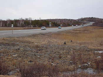
. Most of the route is a Super 2 road with at-grade intersections, with the exception of 1 km of divided freeway at an interchange with Highway 69
, although the remainder of the road is expected to be converted to a freeway within the next decade. With the Northwest Bypass from Lively to Chelmsford, the roads form a partial ring road
around the city's urban core.
.
The Southwest Bypass was opened in 1974 as a local route primarily designed to reduce traffic pressure on the main highway by offering an alternate route into the city from Walden
and points west. The road was considered part of the provincial highway system, although it was designated with a private 7000-series number and was never signed as a provincial highway — only with trailblazers to Highway 69 eastbound and Highway 17 westbound.
When the Highway 17 freeway route through Walden was completed in 1980, the Southwest Bypass terminus in Lively became the freeway's eastern interchange point. The former Highway 17 route through Walden was decommissioned, although the route east of the interchange remained part of Highway 17 until the Southeast Bypass was completed in 1995.
 The Southwest Bypass's western terminus is at the Highway 17 freeway's interchange
with Municipal Road 55. The first kilometre east of the interchange is a transition from the Highway 17 freeway back down to a two-lane highway. The bypass then runs to a folded diamond interchange at Long Lake Road, and then a further 1 km to a parclo interchange with Highway 69, widening to four lanes; at this point the Southwest Bypass ends and the Southeast Bypass begins. The southeast segment runs for approximately 10 km, passing between the Lake Laurentian Conservation Area
and Daisy Lake Uplands Provincial Park. It meets no roads for its entire length (it crosses over but does not interchange with Bancroft Drive), before ending at a signalized intersection with Municipal Road 55 approximately 2 km west of Coniston. Traffic on Highway 17 must turn right to continue on the highway.
A 100-metre right of way has been designated since the 1970s for expansion of the Southwest Bypass to four lanes, which has left the route largely undeveloped despite the fact that it passes quite close to an urbanized part of the city.
The interchange at Highway 69 was constructed as a full freeway interchange in 1995, so as to limit traffic disruption at the junction when the rest of the route is four-laned. The route remains a two-lane roadway at the Long Lake Road interchange — however, the current alignment was built along the new westbound right-of-way, and the original roadbed remains in place for upgrading into the eastbound freeway lanes.
In the Ministry of Transportation's current freeway conversion proposals for the bypass, access will be eliminated to all roads between the junction at Highway 69/Municipal Road 46 and the junction at Municipal Road 55, with the exception of an interchange at Municipal Road 80 (Long Lake Road). The plan has been criticized by municipal councillor Terry Kett, due to the potential for an increased volume of traffic — particularly trucking traffic from the Walden Industrial Park on Fielding Road — spilling into the Mikkola
subdivision.
The final phase of the Highway 400 construction, expected sometime in the mid-2010s, will see a new interchange between Highway 400 and Highway 17 along the southeast section of the bypass, several kilometres to the northeast of the existing Highway 69 interchange.
Any future freeway conversion of Highway 17 past the existing eastern terminus of the bypass route is expected to take place on a new alignment north of Coniston and Wahnapitae.
Ontario
Ontario is a province of Canada, located in east-central Canada. It is Canada's most populous province and second largest in total area. It is home to the nation's most populous city, Toronto, and the nation's capital, Ottawa....
, that form a loop around the southern end of the city's urban core for traffic travelling on Highway 17, a route of the Trans-Canada Highway
Trans-Canada Highway
The Trans-Canada Highway is a federal-provincial highway system that joins the ten provinces of Canada. It is, along with the Trans-Siberian Highway and Australia's Highway 1, one of the world's longest national highways, with the main route spanning 8,030 km...
. Most of the route is a Super 2 road with at-grade intersections, with the exception of 1 km of divided freeway at an interchange with Highway 69
Ontario Highway 69
King's Highway 69, commonly referred to as Highway 69, is a major north–south highway in the central area of the Canadian province of Ontario, linking Highway 400 north of Parry Sound with Sudbury...
, although the remainder of the road is expected to be converted to a freeway within the next decade. With the Northwest Bypass from Lively to Chelmsford, the roads form a partial ring road
Ring road
A ring road, orbital motorway, beltway, circumferential highway, or loop highway is a road that encircles a town or city...
around the city's urban core.
History
Prior to the construction of the bypasses, the Highway 17 designation belonged to what is now Municipal Road 55Greater Sudbury Road 55
Sudbury Municipal Road 55 is a municipal road in the city of Greater Sudbury, Ontario, Canada. Extending from Whitefish to Coniston under a variety of street names, the road's entire length is a former alignment of Highway 17 and the Trans-Canada Highway....
.
The Southwest Bypass was opened in 1974 as a local route primarily designed to reduce traffic pressure on the main highway by offering an alternate route into the city from Walden
Walden, Ontario
Walden was a town in the Canadian province of Ontario, existing from 1973 to 2000. Created as part of the Regional Municipality of Sudbury when regional government was introduced, the town was dissolved when the city of Greater Sudbury was incorporated on January 1, 2001...
and points west. The road was considered part of the provincial highway system, although it was designated with a private 7000-series number and was never signed as a provincial highway — only with trailblazers to Highway 69 eastbound and Highway 17 westbound.
When the Highway 17 freeway route through Walden was completed in 1980, the Southwest Bypass terminus in Lively became the freeway's eastern interchange point. The former Highway 17 route through Walden was decommissioned, although the route east of the interchange remained part of Highway 17 until the Southeast Bypass was completed in 1995.
Route description
Interchange (road)
In the field of road transport, an interchange is a road junction that typically uses grade separation, and one or more ramps, to permit traffic on at least one highway to pass through the junction without directly crossing any other traffic stream. It differs from a standard intersection, at which...
with Municipal Road 55. The first kilometre east of the interchange is a transition from the Highway 17 freeway back down to a two-lane highway. The bypass then runs to a folded diamond interchange at Long Lake Road, and then a further 1 km to a parclo interchange with Highway 69, widening to four lanes; at this point the Southwest Bypass ends and the Southeast Bypass begins. The southeast segment runs for approximately 10 km, passing between the Lake Laurentian Conservation Area
Lake Laurentian Conservation Area
The Lake Laurentian Conservation Area is a conservation area in Greater Sudbury, Ontario. Extending from the southeastern shore of Lake Ramsey to the Southeast Bypass, the park incorporates a large green space, several lakes , a self-guided nature trail, wetland areas, hiking trails, bird watching...
and Daisy Lake Uplands Provincial Park. It meets no roads for its entire length (it crosses over but does not interchange with Bancroft Drive), before ending at a signalized intersection with Municipal Road 55 approximately 2 km west of Coniston. Traffic on Highway 17 must turn right to continue on the highway.
Future construction
The provincial government has announced that the road will be converted to freeway in the 2010s, around the same time that Highway 400 supersedes Highway 69 to Sudbury. The Ministry of Transportation has already prepared and published its preferred plan for the southwest segment; preliminary planning on the southeast segment, from Highway 69 to Coniston with a potential further extension to Markstay, began in fall 2010. A preliminary four-lane plan for the southeast segment, as well as a new connection to Highway 69, was prepared in 1987 as part of the original route plan; however, due to a number of changes in the area, including the four-lane realignment of Highway 69 and the creation of Daisy Lake Uplands Provincial Park, modifications may be needed to the final route plan.A 100-metre right of way has been designated since the 1970s for expansion of the Southwest Bypass to four lanes, which has left the route largely undeveloped despite the fact that it passes quite close to an urbanized part of the city.
The interchange at Highway 69 was constructed as a full freeway interchange in 1995, so as to limit traffic disruption at the junction when the rest of the route is four-laned. The route remains a two-lane roadway at the Long Lake Road interchange — however, the current alignment was built along the new westbound right-of-way, and the original roadbed remains in place for upgrading into the eastbound freeway lanes.
In the Ministry of Transportation's current freeway conversion proposals for the bypass, access will be eliminated to all roads between the junction at Highway 69/Municipal Road 46 and the junction at Municipal Road 55, with the exception of an interchange at Municipal Road 80 (Long Lake Road). The plan has been criticized by municipal councillor Terry Kett, due to the potential for an increased volume of traffic — particularly trucking traffic from the Walden Industrial Park on Fielding Road — spilling into the Mikkola
Walden, Ontario
Walden was a town in the Canadian province of Ontario, existing from 1973 to 2000. Created as part of the Regional Municipality of Sudbury when regional government was introduced, the town was dissolved when the city of Greater Sudbury was incorporated on January 1, 2001...
subdivision.
The final phase of the Highway 400 construction, expected sometime in the mid-2010s, will see a new interchange between Highway 400 and Highway 17 along the southeast section of the bypass, several kilometres to the northeast of the existing Highway 69 interchange.
Any future freeway conversion of Highway 17 past the existing eastern terminus of the bypass route is expected to take place on a new alignment north of Coniston and Wahnapitae.
Interchanges
| km | Intersecting Road(s) | Notes |
|---|---|---|
| 0.0 | Municipal Road 55 | Western terminus of SW bypass, intersecting original Highway 17 alignment. Parclo B4 interchange. |
| Fielding Road / Kantola Road | At-grade intersection. In the current expansion plan, this will become an overpass with no direct access to the freeway. | |
| Southview Drive | At-grade intersection. In the current expansion plan, this will become an underpass with no direct access to the freeway. | |
| Hannah Lake Road | At-grade intersection. In the current expansion plan, access will be restricted to a new service extension of Treeview Road. | |
| Middle Lake Road | At-grade intersection. In the current expansion plan, access will be restricted to a new service extension of Treeview Road. | |
| 9.9 | Long Lake Road (Municipal Road 80) | Parclo B2 interchange with an additional westbound-to-northbound ramp. |
| 13.3 | Highway 69 Ontario Highway 69 King's Highway 69, commonly referred to as Highway 69, is a major north–south highway in the central area of the Canadian province of Ontario, linking Highway 400 north of Parry Sound with Sudbury... / Municipal Road 46 |
Original eastern terminus of bypass until completion in 1995. Meeting point of SW and SE bypass segments. Parclo A2 interchange, with new directional ramps planned for conversion into a Parclo A4. |
| 24.3 | The Kingsway (Municipal Road 55) | Eastern terminus of SE bypass. Traffic must turn to remain on Highway 17. Signalized at-grade intersection. |