
South Hackney
Encyclopedia
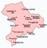
South Hackney is a district in the London Borough of Hackney
situated 4.8 miles (7.7 km) north east of Charing Cross
.
It is immediately north of Victoria Park
and the area centred on Victoria Park Road and Lauriston Road. Sometimes known as Victoria Park Village, particularly by estate agents, to distinguish the residential area from the rest of Hackney.
In Tudor times
, South Hackney consisted of two small settlements. One around the modern Grove and Lauriston Roads; the other where Grove Street and Well Street meet. There were two moated houses, the one on the north side of Well Street belonging to the Knights Hospitaller
in 1416. The house survived into the 18th century, but by then it was in decline and the tenants included chimney sweeps. This is commemorated by the name of the Two Black Boys public house.
In Church Crescent, near the church are six almshouses, created by a bequest from William Monger in 1669, and funded by land on Hackney Marshes
. This land subsequently came into the control of Sir John Cass
. The almshouses were rebuilt in 1849, with funds from Sir John Cass's Foundation.
Victoria Park was laid out between 1842–46, the large Victorian
villas that characterise this area were built soon after. South Hackney originally had a chapel of ease, but became an independent parish in 1825, with the parish church of St John the Baptist erected in 1848.
The area is well served by shops, restaurants and public houses.
 There are no London Underground
stations in the district, but Mile End tube station
, a mile to the south is served by the Hammersmith & City
, District
and Central line
s.
London Borough of Hackney
The London Borough of Hackney is a London borough of North/North East London, and forms part of inner London. The local authority is Hackney London Borough Council....
situated 4.8 miles (7.7 km) north east of Charing Cross
Charing Cross
Charing Cross denotes the junction of Strand, Whitehall and Cockspur Street, just south of Trafalgar Square in central London, England. It is named after the now demolished Eleanor cross that stood there, in what was once the hamlet of Charing. The site of the cross is now occupied by an equestrian...
.
It is immediately north of Victoria Park
Victoria Park, East London
Victoria Park is 86.18 hectares of open space that stretches out across part of the East End of London, England bordering parts of Bethnal Green, Hackney, and Bow, such as along Old Ford Road, London E3 and Victoria Park Road E9. The park is entirely within the London Borough of Tower Hamlets...
and the area centred on Victoria Park Road and Lauriston Road. Sometimes known as Victoria Park Village, particularly by estate agents, to distinguish the residential area from the rest of Hackney.
In Tudor times
Tudor period
The Tudor period usually refers to the period between 1485 and 1603, specifically in relation to the history of England. This coincides with the rule of the Tudor dynasty in England whose first monarch was Henry VII...
, South Hackney consisted of two small settlements. One around the modern Grove and Lauriston Roads; the other where Grove Street and Well Street meet. There were two moated houses, the one on the north side of Well Street belonging to the Knights Hospitaller
Knights Hospitaller
The Sovereign Military Hospitaller Order of Saint John of Jerusalem of Rhodes and of Malta , also known as the Sovereign Military Order of Malta , Order of Malta or Knights of Malta, is a Roman Catholic lay religious order, traditionally of military, chivalrous, noble nature. It is the world's...
in 1416. The house survived into the 18th century, but by then it was in decline and the tenants included chimney sweeps. This is commemorated by the name of the Two Black Boys public house.
In Church Crescent, near the church are six almshouses, created by a bequest from William Monger in 1669, and funded by land on Hackney Marshes
Hackney Marshes
Hackney Marshes is an area of grassland on the western bank of the River Lea in the London Borough of Hackney. It was incorporated into the Lee Valley Park in 1967...
. This land subsequently came into the control of Sir John Cass
Sir John Cass
Sir John Cass was a merchant, politician and philanthropist. He was born in Rosemary Lane, in the City of London. He was the son of Thomas Cass, carpenter to the Royal Ordnance...
. The almshouses were rebuilt in 1849, with funds from Sir John Cass's Foundation.
Victoria Park was laid out between 1842–46, the large Victorian
Victorian era
The Victorian era of British history was the period of Queen Victoria's reign from 20 June 1837 until her death on 22 January 1901. It was a long period of peace, prosperity, refined sensibilities and national self-confidence...
villas that characterise this area were built soon after. South Hackney originally had a chapel of ease, but became an independent parish in 1825, with the parish church of St John the Baptist erected in 1848.
The area is well served by shops, restaurants and public houses.
Transport and locale
London Underground
The London Underground is a rapid transit system serving a large part of Greater London and some parts of Buckinghamshire, Hertfordshire and Essex in England...
stations in the district, but Mile End tube station
Mile End tube station
Mile End is a London Underground station in Tower Hamlets, East London, served by the Hammersmith & City, District and Central Lines. It is in Travelcard Zone 2.-History:...
, a mile to the south is served by the Hammersmith & City
Hammersmith & City Line
The Hammersmith & City line is a subsurface London Underground line. It connects Hammersmith in the west with Barking in the east, running through the northern part of central London. It is coloured salmon pink on the Tube map...
, District
District Line
The District line is a line of the London Underground, coloured green on the Tube map. It is a "sub-surface" line, running through the central area in shallow cut-and-cover tunnels. It is the busiest of the sub-surface lines. Out of the 60 stations served, 25 are underground...
and Central line
Central Line
The Central line is a London Underground line, coloured red on the tube map. It is a deep-level "tube" line, running east-west across London, and, at , has the greatest total length of track of any line on the Underground. Of the 49 stations served, 20 are below ground...
s.