
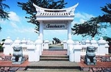
Songkhla
Encyclopedia
Songkhla is a city (thesaban nakhon) in the Songkhla Province
Songkhla Province
Songkhla is one of the southern provinces of Thailand. Neighboring provinces are Satun, Phatthalung, Nakhon Si Thammarat, Pattani and Yala. To the south it borders Kedah and Perlis of Malaysia....
of southern Thailand
Thailand
Thailand , officially the Kingdom of Thailand , formerly known as Siam , is a country located at the centre of the Indochina peninsula and Southeast Asia. It is bordered to the north by Burma and Laos, to the east by Laos and Cambodia, to the south by the Gulf of Thailand and Malaysia, and to the...
, near the border with Malaysia. As of 2006 it had a population of 75,048. The city is a part of Greater Hatyai-Songkhla Metropolitan Area
Greater Hatyai-Songkhla Metropolitan Area
The Greater Hatyai–Songkhla Metropolitan Area is an urban corridor in Southern Thailand's Songkhla Province between two cities--Hat Yai, the commercial center of the province and the region, and Songkhla, the provincial capital. Located 30 km apart, the twin cities are complementary to each...
.
Despite being smaller than the neighboring city Hat Yai
Hat Yai
Hat Yai is a city in southern Thailand near the Malaysian border. Located at , it has a population of 157,359 in the city itself and about 800,000 in the greater Hat Yai area. Hat Yai is the largest city of Songkhla Province, the largest metropolitan area in Southern, and third largest...
, Songkhla is the capital of Songkhla Province as well as the Mueang Songkhla district
Amphoe Mueang Songkhla
Mueang Songkhla is the capital district of Songkhla Province, southern Thailand.-Geography:Neighboring districts are Chana, Na Mom, Hat Yai and Singhanakhon of Songkhla Province...
(Songkhla Town district).
Due to its location at the opening of the big Songkhla lake
Songkhla Lake
The Songkhla lake is the largest natural lake in Thailand, located on the Malay peninsula in the southern part of the country. Covering an area of 1,040 km² it borders the provinces of Songkhla and Phatthalung. Despite being called a lake, this water surface is actually a lagoon complex...
to the Gulf of Thailand
Gulf of Thailand
The Gulf of Thailand , also known in to Malays as Teluk Siam literally meant Gulf of Siam, is a shallow arm of the South China Sea.-Geography:...
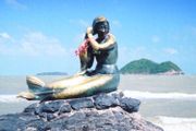
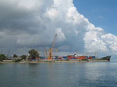
, Songkhla is a fishing town and also an important harbour. It is the major seaport on the east side of the Isthmus of Kra.
Songkhla was sometimes known as Singgora or Singora (City on the Mountain).
History
On December 8, 1941, hours before the bombing of Pearl HarborAttack on Pearl Harbor
The attack on Pearl Harbor was a surprise military strike conducted by the Imperial Japanese Navy against the United States naval base at Pearl Harbor, Hawaii, on the morning of December 7, 1941...
, the Imperial Japanese army
Imperial Japanese Army
-Foundation:During the Meiji Restoration, the military forces loyal to the Emperor were samurai drawn primarily from the loyalist feudal domains of Satsuma and Chōshū...
landed here
Japanese Invasion of Thailand
The Japanese invasion of Thailand occurred on December 8, 1941. It was fought between Thailand and the Empire of Japan. Despite fierce fighting in Southern Thailand, Thai resistance lasted only a few hours before ending in a ceasefire.-Background:...
and proceeded south towards Perlis
Perlis
Perlis is the smallest state in Malaysia. It lies at the northern part of the west coast of Peninsular Malaysia and has Satun and Songkhla Provinces of Thailand on its northern border. It is bordered by the state of Kedah to the south...
and Penang
Penang
Penang is a state in Malaysia and the name of its constituent island, located on the northwest coast of Peninsular Malaysia by the Strait of Malacca. It is bordered by Kedah in the north and east, and Perak in the south. Penang is the second smallest Malaysian state in area after Perlis, and the...
as part of the Malayan campaign
Battle of Malaya
The Malayan Campaign was a campaign fought by Allied and Japanese forces in Malaya, from 8 December 1941 – 31 January 1942 during the Second World War. The campaign was dominated by land battles between British Commonwealth army units, and the Imperial Japanese Army...
which culminated in the capture of Singapore
Battle of Singapore
The Battle of Singapore was fought in the South-East Asian theatre of the Second World War when the Empire of Japan invaded the Allied stronghold of Singapore. Singapore was the major British military base in Southeast Asia and nicknamed the "Gibraltar of the East"...
.
Since 2003 Songhkla has been affected by the Muslim hard-line militant insurgency in neighboring Narathiwat
Narathiwat
Narathiwat is a town in southern Thailand, capital of the Narathiwat Province. The town covers the whole subdistrict Bang Nak of Mueang Narathiwat district. The town was established in 1936.-External links:...
, Pattani
Pattani
Pattani may refer to* Pattani Province, in southern Thailand* Pattani , in southern Thailand* Pattani , which includes the above province** Pattani Kingdom, a former semi-independent kingdom...
, and Yala
Yala Province
Yala is the southernmost province of Thailand. Neighboring provinces are Songkhla, Pattani and Narathiwat. Yala is the only land-locked province in the south of Thailand...
.
Population
Although the majority is Buddhist, there is a large proportion of Muslims in Songkhla, especially in the rural areas fringing the Malaysian border. These Muslims speak a Malay-based language which has some Thai influence in the form of words borrowed from the Thai languageThai language
Thai , also known as Central Thai and Siamese, is the national and official language of Thailand and the native language of the Thai people, Thailand's dominant ethnic group. Thai is a member of the Tai group of the Tai–Kadai language family. Historical linguists have been unable to definitively...
.
Songkhla's district (Amphoe) has five Tambon Administrative Organizations (องค์การบริหารส่วนตำบล). Songkhla town takes up the whole of Bo Yang division.
| No. | Name | Thai | Villages | Inhab. | |
|---|---|---|---|---|---|
| 1. | Bo Yang | ||||
| 74,875 | |||||
| 2. | Khao Rup Chang | 10 | 38,662 | ||
| 3. | Ko Taeo | 9 | 10,608 | ||
| 4. | Phawong | 8 | 24,130 | ||
| 5. | Thung Wang | 10 | 10,343 | ||
| 6. | Ko Yo | 9 | 4,454 |
External links
- http://www.songkhlamun.org Website of city