
Skykomish River
Encyclopedia
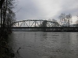
The Skykomish River is a Washington river
which drains the west side of the Cascade Mountains in the southeast section of Snohomish County and the northeast corner of King County
. The river starts with the confluence of the North Fork Skykomish River and South Fork Skykomish River approximately one mile west of Index
, then flowing northwesterly towards Puget Sound
. It is joined by the Sultan River
and the Wallace River
at Sultan
. It then meets the Snoqualmie River
to form the Snohomish River
at Monroe
. The Snohomish River
continues along the river valley eventually dumping into Port Gardner Bay
on Possession Sound
(part of Puget Sound
).
The Skykomish River's main stem
is 29 miles (47 km) long. The length including its headwater tributaries, South Fork Skykomish and Tye River, is 62.4 miles (100 km). The Skykomish's drainage basin
is 834 square miles (2,160.1 km²) in area.
United States Highway 2 and the BNSF Railway
are routed to follow the Skykomish River, South Fork Skykomish, and Tye River
to Stevens Pass
and the Cascade Tunnel
.
The Skykomish is sometimes referred to by the nickname "Sky River" or "The Sky".
According to Fred Beckey
the North Fork and South Fork are about equal in size and neither is clearly the main course of the Skykomish River. However, the South Fork's true source, in terms of streamflow, is the Rapid River
, a tributary of the Beckler River
, which in turn is a tributary of the South Fork Skykomish.
The name "Skykomish" comes from the Northern Lushootseed word /sq'íxʷəbš/, meaning "upriver people", from /q'íxʷ/, "upstream". It is the name of a Southern Coast Salish group.
near Dishpan Gap along the Pacific Crest Trail
. It flows as a small stream off the north slope of Skykomish Peak. The Wild Sky Wilderness
protects tributaries and forests adjacent to the North Fork Skykomish, although not the river itself. The river flows generally in a southwestern direction from its source to its mouth. Just before picking up Goblin Creek, the river flows through a short but impressive canyon and within that canyon the river drops over Deer Falls
. A short ways down from that, the river flows through an even shorter but very twisted and interestingly shaped canyon at Bear Creek Falls
.
and the Foss River
, to the east of Skykomish
. From the confluence the South Fork flows northwest. Near the eastern boundary of the city of Skykomish, the Beckler River
joins it. To the west of the city of Skykomish, the Miller River
joins it. Shortly before converging with the North Fork the river drops over Eagle Falls, followed by Canyon Falls
and then, finally, Sunset Falls
before its confluence with the North Fork.
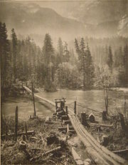 In the 1890s the Great Northern Railway was built along the Skykomish, South Fork Skykomish, and Tye Rivers, crossing the crest of the Cascades at Stevens Pass
. Today the track is owned by BNSF Railway
, known as the Burlington Northern Railroad
from 1970-1995. Stevens Pass is named after the Great Northern surveyor John Frank Stevens
. Two railroad tunnels, both called Cascade Tunnel
, were built at Stevens Pass. The first one was built slightly north of the pass. It was replaced in 1929 with the New Cascade Tunnel, which at 7.8 miles (12.6 km) long was for nearly 60 years the longest railroad tunnel in North America and is still the longest in the United States. The New Cascade Tunnel is a few miles south of Stevens Pass. Its western entrance is near the confluence of Tunnel Creek and the Tye River. A small amount of the water flows out of both tunnels into the Tye River. An interpretive center for the Iron Goat Trail, located at Scenic on the upper Tye River, describes the history of the area including the old railroad and new trail. The interpretive center was built near the site of one of the greatest railroad tragedies in American history, the Wellington Disaster.
One of the Native American trails crossing the Cascades followed the Skykomish and North Fork Skykomish to Cady Pass.
South Fork
River
A river is a natural watercourse, usually freshwater, flowing towards an ocean, a lake, a sea, or another river. In a few cases, a river simply flows into the ground or dries up completely before reaching another body of water. Small rivers may also be called by several other names, including...
which drains the west side of the Cascade Mountains in the southeast section of Snohomish County and the northeast corner of King County
King County, Washington
King County is a county located in the U.S. state of Washington. The population in the 2010 census was 1,931,249. King is the most populous county in Washington, and the 14th most populous in the United States....
. The river starts with the confluence of the North Fork Skykomish River and South Fork Skykomish River approximately one mile west of Index
Index, Washington
Index is a town in Snohomish County, Washington, United States. The population was 178 at the 2010 census.-History:Prior to settlement by westerners, the Skykomish Indians lived in the area between Sultan and Index...
, then flowing northwesterly towards Puget Sound
Puget Sound
Puget Sound is a sound in the U.S. state of Washington. It is a complex estuarine system of interconnected marine waterways and basins, with one major and one minor connection to the Strait of Juan de Fuca and the Pacific Ocean — Admiralty Inlet being the major connection and...
. It is joined by the Sultan River
Sultan River
The Sultan River is a river in Snohomish County in the U.S. state of Washington. It is a tributary of the Skykomish River, which it joins at the town of Sultan, Washington...
and the Wallace River
Wallace River
The Wallace River is a medium sized river in Washington, United States. It is a tributary of the Skykomish River and joins near Sultan, just upstream from the mouth of the Sultan River. The Wallace River is long. Its drainage basin is in area.- Course :...
at Sultan
Sultan, Washington
Sultan is a city in Snohomish County, Washington, United States, located where the Sultan River flows into the Skykomish. The population was 4,651 at the 2010 census. There is an annual 3-day street fair held in July, known as the 'Sultan Shindig'...
. It then meets the Snoqualmie River
Snoqualmie River
The Snoqualmie River is a long river in King County and Snohomish County in the U.S. state of Washington. The river's three main tributaries are the North, Middle, and South Forks, which drain the west side of the Cascade Mountains near the town of North Bend and join near the town of Snoqualmie...
to form the Snohomish River
Snohomish River
The Snohomish River is a river in the U.S. state of Washington, formed by the confluence of the Skykomish and Snoqualmie rivers near Monroe. It flows northwest entering Port Gardner Bay, part of Puget Sound, between Everett and Marysville. The Pilchuck River is its main tributary and joins the...
at Monroe
Monroe, Washington
Monroe is a city in Snohomish County, Washington, United States. The population as of 17,304 at the 2010 census.-History:The history of Monroe is intertwined with that of the Great Northern Railway which pushed over the Cascade Range at Stevens Pass and worked its way down the Skykomish River...
. The Snohomish River
Snohomish River
The Snohomish River is a river in the U.S. state of Washington, formed by the confluence of the Skykomish and Snoqualmie rivers near Monroe. It flows northwest entering Port Gardner Bay, part of Puget Sound, between Everett and Marysville. The Pilchuck River is its main tributary and joins the...
continues along the river valley eventually dumping into Port Gardner Bay
Port Gardner Bay
Port Gardner is an inlet of Possession Sound on which the city of Everett, Washington is located. The Snohomish River flows into the bay.It was named by George Vancouver for his patron and former commander, Alan Gardner. Vancouver meant the name to apply to all of Saratoga Passage, but over time it...
on Possession Sound
Possession Sound
Possession Sound is part of Puget Sound, located in the U.S. state of Washington between Whidbey Island and the coastline of Snohomish County approximately between the cities of Everett and Mukilteo. Possession Sound connects the main Puget Sound basin to the south with Saratoga Passage and Port...
(part of Puget Sound
Puget Sound
Puget Sound is a sound in the U.S. state of Washington. It is a complex estuarine system of interconnected marine waterways and basins, with one major and one minor connection to the Strait of Juan de Fuca and the Pacific Ocean — Admiralty Inlet being the major connection and...
).
The Skykomish River's main stem
Main Stem
"Main Stem" is 1942 instrumental by Duke Ellington and His Famous Orchestra. Although recorded in 1942, the single would not be released until 1944 where it was Duke Ellington's last of four number one's on the Harlem Hit Parade. "Main Stem" would also peak at number twenty on the pop chart"Main...
is 29 miles (47 km) long. The length including its headwater tributaries, South Fork Skykomish and Tye River, is 62.4 miles (100 km). The Skykomish's drainage basin
Drainage basin
A drainage basin is an extent or an area of land where surface water from rain and melting snow or ice converges to a single point, usually the exit of the basin, where the waters join another waterbody, such as a river, lake, reservoir, estuary, wetland, sea, or ocean...
is 834 square miles (2,160.1 km²) in area.
United States Highway 2 and the BNSF Railway
BNSF Railway
The BNSF Railway is a wholly owned subsidiary of Berkshire Hathaway Inc., and is headquartered in Fort Worth, Texas. It is one of seven North American Class I railroads and the second largest freight railroad network in North America, second only to the Union Pacific Railroad, its primary...
are routed to follow the Skykomish River, South Fork Skykomish, and Tye River
Tye River (Washington)
The Tye River is a river in the U.S. state of Washington. It rises near Stevens Pass in the Cascade Mountains and flows west, joining the Foss River to form the South Fork Skykomish River. Its waters eventually empty into Puget Sound near Everett via the Skykomish River and Snohomish River. U.S....
to Stevens Pass
Stevens Pass
Stevens Pass is a mountain pass through the Cascade Mountains located at the border of King County and Chelan County in Washington, United States....
and the Cascade Tunnel
Cascade Tunnel
The Cascade Tunnel refers to two tunnels at Stevens Pass through the Cascade Mountains, approximately to the east of Everett, Washington. The first Cascade Tunnel was a 2.63-mile long single track railroad, built by the Great Northern Railway in 1900 to avoid problems caused by heavy winter...
.
The Skykomish is sometimes referred to by the nickname "Sky River" or "The Sky".
According to Fred Beckey
Fred Beckey
Fred Beckey is an American mountaineer and author, who has made hundreds of first ascents, more than any other North American climber.-Early years:...
the North Fork and South Fork are about equal in size and neither is clearly the main course of the Skykomish River. However, the South Fork's true source, in terms of streamflow, is the Rapid River
Rapid River (Washington)
The Rapid River is a tributary of the Beckler River in the U.S. state of Washington in the United States. It is long, with a drainage basin of ....
, a tributary of the Beckler River
Beckler River
The Beckler River is a tributary of the South Fork Skykomish River in the U.S. state of Washington in the United States.The Beckler River originates near Jack Pass and flows southeast about where it is joined by the Rapid River, its principal tributary...
, which in turn is a tributary of the South Fork Skykomish.
The name "Skykomish" comes from the Northern Lushootseed word /sq'íxʷəbš/, meaning "upriver people", from /q'íxʷ/, "upstream". It is the name of a Southern Coast Salish group.
North Fork
The headwaters of the North Fork Skykomish River are located in the Henry M. Jackson WildernessHenry M. Jackson Wilderness
The Henry M. Jackson Wilderness is a U.S. Wilderness Area in the state of Washington, United States.-History:The Henry M. Jackson Wilderness was created by the 1984 Washington Wilderness Act and named after former US Senator Henry M. Jackson of Washington...
near Dishpan Gap along the Pacific Crest Trail
Pacific Crest Trail
The Pacific Crest Trail is a long-distance mountain hiking and equestrian trail on the Western Seaboard of the United States. The southern terminus is at the California border with Mexico...
. It flows as a small stream off the north slope of Skykomish Peak. The Wild Sky Wilderness
Wild Sky Wilderness
The Wild Sky Wilderness is a wilderness area in the western Cascade Range of Washington state. The wilderness is within the Mount Baker-Snoqualmie National Forest north of the U.S. Highway 2 towns of Index and Skykomish. The wilderness flanks, but does not include, the North Fork Skykomish River...
protects tributaries and forests adjacent to the North Fork Skykomish, although not the river itself. The river flows generally in a southwestern direction from its source to its mouth. Just before picking up Goblin Creek, the river flows through a short but impressive canyon and within that canyon the river drops over Deer Falls
Deer Falls
Deer Falls is the uppermost waterfall on the North Fork Skykomish River. The falls occur within a short but impressive canyon just above the mouth of Goblin Creek....
. A short ways down from that, the river flows through an even shorter but very twisted and interestingly shaped canyon at Bear Creek Falls
Bear Creek Falls
Bear Creek Falls is the final of the two waterfalls on the North Fork Skykomish River. The falls are located within a short, narrow and interestingly shaped canyon....
.
Tributaries of the North Fork
- Pass Creek: Leads to Cady Pass.
- Quartz Creek: Flows from Monte Cristo PeakMonte Cristo PeakMonte Cristo Peak is a mountain peak in the Henry M. Jackson Wilderness in Washington state. Together with Columbia Peak and Kyes Peak it forms a basin that contains Columbia Glacier and Blanca Lake...
, leads to Curry Gap. - Goblin Creek: Flows from Monte Cristo Peak.
- West Cady Creek
- Troublesome Creek: Flows from Monte Cristo Peak, through Blanca Lake, to join the North Fork just below Bear Creek FallsBear Creek FallsBear Creek Falls is the final of the two waterfalls on the North Fork Skykomish River. The falls are located within a short, narrow and interestingly shaped canyon....
. - Silver Creek: Rises near Silvertip Mountain and Poodle Dog Pass, flows by Mineral City, joins North Fork just above Galena (early route to Monte Cristo mining district; both Mineral City and Galena former mining towns).
- Salmon Creek: Joins North Fork just below Galena.
South Fork
The South Fork Skykomish River begins at the confluence of the Tye RiverTye River (Washington)
The Tye River is a river in the U.S. state of Washington. It rises near Stevens Pass in the Cascade Mountains and flows west, joining the Foss River to form the South Fork Skykomish River. Its waters eventually empty into Puget Sound near Everett via the Skykomish River and Snohomish River. U.S....
and the Foss River
Foss River
The Foss River is a stream in the U.S. state of Washington. It has two main forks, the East Fork Foss River and the West Fork Foss River. The main stem is formed by the confluence of the two forks...
, to the east of Skykomish
Skykomish, Washington
As of the census of 2000, there were 214 people, 104 households, and 58 families residing in the town. The population density was 623.2 people per square mile . There were 162 housing units at an average density of 471.8 per square mile...
. From the confluence the South Fork flows northwest. Near the eastern boundary of the city of Skykomish, the Beckler River
Beckler River
The Beckler River is a tributary of the South Fork Skykomish River in the U.S. state of Washington in the United States.The Beckler River originates near Jack Pass and flows southeast about where it is joined by the Rapid River, its principal tributary...
joins it. To the west of the city of Skykomish, the Miller River
Miller River
The Miller River is a river in King County, Washington. Named for 1890s prospector John Miller, it is a tributary of the Skykomish River, which it joins near the community of Miller River . The Miller River is about long from the confluence of its main tributaries, the East Fork and West Fork...
joins it. Shortly before converging with the North Fork the river drops over Eagle Falls, followed by Canyon Falls
Canyon Falls
Canyon Falls is the second of the three waterfalls on the South Fork Skykomish River. The falls occur about halfway between Eagle Falls and Sunset Falls....
and then, finally, Sunset Falls
Sunset Falls
Sunset Falls is the final of the three waterfalls on the South Fork Skykomish River. The falls drop in a long, narrow, powerful chute. The river is thought to attain speeds of an hour and the chute is nearly long...
before its confluence with the North Fork.
Tributaries of the South Fork
- Beckler RiverBeckler RiverThe Beckler River is a tributary of the South Fork Skykomish River in the U.S. state of Washington in the United States.The Beckler River originates near Jack Pass and flows southeast about where it is joined by the Rapid River, its principal tributary...
: Joins just below the river's source.- Rapid RiverRapid River (Washington)The Rapid River is a tributary of the Beckler River in the U.S. state of Washington in the United States. It is long, with a drainage basin of ....
- Rapid River
- Miller RiverMiller RiverThe Miller River is a river in King County, Washington. Named for 1890s prospector John Miller, it is a tributary of the Skykomish River, which it joins near the community of Miller River . The Miller River is about long from the confluence of its main tributaries, the East Fork and West Fork...
: Joins at Miller River. - Money Creek: Joins the South Fork near Grotto.
- Index Creek: Joins South Fork near BaringBaring, WashingtonBaring is a census-designated place in King County, Washington, United States. The population was 220 at the 2010 census. It is located on U.S. Highway 2 about 22 miles west of Stevens Pass, along a very flat and straight three-mile section of highway that's been dubbed the Baring Straight since U.S...
. - Barclay Creek
History
Stevens Pass
Stevens Pass is a mountain pass through the Cascade Mountains located at the border of King County and Chelan County in Washington, United States....
. Today the track is owned by BNSF Railway
BNSF Railway
The BNSF Railway is a wholly owned subsidiary of Berkshire Hathaway Inc., and is headquartered in Fort Worth, Texas. It is one of seven North American Class I railroads and the second largest freight railroad network in North America, second only to the Union Pacific Railroad, its primary...
, known as the Burlington Northern Railroad
Burlington Northern Railroad
The Burlington Northern Railroad was a United States-based railroad company formed from a merger of four major U.S. railroads. Burlington Northern operated between 1970 and 1996....
from 1970-1995. Stevens Pass is named after the Great Northern surveyor John Frank Stevens
John Frank Stevens
John Frank Stevens was an American engineer who built the Great Northern Railway in the United States and was chief engineer on the Panama Canal between 1905 and 1907.- Biography :...
. Two railroad tunnels, both called Cascade Tunnel
Cascade Tunnel
The Cascade Tunnel refers to two tunnels at Stevens Pass through the Cascade Mountains, approximately to the east of Everett, Washington. The first Cascade Tunnel was a 2.63-mile long single track railroad, built by the Great Northern Railway in 1900 to avoid problems caused by heavy winter...
, were built at Stevens Pass. The first one was built slightly north of the pass. It was replaced in 1929 with the New Cascade Tunnel, which at 7.8 miles (12.6 km) long was for nearly 60 years the longest railroad tunnel in North America and is still the longest in the United States. The New Cascade Tunnel is a few miles south of Stevens Pass. Its western entrance is near the confluence of Tunnel Creek and the Tye River. A small amount of the water flows out of both tunnels into the Tye River. An interpretive center for the Iron Goat Trail, located at Scenic on the upper Tye River, describes the history of the area including the old railroad and new trail. The interpretive center was built near the site of one of the greatest railroad tragedies in American history, the Wellington Disaster.
One of the Native American trails crossing the Cascades followed the Skykomish and North Fork Skykomish to Cady Pass.
Recreation
The Skykomish River is used for rafting and kayaking, especially around the Index, WA area during the summer months. The Skykomish River is mostly ranked between Class III and Class III+ rapids, depending on the circumstances and season, but includes Boulder Drop, a class IV+ rapids.Waterfalls
North Fork- Deer FallsDeer FallsDeer Falls is the uppermost waterfall on the North Fork Skykomish River. The falls occur within a short but impressive canyon just above the mouth of Goblin Creek....
- Bear Creek FallsBear Creek FallsBear Creek Falls is the final of the two waterfalls on the North Fork Skykomish River. The falls are located within a short, narrow and interestingly shaped canyon....
South Fork
- Eagle Falls
- Canyon FallsCanyon FallsCanyon Falls is the second of the three waterfalls on the South Fork Skykomish River. The falls occur about halfway between Eagle Falls and Sunset Falls....
- Sunset FallsSunset FallsSunset Falls is the final of the three waterfalls on the South Fork Skykomish River. The falls drop in a long, narrow, powerful chute. The river is thought to attain speeds of an hour and the chute is nearly long...