

Sierra Sur de Oaxaca
Encyclopedia
Sierra Sur is a region in the state of Oaxaca
, Mexico
. It includes the districts of Putla, Sola de Vega, Miahuatlán
and Yautepec. Miahuatlán is the largest city.
The region has 70 municipalities, some very poor, such as Zanizá, Amoltepec and Los Loxichas.
, and includes Quiexoba, the second highest mountain in the state. Forest resources are still important, despite having suffered over-exploitation for decades, and include pines, mixed forests of oak and pine, fir, and areas of hormiguillo cacti.
Fauna include opossums, armadillos, deer, rabbit and gopher.
The climate is varied, ranging from hot and humid to temperate humid. The average temperature is 10°C to 22°C throughout the region. Average rainfall ranges from 800 to 2000mm annually.
Agricultural production includes maize and beans, sugarcane and coffee. Livestock farming mostly consists of backyard breeding of chickens, goats, pigs and mules. Small factories produce castor oil and process mica. The region has deposits of iron and magnetite. Craft products include spirits and mezcal
, palm products and cotton goods.
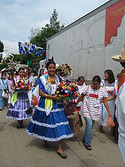 The region's inhabitants are Zapotec, Mixtec
, Chatino
s, Amuzgo
, Triques and mestizos, as well as emigrants from other parts of Mexico.
Since pre-Hispanic times, there has been conflict between rival ethnic groups.
Oaxaca
Oaxaca , , officially Estado Libre y Soberano de Oaxaca is one of the 31 states which, along with the Federal District, comprise the 32 federative entities of Mexico. It is divided into 571 municipalities; of which 418 are governed by the system of customs and traditions...
, Mexico
Mexico
The United Mexican States , commonly known as Mexico , is a federal constitutional republic in North America. It is bordered on the north by the United States; on the south and west by the Pacific Ocean; on the southeast by Guatemala, Belize, and the Caribbean Sea; and on the east by the Gulf of...
. It includes the districts of Putla, Sola de Vega, Miahuatlán
Miahuatlán
Miahuatlán is a Municipality in Veracruz, Mexico. It is located in montane central zone of the State of Veracruz, about 28 km from state capital Xalapa. It has a surface of 20.56 km2. The municipality of Miahuatlán is delimited to the north by Landero y Coss, to the east by Acatlán, to the south...
and Yautepec. Miahuatlán is the largest city.
The region has 70 municipalities, some very poor, such as Zanizá, Amoltepec and Los Loxichas.
Geography
The region is mountainous, along the southern edge of the Sierra Madre del SurSierra Madre del Sur
The Sierra Madre del Sur is a mountain range in southern Mexico, extending from southern Michoacán east through Guerrero, to the Istmo de Tehuantepec in eastern Oaxaca.-Geography:...
, and includes Quiexoba, the second highest mountain in the state. Forest resources are still important, despite having suffered over-exploitation for decades, and include pines, mixed forests of oak and pine, fir, and areas of hormiguillo cacti.
Fauna include opossums, armadillos, deer, rabbit and gopher.
The climate is varied, ranging from hot and humid to temperate humid. The average temperature is 10°C to 22°C throughout the region. Average rainfall ranges from 800 to 2000mm annually.
Economy
Forestry is the main economic activity, with each community managing their forests and selling the logs to private mills.Agricultural production includes maize and beans, sugarcane and coffee. Livestock farming mostly consists of backyard breeding of chickens, goats, pigs and mules. Small factories produce castor oil and process mica. The region has deposits of iron and magnetite. Craft products include spirits and mezcal
Mezcal
Mezcal, or mescal, is a distilled alcoholic beverage made from the maguey plant native to Mexico. The word mezcal comes from Nahuatl metl and ixcalli which mean 'oven cooked agave.'...
, palm products and cotton goods.
Cultural Groups
Mixtec
The Mixtec are indigenous Mesoamerican peoples inhabiting the Mexican states of Oaxaca, Guerrero and Puebla in a region known as La Mixteca. The Mixtecan languages form an important branch of the Otomanguean language family....
, Chatino
Chatino
Chatino is the Spanish name of an indigenous people of southern central Mexico, and also of their language, the Chatino language. Chatino communities are located in the southeastern region of the state of Oaxaca. Speakers of Chatino are numbered around 23,000 , but ethnic Chatinos may number many...
s, Amuzgo
Amuzgo
Amuzgo is an Oto-Manguean language spoken in the Costa Chica region of the Mexican states of Guerrero and Oaxaca by about 44,000 speakers. Like other Oto-Manguean languages, Amuzgo is a tonal language. From syntactical point of view Amuzgo can be considered as an active language...
, Triques and mestizos, as well as emigrants from other parts of Mexico.
Since pre-Hispanic times, there has been conflict between rival ethnic groups.