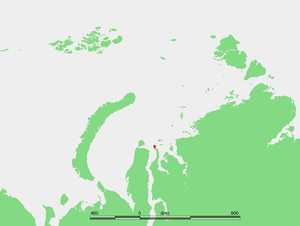
Shokalsky Island
Encyclopedia

Kara Sea
The Kara Sea is part of the Arctic Ocean north of Siberia. It is separated from the Barents Sea to the west by the Kara Strait and Novaya Zemlya, and the Laptev Sea to the east by the Severnaya Zemlya....
, in Russia
Russia
Russia or , officially known as both Russia and the Russian Federation , is a country in northern Eurasia. It is a federal semi-presidential republic, comprising 83 federal subjects...
. It is located on the eastern side of the mouth of the Ob River
Ob River
The Ob River , also Obi, is a major river in western Siberia, Russia and is the world's seventh longest river. It is the westernmost of the three great Siberian rivers that flow into the Arctic Ocean .The Gulf of Ob is the world's longest estuary.-Names:The Ob is known to the Khanty people as the...
, off the tip of the narrow northwestern arm of the Gydan Peninsula
Gydan Peninsula
The Gydan Peninsula is a geographical feature of the Siberian coast in the Kara Sea. It is roughly 500 km long and 260 km wide. This wide peninsula lies between the estuaries of the Ob and Yenisei Rivers , which are two of the most important rivers of Russia and the world...
. It is separated from it by a narrow strait full of islets known as Gydanskiy Proliv.
Its latitude is 72° 58' N and its longitude 74° 27' E.
The island has an area of 428 km² and it is covered by tundra. The sea surrounding the island is covered with pack ice in the winter and there are numerous ice floes even in the summer, so that it is often merged with the Gydanskiy Peninsula in the Siberian mainland.
This island belongs to the Yamalo-Nenets Autonomous Okrug
Yamalo-Nenets Autonomous Okrug
Yamalo-Nenets Autonomous Okrug , is a federal subject of Russia . Its administrative center is the town of Salekhard. Population: -Geography and natural history:...
which is the northern part of the Tyumen Oblast
Tyumen Oblast
Tyumen Oblast is a federal subject of Russia . Its administrative center is the city of Tyumen. The oblast has administrative jurisdiction over two autonomous okrugs—Khanty-Mansi Autonomous Okrug and Yamalo-Nenets Autonomous Okrug. Tyumen is the largest city, with over half a million inhabitants...
administrative division of the Russian Federation. This island is also part of the Great Arctic State Nature Reserve
Great Arctic State Nature Reserve
The Great Arctic State Nature Reserve is a nature reserve in Krasnoyarsk Krai, Russia...
, the largest nature reserve of Russia.
This island was named after Imperial Russian cartographer Yuly Shokalsky
Yuly Shokalsky
Yuly Mikhailovich Shokalsky was a Russian oceanographer, cartographer, and geographer.A grandson of Anna Kern, Pushkin's celebrated mistress, Shokalsky graduated from the Naval Academy in 1880 and made a career in the Imperial Russian Navy, helping establish the Sevastopol Marine Observatory and...
.
Shokalsky Island should not be confused with a little islet also called "Ostrov Shokal'skogo" which is located off the western coast of Vaygach Island
Vaygach Island
Vaygach Island is an island in the Arctic Sea between the Pechora Sea and the Kara Sea.Vaygach Island is separated from the Yugorsky Peninsula in the mainland by the Yugorsky Strait and from Novaya Zemlya by the Kara Strait...
in the Barents Sea
Barents Sea
The Barents Sea is a marginal sea of the Arctic Ocean, located north of Norway and Russia. Known in the Middle Ages as the Murman Sea, the sea takes its current name from the Dutch navigator Willem Barents...
.
See also
- Kara SeaKara SeaThe Kara Sea is part of the Arctic Ocean north of Siberia. It is separated from the Barents Sea to the west by the Kara Strait and Novaya Zemlya, and the Laptev Sea to the east by the Severnaya Zemlya....

