
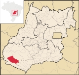
Serranópolis
Encyclopedia
| Serranópolis | |
|---|---|
| State | Goiás Goiás Goiás is a state of Brazil, located in the central part of the country. The name Goiás comes from the name of an indigenous community... |
| Area: | 5,526.5 km² |
| Population: | 7,333 (IBGE 2007) |
| Elevation: | 750 m above sea level |
| Postcode (CEP): | 75820-000 |
| IBGE statistical microregion: | 013 Sudoeste de Goiás |
| Became a city: | 1958 |
| Distance to Goiânia Goiânia -Climate:The city has a tropical wet and dry climate with an average temperature of . There's a wet season, from October to April, and a dry one, from May to September. Annual rainfall is around 1,520 mm.... : |
364 km. |
| Website: | n/a |

Town
A town is a human settlement larger than a village but smaller than a city. The size a settlement must be in order to be called a "town" varies considerably in different parts of the world, so that, for example, many American "small towns" seem to British people to be no more than villages, while...
and municipality
Municipality
A municipality is essentially an urban administrative division having corporate status and usually powers of self-government. It can also be used to mean the governing body of a municipality. A municipality is a general-purpose administrative subdivision, as opposed to a special-purpose district...
in southeast Goiás
Goiás
Goiás is a state of Brazil, located in the central part of the country. The name Goiás comes from the name of an indigenous community...
state, Brazil
Brazil
Brazil , officially the Federative Republic of Brazil , is the largest country in South America. It is the world's fifth largest country, both by geographical area and by population with over 192 million people...
. It is one of the largest municipalities in the state in area and one of the most sparsely inhabited. It is a large producer of cattle and soybeans.
Location
Serranópolis is located 50 km. south of JataíJataí
Jataí is a municipality in southern Goiás state, Brazil. Its population was 88,048 in a total area of 7,174.2 km². Jataí is a major producer of agricultural products, including soybeans, rice, and corn. It has the largest herd of cattle in the state and is a large producer of poultry and...
and about 80 km. north of the border with Mato Grosso do Sul
Mato Grosso do Sul
Mato Grosso do Sul is one of the states of Brazil.Neighboring Brazilian states are Mato Grosso, Goiás, Minas Gerais, São Paulo and Paraná. It also borders the countries of Paraguay and Bolivia to the west. The economy of the state is largely based on agriculture and cattle-raising...
. It is in the Sudoeste de Goiás Microregion and has the following boundaries:
- north: JataíJataíJataí is a municipality in southern Goiás state, Brazil. Its population was 88,048 in a total area of 7,174.2 km². Jataí is a major producer of agricultural products, including soybeans, rice, and corn. It has the largest herd of cattle in the state and is a large producer of poultry and...
- south: AporéAporéAporé is a small town and municipality in southwest Goiás state, Brazil. The municipality is a large producer of cattle. Aporé belongs to the Southwest Goiás Microregion.-Geography:...
- west: MineirosMineirosMineiros is a city in the southwest of the state of Goiás, Brazil. Mineiros is the westernmost city in Goiás and a great producer of cattle, soybeans, and corn....
- east: Itajá
It is crossed by the Verde and Corrente rivers, which are tributaries of the Paranaíba
Paranaíba River
The Paranaíba River is a Brazilian river whose source lies in the state of Minas Gerais in the Mata da Corda mountains, municipality of Rio Paranaíba, at an altitude of 1,148 meters; on the other face of this mountain chain are the sources of the Abaeté river, tributary of the São Francisco River...
.
Highway connections
Highway connections are made by paved road north to the important BR-060 highway near Jataí
Jataí
Jataí is a municipality in southern Goiás state, Brazil. Its population was 88,048 in a total area of 7,174.2 km². Jataí is a major producer of agricultural products, including soybeans, rice, and corn. It has the largest herd of cattle in the state and is a large producer of poultry and...
, which is 46 kilometers away. The distance from state capital, Goiânia
Goiânia
-Climate:The city has a tropical wet and dry climate with an average temperature of . There's a wet season, from October to April, and a dry one, from May to September. Annual rainfall is around 1,520 mm....
, is 381 km. Main highway connections are made by BR-060 / Abadia de Goiás
Abadia de Goiás
Abadia de Goiás is a small town and municipality in central Goiás state, Brazil, located on the western edge of the Goiânia metropolitan area.-Geographical Data:The distance to Goiânia is 27 km...
/ Guapó
Guapó
Guapó is a small town and municipality in central Goiás state, Brazil. The population was 13,586 and the total area of the municipality was 517.0 km² .Guapó is part of the Goiânia Microregion...
/ Indiara
Indiara
Indiara is a small city and municipality in central-south Goiás state, Brazil. Indiara is a large producer of soybeans and cotton.-Location:Indiara is located in the Vale do Rio dos Bois and has municipal boundaries with:*north: Palmeiras de Goiás...
/ Acreúna
Acreúna
Acreúna is a small city and municipality in western Goiás state, Brazil.-Location:Acreúna is located in the statistical micro-region of Vale do Rio dos Bois, southwest of the state capital, Goiânia, on BR-060, which links Goiânia with Rio Verde...
/ Rio Verde
Rio Verde, Goiás
Rio Verde is a city and municipality in the Brazilian state of Goiás. It is a fast-growing center and is the largest producer of grains in the state.-Location:...
/ Jataí
Jataí
Jataí is a municipality in southern Goiás state, Brazil. Its population was 88,048 in a total area of 7,174.2 km². Jataí is a major producer of agricultural products, including soybeans, rice, and corn. It has the largest herd of cattle in the state and is a large producer of poultry and...
/ GO-184 / BR-060 / Estreito
Estreito
-Brazil:* Estreito , a municipality in the State of Maranhão* Estreito, Florianópolis, a neighbourhood of Florianópolis, State of Santa Catarina* Estreito, Goiás, a district of the municipality of Jataí, State of Goiás-Portugal:...
.
History
The history of European occupation is relatively recent. The first settlers arrived in the decade of the 1880s and grew rice, tobacco, coffee, corn, and beans. In 1953 the settlement called Serra do Cafezal had its name changed to Nuputira, which later was changed to Serranópolis, becoming independent from JataíJataí
Jataí is a municipality in southern Goiás state, Brazil. Its population was 88,048 in a total area of 7,174.2 km². Jataí is a major producer of agricultural products, including soybeans, rice, and corn. It has the largest herd of cattle in the state and is a large producer of poultry and...
in 1959.
Political and Demographic Information
- Mayor: Adenir Domingos Facco (01 / 04 / 2006)
- City council: 09 members
- Eligible voters: 4,939 (2007)
- Population density: 1.33 inhab/km² (2007)
- Urban population: 5,155 (2007)
- Rural population: 2,178 (2007)
- Population growth: 1.86% from 2000 to 2007 (the first positive growth since 1991.
The economy
The economy is based on agriculture, cattle raising, services, public administration, and small transformation industries. The economy is predominately agricultural with 604 farms and 407,000 hectares. Only 25,000 hectares were planted, the rest being pasture and woodlands. Agriculture occupied 1,500 workers, including family members, in 2006. Public service occupied 385 persons in 2006.- Industrial units: 3 (2007)
- Commercial units: 91 (2007)
- Destillery: Energética Serranópolis Ltda. (May/2006)
- Financial institutions: -BRADESCO S.A. -Banco do Brasil S.A (01/06/2005)
- Automobiles: 525 (2007)
- Cattle herd: 229,000 head (2006)
- Main crops: rice, bananas, sugarcane, beans, manioc, sunflowers, corn, sorghum and soybeans (24,000 hectares).
Education (2006)
- Schools: 09 with 1,711
- Higher education: none
- Adult literacy rate: 84.1% (2000) (national average was 86.4%)
Health (2007)
- Hospitals: 1
- Hospital beds: 18
- Ambulatory clinics: 3
- Infant mortality rate: 13.70 (2000) (national average was 33.0)
Municipal Human Development Index
Human Development Index
The Human Development Index is a composite statistic used to rank countries by level of "human development" and separate "very high human development", "high human development", "medium human development", and "low human development" countries...
- MHDI: 0.742
- State ranking: 102 (out of 242 municipalities)
- National ranking: 2,115 (out of 5,507 municipalities) For a complete list see Frigoletto.com
Tourism
This area has great touristic potential. Unpolluted rivers, rapids, waterfalls, peaks, and caves make it a much sought-after touristic destination. The Emas National ParkEmas National Park
The Emas National Park |Rhea]] National Park") is a national park and a UNESCO World Heritage Sitein the states of Goiás and Mato Grosso do Sul in Brazil.-Description:...
lies to the west.
There are at least forty caves with paintings left by earlier inhabitants. These show figures of lizards, emas, and parrots and also geometric designs.
See also
- List of municipalities in Goiás
- Microregions of Goiás