

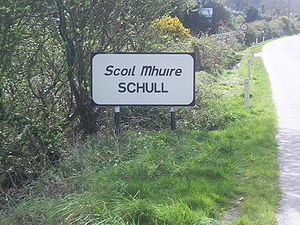
Schull
Encyclopedia
County Cork
County Cork is a county in Ireland. It is located in the South-West Region and is also part of the province of Munster. It is named after the city of Cork . Cork County Council is the local authority for the county...
, Ireland
Republic of Ireland
Ireland , described as the Republic of Ireland , is a sovereign state in Europe occupying approximately five-sixths of the island of the same name. Its capital is Dublin. Ireland, which had a population of 4.58 million in 2011, is a constitutional republic governed as a parliamentary democracy,...
. The name derives from a medieval monastic school of which no trace remains. Located on the southwest coast, in West Cork
West Cork
West Cork refers to a geographical area in south-west Ireland, lying within Ireland's largest county, County Cork. Traditionally a popular tourist destination, the area is seen as being distinct from the more populated northern or eastern parts of the county, as well as the more urban area of...
, the village is situated in a scenic and remote location, dominated by Mount Gabriel (407 m). It has a sheltered harbour, used for recreational boating, and there is currently a proposal to develop a marina. The area, on the peninsula leading to Mizen Head
Mizen Head
Mizen Head , is located at the extremity of a peninsula in the district of Carbery in County Cork, Ireland. It is one of the extreme points of the island of Ireland and is a major tourist attraction, noted for its dramatic cliff scenery...
, is popular with tourists, and there are numerous holiday homes along the adjoining coast. The village had a population of 693 in 2002. The town's secondary school has a planetarium
Planetarium
A planetarium is a theatre built primarily for presenting educational and entertaining shows about astronomy and the night sky, or for training in celestial navigation...
and a sailing school, and each year Schull harbour hosts the Fastnet International Schools Regatta
Fastnet International Schools Regatta
The Fastnet International Schools Regatta is a Regatta that takes place each year in the County Cork village of Schull, Ireland.The regatta consists of three different fleets which experience and ability separate the Bronze and Silver Fleets from the Gold Fleet. Novice sailors enter in the Bronze,...
.
Transport
Schull once had its own railway station. The village was the western terminus of the Schull and Skibbereen RailwaySchull and Skibbereen Railway
The Schull and Skibbereen Railway was a minor narrow gauge railway in County Cork, Ireland. It opened in 1886 and closed in 1947. The track gauge was 3 feet . The formal name of the company was The West Carberry Tramways and Light Railways Company Ltd.-Route:The S&S' main line was 15½ miles long...
, a steam-operated narrow gauge railway which was closed by CIÉ
CIE
-Organizations:* Cambridge International Examinations, an international examination board* Cleveland Institute of Electronics, a private technical and engineering educational institution — the International Commission on Illumination...
in 1947. Schull railway station opened on 6 September 1886, closed for passenger and goods traffic on 27 January 1947 and finally closed altogether on 1 June 1953.
Townlands
The townlands of Schull Parish include:- Arderawinny, Ard Daire Fhine ('Height of the race of Daire'), 701 acres (2.8 km²)
- Ardintenant, Ard an tSaighneáin ('Height of the flash of the beacon'), 120 acre (0.4856232 km²)
- Ardmanagh, Ard Mananch ('High ground of the monks'), 776 acres (3.1 km²)
- Ballyban East Baile Bán Thoir ('Eastern white place'), 847 acres (3.4 km²)
- Ballybane West, Baile Bán Thiar ('Western white place'), 610 acres (2.5 km²)
- Ballybrack, Baile Breac ('Spotted place'), 122 acre (0.49371692 km²)
- Ballycumisk, Baile Cum Uisge ('Place of the black water'), 194 acre (0.78509084 km²)
- Ballydehob, Béal Átha an Dá Chab ('Ford mouth of the two openings'), 191 acre (0.77295026 km²)
- Ballyvonane, Baile Fionnáin ('Finnian's habitation'), 238 acre (0.96315268 km²)
- Balteen, Bailtín ('Small holding'), 102 acre (0.41277972 km²)
- Barnatonicane, Bearna an Tonacairn ('Gap of the slippery place'), 262 acres (1.1 km²)
- Barryroe, Borraidhe Ruadha ('Red lumps or swelling in the land'), 684 acres (2.8 km²)
- Bawnaknockane, Ban a' Chnocáin ('Pasture land of the hillock'), 300 acres (1.2 km²)
- Beakeen, Beicín ('Little field or haggard'), 102 acre (0.41277972 km²)
- Bawnshanaclogh, Ban na Sean-Chloiche ('Pasture land of the old stone building'), 195 acre (0.7891377 km²)
- Caheraviranea, Cathair a' Bhiorainn ('Stone fort of the peak'), 137 acre (0.55441982 km²)
- Caherlusky, Cathair Leasca ('Stone fort of the Duibh Leasc'), 154 acre (0.62321644 km²)
- Caherolickane, Cathair ó Leicne ('Stone fort of brow of the hill'), 240 acre (0.9712464 km²)
- Calf Island Middle, Meadhon Laogh ('Middle calf'), 123 acre (0.49776378 km²)
- Calf Island West, an Laogh Thiar, ('West calf'), 62 acres (250,905.3 m²)
- Cappaglass, Ceapach Ghlas ('Green pasture plot or cutaway wood'), 431 acres (1.7 km²)
- Cappaghbeg, Ceapach Bheag ('Little plot of larger townland'), 476 acres (1.9 km²)
- Cappaghmore, Ceapach Mhír ('Little tillage plot or denuded wood'), 380 acres (1.5 km²)
- Cappaghnacallee, Ceapach na Caillaighe ('Hag's plot'), 228 acre (0.92268408 km²)
- Carbery Island, Inis Cairbre, 23 acres (93,077.8 m²)
- Castle Island, Meadhon Inis ('Middle island'), 123 acre (0.49776378 km²)
- Cashelfean, Caiseal Liadhain ('Stone fort of Liadhan'), 1002 acres (4.1 km²)
- Castle Point, Point an Chaisleain ('Promontory of the castle'), 94 acres (380,404.8 m²)
- Clashmore, Clais Mhór ('Great hollow or valley'), 230 acre (0.9307778 km²)
- Cooradarrigan or Coorydorigan, Cuar a' Deargain ('Round hill of red land'), 286 acres (1.2 km²)
- Colla, Caladh ('Pier of ferry'), 211 acre (0.85388746 km²)
- Coolagh Beg, Cuailleach Beag ('Small marsh place or thicket'), 161 acre (0.65154446 km²)
- Coolagh More, Cuailleach Mór ('Large marsh place or thicket'), 245 acre (0.9914807 km²)
- Coolcaha, Cúl Catha ('Battle recess or hill back'), 258 acres (1 km²)
- Coomfarna, Cum Fearna ('Mountain recess of the alder tree'), 284 acres (1.1 km²)
- Cooragurteen, Cuar a' Ghoirtín ('Curve of the little field'), 292 acres (1.2 km²)
- Coosane, Cuasán ('Little cavity or hollow'), 271 acres (1.1 km²)
- Coosheen, Cuaisín ('Little creek or hollow'), 335 acres (1.4 km²)
- Cove, Cuas ('Sea inlet'), 290 acres (1.2 km²)
- Croagh, Cruach ('Hill or mound'), 172 acre (0.69605992 km²)
- Cusovinna, Cos a 'Mhuine ('Bottom of the thicket'), 191 acre (0.77295026 km²)
- Derreannaclogh, Doire na gCloch ('Stoney oakwood'), 277 acres (1.1 km²)
- Deerreennalomane, Doirín na Loman ('Little oakwood'), 944 acres (3.8 km²)
- Derreenard, Doirín Ard ('Little high wood'), 294 acres (1.2 km²)
- Derrnatra, Doirín na Tragha ('Little oakwood of the strand'), 505 acres (2 km²)
- Derrycarhoon, Doire na Ceathramhan ('Oakwood of the quarter'), 443 acres (1.8 km²)
- Derryconnell, Doire Chonnail ('Connell's oakwood'), 537 acres (2.2 km²)
- Derryfunshion, Doire Fuinnseann ('Ash grove'), 243 acre (0.98338698 km²)
- Derrylahard, Doire leath-Ard ('Oakwood of the gentle slope'), 313 acres (1.3 km²)
- Derryleary, Doire Uí Laoghaire ('Leary's fort'), 189 acre (0.76485654 km²)
- Drinane, Draighneán ('Place of the blackthorn'), 154 acre (0.62321644 km²)
- Dromkeal, Drom Caol ('Narrow ridge'), 170 acre (0.6879662 km²)
- Drishane, Drisean, (Place of briars or brambles'), 329 acres (1.3 km²)
- Dunbeacon, Dún Beacáin ('Beacáin's fort'), 1469 acres (5.9 km²)
- Dunmanus East, Dun Maghnuis Thoir ('Fortress of Manus'), 547 acres (2.2 km²)
- Dunmanus West, Dun Maghnuis Thiar ('Fortress of Manus'), 574 acres (2.3 km²)
- Foilnamuck, Fail na Muc ('Sty of the pig'), 381 acres (1.5 km²)
- Furze Island, Inis Aitinn ('Island of the furse'), 17 acres (68,796.6 m²)
- Garranes, Garrain ('Groves'), 115 acre (0.4653889 km²)
- Glan, Glaun, Gleann ('Glen') 1052 acres
- Glansallagh, Gleann Saileach ('Glen of the willow trees'), 138 acre (0.55846668 km²)
- Goat Island Large, Oileán Clocharach ('Stoney island'), 29 acres (117,358.9 m²)
- Goat Island Small, 10 acres (40,468.6 m²)
- Gortnagrough, Gort na gCruach ('Field of the ricks or hillock'), 455 acres (1.8 km²)
- Gortnamona, Gort na Mona ('Field of the turf'), 232 acre (0.93887152 km²)
- Gortyowen, Gort Tighe Eoghain ('Field of Owen's house'), 259 acres (1 km²)
- Gubbeen, Guibín ('Little projection of the sea into land'), 827 acres (3.3 km²)
- Gunpoint, Gob an Ghunna ('Gun point'), 141 acre (0.57060726 km²)
- Gurteenakilla, Goirtín na Coille ('Little field of the wood'), 520 acres (2.1 km²)
- Gurteenroe, Goirtín Ruadh ('Little red field'), 234 acre (0.94696524 km²)
- Horse Island, Each Inis ('Horse island'), 156 acre (0.63131016 km²)
- Kilbronoge, Cill Moronach ('St. Moronoch's church'), 645 acres (2.6 km²)
- Kilcomane, Cill Damain ('Church of St. Daman'), 426 acres (1.7 km²)
- Kilpatrick, Cill Phádraig ('St. Patrick's church'), 124 acre (0.50181064 km²)
- Knock, Cnoc Con ('Hill of the hound'), 135 acre (0.5463261 km²)
- Knockeens, Cnuicíní ('Place of the little hills'), 228 acre (0.92268408 km²)
- Laharan, Leath-Fhearann ('Half townland'), 226 acre (0.91459036 km²)
- Leamcon, Léim Con ('Hounds' leap'), 139 acre (0.56251354 km²)
- Letter, Leitir ('Wet hillside|hillside of the fort'), 707 acres (2.9 km²)
- Lisheenacreagh, Lisín na Creiche ('Little fort of the cattle spoil'), 657 acres (2.7 km²)
- Lissacaha, Lios a' Chatha ('Fort of the battle'), 778 acres (3.1 km²)
- Lissacaha North, 350 acres (1.4 km²)
- Lissydonnell, Lios Uí Dhomhnaill ('O'Donnell's fort'), 225 acre (0.9105435 km²)
- Long IslandLong Island, County CorkLong Island, historically called Inishfada , is an island that lies south of Schull, County Cork, Ireland. It has a permanent population of around 20. The island is named for being 4.8 km long and only 0.8 km wide. It is the third largest of Carbery's Hundred Isles at 1.8 km2, after Sherkin Island...
, Inis Fhada, ('Long island'), 353 acres (1.4 km²) - Lowertown, Luibh Ghortán ('Herb plot|Lavender garden'), 433 acres (1.8 km²)
- Mauladinna, Meall a' Deanna ('Hillock of the view'), 319 acres (1.3 km²)
- Meenvane, Mín Mheadhon ('Middle tract of pasture land or whitish field'), 154 acre (0.62321644 km²)
- Mount GabrielMount GabrielMount Gabriel is a mountain on the Mizen Peninsula situated immediately to the north of the town of Schull, in West Cork, Ireland.Mt. Gabriel is 407m high and is the highest eminence in the coastal zone south and east of Bantry Bay. A roadway serving the radar installations on the summit is open...
, Cnoc Fhosta ('Hill of the encampment'), 760 acres (3.1 km²) - Murrahin, Maigh Raithín ('Plain of the fern or bracken'), 137 acre (0.55441982 km²)
- Raheenroe, Raithín Ruadh ('Littlered fort0, 21 acres (84,984.1 m²)
- Rathcool, Réidh-Chuil ('Level or smooth hill back'), 400 acres (1.6 km²)
- Rathooragh, Ráth Tuartha ('Fort of the cattle fieldsor Rath Teamhrach conspicuous hill'), 1189 acres (4.8 km²)
- Rathruane Beg, 302 acres (1.2 km²)
- Rathruane More, Ráth an tSrutháin ('Fort of the rivulet'), 266 acres (1.1 km²)
- Rossbrin, Ross Broin ('Bron's headland'), 280 acres (1.1 km²)
- Scarteenakillin, Scairtín a' Chuilinn ('Little shrubbery of the holly'), 454 acres (1.8 km²)
- Schull, Scoil ('School'), 656 acres (2.7 km²)
- Scrahanyleary, Screathán Uí Laoghaire ('Stoney step of O'Leary'), 434 acres (1.8 km²)
- Sgeagh, Sceach ('Whitethorn'), 481 acres (1.9 km²)
- Shanavagh, Sean-Bhoth ('Old assembly hut'), 255 acres (1 km²)
- Shantullig North, Seantullach ('Old mound'), 270 acres (1.1 km²)
- Shantullig, 734 acres (3 km²)
- Shonagree, Srón na Groighe ('Promontory of the cattle or steeds'), 496 acres (2 km²)
- Sparragrada, Speara Greadtha ('Place of sharp rocks'), 263 acres (1.1 km²)
- Stouke, Stuaic ('height of pinnacle0, 248 acres (1 km²)
- Woodlands, Gort na Coille ('Field of the wood'), 266 acres (1.1 km²)
See also
- List of towns and villages in Ireland
- Carbery's Hundred IslesCarbery's Hundred IslesCarbery’s 100 Isles is a term that could refer to all the islands along the coast of the Baronies of Carbery West and Carbery East, descendants of the medieval Barony of Carbery, on the Celtic Sea. It is actually used mainly for those in and around Long Island Bay and Roaringwater Bay...