Sanborn Park
Encyclopedia

Santa Cruz Mountains
The Santa Cruz Mountains, part of the Pacific Coast Ranges, are a mountain range in central California, United States. They form a ridge along the San Francisco Peninsula, south of San Francisco, separating the Pacific Ocean from San Francisco Bay and the Santa Clara Valley, and continuing south,...
owned and managed by the county of Santa Clara, California
Santa Clara County, California
Santa Clara County is a county located at the southern end of the San Francisco Bay Area in the U.S. state of California. As of 2010 it had a population of 1,781,642. The county seat is San Jose. The highly urbanized Santa Clara Valley within Santa Clara County is also known as Silicon Valley...
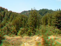
. The park, originally named Sanborn-Skyline County Park (until recently) is also known as Sanborn Skyline Park or Sanborn County Park. The 3688 acres (14.9 km²) holding is heavily forest
Forest
A forest, also referred to as a wood or the woods, is an area with a high density of trees. As with cities, depending where you are in the world, what is considered a forest may vary significantly in size and have various classification according to how and what of the forest is composed...
ed and offers hiking and other generally low intensity outdoor uses. The park lies between the town of Saratoga
Saratoga, California
Saratoga is a city in Santa Clara County, California, USA. It is located on the west side of the Santa Clara Valley, directly west of San Jose, in the San Francisco Bay area. The population was 29,926 at the 2010 census....
and the ridgetop road, Skyline Boulevard. In the summer months, Sanborn Park hosts the only outdoor Shakespearean company in Silicon Valley
Silicon Valley
Silicon Valley is a term which refers to the southern part of the San Francisco Bay Area in Northern California in the United States. The region is home to many of the world's largest technology corporations...
.
Overview for hikers

Trail
A trail is a path with a rough beaten or dirt/stone surface used for travel. Trails may be for use only by walkers and in some places are the main access route to remote settlements...
s comfortable in the heavy use period, from June to September; moreover, there are abundant mixed forest locales having Coast live oak
Coast Live Oak
Quercus agrifolia, the Coast Live Oak, is an evergreen oak , native to the California Floristic Province. It grows west of the Sierra Nevada from Mendocino County, California, south to northern Baja California in Mexico. It is classified in the red oak section Quercus agrifolia, the Coast Live Oak,...
, Pacific madrone
Pacific Madrone
Arbutus menziesii, commonly known as the Pacific Madrone, is a species of Arbutus found on the west coast of North America, from British Columbia to California...
, Big leaf maple and Tanbark oak.
The park features the first segment of the regional Bay Area Ridge Trail
Bay Area Ridge Trail
The Bay Area Ridge Trail is a planned 550+-mile multi-use trail along the hill and mountain ridgelines ringing the San Francisco Bay Area, in Northern California. When complete, the trail will connect over 75 parks and open spaces. The trail is being designed to provide access for hikers,...
in Santa Clara County, which extends along the ridge of the Santa Cruz Mountains to become the Skyline-to-the-Sea Trail
Skyline-to-the-Sea Trail
The Skyline-to-the-Sea Trail is a 29.5-mile hiking trail that descends from the ridge of the Santa Cruz Mountains in Northern California to the Pacific Ocean, passing through Castle Rock State Park and Big Basin Redwoods State Park. Big Basin is California's first state park...
, which continues to the Pacific Ocean
Pacific Ocean
The Pacific Ocean is the largest of the Earth's oceanic divisions. It extends from the Arctic in the north to the Southern Ocean in the south, bounded by Asia and Australia in the west, and the Americas in the east.At 165.2 million square kilometres in area, this largest division of the World...
. This Bay Area Ridge Trail ultimately circumnavigates the entire Bay Area at a length of 500 miles (804.7 km). The Sanborn and San Andreas trails ascend the eastern mountain slope, eventually joining the Skyline Trail
Skyline Trail
The Skyline Trail is located in Jasper National Park, Alberta, Canada.It is well known for its scenic views, with much of the hike being located above the treeline...
and Skyline Boulevard. Summit Rock, which is an established rock-climbing venue offers a panoramic outlook over Saratoga and the South Bay, lies at the upper limit of the park, but is readily reached from the Skyline Boulevard side.
At the southeastern corner of Sanborn Park sits Lake Ranch Reservoir, an attractive tiny mountain lake, accessible via either a steep canyon trail at the terminus of Sanborn Road, or by way of a longer, more level trail originating at Black Road. The latter trail, which sinuates high up along the flanks of Lyndon Canyon, is a lightly used trail, but extremely lush and forested; it crosses numerous small riparian zone
Riparian zone
A riparian zone or riparian area is the interface between land and a river or stream. Riparian is also the proper nomenclature for one of the fifteen terrestrial biomes of the earth. Plant habitats and communities along the river margins and banks are called riparian vegetation, characterized by...
s, whose creeks tumble into the steep-sided canyon, originally formed by the San Andreas Fault
San Andreas Fault
The San Andreas Fault is a continental strike-slip fault that runs a length of roughly through California in the United States. The fault's motion is right-lateral strike-slip...
. Shorter, less strenuous trails extend through the redwood stands and along creeksides within the lower reaches of Sanborn Park.
History of the park formation
Sanborn Park was founded in the late 1970s in an expansionary era of the Santa Clara County Parks and Recreation Department under the leadership of Robert Amery and Charles Rockwell. A series of land acquisitions throughout the county, with the intention to develop a greatly expanded set of county parks emphasizing large land area and low intensity uses. The Sanborn County Park master planMaster plan
A master plan has many meanings, it can refer to:Generally it may be used for serious plans or strategies, see:*Strategy**Strategic planning**Comprehensive planning**Blueprint...
was developed in this era. The county retained Earth Metrics Inc. To prepare an Environmental Impact Report (EIR) for the land use change, pursuant to requirements of the California Environmental Quality Act
California Environmental Quality Act
The California Environmental Quality Act is a California statute passed in 1970, shortly after the United States federal government passed the National Environmental Policy Act , to institute a statewide policy of environmental protection...
. Fairly soon thereafter the County Board of Supervisors approved the park plan and began development of necessary road and trail improvements.
Vegetation

Species
In biology, a species is one of the basic units of biological classification and a taxonomic rank. A species is often defined as a group of organisms capable of interbreeding and producing fertile offspring. While in many cases this definition is adequate, more precise or differing measures are...
noted above, the park contains a variety of native plants, first surveyed in the Earth Metrics EIR. Examples of this flora
Flora
Flora is the plant life occurring in a particular region or time, generally the naturally occurring or indigenous—native plant life. The corresponding term for animals is fauna.-Etymology:...
are:
- Blue elderberryElderberrySambucus is a genus of between 5 and 30 species of shrubs or small trees in the moschatel family, Adoxaceae. It was formerly placed in the honeysuckle family, Caprifoliaceae, but was reclassified due to genetic evidence...
, Sambucus mexicana - California maidenhair fern, Adiantum jordanii
- California mugwort, Artemisia douglasiana
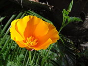
- California poppyCalifornia poppyThe California poppy is a perennial and annual plant, native to the United States, and the official state flower of California.- Description :...
, Eschscholzia californica, the state flower - Elk clover, Aralia californica
- Flowering currant, Ribes sanguineum
- Miniature lupineLupineLupine may be one of several things:*Something that is like, or relating to, a wolf .*A variant spelling for lupin, a flowering plant.*Lu Pine Records, a record label in Detroit.*Lupine Games, a computer game company....
, Lupinus bicolor - Miner's lettuce, Claytonia perfoliata
- Poison oakPoison oakPoison oak may refer to* Toxicodendron diversilobum, grows on West Coast of North America* Toxicodendron pubescens, grows in the Eastern United Statesdamnnnnn tissss is terribleee...
, Toxicodendron diversilobum - Slender tarweed, Madia gracilis
- Sticky cinquefoil, Potentilla glandulosa
- ToyonToyonHeteromeles arbutifolia , and commonly known as Toyon, is a common perennial shrub native to California down to Baja California....
, Heteromeles arbutifolia

Practical information
The park is open year round, although there is no entry after sunset. Sanborn Park is located on Sanborn Road. From the city of Saratoga, proceed two miles (3 km) west on Highway 9California State Route 9
State Route 9 is mainly a rural and mountainous route in the U.S. state of California that travels 35 miles from SR 1 near Santa Cruz to SR 17 in Los Gatos, passing through the San Lorenzo Valley and the Saratoga Gap...
to Sanborn Road, thence turning left onto Sanborn Road, traveling one mile (1.6 km) to the park entrance. Overnight camping is permitted and RV use is allowed for a limited number of vehicle
Vehicle
A vehicle is a device that is designed or used to transport people or cargo. Most often vehicles are manufactured, such as bicycles, cars, motorcycles, trains, ships, boats, and aircraft....
s at designated locations. Pets must be leashed and are permitted in picnic
Picnic
In contemporary usage, a picnic can be defined simply as a pleasure excursion at which a meal is eaten outdoors , ideally taking place in a beautiful landscape such as a park, beside a lake or with an interesting view and possibly at a public event such as before an open air theatre performance,...
and RV areas, and most trails. There are entry fees collected at all times. There are strictly enforced rules prohibiting the picking of vegetation or damaging of trees. All facilities are not handicapped accessible, although there is an all-access trail emanating from the visitor center. Picnic tables and some grassy lawn areas are available in a very small portion of the park.
Sanborn Science and Nature Center
Opened in 1982, the Youth Science Institute - Sanborn Science and Nature Center is a science and nature education facility operated by the Youth Science Institute. The center features live animals found in the Santa Cruz MountainsSanta Cruz Mountains
The Santa Cruz Mountains, part of the Pacific Coast Ranges, are a mountain range in central California, United States. They form a ridge along the San Francisco Peninsula, south of San Francisco, separating the Pacific Ocean from San Francisco Bay and the Santa Clara Valley, and continuing south,...
, earthquake
Earthquake
An earthquake is the result of a sudden release of energy in the Earth's crust that creates seismic waves. The seismicity, seismism or seismic activity of an area refers to the frequency, type and size of earthquakes experienced over a period of time...
and geology
Geology
Geology is the science comprising the study of solid Earth, the rocks of which it is composed, and the processes by which it evolves. Geology gives insight into the history of the Earth, as it provides the primary evidence for plate tectonics, the evolutionary history of life, and past climates...
exhibits, an arthropod
Arthropod
An arthropod is an invertebrate animal having an exoskeleton , a segmented body, and jointed appendages. Arthropods are members of the phylum Arthropoda , and include the insects, arachnids, crustaceans, and others...
zoo and a regional plant garden. The center offers nature and science school and group programs, after-school science and summer camp programs. The center hosts an annual Insect Fair in May.

