

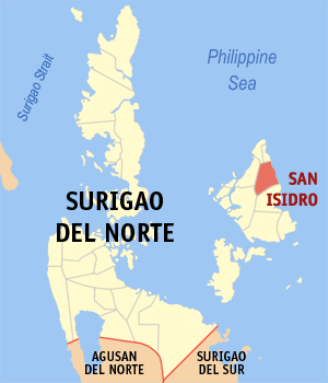
San Isidro, Surigao del Norte
Encyclopedia
Siargao Island
is a tear-drop shaped island in the Philippine Sea situated 800 kilometers southeast of Manila in the province of Surigao del Norte. It has a land area of approximately 437 square kilometers. The east coast is relatively straight with one deep inlet, Port Pilar. The coastline is marked by a...
, in the province of Surigao del Norte, Philippines
Philippines
The Philippines , officially known as the Republic of the Philippines , is a country in Southeast Asia in the western Pacific Ocean. To its north across the Luzon Strait lies Taiwan. West across the South China Sea sits Vietnam...
. According to the 2000 census, it has a population of 6,058 people in 1,130 households.
Barangays
San Isidro is politically subdivided into 12 barangayBarangay
A barangay is the smallest administrative division in the Philippines and is the native Filipino term for a village, district or ward...
s. San Isidro is strategically located in the northeastern part of Surigao del Norte, as of 2006, population of 7344 and has a total area of 4,475.5 geographically in the Island of Siargao. Siargao consisted of 9 Municipalities including socorro part of bukas grande Island.
- Buhing Calipay
- Del Carmen (Pob.)
- Del Pilar
- Macapagal
- Pacifico
- Pelaez
- Roxas
- San Miguel
- Santa Paz
- Santo Niño
- Tambacan
- Tigasao