
.gif)
Route 10 (New Jersey)
Encyclopedia
Route 10 is a 23.51 mi (37.84 km) state highway
in the northern part of the U.S. state
of New Jersey
. It runs from an intersection with U.S. Route 46
in Roxbury Township
, Morris County
east to County Route 577
/County Route 677 (Prospect Avenue) in West Orange
, Essex County
. Route 10 is a major route through northern New Jersey that is lined with two shopping districts in Ledgewood
and East Hanover
/Livingston
featuring many shopping centers and large commercial outlets. It is a four-lane highway for most of its length with the exception of the easternmost part of the route. Route 10 features intersections with many major roads including Route 53
and U.S. Route 202
in Morris Plains
and Interstate 287
in Hanover Township
.
Route 10 was designated in 1927 to run from Jersey City
to Dover
, following the former Newark and Mount Pleasant Turnpike west of Newark
. The route continued east from its present-day routing on current County Route 577, Park Avenue, County Route 508
, and Route 7 to end at U.S. Route 1/9
at the Tonnele Circle
. An alignment of Route 10 farther to the north of its current alignment in Essex County was proposed in 1952; however, it was never constructed with the route being designated to its present alignment a year later. Since 1953, Route 10 has seen improvements that eliminated the Ledgewood Circle
at the western terminus in 1998 and improved safety along the portion of the route in Hanover and East Hanover Townships in the mid 2000s.
in the Ledgewood
section of Roxbury Township
at the former Ledgewood Circle
, heading to the southeast on a four-lane divided highway with some jughandle
s. The road heads through commercial areas, passing by the Ledgewood Mall
, the Roxbury Mall, and many other businesses. The route enters Randolph Township
, where the road becomes less commercial in nature and passes Randolph Lake, interchanging with County Route 617 (Sussex Turnpike). Past this interchange, Route 10 crosses over Mine Hill, where the route is flanked by dense hardwood forest. The route crosses County Route 513
(Dover-Chester Road), skirting several residential neighborhoods and passing by the County College of Morris
past that intersection, with businesses along the road becoming more frequent again. Route 10 widens to six lanes route and then runs through the southwestern corner of Denville
before heading into the Mt. Tabor section of Parsippany-Troy Hills
. The route then forms the border between Parsippany-Troy Hills to the north and Morris Plains
to the south, interchanging with Route 53
and crossing U.S. Route 202
. The route fully enters Parsippany-Troy Hills again before crossing into Hanover Township
, coming to an interchange with Dryden Way, where the route widens to eight lanes. Past Dryden Way, Route 10 features an interchange with Interstate 287
and narrows to four lanes.
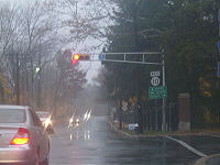
The road heads through the Whippany
section of Hanover Township, which is moderately commercial. Here, it interchanges with County Route 511
(Parsippany Road) at milepost 14.20 and passes by the Whippany Railway Museum
. Route 10 crosses into East Hanover Township at the crossing of Whippany Brook. Along Route 10 in East Hanover, there are newer shopping plazas anchored by 'big box' retail outlets, along with the older strip malls with a variety of individual shops.
 Route 10 crosses the Passaic River
into Livingston
, Essex County
, where it becomes Mt. Pleasant Avenue, a road that is lined with many businesses. The route comes to the Livingston Circle, a realigned traffic circle, with County Route 508
(W. Northfield Avenue) and County Route 609 (Eisenhower Parkway
). Past this traffic circle, the divided highway becomes a four-lane undivided road with some businesses and homes along the road. The route crosses County Route 527
(Livingston Avenue) and narrows to two lanes a short distance past that intersection. The route enters West Orange
at the point it crosses Nance Road. In West Orange, Route 10 ends at the Prospect Avenue intersection where radio station WFME is located. At this intersection, County Route 577
heads east on Mt. Pleasant Avenue and north on Prospect Avenue while County Route 677 (signed as County Route 577 Spur) heads south on Prospect Avenue.
on March 12, 1806, existing as a turnpike until before 1833. Route 10 was designated in 1927 to run from Jersey City
west to Route 6 (now U.S. Route 46) west of Dover, passing through Newark
. This routing of Route 10 followed its current alignment and ran east along present-day County Route 577, Mt. Pleasant Avenue, and Park Avenue to Newark, where it followed County Route 508 and Route 7 to U.S. Route 1/9
at the Tonnele Circle
in Jersey City.
In 1952, Route 10 was designated to run along a new, never-built alignment farther to the north, running through Belleville
, Bloomfield
, Glen Ridge
, Montclair
, West Orange, and along the Livingston/Roseland
border, roughly along much of the routing of present-day County Route 611 (Eagle Rock Avenue), and following its current alignment through Morris County to Ledgewood. A spur of the route was also planned in 1952 to run from Montclair south to Orange
. A year later, in the 1953 New Jersey state highway renumbering
, Route 10 was defined onto its current alignment, with its eastern terminus moved to Prospect Avenue in West Orange. In 1998, the Ledgewood Circle at the western terminus of the route was replaced with a signalized T-intersection. In the mid 2000s, a $11.5 million project was undertaken to improve safety on the portion of Route 10 in Hanover and East Hanover Townships by widening existing lanes and adding turning lanes to the road.
State highway
State highway, state road or state route can refer to one of three related concepts, two of them related to a state or provincial government in a country that is divided into states or provinces :#A...
in the northern part of the U.S. state
U.S. state
A U.S. state is any one of the 50 federated states of the United States of America that share sovereignty with the federal government. Because of this shared sovereignty, an American is a citizen both of the federal entity and of his or her state of domicile. Four states use the official title of...
of New Jersey
New Jersey
New Jersey is a state in the Northeastern and Middle Atlantic regions of the United States. , its population was 8,791,894. It is bordered on the north and east by the state of New York, on the southeast and south by the Atlantic Ocean, on the west by Pennsylvania and on the southwest by Delaware...
. It runs from an intersection with U.S. Route 46
U.S. Route 46
U.S. Route 46 is an east–west U.S. Highway, running for , completely within the state of New Jersey. The west end is at an interchange with Interstate 80 and Route 94 in Columbia, Warren County on the Delaware River...
in Roxbury Township
Roxbury Township, New Jersey
-Demographics:As of the census of 2000, there were 23,883 people, 8,364 households, and 6,532 families residing in the township. The population density was 1,117.4 people per square mile . There were 8,550 housing units at an average density of 400.0 per square mile...
, Morris County
Morris County, New Jersey
Morris County is a county located in the U.S. state of New Jersey, about west of New York City. According to the United States 2010 Census, the population was 492,276. It is part of the New York Metropolitan Area. Its county seat is Morristown....
east to County Route 577
County Route 577 (New Jersey)
County Route 577, abbreviated CR 577, is a county highway in the U.S. state of New Jersey. The highway extends from Springfield Avenue in Springfield Township to Bloomfield Avenue in Verona.-Route description:...
/County Route 677 (Prospect Avenue) in West Orange
West Orange, New Jersey
West Orange is a township in central Essex County, New Jersey, United States. As of the 2010 United States Census, the township population was 46,207...
, Essex County
Essex County, New Jersey
Essex County is a county located in the northeastern part of the U.S. state of New Jersey. As of the United States 2010 Census, the population was 783,969, ranking it third in the state after Bergen County and Middlesex County; Essex County's population has declined from 786,147 as of the bureau's...
. Route 10 is a major route through northern New Jersey that is lined with two shopping districts in Ledgewood
Ledgewood, New Jersey
Ledgewood is an unincorporated area within Roxbury Township in Morris County, New Jersey, United States. The area is served as United States Postal Service ZIP Code 07852....
and East Hanover
East Hanover, New Jersey
East Hanover Township is a township in Morris County, New Jersey, United States. As of the United States 2000 Census, the township population was 11,393. The town was incorporated in 1928. The headquarters of the Nabisco company and the pharmaceutical company Novartis are located in East...
/Livingston
Livingston, New Jersey
Livingston is a township in Essex County, New Jersey, United States. As of the United States 2000 Census, the township population was 29,366.Livingston was incorporated as a township by an Act of the New Jersey Legislature on February 5, 1813, from portions of Caldwell Township and Springfield...
featuring many shopping centers and large commercial outlets. It is a four-lane highway for most of its length with the exception of the easternmost part of the route. Route 10 features intersections with many major roads including Route 53
New Jersey Route 53
-External links:***...
and U.S. Route 202
U.S. Route 202 in New Jersey
U.S. Route 202 is a U.S. Highway running from New Castle, Delaware northeast to Bangor, Maine. In the U.S. state of New Jersey, the route runs from the New Hope-Lambertville Toll Bridge over the Delaware River at the Pennsylvania border in Delaware Township, Hunterdon County near Lambertville...
in Morris Plains
Morris Plains, New Jersey
Morris Plains, billing itself "the Community of Caring," is a Borough in Morris County, New Jersey, United States. As of the United States 2000 Census, the borough population was 5,236....
and Interstate 287
Interstate 287
Interstate 287 is an auxiliary Interstate Highway in the U.S. states of New Jersey and New York. It is a partial beltway around New York City, serving the northern half of New Jersey and the counties of Rockland and Westchester in New York...
in Hanover Township
Hanover Township, New Jersey
Hanover Township is a Township in Morris County, New Jersey, United States. At the 2000 United States Census, the township population was 12,898...
.
Route 10 was designated in 1927 to run from Jersey City
Jersey City, New Jersey
Jersey City is the seat of Hudson County, New Jersey, United States.Part of the New York metropolitan area, Jersey City lies between the Hudson River and Upper New York Bay across from Lower Manhattan and the Hackensack River and Newark Bay...
to Dover
Dover, New Jersey
Dover is a town in Morris County, New Jersey on the Rockaway River. Dover is west of New York City and west of Newark, New Jersey. As of the United States Census, 2000, the town's population was 18,188.-Geography:...
, following the former Newark and Mount Pleasant Turnpike west of Newark
Newark, New Jersey
Newark is the largest city in the American state of New Jersey, and the seat of Essex County. As of the 2010 United States Census, Newark had a population of 277,140, maintaining its status as the largest municipality in New Jersey. It is the 68th largest city in the U.S...
. The route continued east from its present-day routing on current County Route 577, Park Avenue, County Route 508
County Route 508 (New Jersey)
County Route 508 is a county highway in the U.S. state of New Jersey. The highway extends 16.14 miles from Mount Pleasant Avenue in Livingston to Belleville Turnpike in Kearny.-Essex County:...
, and Route 7 to end at U.S. Route 1/9
U.S. Route 1/9
U.S. Route 9 is a U.S. highway in the northeast United States, running from Laurel, Delaware north to the Canadian border near Champlain, New York...
at the Tonnele Circle
Tonnele Circle
The Tonnele Circle is an intersection in Jersey City, New Jersey, United States. It is named after Tonnele Avenue, the north-south road that runs through it. Entrances and exits are, listed clockwise from north:*Tonnele Avenue north...
. An alignment of Route 10 farther to the north of its current alignment in Essex County was proposed in 1952; however, it was never constructed with the route being designated to its present alignment a year later. Since 1953, Route 10 has seen improvements that eliminated the Ledgewood Circle
Ledgewood Circle
The Ledgewood Circle was the intersection of New Jersey State Route 10 and U.S. Route 46 in the Ledgewood neighborhood of Roxbury Township, New Jersey. Both highways are major east–west arteries in Morris County, New Jersey, and both are also lined with businesses and strip malls. ...
at the western terminus in 1998 and improved safety along the portion of the route in Hanover and East Hanover Townships in the mid 2000s.
Morris County
Route 10 begins at U.S. Route 46U.S. Route 46
U.S. Route 46 is an east–west U.S. Highway, running for , completely within the state of New Jersey. The west end is at an interchange with Interstate 80 and Route 94 in Columbia, Warren County on the Delaware River...
in the Ledgewood
Ledgewood, New Jersey
Ledgewood is an unincorporated area within Roxbury Township in Morris County, New Jersey, United States. The area is served as United States Postal Service ZIP Code 07852....
section of Roxbury Township
Roxbury Township, New Jersey
-Demographics:As of the census of 2000, there were 23,883 people, 8,364 households, and 6,532 families residing in the township. The population density was 1,117.4 people per square mile . There were 8,550 housing units at an average density of 400.0 per square mile...
at the former Ledgewood Circle
Ledgewood Circle
The Ledgewood Circle was the intersection of New Jersey State Route 10 and U.S. Route 46 in the Ledgewood neighborhood of Roxbury Township, New Jersey. Both highways are major east–west arteries in Morris County, New Jersey, and both are also lined with businesses and strip malls. ...
, heading to the southeast on a four-lane divided highway with some jughandle
Jughandle
A jughandle is a type of ramp or slip road that changes the way traffic turns left at at-grade intersections. Instead of a standard left turn being made from the left lane, left-turning traffic uses a ramp on the right side of the road...
s. The road heads through commercial areas, passing by the Ledgewood Mall
Ledgewood Mall
The Ledgewood Mall is an enclosed shopping mall in Ledgewood, New Jersey. Its anchor stores are Ashley Furniture HomeStores, Macy's, Marshall's and Walmart...
, the Roxbury Mall, and many other businesses. The route enters Randolph Township
Randolph, New Jersey
-Demographics:As of the census of 2000, there were 24,847 people, 8,679 households, and 6,804 families residing in the township. The population density was 1,185.2 people per square mile . There were 8,903 housing units at an average density of 424.7 per square mile...
, where the road becomes less commercial in nature and passes Randolph Lake, interchanging with County Route 617 (Sussex Turnpike). Past this interchange, Route 10 crosses over Mine Hill, where the route is flanked by dense hardwood forest. The route crosses County Route 513
County Route 513 (New Jersey)
County Route 513 is a county highway in the U.S. state of New Jersey. The highway extends from Kingwood Avenue in Frenchtown to Lakeside Road in West Milford...
(Dover-Chester Road), skirting several residential neighborhoods and passing by the County College of Morris
County College of Morris
County College of Morris is a public community college located in Randolph, New Jersey. The college was founded in 1966, and first opened its doors to students in 1968....
past that intersection, with businesses along the road becoming more frequent again. Route 10 widens to six lanes route and then runs through the southwestern corner of Denville
Denville, New Jersey
Denville is a township in Morris County, New Jersey, United States. As of the 2010 United States Census, the township population was 16,635. Denville is known as the "Hub of Morris County" for its location along major transportation routes at the center of the county...
before heading into the Mt. Tabor section of Parsippany-Troy Hills
Parsippany-Troy Hills, New Jersey
Parsippany-Troy Hills Township, commonly called Parsippany, is a township in Morris County, New Jersey, United States. As of the 2000 United States Census, the township population was 50,649. The name Parsippany comes from the Lenape Native American word parsipanong, which means "the place where...
. The route then forms the border between Parsippany-Troy Hills to the north and Morris Plains
Morris Plains, New Jersey
Morris Plains, billing itself "the Community of Caring," is a Borough in Morris County, New Jersey, United States. As of the United States 2000 Census, the borough population was 5,236....
to the south, interchanging with Route 53
New Jersey Route 53
-External links:***...
and crossing U.S. Route 202
U.S. Route 202 in New Jersey
U.S. Route 202 is a U.S. Highway running from New Castle, Delaware northeast to Bangor, Maine. In the U.S. state of New Jersey, the route runs from the New Hope-Lambertville Toll Bridge over the Delaware River at the Pennsylvania border in Delaware Township, Hunterdon County near Lambertville...
. The route fully enters Parsippany-Troy Hills again before crossing into Hanover Township
Hanover Township, New Jersey
Hanover Township is a Township in Morris County, New Jersey, United States. At the 2000 United States Census, the township population was 12,898...
, coming to an interchange with Dryden Way, where the route widens to eight lanes. Past Dryden Way, Route 10 features an interchange with Interstate 287
Interstate 287
Interstate 287 is an auxiliary Interstate Highway in the U.S. states of New Jersey and New York. It is a partial beltway around New York City, serving the northern half of New Jersey and the counties of Rockland and Westchester in New York...
and narrows to four lanes.
The road heads through the Whippany
Whippany, New Jersey
Whippany is an unincorporated area located within Hanover Township in Morris County, New Jersey. Whippany's name is derived from the Whippanong Native Americans, a tribe that once inhabited the area...
section of Hanover Township, which is moderately commercial. Here, it interchanges with County Route 511
County Route 511 (New Jersey)
County Route 511 is a county highway in the U.S. state of New Jersey. The highway extends 37.44 miles from Columbia Avenue in Morris Township to the New York state line in West Milford....
(Parsippany Road) at milepost 14.20 and passes by the Whippany Railway Museum
Whippany Railway Museum
The Whippany Railway Museum is a railway museum and excursion train ride located in Whippany, New Jersey.-History:In 1965, Whippany was the location of the Morris County Central Railroad, a steam excursion railroad...
. Route 10 crosses into East Hanover Township at the crossing of Whippany Brook. Along Route 10 in East Hanover, there are newer shopping plazas anchored by 'big box' retail outlets, along with the older strip malls with a variety of individual shops.
Essex County
Passaic River
The Passaic River is a mature surface river, approximately 80 mi long, in northern New Jersey in the United States. The river in its upper course flows in a highly circuitous route, meandering through the swamp lowlands between the ridge hills of rural and suburban northern New Jersey,...
into Livingston
Livingston, New Jersey
Livingston is a township in Essex County, New Jersey, United States. As of the United States 2000 Census, the township population was 29,366.Livingston was incorporated as a township by an Act of the New Jersey Legislature on February 5, 1813, from portions of Caldwell Township and Springfield...
, Essex County
Essex County, New Jersey
Essex County is a county located in the northeastern part of the U.S. state of New Jersey. As of the United States 2010 Census, the population was 783,969, ranking it third in the state after Bergen County and Middlesex County; Essex County's population has declined from 786,147 as of the bureau's...
, where it becomes Mt. Pleasant Avenue, a road that is lined with many businesses. The route comes to the Livingston Circle, a realigned traffic circle, with County Route 508
County Route 508 (New Jersey)
County Route 508 is a county highway in the U.S. state of New Jersey. The highway extends 16.14 miles from Mount Pleasant Avenue in Livingston to Belleville Turnpike in Kearny.-Essex County:...
(W. Northfield Avenue) and County Route 609 (Eisenhower Parkway
Eisenhower Parkway
Eisenhower Parkway, also known as County Route 609, is a highway in Essex County, New Jersey, located in the municipalities of Roseland and Livingston...
). Past this traffic circle, the divided highway becomes a four-lane undivided road with some businesses and homes along the road. The route crosses County Route 527
County Route 527 (New Jersey)
County Route 527 is a county highway in the U.S. state of New Jersey. The highway extends from Main Street in Toms River Township to Pompton Avenue in Cedar Grove. It is the second longest county highway in New Jersey after Route 519. It was first given the number 527 in 1954...
(Livingston Avenue) and narrows to two lanes a short distance past that intersection. The route enters West Orange
West Orange, New Jersey
West Orange is a township in central Essex County, New Jersey, United States. As of the 2010 United States Census, the township population was 46,207...
at the point it crosses Nance Road. In West Orange, Route 10 ends at the Prospect Avenue intersection where radio station WFME is located. At this intersection, County Route 577
County Route 577 (New Jersey)
County Route 577, abbreviated CR 577, is a county highway in the U.S. state of New Jersey. The highway extends from Springfield Avenue in Springfield Township to Bloomfield Avenue in Verona.-Route description:...
heads east on Mt. Pleasant Avenue and north on Prospect Avenue while County Route 677 (signed as County Route 577 Spur) heads south on Prospect Avenue.
History
The Newark and Mount Pleasant Turnpike was established along the present-day alignment of Route 10 east of DoverDover, New Jersey
Dover is a town in Morris County, New Jersey on the Rockaway River. Dover is west of New York City and west of Newark, New Jersey. As of the United States Census, 2000, the town's population was 18,188.-Geography:...
on March 12, 1806, existing as a turnpike until before 1833. Route 10 was designated in 1927 to run from Jersey City
Jersey City, New Jersey
Jersey City is the seat of Hudson County, New Jersey, United States.Part of the New York metropolitan area, Jersey City lies between the Hudson River and Upper New York Bay across from Lower Manhattan and the Hackensack River and Newark Bay...
west to Route 6 (now U.S. Route 46) west of Dover, passing through Newark
Newark, New Jersey
Newark is the largest city in the American state of New Jersey, and the seat of Essex County. As of the 2010 United States Census, Newark had a population of 277,140, maintaining its status as the largest municipality in New Jersey. It is the 68th largest city in the U.S...
. This routing of Route 10 followed its current alignment and ran east along present-day County Route 577, Mt. Pleasant Avenue, and Park Avenue to Newark, where it followed County Route 508 and Route 7 to U.S. Route 1/9
U.S. Route 1/9
U.S. Route 9 is a U.S. highway in the northeast United States, running from Laurel, Delaware north to the Canadian border near Champlain, New York...
at the Tonnele Circle
Tonnele Circle
The Tonnele Circle is an intersection in Jersey City, New Jersey, United States. It is named after Tonnele Avenue, the north-south road that runs through it. Entrances and exits are, listed clockwise from north:*Tonnele Avenue north...
in Jersey City.
In 1952, Route 10 was designated to run along a new, never-built alignment farther to the north, running through Belleville
Belleville, New Jersey
Belleville is a Township in Essex County, New Jersey, United States. As of the 2010 United States Census, the township population was 35,926.-History:...
, Bloomfield
Bloomfield, New Jersey
Bloomfield is a township in Essex County, New Jersey, United States. As of the 2010 United States Census, the township population was 47,315. It surrounds the Bloomfield Green Historic District.-History:...
, Glen Ridge
Glen Ridge, New Jersey
Glen Ridge is a borough in Essex County, New Jersey, United States. As of the 2010 United States Census, the borough population was 7,527. In 2010, Glen Ridge was ranked as the 38th Best Place to live by New Jersey Monthly magazine....
, Montclair
Montclair, New Jersey
-Demographics:As of the census of 2000, there were 38,977 people, 15,020 households, and 9,687 families residing in the township. The population density was 6,183.6 people per square mile . There were 15,531 housing units at an average density of 2,464.0 per square mile...
, West Orange, and along the Livingston/Roseland
Roseland, New Jersey
Roseland is a borough in western Essex County, New Jersey, United States. As of the 2010 United States Census, the borough population was 5,819...
border, roughly along much of the routing of present-day County Route 611 (Eagle Rock Avenue), and following its current alignment through Morris County to Ledgewood. A spur of the route was also planned in 1952 to run from Montclair south to Orange
Orange, New Jersey
The City of Orange is a city and township in Essex County, New Jersey, United States. As of the 2010 United States Census, the township population was 30,134...
. A year later, in the 1953 New Jersey state highway renumbering
1953 New Jersey state highway renumbering
On January 1, 1953, the New Jersey Department of Transportation renumbered many of the State Routes. A few rules were followed in deciding what to renumber:...
, Route 10 was defined onto its current alignment, with its eastern terminus moved to Prospect Avenue in West Orange. In 1998, the Ledgewood Circle at the western terminus of the route was replaced with a signalized T-intersection. In the mid 2000s, a $11.5 million project was undertaken to improve safety on the portion of Route 10 in Hanover and East Hanover Townships by widening existing lanes and adding turning lanes to the road.