

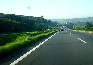
Rodovia Fernão Dias
Encyclopedia
Highway
A highway is any public road. In American English, the term is common and almost always designates major roads. In British English, the term designates any road open to the public. Any interconnected set of highways can be variously referred to as a "highway system", a "highway network", or a...
which runs in the Brazil
Brazil
Brazil , officially the Federative Republic of Brazil , is the largest country in South America. It is the world's fifth largest country, both by geographical area and by population with over 192 million people...
ian states of São Paulo
São Paulo (state)
São Paulo is a state in Brazil. It is the major industrial and economic powerhouse of the Brazilian economy. Named after Saint Paul, São Paulo has the largest population, industrial complex, and economic production in the country. It is the richest state in Brazil...
and southern region of Minas Gerais
Minas Gerais
Minas Gerais is one of the 26 states of Brazil, of which it is the second most populous, the third richest, and the fourth largest in area. Minas Gerais is the Brazilian state with the largest number of Presidents of Brazil, the current one, Dilma Rousseff, being one of them. The capital is the...
. In Atibaia, the Fernão Dias highway intersects the Dom Pedro I highway
Rodovia Dom Pedro I
Rodovia Dom Pedro I is a highway in the state of São Paulo, Brazil.One of the best built and most scenic highways in the country, it interconnects the Anhangüera and the Presidente Dutra highways, serving the major cities of Campinas, Atibaia, Jacareí and São José dos Campos...
, which runs from Campinas
Campinas
Campinas is a city and municipality located in the coastal interior of the state of São Paulo, Brazil. is the administrative center of the meso-region of the same name, with 3,783,597 inhabitants as of the 2010 Census, consisting of 49 cities....
to Jacareí
Jacareí
Jacareí is a city of approximately 211,308 inhabitants in the state of São Paulo, Brazil. The name comes from a native brazilan language . It's a word that means something like "the rivers where alligators are found"....
.
The highway is thus named in honour of Fernão Dias Paes Leme, a Brazilian explorer and "bandeirante
Bandeirantes
The bandeirantes were composed of Indians , caboclos , and some whites who were the captains of the Bandeiras. Members of the 16th–18th century South American slave-hunting expeditions called bandeiras...
" of the 17th century. It is 1,029 km long.
São Paulo
- São Paulo
- GuarulhosGuarulhosGuarulhos is the second largest city in the Brazilian state of São Paulo and a suburb of São Paulo city itself. In the last few years it has outgrown Campinas. The population in 2006 is 1,283,253, the density is 4,035.26 inh./km² and the area is 318 km²...
- MairiporãMairiporãMairiporã is a Brazilian municipality in São Paulo state. It is part of the São Paulo metropolitan area.The population in 2009 was estimated in 79,155 inhabitants and the total area is 321,5 km², resulting in a Population density of 233.4 people per km2....
- AtibaiaAtibaiaAtibaia is a Brazilian city located in the state of São Paulo, Brazil. The name is derived from an indigenous language called Tupi, and means "healthy water river". Its name has changed over time, from the primitive Tupi word Tybaia, to Thibaia, Atubaia, Thibaya, and finally the city's modern...
- Bragança PaulistaBragança PaulistaBragança Paulista is a municipality in the state of São Paulo in Brazil. The population in 2005 is 139.740 and the area is 489 km². The elevation is 817 m....
- VargemVargemVargem is a municipality in the state of São Paulo in Brazil. The population in 2004 was 7,985 and the area is 142.96 km². The elevation is 845 m....
- ExtremaExtremaExtrema may refer to:*maxima and minima*Extremities*Extremophiles*Extrema, Minas Gerais, town in Brazil*Extrema, Rondônia, town in Brazil*Extrema , Italian metal band...
Minas Gerais
- Belo HorizonteBelo HorizonteBelo Horizonte is the capital of and largest city in the state of Minas Gerais, located in the southeastern region of Brazil. It is the third largest metropolitan area in the country...
- BetimBetimBetim is a city in Minas Gerais, Brazil. It is located at around . The city belongs to the mesoregion Metropolitan of Belo Horizonte and to the microregion of Belo Horizonte....
- CamanducaiaCamanducaiaCamanducaia is the southernmost municipality in Minas Gerais, Brazil. Inhabited by 20,212 in 2008....
- Carmo da CachoeiraCarmo da CachoeiraCarmo da Cachoeira is a Brazilian municipality in the south of the state of Minas Gerais. In 2007 its estimated population was 11,656 in a total area of 506 km². The elevation is 959 meters....
- ContagemContagemContagem is a city in the center of the state of Minas Gerais, in Brazil. It is located only 21 kilometers from the capital, Belo Horizonte and forms part of a metropolitan area with a population of 4.8 million....
- IgarapéIgarapéIgarapé is a Brazilian municipality located in the state of Minas Gerais. The city belongs to the mesoregion Metropolitana de Belo Horizonte and to the microregion of Belo Horizonte.-See also:* List of municipalities in Minas Gerais...
- ItapevaItapevaThere are places that have the name Itapeva in Brazil, this place name comes from the Tupi word, itá-peb-a meaning flattened rock, elements: itá, rock + peb-a, flattened:*Itapeva, Minas Gerais*Itapeva, São Paulo...
- NepomucenoNepomucenoNepomuceno is a Brazilian municipality located in the south of the state of Minas Gerais. The population in 2007 was 24,430 in a total area of 584 km². The maximum elevation is 1,100 mts and the minimum is 850 mts with the municipal seat lying at an elevation ofThe city belongs to the IBGE...
- OliveiraOliveira, Minas GeraisOliveira is a Brazilian municipality in the state of Minas Gerais. It is located at latitude 20º41'47" south and longitude 44º49'38" west, at an altitude of 982 metres. Its estimated population was 40,400 inhabitants in 2005....
- Pouso AlegrePouso AlegrePouso Alegre is a city and municipality in southern region of Minas Gerais state, Brazil with a population of 127.974 of which 97.756 were urban and 9.020 were rural. The literacy rate is 94.2%. The area of the municipality is 541 km²...
- Santo Antônio do AmparoSanto Antônio do AmparoSanto Antônio do Amparo is a city in the southwestern part of the state of Minas Gerais, Brazil. It has 17,318 inhabitants and the area is 49.1 km²...
- São Joaquim de BicasSão Joaquim de BicasSão Joaquim de Bicas is a Brazilian municipality located in the state of Minas Gerais. The city belongs to the mesoregion Metropolitana de Belo Horizonte and to the microregion of Belo Horizonte.-See also:* List of municipalities in Minas Gerais...
- Três CoraçõesTrês CoraçõesTrês Corações is a city in the south of Minas Gerais state in Brazil. Founded in 1760, the city has a population of about 70,000 and covers 826.0 km². The elevation is 864 m and the postal code is 37410-000...
- Vale do Aço (Metropolitan areaMetropolitan areaThe term metropolitan area refers to a region consisting of a densely populated urban core and its less-populated surrounding territories, sharing industry, infrastructure, and housing. A metropolitan area usually encompasses multiple jurisdictions and municipalities: neighborhoods, townships,...
)
Minas Gerais
- Km 902 - CambuíCambuíCambuí is a town and municipality in the state of Minas Gerais in the Southeast region of Brazil.-References:...
- Km 804 - São Gonçalo do SapucaíSão Gonçalo do SapucaíSão Gonçalo do Sapucaí is a town and municipality in the state of Minas Gerais in the Southeast region of Brazil.-References:...
- Km 733 - Carmo da CachoeiraCarmo da CachoeiraCarmo da Cachoeira is a Brazilian municipality in the south of the state of Minas Gerais. In 2007 its estimated population was 11,656 in a total area of 506 km². The elevation is 959 meters....
- Km 659 - Santo Antonio do AmparoSanto Antônio do AmparoSanto Antônio do Amparo is a city in the southwestern part of the state of Minas Gerais, Brazil. It has 17,318 inhabitants and the area is 49.1 km²...
- Km 596 - Carmópolis of Mines
- Km 546 - Itatiaiaçu
Note: All squares are bidirectional.
External links
- BR-381. Ministry of Transportation.