

Nepomuceno
Encyclopedia
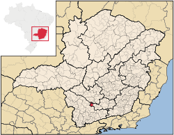
Minas Gerais
Minas Gerais is one of the 26 states of Brazil, of which it is the second most populous, the third richest, and the fourth largest in area. Minas Gerais is the Brazilian state with the largest number of Presidents of Brazil, the current one, Dilma Rousseff, being one of them. The capital is the...
. The population in 2007 was 24,430 in a total area of 584 km². The maximum elevation is 1,100 mts and the minimum is 850 mts with the municipal seat lying at an elevation of
The city belongs to the IBGE statistical microregion of Varginha
Varginha
Varginha is a city and municipality in southwest Minas Gerais state, Brazil. The estimated population is approximately 120,000 inhabitants and the area of the municipality is 396.39 km²...
. It lies 12 km. west of the important highway BR-381 (Fernão Dias). Distances to major and nearby cities are:
- Belo HorizonteBelo HorizonteBelo Horizonte is the capital of and largest city in the state of Minas Gerais, located in the southeastern region of Brazil. It is the third largest metropolitan area in the country...
– 233 km - São PauloSão PauloSão Paulo is the largest city in Brazil, the largest city in the southern hemisphere and South America, and the world's seventh largest city by population. The metropolis is anchor to the São Paulo metropolitan area, ranked as the second-most populous metropolitan area in the Americas and among...
– 330 km - Rio de JaneiroRio de JaneiroRio de Janeiro , commonly referred to simply as Rio, is the capital city of the State of Rio de Janeiro, the second largest city of Brazil, and the third largest metropolitan area and agglomeration in South America, boasting approximately 6.3 million people within the city proper, making it the 6th...
– 396 km - BrasíliaBrasíliaBrasília is the capital city of Brazil. The name is commonly spelled Brasilia in English. The city and its District are located in the Central-West region of the country, along a plateau known as Planalto Central. It has a population of about 2,557,000 as of the 2008 IBGE estimate, making it the...
– 1085 km - Três PontasTrês PontasTrês Pontas is a city and municipality in southern Minas Gerais state, Brazil. The population in 2007 was 51,121 inhabitants in a total area of 689 km²....
– 54 km - Três CoraçõesTrês CoraçõesTrês Corações is a city in the south of Minas Gerais state in Brazil. Founded in 1760, the city has a population of about 70,000 and covers 826.0 km². The elevation is 864 m and the postal code is 37410-000...
– 80 km - VarginhaVarginhaVarginha is a city and municipality in southwest Minas Gerais state, Brazil. The estimated population is approximately 120,000 inhabitants and the area of the municipality is 396.39 km²...
– 81 km - LavrasLavrasLavras is a city and municipality in Southern Minas Gerais state, Brazil. Located at an altitude of 900 m, it has an approximate population of 80,000 inhabitants. The area of the municipality is 566.1 km²...
– 25 km
The climate is humid, with mild summers, subject to sporadic periods of drought and with mild winters. The annual rainfall is 1,600 mm.
Temperature
Annual average: 21.2 C
Annual average maximum: 27.8 C
Annual average minimum: 13.5 C
The main source of income is the cultivation of coffee, which represents 70% of the economy. There is also production of corn, rice, and beans.
Another important activity is poultry raising, producing around one million eggs a day. In 2006 there were 1,080 rural producers with an area of 34,213 hectares of agricultural land. Cultivated land made up 16,000 hectares. There were 4,800 workers in agriculture.
In the health sector there were 12 health clinics and 1 private hospital, with 47 beds (2005). In the school system there were 31 primary schools, of which 3 were private, and 2 middle schools, of which 1 was private. In 2005 there were 114 attending an extension of a private university.
Municipal Human Development Index
Human Development Index
The Human Development Index is a composite statistic used to rank countries by level of "human development" and separate "very high human development", "high human development", "medium human development", and "low human development" countries...
- MHDI: .747
- State ranking: 309 out of 853 municipalities
- National ranking: 1,965 out of 5,138 municipalities
- Life expectancy: 71
- Literacy rate: 85 For the complete list see Frigoletto