

River Tolka
Encyclopedia
River
A river is a natural watercourse, usually freshwater, flowing towards an ocean, a lake, a sea, or another river. In a few cases, a river simply flows into the ground or dries up completely before reaching another body of water. Small rivers may also be called by several other names, including...
s, flowing from County Meath
County Meath
County Meath is a county in Ireland. It is part of the Mid-East Region and is also located in the province of Leinster. It is named after the ancient Kingdom of Mide . Meath County Council is the local authority for the county...
to Fingal
Fingal
Fingal is a county in Ireland. It is one of three smaller counties into which County Dublin was divided in 1994. With its county seat located in Swords, it has a population of 239,992 according to the 2006 census...
, within the old County Dublin
County Dublin
County Dublin is a county in Ireland. It is part of the Dublin Region and is also located in the province of Leinster. It is named after the city of Dublin which is the capital of Ireland. County Dublin was one of the first of the parts of Ireland to be shired by King John of England following the...
, and through the north of Dublin city, Ireland
Republic of Ireland
Ireland , described as the Republic of Ireland , is a sovereign state in Europe occupying approximately five-sixths of the island of the same name. Its capital is Dublin. Ireland, which had a population of 4.58 million in 2011, is a constitutional republic governed as a parliamentary democracy,...
. It is one of Dublin's three main rivers, the others being the Liffey
River Liffey
The Liffey is a river in Ireland, which flows through the centre of Dublin. Its major tributaries include the River Dodder, the River Poddle and the River Camac. The river supplies much of Dublin's water, and a range of recreational opportunities.-Name:The river was previously named An Ruirthech,...
and the Dodder
River Dodder
The River Dodder is one of the three main rivers of the Dublin region in Ireland, the others being the Liffey, of which the Dodder is the largest tributary, and the Tolka.-Course and system:...
. By flow of water, the Tolka is the second largest river in Dublin, but runs more slowly than the Dodder.
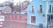
The Tolka is known for occasional but severe flooding.
Course and system
The Tolka rises east of DunshaughlinDunshaughlin
-History:It is named after Saint Seachnall, who established a church there in the 5th century.Máel Seachlainn was ancestor to the principal family of Brega, Ó Maoilsheachlainn, is descended...
, Co. Meath, by-passing Dunboyne
Dunboyne
Dunboyne is a town in County Meath in Ireland. For the most part, it is a dormitory town for the city of Dublin.-Location:Dunboyne is centred on the crossroads formed by the R156 regional road and the old Maynooth Road ....
, from which it receives the Castle Stream tributary. From Clonee it flows through the Fingal suburbs of Mulhuddart
Mulhuddart
Mulhuddart is a suburb situated to the north-west of Dublin city, in the barony of Castleknock, Ireland. The River Tolka passes near the village.-Location and access:The N3 dual carriageway now by-passes the village...
, Blanchardstown
Blanchardstown
Blanchardstown is a large suburb of Dublin in the district of Fingal, Ireland. It is within the historical barony of Castleknock. It is located 10 km north-west of the city centre. The suburb is in the Dublin 15 postal area, the Dublin West electoral constituency, and Fingal County...
and Ashtown (south of Finglas
Finglas
-See also:* List of towns and villages in Ireland* List of abbeys and priories in Ireland...
). The river continues through the north Dublin
Northside (Dublin)
The Northside is the area in County Dublin, Ireland bounded to the south by the River Liffey to the east by Dublin Bay, to the north and west by the boundaries of County Dublin.- Introduction :...
districts of Glasnevin
Glasnevin
Glasnevin is a largely residential neighbourhood of Dublin, Ireland.-Geography:A mainly residential neighbourhood, it is located on the Northside of the city of Dublin . It was originally established on the northern bank of the River Tolka...
and Drumcondra
Drumcondra, Dublin
Drumcondra is a residential area and inner suburb on the Northside of Dublin, Ireland. It is administered by Dublin City Council.The River Tolka and the Royal Canal flow through the area.-History:...
where it comes closest to the Royal Canal near Binn's Bridge. At the southern side of Tolka Park
Tolka Park
Tolka Park is an Irish football ground located in the north Dublin suburb of Drumcondra, on the northern banks of the River Tolka. It is currently the home ground of League of Ireland club Shelbourne...
it forms the border between Ballybough
Ballybough
Ballybough is a district of north Dublin, Ireland situated northeast of Summerhill, between the Royal Canal and the River Tolka. Adjacent areas are North Strand, Fairview and Drumcondra/Clonliffe. The name derives from the Irish baile "town" and bocht "poor"...
and Fairview
Fairview, Dublin
Fairview is a coastal district on the Northside of Dublin, Ireland, in the jurisdiction of Dublin City Council. Part of the area forms Fairview Park, on land reclaimed from the sea.-Location and access:...
, before entering Dublin Bay
Dublin Bay
Dublin Bay is a C-shaped inlet of the Irish Sea on the east coast of Ireland. The bay is about 10 kilometres wide along its north-south base, and 7 km in length to its apex at the centre of the city of Dublin; stretching from Howth Head in the north to Dalkey Point in the south...
at East Wall
East Wall
East Wall is an inner city area of the Northside of Dublin, Ireland.-Location:East Wall is bounded by the North Strand Road to the west, by North Wall and the Royal Canal to the south, and was bounded by East Wall Road, Dublin to the north until land reclamation extended that part...
.
The path of the river through Dublin city takes it through a number of parks. It passes initially though Tolka Valley Park where if forms the source of water for a lovely natural pond featuring considerable bird life, including swans, ducks and herons. A large landscaped pirch and putt facility operated by Dublin City Council is situated on the southern side of the park and is separated from the park by the river. Onwards it flows past the green, tree-lined recreational areas adjacent to Glasnevin Woods and Violet Hill.At this point the river forms the northern boundary of Glasnevin (Procpect) Cemetery before entering The National Botanic gardens. The river foms the northern border of the Botanic Gardens except for the beautiful Rose Gardens situated on the northern side and accessed via a beautiful bridge within the Gardens. The river is a major feature of the Botanic Gardens as it splits into two, creating an island of part of the park and providing water vistas and trickling and flowing water sounds within the park. Thereafter it flows by Glasnevin Village and into Griffith Park where again it forms a major part of the park. Having passed by Drumcondra village, the river largely becomes invisible as it passes to the back of housing, the Archbishops Palace, Clonliffe College and Ballybough. The river forms the northern boundary of the extensive grounds of the Archbishops Palace and Clonliffe College. At Annesley Bridge at Fairview which originally would have been the river mouth before reclaimation, it again becomes a feature of a Dublin Park, flowing between Fairview Park and East Wall. The river then flows into the sea at Clontarf.
The river floods infrequently but with occasional severity such as occurred in 1954 and 1965. In November 2002, flooding caused extensive damage to residential areas along its banks. Since then, much work has been done to strengthen the river's flood defences, though there was also notable flooding again in 2005. Following heavy flooding in 2005, major works to deepen and widen the river, were carried out on a number of stretches most notably at Glasnevin Woods and at Drumcondra Bridge. Controvertially for people living nearby, the small natural waterfall at Glanevin Woods was replaced by an artificial stepped fall.
Tributaries
The Tolka has many tributaries, the first major one being the Castle Stream at Dunboyne. There are at least fourteen infalls within Dublin City boundaries (the count is complicated by connections with the Wad River system).Dublin City Council area tributaries include the East and West Pinkeen Streams, and another waterway in semi-rural Dublin, then the Scribblestown Stream (visible from Abbotstown to past Dunsink), the Finglaswood (or Mount Olivat) Stream from around Cappagh, the Finglas River (joined by a stream from St. Margaret's Road), the Claremont Stream which joins the Tolka near Bons Secours Hospital, the Cemetery Drain (so-called as it runs beneath Glasnevin Cemetery
Glasnevin Cemetery
Glasnevin Cemetery , officially known as Prospect Cemetery, is the largest non-denominational cemetery in Ireland with an estimated 1.5 million burials...
) before joining the Tolka just past the Botanic Gardens
Irish National Botanic Gardens
The National Botanic Gardens are located in Glasnevin, 5 km north-west of Dublin city centre, Ireland...
, the Hamstead Stream (from the area now occupied by Hamstead Park and DCU
Dublin City University
Dublin City University is a university situated between Glasnevin, Santry, Ballymun and Whitehall on the Northside of Dublin in Ireland...
), inflowing somewhat downstream of Mobhi Bridge, and a small stream from around St. Patrick's Teacher Training College, Drumcondra
Drumcondra, Dublin
Drumcondra is a residential area and inner suburb on the Northside of Dublin, Ireland. It is administered by Dublin City Council.The River Tolka and the Royal Canal flow through the area.-History:...
.
The last few tributaries connect to the tidal part of the Tolka, or its estuary, but have been confused by the merging of natural watercourses and city drainage lines. There are at least four such watercourses, including the multi-branched water sometimes called the "Grace Park Stream", another sometimes "Middle Arch Stream" and the Marino Stream.
Wad River connections
The Wad River system, coming from north Ballymun, interconnects with the Tolka, most notably via a link with the Claremont Stream, and with the Wad River Diversion, which flows along Ballymun Road and Glasnevn Avenue (the Wad's main outfall to the sea is at Clontarf, not far east from the Tolka's mouth).Salmon Return
On September 28th 2011 it was reported in the press that Salmon have returned to spawn in the River Tolka for the first time in over 100 years.See also
- List of bridges over the River Tolka
- List of rivers in Ireland
- List of rivers in County Dublin