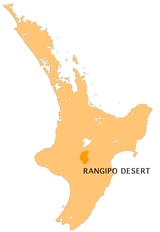
Rangipo Desert
Overview
Desert
A desert is a landscape or region that receives an extremely low amount of precipitation, less than enough to support growth of most plants. Most deserts have an average annual precipitation of less than...
-like environment in New Zealand
New Zealand
New Zealand is an island country in the south-western Pacific Ocean comprising two main landmasses and numerous smaller islands. The country is situated some east of Australia across the Tasman Sea, and roughly south of the Pacific island nations of New Caledonia, Fiji, and Tonga...
, located in the Ruapehu District
Ruapehu District
Ruapehu District is a territorial authority near the centre of New Zealand's North Island.It has an area of 6,730.185 square kilometers and a population of 13,569 at the 2006 census .-Features:...
on the North Island Volcanic Plateau
North Island Volcanic Plateau
The North Island Volcanic Plateau is a volcanic plateau covering much of central North Island of New Zealand with volcanoes, lava plateaus, and crater lakes....
; to the east of the three active peaks of Mount Tongariro
Mount Tongariro
Mount Tongariro is a volcanic complex in the North Island of New Zealand. It is located 20 kilometres to the southwest of Lake Taupo, and is the northernmost of the three active volcanoes that dominate the landscape of the central North Island....
, Mount Ngauruhoe
Mount Ngauruhoe
Mount Ngauruhoe is an active stratovolcano or composite cone in New Zealand, made from layers of lava and tephra. It is the youngest vent in the Tongariro volcanic complex on the Central Plateau of the North Island, and first erupted about 2,500 years ago...
, and Mount Ruapehu
Mount Ruapehu
Mount Ruapehu, or just Ruapehu, is an active stratovolcano at the southern end of the Taupo Volcanic Zone in New Zealand. It is 23 kilometres northeast of Ohakune and 40 kilometres southwest of the southern shore of Lake Taupo, within Tongariro National Park...
, and to the west of the Kaimanawa Range
Kaimanawa Range
The Kaimanawa Range of mountains is located in the central North Island of New Zealand. They extend for 50 kilometres in a northeast/southwest direction through largely uninhabited country to the south of Lake Taupo, east of the "Desert Road"...
.
The Rangipo Desert receives 1500 - 2500 mm of rainfall per year, but resembles a desert because of a poor soil quality, drying winds and the mass sterilization of seeds during a series of violent eruptions, particularly ignimbrite
Ignimbrite
An ignimbrite is the deposit of a pyroclastic density current, or pyroclastic flow, a hot suspension of particles and gases that flows rapidly from a volcano, driven by a greater density than the surrounding atmosphere....
flows about 20,000 years ago.
Unanswered Questions

