
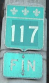
Quebec route 117
Encyclopedia

Provinces and territories of Canada
The provinces and territories of Canada combine to make up the world's second-largest country by area. There are ten provinces and three territories...
of Quebec
Quebec
Quebec or is a province in east-central Canada. It is the only Canadian province with a predominantly French-speaking population and the only one whose sole official language is French at the provincial level....
, running between Montreal
Montreal
Montreal is a city in Canada. It is the largest city in the province of Quebec, the second-largest city in Canada and the seventh largest in North America...
and the Quebec/Ontario
Ontario
Ontario is a province of Canada, located in east-central Canada. It is Canada's most populous province and second largest in total area. It is home to the nation's most populous city, Toronto, and the nation's capital, Ottawa....
border where it continues as Highway 66
Highway 66 (Ontario)
King's Highway 66, commonly referred to as Highway 66, is a provincially maintained highway in the Canadian province of Ontario.Located in the Timiskaming District, the highway begins at Matachewan near a junction with Highway 65. It extends eastward for to the Quebec border just east of...
east of Kearns, Ontario. It is an important road as it is the only direct route between southern Quebec and the Abitibi-Témiscamingue
Abitibi-Témiscamingue
Abitibi-Témiscamingue is a region located in western Quebec, Canada, along the border with Ontario. It became part of the province in 1898. It has a land area of 57,674.26 km2 . As of the 2006 census, the population of the region was 143,872 inhabitants.-History:The land was first occupied...
region.
Route 117 was formerly Route 11 and ran from Montreal north towards Mont Laurier
Mont-Laurier, Quebec
Mont-Laurier is a town and incorporated municipality in northwest Quebec, Canada, located on the banks of the Rivière du Lièvre, a tributary of the Ottawa River. Known as the “Capital of the Haute-Laurentides”, the motto of the town is Laurus elationis praemium, which translates to “Lift the...
, then followed the Gatineau River
Gatineau River
The Gatineau River is a river in western Quebec, Canada, which rises in lakes north of the Baskatong Reservoir and flows south to join the Ottawa River at the city of Gatineau, Quebec...
south towards Gatineau. This routing is joined with Autoroute 15
Quebec Autoroute 15
Autoroute 15 is a highway in western Quebec, Canada...
from Montreal northwards Mont Tremblant. Route 117 also takes in the former Quebec Routes 58 and 59.
Along with Autoroute 15
Quebec Autoroute 15
Autoroute 15 is a highway in western Quebec, Canada...
to Sainte-Agathe-des-Monts, it is also listed as a branch of the Trans-Canada Highway
Trans-Canada Highway
The Trans-Canada Highway is a federal-provincial highway system that joins the ten provinces of Canada. It is, along with the Trans-Siberian Highway and Australia's Highway 1, one of the world's longest national highways, with the main route spanning 8,030 km...
.
Description and towns along Route 117
This description of Route 117 follows it from the south-east to north-west direction.Route 117 starts in Montreal at the Decarie Interchange
Decarie Interchange
The Decarie Interchange is an expressway interchange on the Island of Montreal. It connects the Decarie Expressway heading South, the "Met" or Metropolitan Expressway heading East and West, Marcel-Laurin Boulevard heading North, and Boulevard Décarie heading North...
where Autoroute 40
Quebec Autoroute 40
Autoroute 40 is a major highway on the north shore of the St. Lawrence River in Quebec, Canada. It is one of the two main connections between Montreal and Quebec City...
and Autoroute 15
Quebec Autoroute 15
Autoroute 15 is a highway in western Quebec, Canada...
(Decarie Expressway) meet. Montrealers sometimes unofficially extend Route 117 south along the portion of Decarie Boulevard that runs parallel to the Decarie Expressway.

Bordeaux-Cartierville
Bordeaux-Cartierville is a district of Montreal, Canada in the administrative borough of Ahuntsic-Cartierville. It is bordered to the north by the Rivière des Prairies, to the east by the district of Ahuntsic., to the south by Villeray, Park-Extension, Mount Royal and Saint-Laurent and to the west...
, crossing the Rivière des Prairies
Rivière des Prairies
The Rivière des Prairies is a delta channel of the Ottawa River in southwestern Quebec, Canada....
over the Lachapelle Bridge
Lachapelle Bridge
'Lachapelle Bridge', in French Pont Lachapelle, Also known as Cartierville Bridge.This bridge spans the Rivière des Prairies between the Montreal borough of Ahuntsic-Cartierville and the Laval neighbourhood of Chomedey.Actually there are two bridges, side by side and parallel:The older three...
to Île Jésus
Île Jésus
Île Jésus is an island in southwestern Quebec, separated from the mainland to the north by the Rivière des Mille Îles, and from the Island of Montreal to the south by the Rivière des Prairies....
, continuing through the Laval
Laval, Quebec
Laval is a Canadian city and a region in southwestern Quebec. It is the largest suburb of Montreal, the third largest municipality in the province of Quebec, and the 14th largest city in Canada with a population of 368,709 in 2006...
communities of Chomedey
Chomedey, Quebec
Chomedey is a neighbourhood in the southwest of the city of Laval and was a separate municipality until the municipal mergers on August 6, 1965. Named after Paul Chomedey de Maisonneuve, part of the neighbourhood had previously been known as L'Abord à Plouffe, and was once part of the seigneurie...
, Fabreville
Fabreville, Quebec
Fabreville is a neighbourhood in Laval, Quebec. It was a separate city until the municipal mergers on August 6, 1965.- Geography :Fabreville is delimited north-west by the Rivière des Mille-Îles, north-east by Sainte-Rose, south-east by Chomedey, south by Sainte-Dorothée and west by Laval-Ouest.The...
and Sainte-Rose
Sainte-Rose, Quebec
Sainte-Rose is a neighbourhood in Laval, Quebec. It was incorporated as a village in 1850, and was a separate town until the municipal mergers on August 6, 1965 which amalgamated all the municipalities on Île Jésus into a single City of Laval....
as Boulevard Curé-Labelle.
At the Rivière des Mille Îles
Rivière des Mille Îles
The Rivière des Mille Îles is a channel of the Ottawa River in southwestern Quebec, Canada and runs into the Rivière des Prairies....
, it crosses over the Dufresne Bridge to the "North Shore" (of the Rivière des Mille Îles
Rivière des Mille Îles
The Rivière des Mille Îles is a channel of the Ottawa River in southwestern Quebec, Canada and runs into the Rivière des Prairies....
). From here Route 117 runs parallel to Autoroute 15 until Sainte-Agathe-des-Monts
Sainte-Agathe-des-Monts, Quebec
Sainte-Agathe-des-Monts is a town in the province of Quebec in the regional county municipality of Les Laurentides, in the administrative region of Laurentides, also known as the "Laurentians" or the Laurentian Mountains...
, going through the Laurentian mountains
Laurentian mountains
The Laurentian Mountains are a mountain range in southern Quebec, Canada, north of the St. Lawrence River and Ottawa River, rising to a highest point of 1166 metres at Mont Raoul Blanchard, north east of Quebec City in the Reserve Faunique des Laurentides. The Gatineau, L'Assomption, Lièvre,...
. Towns along the route in this section include:
- Sainte-ThérèseSainte-Thérèse, QuebecSainte-Thérèse is an off-island suburb northwest of Montreal, in southwestern Quebec, Canada, in the Regional County Municipality of Thérèse-de-Blainville....
- BlainvilleBlainville, QuebecBlainville is an off-island suburb of Montreal, in southwestern Quebec and is located northwest of downtown Montreal.The idyllic setting and small town environment makes for a sharp contrast with the booming urban centre next door. Blainville sits right at the foot of the Laurentians, an ancient...
- Saint-Antoine
- Saint-JérômeSaint-Jérôme, QuebecSaint-Jérôme is a town in Quebec, Canada, near Mirabel, about northwest of Montreal along Autoroute des Laurentides. The town is a gateway to the Laurentian Mountains and its resorts....
- Lafontaine
- PrévostPrévost, QuebecPrévost is a town within the La Rivière-du-Nord Regional County Municipality, Quebec, Canada, and the administrative region of Laurentides in the Laurentian Mountains, north of Montreal. It was created in 1973 from the amalgamation of the former villages of Shawbridge and Lesage with old Prévost...
- PiedmontPiedmont, QuebecPiedmont is a small municipality within the Les Pays-d'en-Haut Regional County Municipality, Quebec, Canada, in the Laurentian Mountains of the administrative region of Laurentides...
- Sainte-AdèleSainte-Adèle, QuebecSainte-Adèle is a municipality in Quebec, Canada, and is part of the Les Pays-d'en-Haut Regional County Municipality. It lies on the Route 117 about north-west of Montreal. Its tourism-based economy centres on its skiing and hotel industry...
- Val-David
- Sainte-Agathe-des-MontsSainte-Agathe-des-Monts, QuebecSainte-Agathe-des-Monts is a town in the province of Quebec in the regional county municipality of Les Laurentides, in the administrative region of Laurentides, also known as the "Laurentians" or the Laurentian Mountains...
After Sainte-Agathe-des-Monts, Route 117 continues as a four-lane divided highway winding its way through Laurentides Regional County Municipality
Les Laurentides Regional County Municipality, Quebec
Les Laurentides is a Regional County Municipality in southwestern Quebec, Canada, in the Laurentides region. The seat is in Saint-Faustin-Lac-Carré and it is named after the Laurentian Mountains...
until it reaches the town of Labelle. From this point on to the Ontario border, Route 117 is mostly a standard 2-lane highway. In Grand-Remous
Grand-Remous, Quebec
Grand-Remous is a town and municipality in La Vallée-de-la-Gatineau Regional County Municipality, Quebec, Canada. The municipality is south of the Baskatong Reservoir, spanning both sides of the Gatineau River...
, Route 117 crosses the Gatineau River
Gatineau River
The Gatineau River is a river in western Quebec, Canada, which rises in lakes north of the Baskatong Reservoir and flows south to join the Ottawa River at the city of Gatineau, Quebec...
and intersects with Route 105
Quebec route 105
Route 105 is a north-south highway in Quebec, Canada. It runs from Hull , where it is known as Boulevard Saint-Joseph , to Grand-Remous where it ends at Route 117....
which goes south-west to Maniwaki
Maniwaki, Quebec
Maniwaki is a town north of Gatineau and located north-west of Montreal, in the province of Quebec, Canada. The town is situated on the Gatineau River, at the crossroads of Route 105 and Route 107, not far south of Route 117...
and Gatineau. Towns along the route in this section include:
- Saint-Faustin-Lac-CarréSaint-Faustin–Lac-Carré, QuebecSaint-Faustin–Lac-Carré is a municipality in the Laurentides region of Quebec, Canada, part of the Les Laurentides Regional County Municipality.-Demographics:Population:* Population in 2006: 2985...
- Mont-Tremblant (going through the area which, until the merger in 2000, formed the village and parish of Saint-Jovite, Quebec).
- La ConceptionLa Conception, QuebecLa Conception is a village and municipality in the Laurentides region of Quebec, Canada, part of the Les Laurentides Regional County Municipality.-Demographics:Population:* Population in 2006: 1283...
- LabelleLabelle, QuebecLabelle is a village and municipality in the Laurentides region of Quebec, Canada, part of the Les Laurentides Regional County Municipality. Its large "L"-shaped territory surrounds Lake Labelle, and the village is located along the Rouge River and Route 117....
- Rivière-Rouge, passing through all three sectors of L'Annonciation, Marchand and Sainte-Véronique (A four lane divided section is currently under construction around the L'Annonciation sector)
- Lac-Saguay
- Lac-des-Écorces
- Mont-LaurierMont-Laurier, QuebecMont-Laurier is a town and incorporated municipality in northwest Quebec, Canada, located on the banks of the Rivière du Lièvre, a tributary of the Ottawa River. Known as the “Capital of the Haute-Laurentides”, the motto of the town is Laurus elationis praemium, which translates to “Lift the...
- Saint-Jean-sur-le-Lac
- Lac-Gatineau
- Grand-Remous

Wilderness
Wilderness or wildland is a natural environment on Earth that has not been significantly modified by human activity. It may also be defined as: "The most intact, undisturbed wild natural areas left on our planet—those last truly wild places that humans do not control and have not developed with...
, most of it part of La Vérendrye Wildlife Reserve
La Vérendrye Wildlife Reserve
La Vérendrye wildlife reserve is one of the largest reserves in the province of Quebec, Canada, covering 12,589 square kilometres of contiguous land and lake area . It is named after Pierre Gaultier de Varennes, sieur de La Vérendrye, a French-Canadian explorer...
. While the reserve is popular for a variety of outdoor activities, services along the road are sparse. This section is often considered as one of the most dangerous routes in the province due to numerous fatal accidents, some involving tractor-trailers. During the winter, the route is often extremely slippery, even during dry and clear days. The few communities along this section are:
- Le Domaine
- Dorval-Lodge
- Louvicourt
After the intersection with Route 113
Quebec route 113
Route 113 is a north/south two lane highway in northern Quebec, Canada. It starts at Route 117 just north of Louvicourt and continues north and north-east roughly until Waswanipi from where it continues east until it ends at Route 167 in Chibougamau...
(which continues north to Lebel-sur-Quévillon
Lebel-sur-Quévillon, Quebec
Lebel-sur-Quévillon is a town in the Canadian province of Quebec, located on Route 113 in the Jamésie region. It is located approximately 88 kilometres north of Senneterre and approximately 200 kilometres southwest of Chibougamau...
), Route 117 heads west to Ontario where it becomes Highway 66
Highway 66 (Ontario)
King's Highway 66, commonly referred to as Highway 66, is a provincially maintained highway in the Canadian province of Ontario.Located in the Timiskaming District, the highway begins at Matachewan near a junction with Highway 65. It extends eastward for to the Quebec border just east of...
. The section between Rouyn-Noranda and Arntfield runs concurrent
Concurrency (road)
A concurrency, overlap, or coincidence in a road network is an instance of one physical road bearing two or more different highway, motorway, or other route numbers...
with Route 101
Quebec route 101
Route 101 is a highway in northwestern Quebec running in a north to south direction.In the north the highway begins at Route 111 in Macamic and ends at Témiscaming, a town bordering with Thorne, Ontario on the Ottawa River...
. Towns along the route in this section include:
- Val-d'Or
- Dubuisson
- MalarticMalartic, QuebecMalartic is a town on the Malartic River in northwestern Quebec, Canada, in the La Vallée-de-l'Or Regional County Municipality. It is located about east of the centre of Rouyn-Noranda along Quebec Route 117 and the Canadian National Railway....
- Rivière-Héva
- Cadillac
- McWatters
- Rouyn-Noranda
- Évain
- Arntfield
External links
- Interactive Provincial Route Map (Transports Québec)
- http://maps.google.com/maps?f=d&saddr=Boulevard+Marcel-Laurin+%4045.503388,+-73.670363&daddr=48.113047,-77.803802+to:Boulevard+Rideau%2FRoute+Transcanadienne%2FRTE-117+%4048.249900,+-79.053240+to:Route+Transcanadienne%2FRTE-117+%4048.147596,+-79.516203&hl=en&geocode=8002712797782990351,45.503388,-73.670363%3B15925868696407552455,48.249900,-79.053240%3B7840875095033136783,48.147596,-79.516203&mra=dpe&mrcr=0&mrsp=1&sz=13&via=1,2&dirflg=h&sll=48.101356,-77.798309&sspn=0.052733,0.154495&ie=UTF8&ll=46.950262,-76.981201&spn=3.449906,9.887695&z=7Route 117] on Google Maps