
Quaraí
Encyclopedia
{| border="1" cellpadding="2" cellspacing="0" style="float:right; empty-cells:show; margin-left:1em; margin-bottom:0,5em; background:#FFDEAD;"
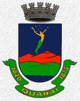
! Coat of arms !! Flag
|---- bgcolor="#FFFFFF"
! !!
!! 
|-
! colspan="2" | Map
|---- bgcolor="#FFFFFF"
! colspan="2" align="center" | |-
|-
! colspan="2" | Statistics
|---- bgcolor="#FFFFFF"
| State: || Rio Grande do Sul
|---- bgcolor="#FFFFFF"
| Meso-region: || Southwestern Rio Grande do Sul
(Sudoeste Rio-Grandense)
|---- bgcolor="#FFFFFF"
| Micro-Region: || Campanha Ocidental
|---- bgcolor="#FFFFFF"
| Founded: || April 8, 1875
|---- bgcolor="#FFFFFF" valign="top"
| Location
: || 30.485/30° 23' 15" S lat.
56.567/56° 27' 5" W long.
|---- bgcolor="#FFFFFF"
| Area
: || 3,148.8 km²
|---- bgcolor="#FFFFFF"
| Population
(2003):
- Total
- Change
- Density ||
24,987
-
7.94/km²
|---- bgcolor="#FFFFFF"
| Elevation
: || 112 m
|---- bgcolor="#FFFFFF"
| Postal code: || 97560-xxx
{| border="1" cellpadding="2" cellspacing="0" style="float:right; empty-cells:show; margin-left:1em; margin-bottom:0,5em; background:#FFDEAD;"
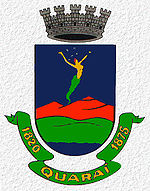
! Coat of arms !! Flag
|---- bgcolor="#FFFFFF"
! !!
|-
! colspan="2" | Map
|---- bgcolor="#FFFFFF"
! colspan="2" align="center" |
|-
! colspan="2" | Statistics
|---- bgcolor="#FFFFFF"
| State: || Rio Grande do Sul
|---- bgcolor="#FFFFFF"
| Meso-region: || Southwestern Rio Grande do Sul
(Sudoeste Rio-Grandense)
|---- bgcolor="#FFFFFF"
| Micro-Region: || Campanha Ocidental
|---- bgcolor="#FFFFFF"
| Founded: || April 8, 1875
|---- bgcolor="#FFFFFF" valign="top"
| Location
: || 30.485/30° 23' 15" S lat.
56.567/56° 27' 5" W long.
|---- bgcolor="#FFFFFF"
| Area
: || 3,148.8 km²
|---- bgcolor="#FFFFFF"
| Population
(2003):
- Total
- Change
- Density ||
24,987
-
7.94/km²
|---- bgcolor="#FFFFFF"
| Elevation
: || 112 m
|---- bgcolor="#FFFFFF"
| Postal code: || 97560-xxx
{| border="1" cellpadding="2" cellspacing="0" style="float:right; empty-cells:show; margin-left:1em; margin-bottom:0,5em; background:#FFDEAD;"
! Coat of arms !! Flag
|---- bgcolor="#FFFFFF"
! !!
|-
! colspan="2" | Map
|---- bgcolor="#FFFFFF"
! colspan="2" align="center" |
|-
! colspan="2" | Statistics
|---- bgcolor="#FFFFFF"
| State: || Rio Grande do Sul
|---- bgcolor="#FFFFFF"
| Meso-region: || Southwestern Rio Grande do Sul
(Sudoeste Rio-Grandense)
|---- bgcolor="#FFFFFF"
| Micro-Region: || Campanha Ocidental
|---- bgcolor="#FFFFFF"
| Founded: || April 8, 1875
|---- bgcolor="#FFFFFF" valign="top"
| Location
: || 30.485/30° 23' 15" S lat.
56.567/56° 27' 5" W long.
|---- bgcolor="#FFFFFF"
| Area
: || 3,148.8 km²
|---- bgcolor="#FFFFFF"
| Population
(2003):
- Total
- Change
- Density ||
24,987
-
7.94/km²
|---- bgcolor="#FFFFFF"
| Elevation
: || 112 m
|---- bgcolor="#FFFFFF"
| Postal code: || 97560-xxx
|---- bgcolor=#"FFFFFF"
| Distance from the capital: || 590
|---- bgcolor="#FFFFFF"
| Website: || www.quarai.rs.gov.br
|}
Quarai is a small Brazil
ian town located near the border with Uruguay
on the Rio Quaraí . It has a population of 24,987 (2005). Its elevation is 112 m. It has an area of 3,488.1 square kilometers making it one of the largest municipalities in the state. It is located 590 km west of the state capital of Porto Alegre
, northeast of Montevideo
, Uruguay as well as Artigas
in the same country and southeast of Alegrete
.
It is the birthplace of the Brazilian composer Luiz Menezes.
|- bgcolor="#efefef"
! Year !! Population !! Change !! Density
|-
| 1996 || 23,244 || - || -
|-
| 1997 || 23,430 || +186 or +0.8% || -
|-
| 1998 || 23,618 || +188 or +0.8% || -
|-
| 1999 || 23,809 || +191 or +0.81% || -
|-
| 2000 || 24,002 || +193 or +0.81% || -
|-
| 2004 || 24,987 || +985 or +4.1% || 7.94/km²
|}
! Coat of arms !! Flag
|---- bgcolor="#FFFFFF"
!
!! |-
! colspan="2" | Map
|---- bgcolor="#FFFFFF"
! colspan="2" align="center" |
! colspan="2" | Statistics
|---- bgcolor="#FFFFFF"
| State: || Rio Grande do Sul
Rio Grande do Sul
Rio Grande do Sul is the southernmost state in Brazil, and the state with the fifth highest Human Development Index in the country. In this state is located the southernmost city in the country, Chuí, on the border with Uruguay. In the region of Bento Gonçalves and Caxias do Sul, the largest wine...
|---- bgcolor="#FFFFFF"
| Meso-region: || Southwestern Rio Grande do Sul
(Sudoeste Rio-Grandense)
|---- bgcolor="#FFFFFF"
| Micro-Region: || Campanha Ocidental
Campanha Ocidental
The Campanha Ocidental micro-region is a micro-region in the western part of the state of Rio Grande do Sul, Brazil...
|---- bgcolor="#FFFFFF"
| Founded: || April 8, 1875
|---- bgcolor="#FFFFFF" valign="top"
| Location
Location (geography)
The terms location and place in geography are used to identify a point or an area on the Earth's surface or elsewhere. The term 'location' generally implies a higher degree of can certainty than "place" which often has an ambiguous boundary relying more on human/social attributes of place identity...
: || 30.485/30° 23' 15" S lat.
56.567/56° 27' 5" W long.
|---- bgcolor="#FFFFFF"
| Area
Area
Area is a quantity that expresses the extent of a two-dimensional surface or shape in the plane. Area can be understood as the amount of material with a given thickness that would be necessary to fashion a model of the shape, or the amount of paint necessary to cover the surface with a single coat...
: || 3,148.8 km²
|---- bgcolor="#FFFFFF"
| Population
Population
A population is all the organisms that both belong to the same group or species and live in the same geographical area. The area that is used to define a sexual population is such that inter-breeding is possible between any pair within the area and more probable than cross-breeding with individuals...
(2003):
- Total
- Change
- Density ||
24,987
-
7.94/km²
|---- bgcolor="#FFFFFF"
| Elevation
Elevation
The elevation of a geographic location is its height above a fixed reference point, most commonly a reference geoid, a mathematical model of the Earth's sea level as an equipotential gravitational surface ....
: || 112 m
|---- bgcolor="#FFFFFF"
| Postal code: || 97560-xxx
{| border="1" cellpadding="2" cellspacing="0" style="float:right; empty-cells:show; margin-left:1em; margin-bottom:0,5em; background:#FFDEAD;"
! Coat of arms !! Flag
|---- bgcolor="#FFFFFF"
!
!! |-
! colspan="2" | Map
|---- bgcolor="#FFFFFF"
! colspan="2" align="center" |
! colspan="2" | Statistics
|---- bgcolor="#FFFFFF"
| State: || Rio Grande do Sul
Rio Grande do Sul
Rio Grande do Sul is the southernmost state in Brazil, and the state with the fifth highest Human Development Index in the country. In this state is located the southernmost city in the country, Chuí, on the border with Uruguay. In the region of Bento Gonçalves and Caxias do Sul, the largest wine...
|---- bgcolor="#FFFFFF"
| Meso-region: || Southwestern Rio Grande do Sul
(Sudoeste Rio-Grandense)
|---- bgcolor="#FFFFFF"
| Micro-Region: || Campanha Ocidental
Campanha Ocidental
The Campanha Ocidental micro-region is a micro-region in the western part of the state of Rio Grande do Sul, Brazil...
|---- bgcolor="#FFFFFF"
| Founded: || April 8, 1875
|---- bgcolor="#FFFFFF" valign="top"
| Location
Location (geography)
The terms location and place in geography are used to identify a point or an area on the Earth's surface or elsewhere. The term 'location' generally implies a higher degree of can certainty than "place" which often has an ambiguous boundary relying more on human/social attributes of place identity...
: || 30.485/30° 23' 15" S lat.
56.567/56° 27' 5" W long.
|---- bgcolor="#FFFFFF"
| Area
Area
Area is a quantity that expresses the extent of a two-dimensional surface or shape in the plane. Area can be understood as the amount of material with a given thickness that would be necessary to fashion a model of the shape, or the amount of paint necessary to cover the surface with a single coat...
: || 3,148.8 km²
|---- bgcolor="#FFFFFF"
| Population
Population
A population is all the organisms that both belong to the same group or species and live in the same geographical area. The area that is used to define a sexual population is such that inter-breeding is possible between any pair within the area and more probable than cross-breeding with individuals...
(2003):
- Total
- Change
- Density ||
24,987
-
7.94/km²
|---- bgcolor="#FFFFFF"
| Elevation
Elevation
The elevation of a geographic location is its height above a fixed reference point, most commonly a reference geoid, a mathematical model of the Earth's sea level as an equipotential gravitational surface ....
: || 112 m
|---- bgcolor="#FFFFFF"
| Postal code: || 97560-xxx
|---- bgcolor=#"FFFFFF"
| Distance from the capital: || 590
|---- bgcolor="#FFFFFF"
| Website: || www.quarai.rs.gov.br
|}
Quarai is a small Brazil
Brazil
Brazil , officially the Federative Republic of Brazil , is the largest country in South America. It is the world's fifth largest country, both by geographical area and by population with over 192 million people...
ian town located near the border with Uruguay
Uruguay
Uruguay ,officially the Oriental Republic of Uruguay,sometimes the Eastern Republic of Uruguay; ) is a country in the southeastern part of South America. It is home to some 3.5 million people, of whom 1.8 million live in the capital Montevideo and its metropolitan area...
on the Rio Quaraí . It has a population of 24,987 (2005). Its elevation is 112 m. It has an area of 3,488.1 square kilometers making it one of the largest municipalities in the state. It is located 590 km west of the state capital of Porto Alegre
Porto Alegre
Porto Alegre is the tenth most populous municipality in Brazil, with 1,409,939 inhabitants, and the centre of Brazil's fourth largest metropolitan area . It is also the capital city of the southernmost Brazilian state of Rio Grande do Sul. The city is the southernmost capital city of a Brazilian...
, northeast of Montevideo
Montevideo
Montevideo is the largest city, the capital, and the chief port of Uruguay. The settlement was established in 1726 by Bruno Mauricio de Zabala, as a strategic move amidst a Spanish-Portuguese dispute over the platine region, and as a counter to the Portuguese colony at Colonia del Sacramento...
, Uruguay as well as Artigas
Artigas, Uruguay
Artigas is the capital of the Artigas Department of Uruguay. The name Artigas comes from that of the national hero, Jose Gervasio Artigas, who fought for the emancipation of the River Plate, and sought to create a federative nation from these colonies...
in the same country and southeast of Alegrete
Alegrete
Alegrete is a town and a municipality in Rio Grande do Sul located in southern Brazil. Its medium altitude is 102 m. Its estimated population in 2008 was 78,984 inhabitants and the total area is 7,803.967 km² . Its inhabitants are called Alegretenses.Alegrete was settled in 1816 and became a...
.
It is the birthplace of the Brazilian composer Luiz Menezes.
Neighbouring municipalities
- UruguaianaUruguaianaUruguaiana is a municipality in the Brazilian state of Rio Grande do Sul. It is located on the left-hand shore of the Uruguay River that forms the border with Argentina. Opposite Uruguaiana, and joined to it by a road/railway bridge, lies the Argentine city of Paso de los Libres, Corrientes...
, north - Rosário do SulRosário do SulRosário do Sul is a small Brazilian town in the southwestern part of the state of Rio Grande do Sul. It has a population of 40,645 . Its elevation is 151 m. It has an area of 2,530.9 km². It is located 385 km west of the state capital of Porto Alegre. The nicknames of the city are Rosul and Rosário...
, east - Santana do LivramentoSantana do LivramentoSantana do Livramento is a city in the state of Rio Grande do Sul, Brazil. It is located along the border with the city of Rivera, Uruguay, which helps form an international city of 200,000 inhabitants.- Overview :...
, south - ArtigasArtigas, UruguayArtigas is the capital of the Artigas Department of Uruguay. The name Artigas comes from that of the national hero, Jose Gervasio Artigas, who fought for the emancipation of the River Plate, and sought to create a federative nation from these colonies...
, UruguayUruguayUruguay ,officially the Oriental Republic of Uruguay,sometimes the Eastern Republic of Uruguay; ) is a country in the southeastern part of South America. It is home to some 3.5 million people, of whom 1.8 million live in the capital Montevideo and its metropolitan area...
, south - AlegreteAlegreteAlegrete is a town and a municipality in Rio Grande do Sul located in southern Brazil. Its medium altitude is 102 m. Its estimated population in 2008 was 78,984 inhabitants and the total area is 7,803.967 km² . Its inhabitants are called Alegretenses.Alegrete was settled in 1816 and became a...
, northwest
Flag
Created in 1971, the flag is made up of three stripes, blue, green and white in normal tones, it features a blue and red triangle-rectangle and a quadrilateral green that ascends between the two triangles with a blue triangle and in the left side of the flag, the angle of the green triangle is low and right. The center is elliptically vertical, in the white panel, the coat of arms added under law 400 of December 21, 1964. It features two equal faces with minimal dimensions with one metre in length.Geography
The area includes the Cerro do Jarau, a crater with 5.5 km in diameter dating back to around 117 million years and Salamanda do Jarau.Population
{| border="1" cellpadding="2" cellspacing="0"11|- bgcolor="#efefef"
! Year !! Population !! Change !! Density
|-
| 1996 || 23,244 || - || -
|-
| 1997 || 23,430 || +186 or +0.8% || -
|-
| 1998 || 23,618 || +188 or +0.8% || -
|-
| 1999 || 23,809 || +191 or +0.81% || -
|-
| 2000 || 24,002 || +193 or +0.81% || -
|-
| 2004 || 24,987 || +985 or +4.1% || 7.94/km²
|}
History
The first inhabitants were South American Indians including the Jarros, Guenoas, Minuanos and the Charruas people. The city was created on April 8, 1875.The creation
The diplomatic action of the Treaty of Badajós was signed in 1801 in which the then territorial boundary of Rio Grande do Sul became bounded at the Rio Quaraí. In 1814, its first ranches were founded.External links
- http://www.citybrazil.com.br/rs/quarai/
- Map and Aerial photos:
- Coordinates: 30°23′15"S 56°27′5"W
- Street maps: Street map from Mapquest, MapPoint or Google
- Satellite images and Aerial photos: Google
- ZYK 282, 1540 kHz - Rádio Quaraí AM: http://www.radioquarai.com