
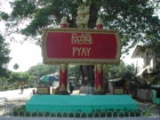
Pyay
Encyclopedia
Pyay is a town in the Bago Division
in Burma. It has an estimated population of 123,800 (2001). Pyay is positioned on the Ayeyarwady River
(Irrawaddy River) and is 260 km (161.6 mi) northwest of Yangon
.
The British Irrawaddy Flotilla Company
established the current town in the late 19th century on the Ayeyarwady River
(Irrawaddy River) as a transshipment point for cargo between Upper
and Lower Burma
.
The district of Pyay encompasses the valley of the Ayeyarwady, located between Thayetmyo, Hinthada
and Tharrawaddy districts. Along the western side of Pyay District are the Rakhine (Arakan) Yoma mountain ranges, and along the eastern side are the Bago (Pegu) Yoma mountain ranges. Pyay District's main towns are Pyay, Shwedaung
, and Paungde.
, and refers to the ruins of the Pyu
capital of Sri Ksetra , which is located 8 km (5 mi) to the southeast of modern Pyay and is in the village of Hmawa.
 Much debate surrounds the construction of Sri Ksetra. Maung Htin Aung suggests that Pyu might have been founded in 78 CE, based on the Sanskrit / Pyu Era. D.G.E. Hall and Gordon Luce however claim that civilisation of the Irrawaddy Valley could not have been possible before the 4th century, thus, attributing the founding of Sri Ksetra to 638, from which the current Burmese Kawza Era begins.
Sri Ksetra was the capital of the Pyu dynasty of Vikrama. The city was circular with walls enclosing an around of 46 km² (17.8 sq mi), making it the largest walled city in Southeast Asia during its peak. The city contained both housing and also farms, as evident from the remains of water ways and tanks which have been discovered. The Chinese pilgrims Xuanzang
and I Ching
mentioned about Sri Ksetra in their mid-7th century accounts. It is not known when precisely the Pyus abandoned Sri Ksetra and moved northward. It is speculated that their decline was due to the growth of the Irrawaddy river delta, cutting it off from coastal trade, and also from Mon and later Tai Shan incursions. Burmese chronicles state that when Anawrahta invaded the southern parts of modern day Myanmar in 1057, he ordered the ruins of Sri Ksetra to be destroyed to prevent rebels from sheltering.The Burmese came to call the old Pyu center Pyi. The extensive ruins have been the subject of intensive archaeological investigation.
Pyay was once the centre of a small kingdom that fell after the conquest of Pegu in 1758 by King Alaungpaya
, founder of the Konbaung dynasty
. Called Prome by the British, the city became part of British territory after the Second Anglo-Burman War in 1853. The town was taken by the British in 1825 and again in 1852, on both occasions with hardly any opposition. In 1862, it was almost entirely destroyed by fire, and was afterwards relaid out in straight and broad streets. It was erected into a municipality in 1874, and since then great improvements have been made, including waterworks.
To the south and south-east the town is closed in by low pagoda-topped hills, on one of which stands the conspicuous gilded Shwesandaw Pagoda
. The Shwesandaw Pagoda
, or Shwesandaw Paya (Sunset Pagoda), is a Buddhist pagoda in the center of Pyay. It is the terminus for a railway from Yangon, which runs through the district. The Shwesandaw Pagoda was built by King Anawrahta in 1057.
The climate is much drier than other districts in Lower Burma, the annual rainfall being about 1200 mm (47.2 in). The temperature ranges from about 38 °C (100.4 °F) in June to 16 °C (60.8 °F) in January.
, but some cotton and tobacco are grown, while the custard apples are famous. Sericulture
is extensively carried on by a special class. The forests yield teak
and cutch, cotton and silk-weaving are important industries; there are also manufactures of ornamental boxes, coarse brown sugar
and cutch.
 Pyay City has three universities. The universities are Pyay University (PU), Pyay Technological University (PTU), and Government Computer University (GCU). Pyay University is situated near to the town centre of Pyay. PTU is situated near to Hnawgone village and Latkhoukpin village, a few miles away from Pyay. GCU is also quite a far distance from downtown.
Bago Division
Bago Region is an administrative region of Burma, located in the southern central part of the country. It is bordered by Magway Region and Mandalay Region to the north; Kayin State, Mon State and the Gulf of Martaban to the east; Yangon Region to the south and Ayeyarwady Region and Rakhine State...
in Burma. It has an estimated population of 123,800 (2001). Pyay is positioned on the Ayeyarwady River
Ayeyarwady River
The Irrawaddy River or Ayeyarwady River is a river that flows from north to south through Burma . It is the country's largest river and most important commercial waterway. Originating from the confluence of the N'mai and Mali rivers, it flows relatively straight North-South before emptying through...
(Irrawaddy River) and is 260 km (161.6 mi) northwest of Yangon
Yangon
Yangon is a former capital of Burma and the capital of Yangon Region . Although the military government has officially relocated the capital to Naypyidaw since March 2006, Yangon, with a population of over four million, continues to be the country's largest city and the most important commercial...
.
The British Irrawaddy Flotilla Company
Irrawaddy Flotilla Company
The Irrawaddy Flotilla Company was a passenger and cargo ferry company, which operated services on the Irrawaddy River in Burma, now Myanmar. The IFC was Scottish-owned, and was managed by P Henderson & Company from Glasgow. The IFC operated from 1865 until the late 1940s...
established the current town in the late 19th century on the Ayeyarwady River
Ayeyarwady River
The Irrawaddy River or Ayeyarwady River is a river that flows from north to south through Burma . It is the country's largest river and most important commercial waterway. Originating from the confluence of the N'mai and Mali rivers, it flows relatively straight North-South before emptying through...
(Irrawaddy River) as a transshipment point for cargo between Upper
Upper Burma
Upper Burma refers to a geographic region of Burma , traditionally encompassing Mandalay and its periphery , or more broadly speaking, Kachin and Shan States....
and Lower Burma
Lower Burma
Lower Burma is a geographic region of Burma and includes the low-lying Irrawaddy delta , as well as coastal regions of the country ....
.
The district of Pyay encompasses the valley of the Ayeyarwady, located between Thayetmyo, Hinthada
Hinthada District
-Townships:The district contains the following townships:*Hinthada Township*Zalun Township*Laymyethna Township*Myanaung Township*Kyangin Township*Ingapu Township...
and Tharrawaddy districts. Along the western side of Pyay District are the Rakhine (Arakan) Yoma mountain ranges, and along the eastern side are the Bago (Pegu) Yoma mountain ranges. Pyay District's main towns are Pyay, Shwedaung
Shwedaung
Shwedaung is a village in Kalewa Township, Kale District, in the Sagaing Region of western Burma.-External links:*...
, and Paungde.
Etymology
The name "Pyi" means "country" in BurmeseBurmese language
The Burmese language is the official language of Burma. Although the constitution officially recognizes it as the Myanmar language, most English speakers continue to refer to the language as Burmese. Burmese is the native language of the Bamar and related sub-ethnic groups of the Bamar, as well as...
, and refers to the ruins of the Pyu
Pyu
Pyu city states were a group of city-states that existed from c. 2nd century BCE to late 9th century CE in present-day Upper Burma . The city-states were founded as part of the southward migration by the Tibeto-Burman-speaking Pyu, the earliest inhabitants of Burma of whom records are extant...
capital of Sri Ksetra , which is located 8 km (5 mi) to the southeast of modern Pyay and is in the village of Hmawa.
History
Sri Ksetra was the capital of the Pyu dynasty of Vikrama. The city was circular with walls enclosing an around of 46 km² (17.8 sq mi), making it the largest walled city in Southeast Asia during its peak. The city contained both housing and also farms, as evident from the remains of water ways and tanks which have been discovered. The Chinese pilgrims Xuanzang
Xuanzang
Xuanzang was a famous Chinese Buddhist monk, scholar, traveler, and translator who described the interaction between China and India in the early Tang period...
and I Ching
I Ching (monk)
Yijing was a Tang Dynasty Chinese Buddhist monk, originally named Zhang Wenming . The written records of his travels contributed to the world knowledge of the ancient kingdom of Srivijaya, as well as providing information about the other kingdoms lying on the route between China and the Nālandā...
mentioned about Sri Ksetra in their mid-7th century accounts. It is not known when precisely the Pyus abandoned Sri Ksetra and moved northward. It is speculated that their decline was due to the growth of the Irrawaddy river delta, cutting it off from coastal trade, and also from Mon and later Tai Shan incursions. Burmese chronicles state that when Anawrahta invaded the southern parts of modern day Myanmar in 1057, he ordered the ruins of Sri Ksetra to be destroyed to prevent rebels from sheltering.The Burmese came to call the old Pyu center Pyi. The extensive ruins have been the subject of intensive archaeological investigation.
Pyay was once the centre of a small kingdom that fell after the conquest of Pegu in 1758 by King Alaungpaya
Alaungpaya
Alaungpaya was king of Burma from 1752 to 1760, and the founder of the Konbaung Dynasty. By his death in 1760, the former chief of a small village in Upper Burma had reunified all of Burma, subdued Manipur, recovered Lan Na, and driven out the French and the English who had given help to the...
, founder of the Konbaung dynasty
Konbaung dynasty
The Konbaung Dynasty was the last dynasty that ruled Burma from 1752 to 1885. The dynasty created the second largest empire in Burmese history, and continued the administrative reforms begun by the Toungoo dynasty, laying the foundations of modern state of Burma...
. Called Prome by the British, the city became part of British territory after the Second Anglo-Burman War in 1853. The town was taken by the British in 1825 and again in 1852, on both occasions with hardly any opposition. In 1862, it was almost entirely destroyed by fire, and was afterwards relaid out in straight and broad streets. It was erected into a municipality in 1874, and since then great improvements have been made, including waterworks.
To the south and south-east the town is closed in by low pagoda-topped hills, on one of which stands the conspicuous gilded Shwesandaw Pagoda
Shwesandaw Pagoda, Pyay
The Shwesandaw Pagoda, or Shwesandaw Paya, is a Buddhist pagoda in the center of Pyay, Burma. It is one of the more important Buddhist pilgrimage locations in Burma. It is said to contain a couple of the Buddha's hairs, as its name means Golden Hair Relic. It is one meter taller in height than...
. The Shwesandaw Pagoda
Shwesandaw Pagoda
The Shwesandaw Pagoda is a Buddhist pagoda located in Bagan, Burma. The pagoda contains a series of five terraces, topped with a cylindrical stupa, which has a bejewelled umbrella . The pagoda was built by King Anawrahta in 1057, and once contained terra cotta tiles depicting scenes from the Jataka...
, or Shwesandaw Paya (Sunset Pagoda), is a Buddhist pagoda in the center of Pyay. It is the terminus for a railway from Yangon, which runs through the district. The Shwesandaw Pagoda was built by King Anawrahta in 1057.
Geography and climate
The north and northeast of the district is forest-covered, and contains numerous valleys and ravines, which unite in one large stream called the Naweng River. The most important of the plains lie in the south and southwest portions of Pyay, and extend along the whole length of the railway that runs between. There are, in addition large tracts of land covered by jungle, which are available for cultivation. The principal river is the Irrawaddy, which intersects the district from north to south; next in importance are the Thani and its tributaries and the Naweng system of rivers. In the hills near the capital the soil is of Tertiary formation, and in the plains it is an alluvial deposit.The climate is much drier than other districts in Lower Burma, the annual rainfall being about 1200 mm (47.2 in). The temperature ranges from about 38 °C (100.4 °F) in June to 16 °C (60.8 °F) in January.
Economy
The staple crop is riceRice
Rice is the seed of the monocot plants Oryza sativa or Oryza glaberrima . As a cereal grain, it is the most important staple food for a large part of the world's human population, especially in East Asia, Southeast Asia, South Asia, the Middle East, and the West Indies...
, but some cotton and tobacco are grown, while the custard apples are famous. Sericulture
Sericulture
Sericulture, or silk farming, is the rearing of silkworms for the production of raw silk.Although there are several commercial species of silkworms, Bombyx mori is the most widely used and intensively studied. According to Confucian texts, the discovery of silk production by B...
is extensively carried on by a special class. The forests yield teak
Teak
Teak is the common name for the tropical hardwood tree species Tectona grandis and its wood products. Tectona grandis is native to south and southeast Asia, mainly India, Indonesia, Malaysia, and Burma, but is naturalized and cultivated in many countries, including those in Africa and the...
and cutch, cotton and silk-weaving are important industries; there are also manufactures of ornamental boxes, coarse brown sugar
Brown sugar
Brown sugar is a sucrose sugar product with a distinctive brown color due to the presence of molasses. It is either an unrefined or partially refined soft sugar consisting of sugar crystals with some residual molasses content, or it is produced by the addition of molasses to refined white...
and cutch.
Education