Pozières
Encyclopedia
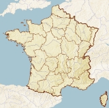
Pozières is a commune
in the Somme
department in Picardie
in northern France
.
between Albert
and Bapaume
, on the Pozières ridge.
.jpg) The village was completely destroyed in World War I
The village was completely destroyed in World War I
during what became the Battle of Pozières
(23 July–7 August 1916), which was part of the Battle of the Somme. The village was subsequently rebuilt, and is now the site of several war memorial
s. The Australian flag
flies over Pozières in recognition of the sacrifice of the ANZACs in the Battle of Pozières. Amongst the British and other Commonwealth forces who fought at Pozières, the Australians suffered over 5,000 killed, wounded or taken prisoner.
One of those killed, on 5 August, was the English composer George Butterworth
, and in 2008 the road between the town and Martinpuich
was renamed (George Butterworth Lane; 50.041172°N 2.733112°W).
Communes of France
The commune is the lowest level of administrative division in the French Republic. French communes are roughly equivalent to incorporated municipalities or villages in the United States or Gemeinden in Germany...
in the Somme
Somme
Somme is a department of France, located in the north of the country and named after the Somme river. It is part of the Picardy region of France....
department in Picardie
Picardie
Picardy is one of the 27 regions of France. It is located in the northern part of France.-History:The historical province of Picardy stretched from north of Noyon to Calais, via the whole of the Somme department and the north of the Aisne department...
in northern France
France
The French Republic , The French Republic , The French Republic , (commonly known as France , is a unitary semi-presidential republic in Western Europe with several overseas territories and islands located on other continents and in the Indian, Pacific, and Atlantic oceans. Metropolitan France...
.
Geography
The commune is situated on the D929 road, some 21 miles (34 km) northeast of AmiensAmiens
Amiens is a city and commune in northern France, north of Paris and south-west of Lille. It is the capital of the Somme department in Picardy...
between Albert
Albert, Somme
Albert is a commune in the Somme department in Picardie in northern France.It is located about halfway between Amiens and Bapaume.-History:Albert was founded as a Roman outpost called Encre, in about 54 BC...
and Bapaume
Bapaume
Bapaume is a commune and the seat of a canton in the Pas-de-Calais department in the Nord-Pas-de-Calais region of France.-Geography:A farming and light industrial town located 10 miles south of Arras at the junction of the A1 autoroute and the N17 and N30 national roads its location is...
, on the Pozières ridge.
Population
| 1962 | 1968 | 1975 | 1982 | 1990 | 1999 | 2006 |
|---|---|---|---|---|---|---|
| 278 | 281 | 254 | 279 | 276 | 244 | 238 |
| Starting in 1962: Population without duplicates | ||||||
History
.jpg)
World War I
World War I , which was predominantly called the World War or the Great War from its occurrence until 1939, and the First World War or World War I thereafter, was a major war centred in Europe that began on 28 July 1914 and lasted until 11 November 1918...
during what became the Battle of Pozières
Battle of Pozières
The Battle of Pozières was a two week struggle for the French village of Pozières and the ridge on which it stands, during the middle stages of the 1916 Battle of the Somme. Though British divisions were involved in most phases of the fighting, Pozières is primarily remembered as an Australian battle...
(23 July–7 August 1916), which was part of the Battle of the Somme. The village was subsequently rebuilt, and is now the site of several war memorial
War memorial
A war memorial is a building, monument, statue or other edifice to celebrate a war or victory, or to commemorate those who died or were injured in war.-Historic usage:...
s. The Australian flag
Flag of Australia
The flag of Australia is a defaced Blue Ensign: a blue field with the Union Flag in the canton , and a large white seven-pointed star known as the Commonwealth Star in the lower hoist quarter...
flies over Pozières in recognition of the sacrifice of the ANZACs in the Battle of Pozières. Amongst the British and other Commonwealth forces who fought at Pozières, the Australians suffered over 5,000 killed, wounded or taken prisoner.
One of those killed, on 5 August, was the English composer George Butterworth
George Butterworth
George Sainton Kaye Butterworth, MC was an English composer best known for the orchestral idyll The Banks of Green Willow and his song settings of A. E...
, and in 2008 the road between the town and Martinpuich
Martinpuich
Martinpuich is a commune in the Pas-de-Calais department in the Nord-Pas-de-Calais region of France.-Geography:Martinpuich is situated south of Arras, near the junction of the D929 and the D6 roads.-Population:-Places of interest:...
was renamed (George Butterworth Lane; 50.041172°N 2.733112°W).

