

Portway, Bristol
Encyclopedia
The Portway is a trunk road, approximately 6.5 miles (10.5 km) long, which links central Bristol
, England, with its port at Avonmouth
. It is part of the A4 road, which was the primary east west highway in Southern England before the construction of the M4 motorway
.
The road starts at Hotwells
and runs through the Avon Gorge
, under the Clifton Suspension Bridge
, parallel to the serpentine path of the River Avon. It passes through the suburbs of Sea Mills
, where it crosses the River Trym
, and Shirehampton
, before terminating at a roundabout in Avonmouth at a junction with the M5 motorway
.
. In 1924, approximately 200 yards (182.9 m) of newly constructed concrete embankment slid into the river, posing a hazard to navigation and adding 12 months to the duration of the work. The Portway was the most expensive road in Britain when it was opened by the Minister of Transport
, Colonel Wilfrid Ashley, in 1926, costing £800,000.
Electric lighting was provided to illuminate the new road, but for one year after the opening the lights were kept switched off following objections from river pilots
who argued that they would make it hard to distinguish the navigation light
s of shipping and the signal lights
on the shore. Eventually the electric lights were turned on at a reduced brilliance.
In 1974 City of Bristol and DTp were advised by the Civil Engineering consultants appointed that the rock wall so favoured by climbers at the car park green recess was impracticable to save and although Bristol Council members and engineers were concerned over services in the Portway road that the precipice needing taking back to relieve the rocking action that had set into the cliff face. The City refused, the prospective engineers resigned the contract as the slab was so unstable and pinning (rock bolt) would have required too great a stress load. Later some cut back had to be enforced with the Portway closed and many net units were rock bolted into the Avon Gorge face. Canopy as described herein was utilized in Austria at that date and adopted for the section below the Suspension Bridge, where the "Brunel" foundations are juxtaposed with highly cavernous solution reduced Cardoniferous Limestone mass blocks at rest (William J. Larnach & Reginald Bradshaw University of Bristol and other reports in Engineering Geology, University of Bristol, aver there is no immediate danger, but the site is less than suited to alteration of high bearing stress dependency if not monitored and for new build). It is likely if the records are read that even with pins the base nature of the riparian edge and types of rock therein do not suit support of block limestone above. The 2010 closure of Portway Bridge Valley Road is just one session in a number of engineering works, including the loss of the basement road river alluvial edge, piled and service pipes.
Rockfalls from the limestone
cliffs of the Avon Gorge have caused a hazard to motorists on occasion and every year the road is closed to allow for inspection of the cliffs for potentially dangerous cracks and loose rocks, and to allow remedial works. In 1980, a glass fibre reinforced concrete
canopy was constructed over the road where it passes under the Clifton Suspension Bridge in order to protect traffic from danger at that point.
In 2001, a 27 inches (68.6 cm) water main burst near the junction with Bridge Valley Road, causing a major collapse and putting the road out of action for several months. One passer-by was swept into the river but was rescued uninjured.
 The Portway Park and Ride is in Shirehampton near the M5 junction. A bus lane
on the inbound section of the road from Sea Mills is designed to allow quicker access for buses to the city centre. The railway stations of both Shirehampton
and Sea Mills
are both very close to the road and there is a proposal to build a new station at the Park and Ride.
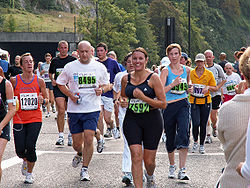
The annual Bristol Half Marathon
uses the Portway as part of its route and the annual Bristol's Biggest Bike Ride also uses the road which is closed to motor traffic for the day. In June 2009, city councillor John Rogers proposed that the Portway be closed to motor traffic on summer Sundays to allow cycling in a car free environment.
Bristol city centre
Bristol city centre is the commercial, cultural and business centre of Bristol, England. It is the area south of the central ring road and north of the Floating Harbour, bounded north by St Pauls and Easton, east by Temple Meads and Redcliffe, and west by Clifton and Canon's Marsh...
, England, with its port at Avonmouth
Avonmouth
Avonmouth is a port and suburb of Bristol, England, located on the Severn Estuary, at the mouth of the River Avon.The council ward of Avonmouth also includes Shirehampton and the western end of Lawrence Weston.- Geography :...
. It is part of the A4 road, which was the primary east west highway in Southern England before the construction of the M4 motorway
M4 motorway
The M4 motorway links London with South Wales. It is part of the unsigned European route E30. Other major places directly accessible from M4 junctions are Reading, Swindon, Bristol, Newport, Cardiff and Swansea...
.
The road starts at Hotwells
Hotwells
Hotwells is a district of the English port city of Bristol. It is located to the south of and below the high ground of Clifton, and directly to the north of the Floating Harbour. The southern entrance to the Avon Gorge, which connects those docks to the sea, lies at the western end of Hotwells. The...
and runs through the Avon Gorge
Avon Gorge
The Avon Gorge is a 1.5-mile long gorge on the River Avon in Bristol, England. The gorge runs south to north through a limestone ridge west of Bristol city centre, and about 3 miles from the mouth of the river at Avonmouth. The gorge forms the boundary between the unitary authorities of...
, under the Clifton Suspension Bridge
Clifton Suspension Bridge
Brunel died in 1859, without seeing the completion of the bridge. Brunel's colleagues in the Institution of Civil Engineers felt that completion of the Bridge would be a fitting memorial, and started to raise new funds...
, parallel to the serpentine path of the River Avon. It passes through the suburbs of Sea Mills
Sea Mills, Bristol
Sea Mills is a suburb of the English port city of Bristol. It is situated some 3.5 miles north-west of the city centre, towards the seaward end of the Avon Gorge. Nearby suburbs are Shirehampton, Sneyd Park, Combe Dingle and Stoke Bishop...
, where it crosses the River Trym
River Trym
The River Trym is a short river, some in length, which rises in Filton, South Gloucestershire, England. The upper reaches are culverted, some underground, through mostly urban landscapes, but once it emerges into the open it flows through a nature reserve and city parks before joining the tidal...
, and Shirehampton
Shirehampton
Shirehampton, near Avonmouth, at the north-western edge of the city of Bristol, England, is a district of Bristol which originated as a separate village. It retains something of its village feel, having a short identifiable High Street with the parish church situated among shops, and is still...
, before terminating at a roundabout in Avonmouth at a junction with the M5 motorway
M5 motorway
The M5 is a motorway in England. It runs from a junction with the M6 at West Bromwich near Birmingham to Exeter in Devon. Heading south-west, the M5 runs east of West Bromwich and west of Birmingham through Sandwell Valley...
.
Construction
Construction of the Portway started in 1919, partly on the line of the Bristol Port and Pier RailwaySevern Beach Line
The Severn Beach Line is a local railway in Bristol, UK. It runs from Narroways Hill Junction to Severn Beach, and is the successor to the Bristol Port Railway and Pier, which ran from a Bristol terminus in the Avon Gorge to a station and pier on the Severn Estuary.Passenger trains run from Bristol...
. In 1924, approximately 200 yards (182.9 m) of newly constructed concrete embankment slid into the river, posing a hazard to navigation and adding 12 months to the duration of the work. The Portway was the most expensive road in Britain when it was opened by the Minister of Transport
Secretary of State for Transport
The Secretary of State for Transport is the member of the cabinet responsible for the British Department for Transport. The role has had a high turnover as new appointments are blamed for the failures of decades of their predecessors...
, Colonel Wilfrid Ashley, in 1926, costing £800,000.
Electric lighting was provided to illuminate the new road, but for one year after the opening the lights were kept switched off following objections from river pilots
Maritime pilot
A pilot is a mariner who guides ships through dangerous or congested waters, such as harbours or river mouths. With the exception of the Panama Canal, the pilot is only an advisor, as the captain remains in legal, overriding command of the vessel....
who argued that they would make it hard to distinguish the navigation light
Navigation light
A navigation light is a colored source of illumination on an aircraft, spacecraft, or waterborne vessel, used to signal a craft's position, heading, and status...
s of shipping and the signal lights
Sea mark
A sea mark, also seamark and navigation mark, is a form of aid to navigation and pilotage aid which identifies the approximate position of a maritime channel, hazard and administrative area to allow boats, ships and seaplanes to navigate safely....
on the shore. Eventually the electric lights were turned on at a reduced brilliance.
In 1974 City of Bristol and DTp were advised by the Civil Engineering consultants appointed that the rock wall so favoured by climbers at the car park green recess was impracticable to save and although Bristol Council members and engineers were concerned over services in the Portway road that the precipice needing taking back to relieve the rocking action that had set into the cliff face. The City refused, the prospective engineers resigned the contract as the slab was so unstable and pinning (rock bolt) would have required too great a stress load. Later some cut back had to be enforced with the Portway closed and many net units were rock bolted into the Avon Gorge face. Canopy as described herein was utilized in Austria at that date and adopted for the section below the Suspension Bridge, where the "Brunel" foundations are juxtaposed with highly cavernous solution reduced Cardoniferous Limestone mass blocks at rest (William J. Larnach & Reginald Bradshaw University of Bristol and other reports in Engineering Geology, University of Bristol, aver there is no immediate danger, but the site is less than suited to alteration of high bearing stress dependency if not monitored and for new build). It is likely if the records are read that even with pins the base nature of the riparian edge and types of rock therein do not suit support of block limestone above. The 2010 closure of Portway Bridge Valley Road is just one session in a number of engineering works, including the loss of the basement road river alluvial edge, piled and service pipes.
Rockfalls from the limestone
Limestone
Limestone is a sedimentary rock composed largely of the minerals calcite and aragonite, which are different crystal forms of calcium carbonate . Many limestones are composed from skeletal fragments of marine organisms such as coral or foraminifera....
cliffs of the Avon Gorge have caused a hazard to motorists on occasion and every year the road is closed to allow for inspection of the cliffs for potentially dangerous cracks and loose rocks, and to allow remedial works. In 1980, a glass fibre reinforced concrete
Glass fiber reinforced concrete
Glass Fiber Reinforced Concrete is a type of fiber reinforced concrete. Glass fiber concretes are mainly used in exterior building façade panels and as architectural precast concrete.-Composition:...
canopy was constructed over the road where it passes under the Clifton Suspension Bridge in order to protect traffic from danger at that point.
In 2001, a 27 inches (68.6 cm) water main burst near the junction with Bridge Valley Road, causing a major collapse and putting the road out of action for several months. One passer-by was swept into the river but was rescued uninjured.
Other facilities
Bus lane
A bus lane or bus only lane is a lane restricted to buses, and generally used to speed up public transport that would be otherwise held up by traffic congestion...
on the inbound section of the road from Sea Mills is designed to allow quicker access for buses to the city centre. The railway stations of both Shirehampton
Shirehampton
Shirehampton, near Avonmouth, at the north-western edge of the city of Bristol, England, is a district of Bristol which originated as a separate village. It retains something of its village feel, having a short identifiable High Street with the parish church situated among shops, and is still...
and Sea Mills
Sea Mills, Bristol
Sea Mills is a suburb of the English port city of Bristol. It is situated some 3.5 miles north-west of the city centre, towards the seaward end of the Avon Gorge. Nearby suburbs are Shirehampton, Sneyd Park, Combe Dingle and Stoke Bishop...
are both very close to the road and there is a proposal to build a new station at the Park and Ride.
The annual Bristol Half Marathon
Bristol Half Marathon
The Bristol Half Marathon is an annual road running event held on the streets of Bristol, UK. The route is at sea level and winds through the city centre, along the Avon Gorge and under the Clifton Suspension Bridge...
uses the Portway as part of its route and the annual Bristol's Biggest Bike Ride also uses the road which is closed to motor traffic for the day. In June 2009, city councillor John Rogers proposed that the Portway be closed to motor traffic on summer Sundays to allow cycling in a car free environment.