
Port of Anchorage
Encyclopedia
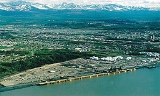
The Port of Anchorage is a critical link between the U.S. state
U.S. state
A U.S. state is any one of the 50 federated states of the United States of America that share sovereignty with the federal government. Because of this shared sovereignty, an American is a citizen both of the federal entity and of his or her state of domicile. Four states use the official title of...
and Alaska
Alaska
Alaska is the largest state in the United States by area. It is situated in the northwest extremity of the North American continent, with Canada to the east, the Arctic Ocean to the north, and the Pacific Ocean to the west and south, with Russia further west across the Bering Strait...
, providing an estimated 90% of the merchandise cargo to 80% of Alaska's populated areas. The Port of Anchorage also provides essential fuel supplies to the Anchorge and southcentral area and serves as the entry point for additional goods and cargos distributed to rural Alaskan communities. It is located just north of Ship Creek
Ship Creek
Ship Creek is an Alaskan river that flows from the Chugach Mountains into Cook Inlet. The Port of Anchorage at the mouth of Ship Creek gave its name to the city of Anchorage that grew up nearby. The river lies entirely within the limits of the Municipality of Anchorage, Alaska....
near downtown Anchorage
Anchorage, Alaska
Anchorage is a unified home rule municipality in the southcentral part of the U.S. state of Alaska. It is the northernmost major city in the United States...
on the Knik Arm of the Cook Inlet
Cook Inlet
Cook Inlet stretches from the Gulf of Alaska to Anchorage in south-central Alaska. Cook Inlet branches into the Knik Arm and Turnagain Arm at its northern end, almost surrounding Anchorage....
of the Pacific Ocean
Pacific Ocean
The Pacific Ocean is the largest of the Earth's oceanic divisions. It extends from the Arctic in the north to the Southern Ocean in the south, bounded by Asia and Australia in the west, and the Americas in the east.At 165.2 million square kilometres in area, this largest division of the World...
.
Geography
The Port of Anchorage is located on the Anchorage side of the Knik Arm of the Cook InletCook Inlet
Cook Inlet stretches from the Gulf of Alaska to Anchorage in south-central Alaska. Cook Inlet branches into the Knik Arm and Turnagain Arm at its northern end, almost surrounding Anchorage....
on the Pacific Ocean
Pacific Ocean
The Pacific Ocean is the largest of the Earth's oceanic divisions. It extends from the Arctic in the north to the Southern Ocean in the south, bounded by Asia and Australia in the west, and the Americas in the east.At 165.2 million square kilometres in area, this largest division of the World...
.
Climate
The Port of Anchorage itself operates year-round, but the Knik Arm of the Cook Inlet freezes over with pan ice from mid-Fall through mid-Spring.Ice
Between October 17. and November 17.,the Knik Arm of the Cook Inlet ices or freezes over for the Winter.
Between March 10. and May 15.,
the ice breaks-up for the Summer.
History
The Port of Anchorage began operations in September, 1961 and in its first year over 38,000 tons of marine cargo moved across its single berth. The Port of Anchorage was the only port in South Central AlaskaSouth Central Alaska
Southcentral Alaska is the portion of the U.S. state of Alaska consisting of the shorelines and uplands of the central Gulf of Alaska. Most of the population of the state lives in this region, concentrated in and around the city of Anchorage....
to survive the 1964 Good Friday Earthquake
Good Friday Earthquake
The 1964 Alaska earthquake, also known as the Great Alaskan Earthquake, the Portage Earthquake and the Good Friday Earthquake, was a megathrust earthquake that began at 5:36 P.M. AST on Good Friday, March 27, 1964...
and became the main shipping hub for consumer and essential goods entering southcentral Alaska. The Port has since expanded to a five-berth terminal providing facilities for the movement of containerized freight, iron and steel products, bulk petroleum and cement. The high water mark of Port operations occurred in 2005 when, for the first time, more than 5 million tons of various commodities moved across the Port's docks.
Anchorage
Anchorage, Alaska
Anchorage is a unified home rule municipality in the southcentral part of the U.S. state of Alaska. It is the northernmost major city in the United States...
is served regularly by two major carriers:
- Horizon Shipping Lines, and
- Totem Ocean Trailer Express (TOTE)
which bring four to five ships weekly from Tacoma, Washington Pacific Northwest
Pacific Northwest
The Pacific Northwest is a region in northwestern North America, bounded by the Pacific Ocean to the west and, loosely, by the Rocky Mountains on the east. Definitions of the region vary and there is no commonly agreed upon boundary, even among Pacific Northwesterners. A common concept of the...
. Petroleum tankers supply jet fuel for airport operations, barges on-load petroleum products for western and Interior Alaska, and ships from Japan
Japan
Japan is an island nation in East Asia. Located in the Pacific Ocean, it lies to the east of the Sea of Japan, China, North Korea, South Korea and Russia, stretching from the Sea of Okhotsk in the north to the East China Sea and Taiwan in the south...
and Korea
Korea
Korea ) is an East Asian geographic region that is currently divided into two separate sovereign states — North Korea and South Korea. Located on the Korean Peninsula, Korea is bordered by the People's Republic of China to the northwest, Russia to the northeast, and is separated from Japan to the...
call frequently transporting construction materials, pipeline for the north slope or loading refined petroleum.
A 128.96 acre (0.5218830656 km²) Industrial Park adjoins the Port to the east. Approximately 80.87 acres (327,269.6 m²) of the Park are under long-term lease to various Port users. Additionally, there are 31 acres (125,452.7 m²) for the staging and storage of marine cargo in transit. However, a majority of that acreage is presently occupied by the two major general cargo carriers, Horizon Lines and Totem Ocean Trailer Excpress (TOTE
Tote
Tote may refer to:*Tote, abbreviation for Tote board, the name for the computerised system which runs parimutuel betting, calculating payoff odds, displaying them, and producing tickets based on incoming bets...
). In order to maintain market dominance, the Port will need to accommodate larger ships, be able to unload containers using better and bigger cranes, and ensure continued service to city businesses, citizens, and the State. As the Port celebrates its 50th year of service in 2011, the current faciltiy is deteriorated and must be replaced leaving the Port extremely vulnerable to failure following a large seimic event. The Port needs to modernize the necessary infrastrcuture and intermodal transportation links needed to meet future demands.
Future
Towards that end, starting in 2003, the Port of Anchorage undertook an initiative to expand and modernize. This will allow the Port to double in size and be a world-class Intermodal facility capable of not only better supporting its current tenants; but also poised to take advantage of growing opportunities being presented by changes occurring in the global shipping industry. When complete, the Port of Anchorage Intermodal Expansion Proejct will contruct a wharf designed to a higher degree of seismic stability with the addition of three "essential facilities" designed to remain operational following a large seismic event.Rail
Direct connection to Alaska RailroadAlaska Railroad
The Alaska Railroad is a Class II railroad which extends from Seward and Whittier, in the south of the state of Alaska, in the United States, to Fairbanks , and beyond to Eielson Air Force Base and Fort Wainwright in the interior of that state...
a Class II railroad
Class II railroad
A Class II railroad in the United States is a mid-sized freight-hauling railroad, in terms of its operating revenue. , a railroad with revenues greater than $20.5 million but less than $277.7 million for at least three consecutive years is considered a Class II railroad...
serving South Central Alaska
South Central Alaska
Southcentral Alaska is the portion of the U.S. state of Alaska consisting of the shorelines and uplands of the central Gulf of Alaska. Most of the population of the state lives in this region, concentrated in and around the city of Anchorage....
and Interior Alaska.
Truck
Nearby truck access to the Alaska intrastate highway routes: Alaska Route 1Alaska Route 1Alaska Route 1 is a state highway in the southern portion of the U.S. state of Alaska. It runs from Homer northeast and east to Tok by way of Anchorage...
North-East bound, the Glenn HighwayGlenn Highway-References:* Pasch, A. D., K. C. May. 2001. Taphonomy and paleoenvironment of hadrosaur from the Matanuska Formation in South-Central Alaska. In: Mesozioc Vertebrate Life. Ed.s Tanke, D. H., Carpenter, K., Skrepnick, M. W. Indiana University Press. Pages 219-236.-External links:**...
to either: Alaska Route 4, the Richardson HighwayRichardson HighwayThe Richardson Highway is a highway in the U.S. state of Alaska, running 368 miles from Valdez to Fairbanks. It is marked as Alaska Route 4 from Valdez to Delta Junction and as Alaska Route 2 from there to Fairbanks. It is also connects segments of Alaska Route 1 between the Glenn Highway and the...
North-bound to Fairbanks or South-bound to Valdez/Cordova. Alaska Route 3 North-bound, the George Parks HighwayGeorge Parks HighwayThe George Parks Highway , usually called simply the Parks Highway, runs 323 miles from the Glenn Highway 35 miles north of Anchorage to Fairbanks in the Alaska Interior...
to WasillaWasilla, AlaskaWasilla is a city in Matanuska-Susitna Borough, United States and the sixth-largest city in Alaska. It is located on the northern point of Cook Inlet in the Matanuska-Susitna Valley of the southcentral part of the state. The city's population was 7,831 at the 2010 census...
, HoustonHouston, AlaskaHouston is a city in Matanuska-Susitna Borough, Alaska, United States. It is part of the Anchorage, Alaska Metropolitan Statistical Area. The population was 1,202 at the 2000 census.-Geography:Houston is located at ....
, WillowWillow, AlaskaWillow is a census-designated place in the Matanuska-Susitna Borough in the U.S. state of Alaska. It is part of the Anchorage, Alaska Metropolitan Statistical Area. At the 2000 census the population was 1,658.-History:...
, TalkeetnaTalkeetna, AlaskaTalkeetna is a census-designated place in Matanuska-Susitna Borough, Alaska, United States. It is part of the Anchorage, Alaska Metropolitan Statistical Area. At the 2000 census the population was 772.-Geography:...
/Trapper CreekTrapper Creek, AlaskaTrapper Creek is a census-designated place in Matanuska-Susitna Borough, Alaska, United States. It is part of the Anchorage, Alaska Metropolitan Statistical Area and is known as the southern gateway to Denali State Park...
, CantwellCantwell, AlaskaCantwell was a railway flag stop at the junction with the Denali Highway. The original town is off the Parks Highway. It is a census-designated place in Denali Borough, Alaska, United States...
, Denali, HealyHealy, AlaskaHealy is a census-designated place in and the borough seat of Denali Borough in the U.S. state of Alaska. The population was 971 at the 2007 census.-Geography:Healy is located at ....
, AndersonAnderson, AlaskaAnderson is a city in Denali Borough, Alaska, United States. At the 2000 census the population was 367. The city is named after one of the original homesteaders.- History :...
/Clear, NenanaNenana, AlaskaNenana is a Home Rule City in the Yukon-Koyukuk Census Area of the Unorganized Borough of the U.S. state of Alaska. Nenana lies at the juncture of the Nenana River and the Tanana River. The population was 402 at the 2000 census. "Nenana" means 'a good place to camp between two rivers.'-History...
and FairbanksFairbanks, AlaskaFairbanks is a home rule city in and the borough seat of the Fairbanks North Star Borough in the U.S. state of Alaska.Fairbanks is the largest city in the Interior region of Alaska, and second largest in the state behind Anchorage...
. Alaska Route 2Alaska Route 2Alaska Route 2 is a state highway in the central and east-central portions of the U.S. state of Alaska. It runs from Manley Hot Springs via Fairbanks to the Yukon Territory, including the entire length of the Alaska Highway in the state.-Route description:...
, the Alaska HighwayAlaska HighwayThe Alaska Highway was constructed during World War II for the purpose of connecting the contiguous U.S. to Alaska through Canada. It begins at the junction with several Canadian highways in Dawson Creek, British Columbia and runs to Delta Junction, Alaska, via Whitehorse, Yukon...
from TokTok, AlaskaTok is a census-designated place in Southeast Fairbanks Census Area, Alaska, United States. The population was 1,393 at the 2000 census.-Geography:...
to FairbanksFairbanks, AlaskaFairbanks is a home rule city in and the borough seat of the Fairbanks North Star Borough in the U.S. state of Alaska.Fairbanks is the largest city in the Interior region of Alaska, and second largest in the state behind Anchorage...
or Yukon Territory, Canada.- Alaska Route 1Alaska Route 1Alaska Route 1 is a state highway in the southern portion of the U.S. state of Alaska. It runs from Homer northeast and east to Tok by way of Anchorage...
South-West bound, the Seward HighwaySeward HighwayThe Seward Highway is a highway in the U.S. state of Alaska that extends 127 miles from Seward to Anchorage. It was completed in 1951 and runs through the scenic Kenai Peninsula and Turnagain Arm, for which it was designated an All-American Road by the U.S...
to either: - Whittier Tunnel and Whittier, AlaskaWhittier, AlaskaWhittier is a city in the Valdez-Cordova Census Area, in the U.S. state of Alaska. As of 2006, the population was 177. The city is also a port for the Alaska Marine Highway.-Geography:...
- Alaska Route 1Alaska Route 1Alaska Route 1 is a state highway in the southern portion of the U.S. state of Alaska. It runs from Homer northeast and east to Tok by way of Anchorage...
, the Sterling HighwaySterling HighwayThe Sterling Highway is a 142-mile highway in the Southcentral region of the U.S. state of Alaska, leading from the Seward Highway at Tern Lake Junction, south of Anchorage, to Homer....
to SterlingSterling, AlaskaSterling is a census-designated place in Kenai Peninsula Borough, Alaska, United States. At the 2000 census the population was 4,705.-Geography:Sterling is located at .Sterling is east of Kenai....
, SoldotnaSoldotna, AlaskaAs of the census of 2000, there were 3,759 people, 1,465 households, and 969 families residing in the city. As of 2008, the population was close to 4,200. The population density was 541.9 people per square mile . There were 1,670 housing units at an average density of 240.7 per square mile...
, and HomerHomer, AlaskaHomer is a city located in Kenai Peninsula Borough in the U.S. state of Alaska. According to 2005 Census Bureau estimates, the population was 5,364. One of Homer's nicknames is "the cosmic hamlet by the sea"; another is "the end of the road"...
.  Alaska Route 9, the Seward HighwaySeward HighwayThe Seward Highway is a highway in the U.S. state of Alaska that extends 127 miles from Seward to Anchorage. It was completed in 1951 and runs through the scenic Kenai Peninsula and Turnagain Arm, for which it was designated an All-American Road by the U.S...
to SewardSeward, AlaskaSeward is a city in Kenai Peninsula Borough in the U.S. state of Alaska. According to 2005 Census Bureau estimates, the population of the city is 3,016....
.
Maritime Services
Port facilities include five berths and 0 foot (0 m) of linear dock space. Docks are maintained at a full seaway depth, which is 35 feet (10.7 m) to 45 feet (13.7 m).The docks have excellent direct connections with the Alaska Railroad
Alaska Railroad
The Alaska Railroad is a Class II railroad which extends from Seward and Whittier, in the south of the state of Alaska, in the United States, to Fairbanks , and beyond to Eielson Air Force Base and Fort Wainwright in the interior of that state...
, and
highway connections to Alaska intrastate highway routes.
? terminal operators use port facilities:
Berths
| Dock |
Berth Length |
Warehouse Storage |
Facilities |
Tenants |
|---|---|---|---|---|
| 1 | 0 foot (0 m) | |||
| 2 | 0 foot (0 m) | |||
| 3 | 0 foot (0 m) | 0 ft2 | ||
| 4 | 0 foot (0 m) | 0 ft2 | ||
| 5 | 0 foot (0 m) | |||
Annual Tonnage
| Year |
U.S. United States The United States of America is a federal constitutional republic comprising fifty states and a federal district... Rank |
Total Ton Ton The ton is a unit of measure. It has a long history and has acquired a number of meanings and uses over the years. It is used principally as a unit of weight, and as a unit of volume. It can also be used as a measure of energy, for truck classification, or as a colloquial term.It is derived from... s |
Domestic Ton Ton The ton is a unit of measure. It has a long history and has acquired a number of meanings and uses over the years. It is used principally as a unit of weight, and as a unit of volume. It can also be used as a measure of energy, for truck classification, or as a colloquial term.It is derived from... s |
Foreign Total Ton Ton The ton is a unit of measure. It has a long history and has acquired a number of meanings and uses over the years. It is used principally as a unit of weight, and as a unit of volume. It can also be used as a measure of energy, for truck classification, or as a colloquial term.It is derived from... s |
Foreign Imports Ton Ton The ton is a unit of measure. It has a long history and has acquired a number of meanings and uses over the years. It is used principally as a unit of weight, and as a unit of volume. It can also be used as a measure of energy, for truck classification, or as a colloquial term.It is derived from... s |
Foreign Exports Ton Ton The ton is a unit of measure. It has a long history and has acquired a number of meanings and uses over the years. It is used principally as a unit of weight, and as a unit of volume. It can also be used as a measure of energy, for truck classification, or as a colloquial term.It is derived from... s |
Reference |
|---|---|---|---|---|---|---|---|
| 2006 | 102 | 2,926,536 | 2,306,192 | 620,344 | 464,774 | 155,570 | |
| 2005 | 94 | 3,527,469 | 2,629,553 | 897,916 | 430,396 | 467,520 | |
| 2004 | 101 | 3,085,753 | 2,323,089 | 762,664 | 284,347 | 478,317 | |
| 2003 | 96 | 3,178,633 | 2,494,261 | 684,372 | 218,233 | 466,139 | |
| 2002 | 102 | 2,983,137 | 2,318,653 | 664,484 | 251,203 | 413,281 | |
| 2001 | 108 | 2,861,134 | 2,157,496 | 703,638 | 225,281 | 478,357 | |
| 2000 | 103 | 3,157,247 | 2,416,514 | 740,733 | 382,240 | 358,493 |
Annual Container Traffic
| Year |
Domestic Inbound Loaded TEU Twenty-foot equivalent unit The twenty-foot equivalent unit is an inexact unit of cargo capacity often used to describe the capacity of container ships and container terminals... s |
Domestic Inbound Empty TEU Twenty-foot equivalent unit The twenty-foot equivalent unit is an inexact unit of cargo capacity often used to describe the capacity of container ships and container terminals... s |
Domestic Outbound Loaded TEU Twenty-foot equivalent unit The twenty-foot equivalent unit is an inexact unit of cargo capacity often used to describe the capacity of container ships and container terminals... s |
Domestic Outbound Empty TEU Twenty-foot equivalent unit The twenty-foot equivalent unit is an inexact unit of cargo capacity often used to describe the capacity of container ships and container terminals... s |
Domestic Total TEU Twenty-foot equivalent unit The twenty-foot equivalent unit is an inexact unit of cargo capacity often used to describe the capacity of container ships and container terminals... s |
Foreign Inbound Loaded TEU Twenty-foot equivalent unit The twenty-foot equivalent unit is an inexact unit of cargo capacity often used to describe the capacity of container ships and container terminals... s |
Foreign Outbound Loaded TEU Twenty-foot equivalent unit The twenty-foot equivalent unit is an inexact unit of cargo capacity often used to describe the capacity of container ships and container terminals... s |
Foreign Total Loaded TEU Twenty-foot equivalent unit The twenty-foot equivalent unit is an inexact unit of cargo capacity often used to describe the capacity of container ships and container terminals... s |
Grand Total Loaded TEU Twenty-foot equivalent unit The twenty-foot equivalent unit is an inexact unit of cargo capacity often used to describe the capacity of container ships and container terminals... s |
References |
|---|---|---|---|---|---|---|---|---|---|---|
| 2006 | 227,126 | 523 | 47,641 | 3,216 | 278,506 | 0 | 2,342 | 2,342 | 277,109 | |
| 2005 | 231,274 | 656 | 59,864 | 25,379 | 317,173 | 299 | 1,881 | 2,180 | 293,318 | |
| 2004 | 440,559 | 207 | 161,301 | 61,441 | 663,508 | 1,880 | 527 | 2,407 | 604,267 | |
| 2003 | 223,962 | 183 | 58,056 | 10,423 | 292,623 | 383 | 347 | 730 | 282,748 | |
General References
- United States Army Corps of EngineersUnited States Army Corps of EngineersThe United States Army Corps of Engineers is a federal agency and a major Army command made up of some 38,000 civilian and military personnel, making it the world's largest public engineering, design and construction management agency...
, United States Department of DefenseUnited States Department of DefenseThe United States Department of Defense is the U.S...