Pinery Provincial Park
Encyclopedia
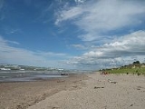
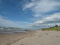
The Pinery Provincial Park is a park located on Lake Huron
near Grand Bend
, Ontario
. It occupies an area of 25.32 square kilometres (6,330 acres).
 The park features the largest area of Oak Savanna
in Ontario. To preserve this habitat, a population control program for White-tailed Deer
has been implemented. During the early 1960s, because the value of the native savanna was not recognized, large numbers of Red
and White pine
trees were planted in the park, displacing the native vegetation. That is also how the park got its name.
The Old Ausable Channel is a wide, slow-moving river which flows through the park. It was separated from the main Ausable River when two channels were excavated at Port Franks
and Grand Bend
at the end of the 19th century.
Juniper trees
growing in the dunes are constantly shifting with the sands. Fallen junipers are eventually re-buried, with main branches becoming new trees, so that distant trees are genetically identical, and sometimes still connected below ground. The oak trees are also critical to this habitat. Oaks are one of the few trees that will share the water it draws from deep underground with the surface plants that surround it, a critical element in this dry sandy ecosystem.
Many of the plant species in the park depend on fire to reproduce. In recent years controlled burning has been attempted to try and restore some of the original flora and fauna.
In 1966, the park saw a 433-acre addition, adding 200 campsites to the park's existing 1,075 to accommodate the growth of the park patronage, which had reached peaks of 1,500 campers per day, causing many to be packed into overflow areas.
As part of a Government of Ontario pilot program, visitors to Pinery Provincial Park will be able to access free wireless internet until November 2011, after which the program will be re-evaluated.
To ensure that the water at public beaches is safe for swimming, the Community Health Services Department regularly conducts sampling for beach water quality. Ontario beaches are posted with warnings of possible health risks when elevated E. coli levels are detected. Storm water runoff, combined with sewer overflows, sewage treatment plant by-passes, agricultural runoff, faulty septic systems, and large populations of waterfowl which colonize a beach or the surrounding area all contribute to water pollution which can result in beach postings. Warning signs at Pinery Provincial Park we're removed the week of Monday, August 15, 2011.
Lake Huron
Lake Huron is one of the five Great Lakes of North America. Hydrologically, it comprises the larger portion of Lake Michigan-Huron. It is bounded on the east by the Canadian province of Ontario and on the west by the state of Michigan in the United States...
near Grand Bend
Grand Bend, Ontario
Grand Bend, often referred to as simply "The Bend" or "GB," is a Southern Ontario community located on the shores of Lake Huron and a part of the municipality of Lambton Shores in the county of Lambton.Grand Bend is home to a variety of stores and eateries...
, Ontario
Ontario
Ontario is a province of Canada, located in east-central Canada. It is Canada's most populous province and second largest in total area. It is home to the nation's most populous city, Toronto, and the nation's capital, Ottawa....
. It occupies an area of 25.32 square kilometres (6,330 acres).

Oak savanna
An oak savanna is a type of savanna, or lightly forested grassland, where oaks are the dominant tree species. These savannas were maintained historically through wildfires set by lightning, grazing, low precipitation, poor soil, and/or fires set by Native Americans...
in Ontario. To preserve this habitat, a population control program for White-tailed Deer
White-tailed Deer
The white-tailed deer , also known as the Virginia deer or simply as the whitetail, is a medium-sized deer native to the United States , Canada, Mexico, Central America, and South America as far south as Peru...
has been implemented. During the early 1960s, because the value of the native savanna was not recognized, large numbers of Red
Red Pine
Pinus resinosa, commonly known as the red pine or Norway pine, is pine native to North America. The Red Pine occurs from Newfoundland west to Manitoba, and south to Pennsylvania, with several smaller, disjunct populations occurring in the Appalachian Mountains in Virginia and West Virginia, as well...
and White pine
Eastern White Pine
Pinus strobus, commonly known as the eastern white pine, is a large pine native to eastern North America, occurring from Newfoundland west to Minnesota and southeastern Manitoba, and south along the Appalachian Mountains to the northern edge of Georgia.It is occasionally known as simply white pine,...
trees were planted in the park, displacing the native vegetation. That is also how the park got its name.
The Old Ausable Channel is a wide, slow-moving river which flows through the park. It was separated from the main Ausable River when two channels were excavated at Port Franks
Port Franks, Ontario
Port Franks is a small Southern Ontario community in the municipality of Lambton Shores, Lambton County in southwestern Ontario, Canada. It is located along Kings Highway 21 near Pinery Provincial Park, about north of Thedford, Ontario...
and Grand Bend
Grand Bend, Ontario
Grand Bend, often referred to as simply "The Bend" or "GB," is a Southern Ontario community located on the shores of Lake Huron and a part of the municipality of Lambton Shores in the county of Lambton.Grand Bend is home to a variety of stores and eateries...
at the end of the 19th century.
Juniper trees
Juniper
Junipers are coniferous plants in the genus Juniperus of the cypress family Cupressaceae. Depending on taxonomic viewpoint, there are between 50-67 species of juniper, widely distributed throughout the northern hemisphere, from the Arctic, south to tropical Africa in the Old World, and to the...
growing in the dunes are constantly shifting with the sands. Fallen junipers are eventually re-buried, with main branches becoming new trees, so that distant trees are genetically identical, and sometimes still connected below ground. The oak trees are also critical to this habitat. Oaks are one of the few trees that will share the water it draws from deep underground with the surface plants that surround it, a critical element in this dry sandy ecosystem.
Many of the plant species in the park depend on fire to reproduce. In recent years controlled burning has been attempted to try and restore some of the original flora and fauna.
In 1966, the park saw a 433-acre addition, adding 200 campsites to the park's existing 1,075 to accommodate the growth of the park patronage, which had reached peaks of 1,500 campers per day, causing many to be packed into overflow areas.
As part of a Government of Ontario pilot program, visitors to Pinery Provincial Park will be able to access free wireless internet until November 2011, after which the program will be re-evaluated.
To ensure that the water at public beaches is safe for swimming, the Community Health Services Department regularly conducts sampling for beach water quality. Ontario beaches are posted with warnings of possible health risks when elevated E. coli levels are detected. Storm water runoff, combined with sewer overflows, sewage treatment plant by-passes, agricultural runoff, faulty septic systems, and large populations of waterfowl which colonize a beach or the surrounding area all contribute to water pollution which can result in beach postings. Warning signs at Pinery Provincial Park we're removed the week of Monday, August 15, 2011.
External links
- Pinery Provincial Park, Official Web Site
- Friends of Pinery Park

