

Picacho Peak State Park
Encyclopedia
Picacho Peak State Park is a state park
of Arizona
, USA, surrounding Picacho Peak. The park is located between Casa Grande
and Tucson
near Interstate 10
in Pinal County
. Its centerpiece spire is visible from downtown Tucson, a distance of 45 miles (72.4 km). The summit rises to 3374 feet (1,028.4 m) above mean sea level. Though appearing to be the remnant of a volcanic neck, it is now believed to be a tilted and eroded piece of rock overlain by a lava flow. The place name is redundant: "picacho" means "big peak" in Spanish.

 The park is celebrated for wildflowers that appear mid-March to early April following good winter rain. Though set next to an interstate highway (10
), the park's west face possesses an unspoiled Sonoran Desert
setting. A small flat space on top of the spire can be reached via two trail heads. Portions of the trails are precarious, and hikers are aided by cables and catwalks, making the routes some of the few Via ferrata
in the United States. From the top, there is a view south to the Santa Catalina Mountains
near Tucson, northwest to Tabletop Mountain near Casa Grande, north to the many mountain ranges surrounding Phoenix
, and west to where the north-running Santa Cruz River runs underground supporting farms in a desert valley.
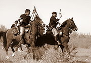
The park is near the site of the Battle of Picacho Peak, one of several American Civil War
era engagements to occur in Arizona Territory
. A Union
cavalry patrol from California skirmished with Confederate
scouts from Texas, and three men were killed. This marks the westernmost battle of the American Civil War. Every year during early March, there are reenactments of the battle and other demonstrations of Civil War military history.
Picacho is a Spanish word meaning big peak, and there are many features with the word in its name across the U.S. Southwest
. A stop on the Butterfield Overland Mail
existed until the 1860's. There is another Picacho Peak near Seligman, Arizona
, one outside Las Cruces, New Mexico
, and one in the Santa Fe, New Mexico
area. The mining settlement of Picacho, California
(now a ghost town
) was named after another picacho.
The Hunter Trail is a hiking path to the top of the peak. It is not a technical climb, but includes an interval where steel cables have been installed to aid ascending hikers. The park recommends that hikers wear hiking boots and carry two liters of water per person. Gloves are commonly used to help grip the cables.
by Stephenie Meyer
, serving as a guide to the main character in the first act of the story. Much of the action of the novel takes place in or near the state park.
State park
State parks are parks or other protected areas managed at the federated state level within those nations which use "state" as a political subdivision. State parks are typically established by a state to preserve a location on account of its natural beauty, historic interest, or recreational...
of Arizona
Arizona
Arizona ; is a state located in the southwestern region of the United States. It is also part of the western United States and the mountain west. The capital and largest city is Phoenix...
, USA, surrounding Picacho Peak. The park is located between Casa Grande
Casa Grande, Arizona
Casa Grande is a city in Pinal County, approximately halfway between Phoenix and Tucson in the U.S. state of Arizona. According to 2010 Census, the population of the city is 48,571...
and Tucson
Tucson, Arizona
Tucson is a city in and the county seat of Pima County, Arizona, United States. The city is located 118 miles southeast of Phoenix and 60 miles north of the U.S.-Mexico border. The 2010 United States Census puts the city's population at 520,116 with a metropolitan area population at 1,020,200...
near Interstate 10
Interstate 10
Interstate 10 is the fourth-longest Interstate Highway in the United States, after I-90, I-80, and I-40. It is the southernmost east–west, coast-to-coast Interstate Highway, although I-4 and I-8 are further south. It stretches from the Pacific Ocean at State Route 1 in Santa Monica,...
in Pinal County
Pinal County, Arizona
-2010:Whereas according to the 2010 U.S. Census Bureau:*72.4% White*4.6% Black*5.6% Native American*1.7% Asian*0.4% Native Hawaiian or Pacific Islander*3.8% Two or more races*11.5% Other races*28.5% Hispanic or Latino -2000:...
. Its centerpiece spire is visible from downtown Tucson, a distance of 45 miles (72.4 km). The summit rises to 3374 feet (1,028.4 m) above mean sea level. Though appearing to be the remnant of a volcanic neck, it is now believed to be a tilted and eroded piece of rock overlain by a lava flow. The place name is redundant: "picacho" means "big peak" in Spanish.
Interstate 10
Interstate 10 is the fourth-longest Interstate Highway in the United States, after I-90, I-80, and I-40. It is the southernmost east–west, coast-to-coast Interstate Highway, although I-4 and I-8 are further south. It stretches from the Pacific Ocean at State Route 1 in Santa Monica,...
), the park's west face possesses an unspoiled Sonoran Desert
Sonoran Desert
The Sonoran Desert is a North American desert which straddles part of the United States-Mexico border and covers large parts of the U.S. states of Arizona and California and the northwest Mexican states of Sonora, Baja California, and Baja California Sur. It is one of the largest and hottest...
setting. A small flat space on top of the spire can be reached via two trail heads. Portions of the trails are precarious, and hikers are aided by cables and catwalks, making the routes some of the few Via ferrata
Via ferrata
A via ferrata or klettersteig is a mountain route which is equipped with fixed cables, stemples, ladders, and bridges. The use of these allows otherwise isolated routes to be joined to create longer routes which are accessible to people with a wide range of climbing abilities...
in the United States. From the top, there is a view south to the Santa Catalina Mountains
Santa Catalina Mountains
The Santa Catalina Mountains, commonly referred to as the Catalina Mountains, are located north, and northeast of Tucson, Arizona, United States, on Tucson's north perimeter. The mountain range is the most prominent in the Tucson area, with the highest average elevation...
near Tucson, northwest to Tabletop Mountain near Casa Grande, north to the many mountain ranges surrounding Phoenix
Phoenix, Arizona
Phoenix is the capital, and largest city, of the U.S. state of Arizona, as well as the sixth most populated city in the United States. Phoenix is home to 1,445,632 people according to the official 2010 U.S. Census Bureau data...
, and west to where the north-running Santa Cruz River runs underground supporting farms in a desert valley.
The park is near the site of the Battle of Picacho Peak, one of several American Civil War
American Civil War
The American Civil War was a civil war fought in the United States of America. In response to the election of Abraham Lincoln as President of the United States, 11 southern slave states declared their secession from the United States and formed the Confederate States of America ; the other 25...
era engagements to occur in Arizona Territory
Arizona Territory (CSA)
The Territory of Arizona was a territory claimed by the Confederate States of America during the American Civil War, between 1861 and 1865. It consisted of the portion of the New Mexico Territory south of the 34th parallel north including parts of the modern states of New Mexico and Arizona. Its...
. A Union
Union Army
The Union Army was the land force that fought for the Union during the American Civil War. It was also known as the Federal Army, the U.S. Army, the Northern Army and the National Army...
cavalry patrol from California skirmished with Confederate
Confederate States Army
The Confederate States Army was the army of the Confederate States of America while the Confederacy existed during the American Civil War. On February 8, 1861, delegates from the seven Deep South states which had already declared their secession from the United States of America adopted the...
scouts from Texas, and three men were killed. This marks the westernmost battle of the American Civil War. Every year during early March, there are reenactments of the battle and other demonstrations of Civil War military history.
Picacho is a Spanish word meaning big peak, and there are many features with the word in its name across the U.S. Southwest
Southwestern United States
The Southwestern United States is a region defined in different ways by different sources. Broad definitions include nearly a quarter of the United States, including Arizona, California, Colorado, Nevada, New Mexico, Oklahoma, Texas and Utah...
. A stop on the Butterfield Overland Mail
Butterfield Overland Mail
The Butterfield Overland Mail Trail was a stagecoach route in the United States, operating from 1857 to 1861. It was a conduit for the U.S. mail from two eastern termini, Memphis, Tennessee and St. Louis, Missouri, meeting Fort Smith, Arkansas, and continuing through Indian Territory, New Mexico,...
existed until the 1860's. There is another Picacho Peak near Seligman, Arizona
Seligman, Arizona
Seligman is a census-designated place in Yavapai County, Arizona, United States. The population was 456 at the 2000 census.-History:Between 1889-1891, Seligman was established by the Theut and Moultrie families. Both were prosperous slaughterhouse owners in Southern antebellum families who lost...
, one outside Las Cruces, New Mexico
Las Cruces, New Mexico
Las Cruces, also known as "The City of the Crosses", is the county seat of Doña Ana County, New Mexico, United States. The population was 97,618 in 2010 according to the 2010 Census, making it the second largest city in the state....
, and one in the Santa Fe, New Mexico
Santa Fe, New Mexico
Santa Fe is the capital of the U.S. state of New Mexico. It is the fourth-largest city in the state and is the seat of . Santa Fe had a population of 67,947 in the 2010 census...
area. The mining settlement of Picacho, California
Picacho, California
Picacho is an unincorporated community in Imperial County, California. It is located on the Colorado River south-southeast of Palo Verde, at an elevation of 203 feet .Picacho, now a ghost town, was an early mining town on the Colorado River...
(now a ghost town
Ghost town
A ghost town is an abandoned town or city. A town often becomes a ghost town because the economic activity that supported it has failed, or due to natural or human-caused disasters such as floods, government actions, uncontrolled lawlessness, war, or nuclear disasters...
) was named after another picacho.
The Hunter Trail is a hiking path to the top of the peak. It is not a technical climb, but includes an interval where steel cables have been installed to aid ascending hikers. The park recommends that hikers wear hiking boots and carry two liters of water per person. Gloves are commonly used to help grip the cables.
Appearances in fiction
Picacho Peak features prominently in the novel The HostThe Host (novel)
The Host is a science fiction/romance novel by Stephenie Meyer. The novel introduces an alien race, called Souls, which takes over the Earth and its inhabitants. The book describes one Soul's predicament when the mind of its human host refuses to cooperate with her takeover. The Host was released...
by Stephenie Meyer
Stephenie Meyer
Stephenie Meyer is an American author known for her vampire romance series Twilight. The Twilight novels have gained worldwide recognition and sold over 100 million copies globally, with translations into 37 different languages...
, serving as a guide to the main character in the first act of the story. Much of the action of the novel takes place in or near the state park.