
Pershing Township, Jackson County, Indiana
Encyclopedia
Pershing Township is one of twelve townships
in Jackson County
, Indiana
, USA
. As of the 2000 census
, its population was 1,386.
Civil township
A civil township is a widely used unit of local government in the United States, subordinate to, and geographic divisions of, a county. Specific responsibilities and the degree of autonomy vary based on each state. Civil townships are distinct from survey townships, but in states that have both,...
in Jackson County
Jackson County, Indiana
Jackson County is a county located in the U.S. state of Indiana. As of 2010, the population was 42,376. The county seat is Brownstown.-History:...
, Indiana
Indiana
Indiana is a US state, admitted to the United States as the 19th on December 11, 1816. It is located in the Midwestern United States and Great Lakes Region. With 6,483,802 residents, the state is ranked 15th in population and 16th in population density. Indiana is ranked 38th in land area and is...
, USA
United States
The United States of America is a federal constitutional republic comprising fifty states and a federal district...
. As of the 2000 census
United States Census, 2000
The Twenty-second United States Census, known as Census 2000 and conducted by the Census Bureau, determined the resident population of the United States on April 1, 2000, to be 281,421,906, an increase of 13.2% over the 248,709,873 persons enumerated during the 1990 Census...
, its population was 1,386.
Geography
Pershing Township covers an area of 30.85 square miles (79.9 km²); of this, 0.07 square mile (0.1812991677 km²) or 0.23 percent is water. Lakes in this township include Beck Pond, Buckskin Pond, Fox Pond and Scholl Pond. The streams of Cross Branch and Runt Run run through this township.Adjacent townships
- Jackson Township, Bartholomew CountyJackson Township, Bartholomew County, IndianaJackson Township is one of twelve townships in Bartholomew County, Indiana, USA. As of the 2000 census, its population was 940.-Geography:According to the United States Census Bureau, Jackson Township covers an area of ; of this, or 0.89 percent is water....
(northeast) - Hamilton TownshipHamilton Township, Jackson County, IndianaHamilton Township is one of twelve townships in Jackson County, Indiana, USA. As of the 2000 census, its population was 1,615.-Geography:Hamilton Township covers an area of ; of this, or 0.82 percent is water. Lakes in this township include Docs Lake...
(east) - Brownstown TownshipBrownstown Township, Jackson County, IndianaBrownstown Township is one of twelve townships in Jackson County, Indiana, USA. As of the 2000 census, its population was 5,301.-Geography:Brownstown Township covers an area of ; of this, or 1.6 percent is water...
(southeast) - Owen TownshipOwen Township, Jackson County, IndianaOwen Township is one of twelve townships in Jackson County, Indiana, USA. As of the 2000 census, its population was 1,625.-Geography:Owen Township covers an area of ; of this, or 0.32 percent is water...
(southwest) - Salt Creek TownshipSalt Creek Township, Jackson County, IndianaSalt Creek Township is one of twelve townships in Jackson County, Indiana, USA. As of the 2000 census, its population was 309.-Geography:Salt Creek Township covers an area of ; of this, or 0.21 percent is water...
(west) - Van Buren Township, Brown CountyVan Buren Township, Brown County, IndianaVan Buren Township is one of four townships in Brown County, Indiana. As of the 2000 census, its population was 1,782. The township includes the southern portion of Brown County State Park.-History:...
(northwest)
Major highways
-
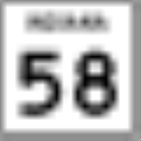
 Indiana State Road 58Indiana State Road 58State Road 58 is an east–west road in Central Indiana. State Road 58 runs from Merom in the west to Columbus in the east, a distance of approximately . Along its route it has concurrencies with one U.S. Route and six other Indiana state roads....
 -
 Indiana State Road 135Indiana State Road 135State Road 135 in the U.S. State of Indiana is a road that connects Indianapolis with the Ohio River; for the most part it is a two-lane road.-Route description:The southern terminus is the Matthew E. Welsh Bridge on the east side of Mauckport...
 -
 Indiana State Road 258Indiana State Road 258State Road 258 is a short undivided two-lane road in Jackson County in the southern part of the U.S. state of Indiana.-Route description:State Road 258 begins at State Road 58 about a mile northeast of the small town of Freetown. From here, it runs east to State Road 11 in Seymour, a distance of...