

Pennsylvania Route 405
Encyclopedia
Pennsylvania Route 405 is a state highway
that runs for 28.05 miles (45.1 km) in north central Pennsylvania
, United States
. The southern terminus of Pennsylvania Route 147
in West Chillisquaque Township. The route heads northward along the West Branch Susquehanna River
through Milton
, Watsontown
and Muncy
until entering Hughesville
, where it terminates at an intersection with U.S. Route 220
.
Route 405 originated as the Muncy and Hughesville Plank Road, a 5 miles (8 km) plank road
from Muncy to Hughesville, created in 1853. The plank road also consisted of a bridge over the Muncy Canal on the outskirts of the community. Route 405 was assigned in 1941, after switching between numerous designations, including alignments of U.S. Route 15
, U.S. Route 111
, U.S. Route 220
, and U.S. Route 711. The alignment of Route 405 was extended to its current southern terminus when Route 147 was realigned onto a new highway. As part of the Central Susquehanna Valley Transportation Project, PA 405 will continue south from its current southern terminus, replacing the stretch of PA 147
until its junction with PA 61
in Sunbury, its new southern terminus. PA 147 will have an alternate route between those two junctions and will not be duplexed with PA 405 at any point.
 On May 31, 1911, the state of Pennsylvania signed the Sproul Road Bill, which started a drastic state takeover of highways. Originally, only several routes were assigned around the state. The stretch of Route 405 from the southern terminus to the current day intersection with Pennsylvania Route 44
was designated as Legislative Route 18. The portion of Route 405 along the Route 44 concurrency to Delwart was designated as Legislative Route 240 (most of this alignment is Route 44). The stretch from Delwart to Montgomery was not designated in 1911. From Montgomery to Muncy, Route 405 follows more of Legislative Route 240. After Muncy, Route 405 follows Legislative Route 19 until the current terminus in Hughesville.
When the switch was made in 1924 from the old highway system in Pennsylvania, the alignment of Route 405 was designated as Pennsylvania Legislative Route 4 from the community of Chillisquaque to the intersection with the Susquehanna Trail
. Route 4 was designated in 1925 along the main alignment of the Susquehanna Trail. The route designation remained in place for a short time. The stretch from Muncy to Hughesville (which followed the alignment of the Penn's Plank Road), was designated in 1926 as an alignment of U.S. Route 220. The portion of Route 4 from Chillisquaque to the Susquehanna trail was also designated as U.S. Route 111
and U.S. Route 711, both decommissioned spurs of U.S. Route 11
in 1926. Route 111 remained in place until 1936, while Route 711 and Route 4 were decommissioned in 1928 and 1930 respectively. In 1928, the segment of Route 4 from Watsontown to Muncy was re-designated as Pennsylvania Route 14
. In 1936, U.S. Route 111 was decommissioned, and the route from Chillisquaque to Watsontown was redesignated as part of U.S. Route 15
. PA 14, US 220 and US 15 remained on most of Route 405's alignment until 1941, when the alignment of all three routes were changed. Upon the decommissioning, Route 405 was designated onto the alignment from the Susquehanna Trail (where it intersected with Route 147) to Hughesville. The alignment of Route 405 south of the Susquehanna Trail was part of Route 147 until 1972, when it was realigned, and Route 405 was extended to Chillisquaque.
. The Central Susquehanna Transportation Project is proposing to extend the super-two freeway alignment of PA 147 on a new freeway along the opposite side of the Susquehanna. The designation of Route 405 is proposed to be extended over the non-freeway alignment of Route 147 down to an intersection with Pennsylvania Route 61
in Sunbury
. An interchange with Route 405 would also be constructed. The 12 miles (19.3 km) long project will also involve a realignment of U.S. Route 11 and U.S. Route 15 onto the new alignment as well, a proposal that lost funding in the 1970s. As of July 2009, the design is 40% completed, while the project was put on a freeze by Governor Edward Rendell. The project, which will take $9 million (2009 USD) to study and design, and another $525 million (2009 USD) to construct.
 Route 405 begins at an intersection with Pennsylvania Route 147
in Chillisquaque. The route heads to the northwest, heading along a parallel to Route 147 near rural farms and houses. The route reaches the center of Chillisquaque, where it turns westward for a distance through an isolated area along the West Branch of the Susquehanna River. The route meets the shoreline, where Route 405 turns to the northwest along a rural, unpopulated stretch of West Chillisquaque Township. The route heads northward, crossing through a deep patch of forests. A short distance later, the forests dissipate, and Route 405 intersects with Pennsylvania Route 45
(the Purple Heart Highway) just across the river from Lewisburg
. Route 405 continues northward along the Susquehanna River, intersecting with a former alignment of Route 45 a short distance later. The route continues through the rural farmland along the river, entering the small community of East Lewisburg. North of East Lewisburg, Route 405 passes a large farmland plot before leaving the shoreline of the Susquehanna West Branch. The route continues northward a short distance from the Susquehanna River before entering the community of Milton
.
In Milton, Route 405 crosses over a set of railroad tracks and turns onto Ferry Lane. The route heads eastward until turning northward onto Garfield Street, heading past homes and businesses and intersecting with Pennsylvania Route 642
(Mahoning Street). The route continues northward onto South Arch Street, intersecting with Center Street, where it turns northward. At the end of the block, Route 405 intersects with Pennsylvania Route 254 (Broadway Road). The highway continues northward, intersecting with local streets and paralleling railroad tracks. At the intersection with 10th Street, Route 405 turns to the northwest and leaves the community of Milton. The route returns to the shoreline of the West Branch of the Susquehanna River, continuing northward along the Turbot Hills Golf Course. The route continues northward, intersecting with Golf Course Road, where the route becomes surrounded by forests. A short distance later, Route 405 crosses under the four lane alignment of Interstate 80
and intersects an old alignment of the Susquehanna Trail
. The route continues northward along the West Branch of the Susquehanna River, passing a large industrial complex before reaching a merge in the railroad tracks. At the merge, Route 405 enters the community of Watsontown
.
 After entering Watsontown, Route 405 passes the local memorial park and intersects with Pennsylvania Route 44
(South Main Street). Route 405 and Route 44 become concurrent along Main Street into downtown Watsontown. The two highways continue several blocks from the Susquehanna River, intersecting with Brimmer Avenue. The surroundings of the highways are highly populated, and the two routes continue in Watsontown until an intersection with East 11th Street, when the two roads leave the community. Routes 405 and 44 continue northward, intersecting with local roads in a rural region north of Watsontown. The highways continue, entering the community of Dewart, where Route 44 turns to the west towards the Susquehanna West Branch. Route 405 continues northward, bypassing around Dewart and crossing the railroad tracks it had been paralleling for the distance. The route continues northward, leaving Dewart at an intersection with Delaware Drive. The route heads northward, crossing through the rural areas before intersecting with Pennsylvania Route 54
, where they merge. Routes 405 and 54 continue through a deep patch of forests before crossing the river, entering the community of Montgomery
.
 In Montgomery, Routes 405 and 54 continue for a short distance along Second Street, until Montgomery Street, where Route 405 turns to the northeast, while Route 54 turns to the northwest. Route 405 continues along Montgomery Street, passing through downtown. At an intersection with School House Road, the highway leaves Montgomery. Route 405 continues to the northeast along a set of railroad tracks and at an intersection with Saegers Station Road, enters the community of Saegers. At a merge with Private 158 Road, Route 405 turns to the north, passing the small community to the north. At an intersection with Armstrong Road, the highway turns to the northeast, leaving Saegers. The route continues to the east, crossing over the West Branch once again, entering the community of Muncy
. In Muncy, the highway heads to the southeast along Water Street into the community center, where it turns to the northeast. The route leaves Muncy a short distance later, interchanging with Interstate 180
Exit 13. Route 405 heads to the northeast until reaching Muncy Creek, where it turns to the southeast, intersecting with the western terminus of Pennsylvania Route 442
. Route 405 continues farther, intersecting with local roads, running along South Main Street for a distance, entering the community of Hughesville
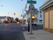
, where the highway becomes densely populated. The route heads northward, intersecting with the western terminus of Pennsylvania Route 118
. The route continues northward for a short distance, with the Route 405 designation terminating at an intersection with U.S. Route 220
.
State highway
State highway, state road or state route can refer to one of three related concepts, two of them related to a state or provincial government in a country that is divided into states or provinces :#A...
that runs for 28.05 miles (45.1 km) in north central Pennsylvania
Pennsylvania
The Commonwealth of Pennsylvania is a U.S. state that is located in the Northeastern and Mid-Atlantic regions of the United States. The state borders Delaware and Maryland to the south, West Virginia to the southwest, Ohio to the west, New York and Ontario, Canada, to the north, and New Jersey to...
, United States
United States
The United States of America is a federal constitutional republic comprising fifty states and a federal district...
. The southern terminus of Pennsylvania Route 147
Pennsylvania Route 147
Pennsylvania Route 147 is a north–south route that runs for along the east shore of the Susquehanna River in central Pennsylvania, United States. The northern terminus is at an interchange with Interstate 80 and Interstate 180 in Turbot Township. The southern terminus is at an interchange...
in West Chillisquaque Township. The route heads northward along the West Branch Susquehanna River
West Branch Susquehanna River
The West Branch Susquehanna River is one of the two principal branches, along with the North Branch, of the Susquehanna River in the northeastern United States. The North Branch, which rises in upstate New York, is generally regarded as the extension of the main branch, with the shorter West Branch...
through Milton
Milton, Pennsylvania
Milton is a borough in Northumberland County, Pennsylvania, on the Susquehanna River, north of Harrisburg. Settled in 1770, it was incorporated in 1817, and is governed by a charter that was revised in 1890...
, Watsontown
Watsontown, Pennsylvania
Watsontown is a borough in Northumberland County, Pennsylvania, United States. The population was 2,255 at the 2000 census. It was named for John Watson, a local landowner.-Geography:Watsontown is located at ....
and Muncy
Muncy, Pennsylvania
For other places named 'Muncy', please see Muncy .Muncy is a borough in Lycoming County, Pennsylvania, in the United States. The name Muncy comes from the Munsee Indians who once lived in the area. The population was 2,663 at the 2000 census. It is part of the Williamsport, Pennsylvania...
until entering Hughesville
Hughesville, Pennsylvania
Hughesville is a borough in Lycoming County, Pennsylvania, United States. The population was 2,220 at the 2000 census. It is part of the Williamsport, Pennsylvania Metropolitan Statistical Area.-History:...
, where it terminates at an intersection with U.S. Route 220
U.S. Route 220
U.S. Route 220 is a long U.S. Route in the eastern United States.US 220 is a spur route of U.S. Route 20 but at present, the two routes do not intersect nor do they connect via other spurs of US 20. The former U. S. Route 120, which was signed in Pennsylvania between 1926 and 1967, intersected...
.
Route 405 originated as the Muncy and Hughesville Plank Road, a 5 miles (8 km) plank road
Plank road
A plank road or puncheon is a dirt path or road covered with a series of planks, similar to the wooden sidewalks one would see in a Western movie. Plank roads were very popular in Ontario, the U.S. Northeast and U.S. Midwest in the first half of the 19th century...
from Muncy to Hughesville, created in 1853. The plank road also consisted of a bridge over the Muncy Canal on the outskirts of the community. Route 405 was assigned in 1941, after switching between numerous designations, including alignments of U.S. Route 15
U.S. Route 15
U.S. Route 15 is a -long United States highway, designated along South Carolina, North Carolina, Virginia, Maryland, Pennsylvania, and New York. The route is signed north–south, from U.S. Route 17 Alternate in Walterboro, South Carolina to Interstate 86 and NY 17 in Painted Post, New York.US...
, U.S. Route 111
U.S. Route 111
U.S. Route 111 was a U.S. Route that ran from Baltimore, Maryland north to the Harrisburg, Pennsylvania area. It replaced part of the Susquehanna Trail and was in turn replaced by Interstate 83. Portions of its pre-freeway alignment are now Maryland Route 45 and Interstate 83 Business...
, U.S. Route 220
U.S. Route 220
U.S. Route 220 is a long U.S. Route in the eastern United States.US 220 is a spur route of U.S. Route 20 but at present, the two routes do not intersect nor do they connect via other spurs of US 20. The former U. S. Route 120, which was signed in Pennsylvania between 1926 and 1967, intersected...
, and U.S. Route 711. The alignment of Route 405 was extended to its current southern terminus when Route 147 was realigned onto a new highway. As part of the Central Susquehanna Valley Transportation Project, PA 405 will continue south from its current southern terminus, replacing the stretch of PA 147
Pennsylvania Route 147
Pennsylvania Route 147 is a north–south route that runs for along the east shore of the Susquehanna River in central Pennsylvania, United States. The northern terminus is at an interchange with Interstate 80 and Interstate 180 in Turbot Township. The southern terminus is at an interchange...
until its junction with PA 61
Pennsylvania Route 61
Pennsylvania Route 61 is an -long state highway in the U.S. state of Pennsylvania. The route is signed on a north–south direction, from U.S. Route 222 Business in Reading to U.S. Route 11 and U.S. Route 15 in Shamokin Dam. PA 61 meets up with Pennsylvania Route 54 in Ashland and these...
in Sunbury, its new southern terminus. PA 147 will have an alternate route between those two junctions and will not be duplexed with PA 405 at any point.
History
Old roads
The short alignment of Route 405 from Muncy to Hughesville contains the most of the highway's history. The bridge over the West Branch of the Susquehanna River was originally privately maintained, with the charter for its construction coming down from the Pennsylvania State Legislature on March 13, 1835. The charter designated the company that owned the bridge as the Susquehanna Bridge Company at Walton's Landing (now Muncy) and the state appointed eleven commissioners to help erect the toll bridge. In 1853, a portion of land from the Susquehanna River West Branch (which was a canal at the time) was chartered to become a canal. The canal was constructed in 1848 by a privately-maintained company for $3,000 (1848 USD). The bridge over the canal that currently uses Route 405 was constructed in 1854 at a cost of $27,000 (1854 USD), nine times the amount to construct the canal. The portion of Route 405 from Muncy to Hughesville was also chartered in 1853, consisting of a plank road between the two towns.Designation
Pennsylvania Route 44
Pennsylvania Route 44 is a -long state highway in the U.S. state of Pennsylvania. The route is designated from Interstate 80 and Pennsylvania Route 42 in Buckhorn to the New York state line near New York State Route 417 in Ceres Township....
was designated as Legislative Route 18. The portion of Route 405 along the Route 44 concurrency to Delwart was designated as Legislative Route 240 (most of this alignment is Route 44). The stretch from Delwart to Montgomery was not designated in 1911. From Montgomery to Muncy, Route 405 follows more of Legislative Route 240. After Muncy, Route 405 follows Legislative Route 19 until the current terminus in Hughesville.
When the switch was made in 1924 from the old highway system in Pennsylvania, the alignment of Route 405 was designated as Pennsylvania Legislative Route 4 from the community of Chillisquaque to the intersection with the Susquehanna Trail
Susquehanna Trail
The Susquehanna Trail was an auto trail in the United States linking Washington, D.C. with Niagara Falls, New York. It passed through Baltimore, Maryland; Harrisburg, Pennsylvania; Williamsport, Pennsylvania; and Buffalo, New York....
. Route 4 was designated in 1925 along the main alignment of the Susquehanna Trail. The route designation remained in place for a short time. The stretch from Muncy to Hughesville (which followed the alignment of the Penn's Plank Road), was designated in 1926 as an alignment of U.S. Route 220. The portion of Route 4 from Chillisquaque to the Susquehanna trail was also designated as U.S. Route 111
U.S. Route 111
U.S. Route 111 was a U.S. Route that ran from Baltimore, Maryland north to the Harrisburg, Pennsylvania area. It replaced part of the Susquehanna Trail and was in turn replaced by Interstate 83. Portions of its pre-freeway alignment are now Maryland Route 45 and Interstate 83 Business...
and U.S. Route 711, both decommissioned spurs of U.S. Route 11
U.S. Route 11
U.S. Route 11 is a north–south United States highway extending 1,645 miles across the eastern United States. The southern terminus of the route is at U.S. Route 90 in the Bayou Sauvage National Wildlife Refuge in eastern New Orleans, Louisiana. The northern terminus is at the United...
in 1926. Route 111 remained in place until 1936, while Route 711 and Route 4 were decommissioned in 1928 and 1930 respectively. In 1928, the segment of Route 4 from Watsontown to Muncy was re-designated as Pennsylvania Route 14
Pennsylvania Route 14
Pennsylvania Route 14 is a Pennsylvania highway that runs for . It runs from U.S. Route 15 in Trout Run, Pennsylvania to the New York-Pennsylvania border at Fassett, Pennsylvania, co-signed with U.S. Route 6 for a short distance in Troy...
. In 1936, U.S. Route 111 was decommissioned, and the route from Chillisquaque to Watsontown was redesignated as part of U.S. Route 15
U.S. Route 15
U.S. Route 15 is a -long United States highway, designated along South Carolina, North Carolina, Virginia, Maryland, Pennsylvania, and New York. The route is signed north–south, from U.S. Route 17 Alternate in Walterboro, South Carolina to Interstate 86 and NY 17 in Painted Post, New York.US...
. PA 14, US 220 and US 15 remained on most of Route 405's alignment until 1941, when the alignment of all three routes were changed. Upon the decommissioning, Route 405 was designated onto the alignment from the Susquehanna Trail (where it intersected with Route 147) to Hughesville. The alignment of Route 405 south of the Susquehanna Trail was part of Route 147 until 1972, when it was realigned, and Route 405 was extended to Chillisquaque.
Involvement with Route 147
Route 405 currently has its southern terminus at Route 147 in the community of Chillisquaque. Near that intersection, Route 147 turns into a super-2 freeway towards WilliamsportWilliamsport, Pennsylvania
Williamsport is a city in and the county seat of Lycoming County, Pennsylvania in the United States. In 2009, the population was estimated at 29,304...
. The Central Susquehanna Transportation Project is proposing to extend the super-two freeway alignment of PA 147 on a new freeway along the opposite side of the Susquehanna. The designation of Route 405 is proposed to be extended over the non-freeway alignment of Route 147 down to an intersection with Pennsylvania Route 61
Pennsylvania Route 61
Pennsylvania Route 61 is an -long state highway in the U.S. state of Pennsylvania. The route is signed on a north–south direction, from U.S. Route 222 Business in Reading to U.S. Route 11 and U.S. Route 15 in Shamokin Dam. PA 61 meets up with Pennsylvania Route 54 in Ashland and these...
in Sunbury
Sunbury, Pennsylvania
Sunbury is a city in Northumberland County, Pennsylvania, United States. The city is located on the east bank of the Susquehanna River, just downstream of the confluence of its main and West branches. The population was 9,905 at the 2010 census...
. An interchange with Route 405 would also be constructed. The 12 miles (19.3 km) long project will also involve a realignment of U.S. Route 11 and U.S. Route 15 onto the new alignment as well, a proposal that lost funding in the 1970s. As of July 2009, the design is 40% completed, while the project was put on a freeze by Governor Edward Rendell. The project, which will take $9 million (2009 USD) to study and design, and another $525 million (2009 USD) to construct.
Route 147 to Watsontown
Pennsylvania Route 147
Pennsylvania Route 147 is a north–south route that runs for along the east shore of the Susquehanna River in central Pennsylvania, United States. The northern terminus is at an interchange with Interstate 80 and Interstate 180 in Turbot Township. The southern terminus is at an interchange...
in Chillisquaque. The route heads to the northwest, heading along a parallel to Route 147 near rural farms and houses. The route reaches the center of Chillisquaque, where it turns westward for a distance through an isolated area along the West Branch of the Susquehanna River. The route meets the shoreline, where Route 405 turns to the northwest along a rural, unpopulated stretch of West Chillisquaque Township. The route heads northward, crossing through a deep patch of forests. A short distance later, the forests dissipate, and Route 405 intersects with Pennsylvania Route 45
Pennsylvania Route 45
Pennsylvania Route 45 or State Route 45 is an long state highway located in central Pennsylvania. PA 45 is called the Purple Heart Highway.The western terminus of the route is at Pennsylvania Route 453 in the Morris Township near the community of Water Street...
(the Purple Heart Highway) just across the river from Lewisburg
Lewisburg, Pennsylvania
Lewisburg is a borough in Union County, Pennsylvania, United States, south by southeast of Williamsport and north of Harrisburg. In the past, it was the commercial center for a fertile grain and general farming region. The population was 5,620 at the 2000 census. It is the county seat of Union...
. Route 405 continues northward along the Susquehanna River, intersecting with a former alignment of Route 45 a short distance later. The route continues through the rural farmland along the river, entering the small community of East Lewisburg. North of East Lewisburg, Route 405 passes a large farmland plot before leaving the shoreline of the Susquehanna West Branch. The route continues northward a short distance from the Susquehanna River before entering the community of Milton
Milton, Pennsylvania
Milton is a borough in Northumberland County, Pennsylvania, on the Susquehanna River, north of Harrisburg. Settled in 1770, it was incorporated in 1817, and is governed by a charter that was revised in 1890...
.
In Milton, Route 405 crosses over a set of railroad tracks and turns onto Ferry Lane. The route heads eastward until turning northward onto Garfield Street, heading past homes and businesses and intersecting with Pennsylvania Route 642
Pennsylvania Route 642
Pennsylvania Route 642 is an long state highway located in Union, Northumberland, Montour, and Columbia counties in Pennsylvania. The western terminus is at US 15 in Kelly Township. The eastern terminus is at PA 254 in Madison Township....
(Mahoning Street). The route continues northward onto South Arch Street, intersecting with Center Street, where it turns northward. At the end of the block, Route 405 intersects with Pennsylvania Route 254 (Broadway Road). The highway continues northward, intersecting with local streets and paralleling railroad tracks. At the intersection with 10th Street, Route 405 turns to the northwest and leaves the community of Milton. The route returns to the shoreline of the West Branch of the Susquehanna River, continuing northward along the Turbot Hills Golf Course. The route continues northward, intersecting with Golf Course Road, where the route becomes surrounded by forests. A short distance later, Route 405 crosses under the four lane alignment of Interstate 80
Interstate 80 in Pennsylvania
The transcontinental Interstate 80 is designated across northern Pennsylvania as the Keystone Shortway, officially the Z.H. Confair Memorial Highway. This route was built mainly along a completely new alignment, not paralleling any earlier U.S. Routes, as a shortcut to the tolled Pennsylvania...
and intersects an old alignment of the Susquehanna Trail
Susquehanna Trail
The Susquehanna Trail was an auto trail in the United States linking Washington, D.C. with Niagara Falls, New York. It passed through Baltimore, Maryland; Harrisburg, Pennsylvania; Williamsport, Pennsylvania; and Buffalo, New York....
. The route continues northward along the West Branch of the Susquehanna River, passing a large industrial complex before reaching a merge in the railroad tracks. At the merge, Route 405 enters the community of Watsontown
Watsontown, Pennsylvania
Watsontown is a borough in Northumberland County, Pennsylvania, United States. The population was 2,255 at the 2000 census. It was named for John Watson, a local landowner.-Geography:Watsontown is located at ....
.
Watsontown to Hughesville
Pennsylvania Route 44
Pennsylvania Route 44 is a -long state highway in the U.S. state of Pennsylvania. The route is designated from Interstate 80 and Pennsylvania Route 42 in Buckhorn to the New York state line near New York State Route 417 in Ceres Township....
(South Main Street). Route 405 and Route 44 become concurrent along Main Street into downtown Watsontown. The two highways continue several blocks from the Susquehanna River, intersecting with Brimmer Avenue. The surroundings of the highways are highly populated, and the two routes continue in Watsontown until an intersection with East 11th Street, when the two roads leave the community. Routes 405 and 44 continue northward, intersecting with local roads in a rural region north of Watsontown. The highways continue, entering the community of Dewart, where Route 44 turns to the west towards the Susquehanna West Branch. Route 405 continues northward, bypassing around Dewart and crossing the railroad tracks it had been paralleling for the distance. The route continues northward, leaving Dewart at an intersection with Delaware Drive. The route heads northward, crossing through the rural areas before intersecting with Pennsylvania Route 54
Pennsylvania Route 54
Pennsylvania Route 54 is a state highway which runs for in eastern Pennsylvania. It runs from U.S. Route 209 in Nesquehoning, Carbon County in the east to U.S. Route 15, which is three miles west of Montgomery, Lycoming County in the west...
, where they merge. Routes 405 and 54 continue through a deep patch of forests before crossing the river, entering the community of Montgomery
Montgomery, Pennsylvania
Montgomery is a borough in Lycoming County, Pennsylvania, in the United States. The population was 1,695 at the 2000 census. It is part of the Williamsport, Pennsylvania Metropolitan Statistical Area.-History:...
.
Muncy, Pennsylvania
For other places named 'Muncy', please see Muncy .Muncy is a borough in Lycoming County, Pennsylvania, in the United States. The name Muncy comes from the Munsee Indians who once lived in the area. The population was 2,663 at the 2000 census. It is part of the Williamsport, Pennsylvania...
. In Muncy, the highway heads to the southeast along Water Street into the community center, where it turns to the northeast. The route leaves Muncy a short distance later, interchanging with Interstate 180
Interstate 180 (Pennsylvania)
Interstate 180 is a spur highway that connects Williamsport, Pennsylvania to Interstate 80 near Milton, Pennsylvania. The length of the highway is . It was also the designation of present-day Interstate 176 between Morgantown, Pennsylvania and Reading, when the Pennsylvania Turnpike carried the...
Exit 13. Route 405 heads to the northeast until reaching Muncy Creek, where it turns to the southeast, intersecting with the western terminus of Pennsylvania Route 442
Pennsylvania Route 442
Pennsylvania Route 442 is an long state highway located in Lycoming and Columbia counties in Pennsylvania. The western terminus is at PA 405 in Muncy. The eastern terminus is at PA 42 in Iola.-Major intersections:...
. Route 405 continues farther, intersecting with local roads, running along South Main Street for a distance, entering the community of Hughesville
Hughesville, Pennsylvania
Hughesville is a borough in Lycoming County, Pennsylvania, United States. The population was 2,220 at the 2000 census. It is part of the Williamsport, Pennsylvania Metropolitan Statistical Area.-History:...
, where the highway becomes densely populated. The route heads northward, intersecting with the western terminus of Pennsylvania Route 118
Pennsylvania Route 118
Route 118 is a long state route located in northeastern Pennsylvania. The western terminus of the route is at PA 405 in Hughesville. The eastern terminus is at PA 415 in Dallas...
. The route continues northward for a short distance, with the Route 405 designation terminating at an intersection with U.S. Route 220
U.S. Route 220
U.S. Route 220 is a long U.S. Route in the eastern United States.US 220 is a spur route of U.S. Route 20 but at present, the two routes do not intersect nor do they connect via other spurs of US 20. The former U. S. Route 120, which was signed in Pennsylvania between 1926 and 1967, intersected...
.