

Pennsylvania Route 118
Encyclopedia
Route 118 is a 42.33 miles (68.1 km) long state route located in northeastern Pennsylvania
. The western terminus of the route is at PA 405
in Hughesville
. The eastern terminus is at PA 415
in Dallas
. The road is known briefly as East Water Street from its western terminus to its intersection with 6th Street in Hughesville, where it becomes Lairdsville Road for 12 miles (19.3 km) until crossing PA 42
near Unityville. It joins PA 487
for one mile (1.6 km) in Red Rock, where it passes through the southern part of Ricketts Glen State Park
.
 Route 118 begins at an intersection with Route 405
(Main Street) in the center of Hughesville
in Lycoming County
. The route progresses southeastward through the borough as East Water Street. The local street crosses a long stretch of commercial businesses before reaching North Fifth Street, where it turns to the east and crosses over Muncy Creek
. After crossing the river, Route 118 changes names to Lairdville Road and the surroundings become residential. The route there turns to the southeast once again, paralleling a long distance with Gregg Run Road. The surroundings quickly change to farmland, and Route 118 continues east through woodlands that begins soon after. At the intersection with Old Lairdsville Road, the route turns to the northeast until a short clearing, where the highway intersects with L Harman Road. At that intersection, the route turns to the southeast once again.
Heading through now Moreland Township
, the woodlands soon give way in favor of open fields, where the route intersects with Neuhard and Stan Warn Roads. There, Route 118 turns even further to the southeast and makes a large bend to the northeast later on, where the highway enters the hamlet of Frenchtown. The highway leaves the rural hamlet to the northeast, paralleling Old Lairdsville Road, which soon merges back in. The highway continues, leaving the fields for more woodlands, paralleling an old alignment of Route 118. A short distance after the old alignment stops paralleling, Route 118 breaks free of the woodlands in favor of the village of Lairdsville. Through Lairdsville, the highway passes a long stretch of residential homes and intersects with Dark Hollow Road. At Dark Hollow Road, Route 118 leaves Lairdsville and enters the rural segments of Franklin Township
.
Heading to the northeast through Franklin Township, Route 118 retains the name of Lairdsville Road, re-enters the nearby woods and makes a gradual curve back to the southeast. This soon returns to the northeast progression and the highway follows a sporadic stretch of eastern directions, entering Jordan Township
. Entering the hamlet of Biggerstown, Route 118 curves eastward and intersects with Route 42
. There the Lairdsville Road name ends, and Route 118 continues to the northeast through Jordan Township. The surroundings remain a mix of fields and woodlands, entering the hamlet of Richarts Grove. Richarts Grove has several residents far off the main highway, but has an intersection with North Woods Road, which connects to nearby Route 239
. Route 118 continues northeast through the sporadic changes in surroundings before nearing the Columbia County
line. Still in Lycoming County, Route 118 enters the hamlet of Divide, where it intersects at a cross with Route 239. After the intersection, both Route 239 and Route 118 enter Columbia County, heading different directions.
. The highway continues through the woodlands as a two-lane road, until intersecting with Mountain Road, where the woodlands give way to fields once again. After the intersection with Saddle Brook Road, another long patch of woodlands begins. Route 118, continuing eastward soon comes to another clearing, where it intersects with the northern terminus of Camp Lavigne Road (Quadant Route 4049). After intersecting with Schoolhouse Road, the highway re-enters the woodlands, crossing over several bodies of water and turns northeast into Sugarloaf Township
. Through Sugarloaf Township, Route 118 parallels several side streets, including Township Road 737, which provides access to one residence. Passing to the south and north of two ponds, the highway begins a parallel and soon merges with Route 487
. Route 118 and Route 487 head eastward through Sugarloaf Township, crossing the line into Luzerne County
.
. After entering the small hamlet of Red Rock, Route 487 forks to the north along Red Rock Mountain Road while Route 118 turns to the northeast and enters Ricketts Glen State Park
. The highway heads eastward through the dense forestry of the park, crossing over Kitchen Creek. Right after leaving the park, Route 118 enters a large clearing, where Bethel Hill Road forks to the southeast. The highway winds through more dense woods, passing several roadside residences until turning to the northeast at Maransky Road. Route 118 soon enters the hamlet of Kyttle, where it intersects with the Kyttle Pike.
Kyttle is a small hamlet of few residences and large fields, and Route 118 intersects with Mooretown Road as it enters Ross Township
. Through Ross Township, residences become more common in the mix of fields and forests, along with the nearby alignment of Old State Road. At the intersection with Harris Pond Road, Route 118 passes to the south of the hamlet of Fades, turning southeastward into the hamlet of Pikes Creek. Through the small downtown of Pikes Creek, Route 118 turns eastward at Gordon Road and intersects with Route 29
. After Route 29, Route 118 passes some local businesses and leaves Pikes Creek, following a long stretch of residences and soon into fields.
Route 118 heads further to the northeast, paralleling Cornell Road into a long stretch of farmhouses and silos and into the community of Meeker. In Meeker, the highway intersects with Loyalville Road, where it turns southeastward once again until Fedor Road, where it returns to the northeast progression. Route 118 heads back into the dense forestry, entering Lehman Township
, where an old alignment of Route 115
forks near the hamlet of Lehman. Through the hamlet portion, Route 118 passes a long stretch of houses and several side streets. The route continues northeast, and while the fields become more evident once again, Route 118 passes the Lehman Golf Club. Route 118 soon enters Dallas Township
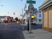
and the hamlet of Back Mountain, where a large farm is visible for the short distance to the eastern terminus, an intersection with Route 415
(Memorial Highway) in Back Mountain.
Pennsylvania
The Commonwealth of Pennsylvania is a U.S. state that is located in the Northeastern and Mid-Atlantic regions of the United States. The state borders Delaware and Maryland to the south, West Virginia to the southwest, Ohio to the west, New York and Ontario, Canada, to the north, and New Jersey to...
. The western terminus of the route is at PA 405
Pennsylvania Route 405
Pennsylvania Route 405 is a state highway that runs for in north central Pennsylvania, United States. The southern terminus of Pennsylvania Route 147 in West Chillisquaque Township...
in Hughesville
Hughesville, Pennsylvania
Hughesville is a borough in Lycoming County, Pennsylvania, United States. The population was 2,220 at the 2000 census. It is part of the Williamsport, Pennsylvania Metropolitan Statistical Area.-History:...
. The eastern terminus is at PA 415
Pennsylvania Route 415
Pennsylvania Route 415, designated by the Pennsylvania Department of Transportation as State Route 0415 is an long state highway located in Luzerne and Wyoming counties in Pennsylvania. The southern terminus is at Route 309 in Dallas while the northern terminus is at Route 29 near Harveys Lake...
in Dallas
Dallas, Pennsylvania
Dallas is a borough in Luzerne County, Pennsylvania, United States. The population was 2,557 at the 2000 census. It was created by a charter granted April 21, 1879 from land entirely within Dallas Township. The township had been formed in 1817 and was named for Alexander J. Dallas, who was the 6th...
. The road is known briefly as East Water Street from its western terminus to its intersection with 6th Street in Hughesville, where it becomes Lairdsville Road for 12 miles (19.3 km) until crossing PA 42
Pennsylvania Route 42
Pennsylvania Route 42 is a long state route located in central Pennsylvania. The southern terminus of the route is at Pennsylvania Route 61 in Centralia. The northern terminus is at U.S. Route 220 in Laporte. In Beech Glen, Sullivan County, it concurs with U.S. 220, loops through Eagles Mere and...
near Unityville. It joins PA 487
Pennsylvania Route 487
Pennsylvania Route 487 is a long, north–south state highway running from PA 61 in Shamokin Township, Northumberland County to PA 87 in Dushore, Sullivan County. In Bloomsburg, PA 487 and US 11 share a brief wrong-way concurrency...
for one mile (1.6 km) in Red Rock, where it passes through the southern part of Ricketts Glen State Park
Ricketts Glen State Park
Ricketts Glen State Park is a Pennsylvania state park on in Columbia, Luzerne, and Sullivan counties in Pennsylvania in the United States. Ricketts Glen is a National Natural Landmark known for its old-growth forest and 24 named waterfalls along Kitchen Creek, which flows down the Allegheny...
.
Lycoming County
Pennsylvania Route 405
Pennsylvania Route 405 is a state highway that runs for in north central Pennsylvania, United States. The southern terminus of Pennsylvania Route 147 in West Chillisquaque Township...
(Main Street) in the center of Hughesville
Hughesville, Pennsylvania
Hughesville is a borough in Lycoming County, Pennsylvania, United States. The population was 2,220 at the 2000 census. It is part of the Williamsport, Pennsylvania Metropolitan Statistical Area.-History:...
in Lycoming County
Lycoming County, Pennsylvania
-Appalachian Mountains and Allegheny Plateau:Lycoming County is divided between the Appalachian Mountains in the south, the dissected Allegheny Plateau in the north and east, and the valley of the West Branch Susquehanna River between these.-West Branch Susquehanna River:The West Branch of the...
. The route progresses southeastward through the borough as East Water Street. The local street crosses a long stretch of commercial businesses before reaching North Fifth Street, where it turns to the east and crosses over Muncy Creek
Muncy Creek
Muncy Creek is a tributary of the West Branch Susquehanna River in Lycoming and Sullivan counties, Pennsylvania, USA. Little Muncy Creek is its major tributary.-Course:The creek is long. For much of its length, U.S. Route 220 runs parallel to Muncy Creek....
. After crossing the river, Route 118 changes names to Lairdville Road and the surroundings become residential. The route there turns to the southeast once again, paralleling a long distance with Gregg Run Road. The surroundings quickly change to farmland, and Route 118 continues east through woodlands that begins soon after. At the intersection with Old Lairdsville Road, the route turns to the northeast until a short clearing, where the highway intersects with L Harman Road. At that intersection, the route turns to the southeast once again.
Heading through now Moreland Township
Moreland Township, Pennsylvania
Moreland Township is a township in Lycoming County, Pennsylvania, in the United States. The population was 1,036 at the 2000 census. It is part of the Williamsport, Pennsylvania, Metropolitan Statistical Area.-History:...
, the woodlands soon give way in favor of open fields, where the route intersects with Neuhard and Stan Warn Roads. There, Route 118 turns even further to the southeast and makes a large bend to the northeast later on, where the highway enters the hamlet of Frenchtown. The highway leaves the rural hamlet to the northeast, paralleling Old Lairdsville Road, which soon merges back in. The highway continues, leaving the fields for more woodlands, paralleling an old alignment of Route 118. A short distance after the old alignment stops paralleling, Route 118 breaks free of the woodlands in favor of the village of Lairdsville. Through Lairdsville, the highway passes a long stretch of residential homes and intersects with Dark Hollow Road. At Dark Hollow Road, Route 118 leaves Lairdsville and enters the rural segments of Franklin Township
Franklin Township, Lycoming County, Pennsylvania
Franklin Township is a township in Lycoming County, Pennsylvania, in the United States. The population was 915 at the 2000 census. It is part of the Williamsport, Pennsylvania Metropolitan Statistical Area.-History:...
.
Heading to the northeast through Franklin Township, Route 118 retains the name of Lairdsville Road, re-enters the nearby woods and makes a gradual curve back to the southeast. This soon returns to the northeast progression and the highway follows a sporadic stretch of eastern directions, entering Jordan Township
Jordan Township, Lycoming County, Pennsylvania
Jordan Township is a township in Lycoming County, Pennsylvania, in the United States. The population was 878 at the 2000 census. It is part of the Williamsport, Pennsylvania Metropolitan Statistical Area.-History:...
. Entering the hamlet of Biggerstown, Route 118 curves eastward and intersects with Route 42
Pennsylvania Route 42
Pennsylvania Route 42 is a long state route located in central Pennsylvania. The southern terminus of the route is at Pennsylvania Route 61 in Centralia. The northern terminus is at U.S. Route 220 in Laporte. In Beech Glen, Sullivan County, it concurs with U.S. 220, loops through Eagles Mere and...
. There the Lairdsville Road name ends, and Route 118 continues to the northeast through Jordan Township. The surroundings remain a mix of fields and woodlands, entering the hamlet of Richarts Grove. Richarts Grove has several residents far off the main highway, but has an intersection with North Woods Road, which connects to nearby Route 239
Pennsylvania Route 239
Pennsylvania Route 239 is an long state highway located in Luzerne, Columbia and Lycoming Counties in Pennsylvania. The southern terminus is at Route 93 in Nescopeck Township...
. Route 118 continues northeast through the sporadic changes in surroundings before nearing the Columbia County
Columbia County, Pennsylvania
As of the census of 2000, there were 64,151 people, 24,915 households, and 16,568 families residing in the county. The population density was 132 people per square mile . There were 27,733 housing units at an average density of 57 per square mile...
line. Still in Lycoming County, Route 118 enters the hamlet of Divide, where it intersects at a cross with Route 239. After the intersection, both Route 239 and Route 118 enter Columbia County, heading different directions.
Columbia County
Working its way away from Route 239, Route 118 heads to the northeast through now Jackson TownshipJackson Township, Columbia County, Pennsylvania
Jackson Township is a township in Columbia County, Pennsylvania, United States. The population was 598 at the 2000 census.-Geography:According to the United States Census Bureau, the township has a total area of , all of it land.-Demographics:...
. The highway continues through the woodlands as a two-lane road, until intersecting with Mountain Road, where the woodlands give way to fields once again. After the intersection with Saddle Brook Road, another long patch of woodlands begins. Route 118, continuing eastward soon comes to another clearing, where it intersects with the northern terminus of Camp Lavigne Road (Quadant Route 4049). After intersecting with Schoolhouse Road, the highway re-enters the woodlands, crossing over several bodies of water and turns northeast into Sugarloaf Township
Sugarloaf Township, Columbia County, Pennsylvania
Sugarloaf Township is a township in Columbia County, Pennsylvania, United States. The population was 885 at the 2000 census.-Geography:According to the United States Census Bureau, the township has a total area of 25.9 square miles , of which, 25.9 square miles of it is land and...
. Through Sugarloaf Township, Route 118 parallels several side streets, including Township Road 737, which provides access to one residence. Passing to the south and north of two ponds, the highway begins a parallel and soon merges with Route 487
Pennsylvania Route 487
Pennsylvania Route 487 is a long, north–south state highway running from PA 61 in Shamokin Township, Northumberland County to PA 87 in Dushore, Sullivan County. In Bloomsburg, PA 487 and US 11 share a brief wrong-way concurrency...
. Route 118 and Route 487 head eastward through Sugarloaf Township, crossing the line into Luzerne County
Luzerne County, Pennsylvania
- Demographics :As of the 2010 census, the county was 90.7% White, 3.4% Black or African American, 0.2% Native American, 1.0% Asian, 3.3% were of some other race, and 1.5% were two or more races. 6.7% of the population was of Hispanic or Latino ancestry...
.
Luzerne County
After entering Luzerne County, Route 118 and Route 487 intersect with County Line Road as they go through the hamlet of Fairmount Springs, a part of Fairmount TownshipFairmount Township, Pennsylvania
Fairmount Township is a township in Luzerne County, Pennsylvania, United States. The population was 1,226 at the 2000 census.-Geography:According to the United States Census Bureau, the township has a total area of , of which, of it is land and of it is water.Much of Ricketts Glen State Park is...
. After entering the small hamlet of Red Rock, Route 487 forks to the north along Red Rock Mountain Road while Route 118 turns to the northeast and enters Ricketts Glen State Park
Ricketts Glen State Park
Ricketts Glen State Park is a Pennsylvania state park on in Columbia, Luzerne, and Sullivan counties in Pennsylvania in the United States. Ricketts Glen is a National Natural Landmark known for its old-growth forest and 24 named waterfalls along Kitchen Creek, which flows down the Allegheny...
. The highway heads eastward through the dense forestry of the park, crossing over Kitchen Creek. Right after leaving the park, Route 118 enters a large clearing, where Bethel Hill Road forks to the southeast. The highway winds through more dense woods, passing several roadside residences until turning to the northeast at Maransky Road. Route 118 soon enters the hamlet of Kyttle, where it intersects with the Kyttle Pike.
Kyttle is a small hamlet of few residences and large fields, and Route 118 intersects with Mooretown Road as it enters Ross Township
Ross Township, Luzerne County, Pennsylvania
Ross Township is a township in Luzerne County, Pennsylvania, United States. The population was 2,742 at the 2000 census.-Geography:According to the United States Census Bureau, the township has a total area of 43.7 square miles , of which, 43.2 square miles of it is land and...
. Through Ross Township, residences become more common in the mix of fields and forests, along with the nearby alignment of Old State Road. At the intersection with Harris Pond Road, Route 118 passes to the south of the hamlet of Fades, turning southeastward into the hamlet of Pikes Creek. Through the small downtown of Pikes Creek, Route 118 turns eastward at Gordon Road and intersects with Route 29
Pennsylvania Route 29
Pennsylvania Route 29 is a 118 mile long north–south state highway that runs through most of eastern Pennsylvania. The route currently exists in two segments, a southern segment and a northern segment. The southernmost terminus of the designation is at U.S. Route 30 in Malvern...
. After Route 29, Route 118 passes some local businesses and leaves Pikes Creek, following a long stretch of residences and soon into fields.
Route 118 heads further to the northeast, paralleling Cornell Road into a long stretch of farmhouses and silos and into the community of Meeker. In Meeker, the highway intersects with Loyalville Road, where it turns southeastward once again until Fedor Road, where it returns to the northeast progression. Route 118 heads back into the dense forestry, entering Lehman Township
Lehman Township, Luzerne County, Pennsylvania
Lehman Township is a township in Luzerne County, Pennsylvania, United States. It is locally pronounced "LEE-man." The campus of Penn State Wilkes-Barre is located at the Hayfield Farms on Old Route 115 in Lehman Township...
, where an old alignment of Route 115
Pennsylvania Route 115
Pennsylvania Route 115 is a north–south state highway in eastern Pennsylvania. It stretches from U.S. Route 209 in Brodheadsville to Interstate 81 and Pennsylvania Route 309 near Wilkes-Barre. The road originated as the Sullivan Trail which later became known as the Easton and Wilkes-Barre...
forks near the hamlet of Lehman. Through the hamlet portion, Route 118 passes a long stretch of houses and several side streets. The route continues northeast, and while the fields become more evident once again, Route 118 passes the Lehman Golf Club. Route 118 soon enters Dallas Township
Dallas Township, Pennsylvania
Dallas Township is a township in Luzerne County, Pennsylvania, United States. The population was 8,179 at the 2000 census. The township was formed in 1817 from territory taken from Kingston Township, and it was named for Alexander J. Dallas, who was the 6th United States Secretary of the Treasury...
and the hamlet of Back Mountain, where a large farm is visible for the short distance to the eastern terminus, an intersection with Route 415
Pennsylvania Route 415
Pennsylvania Route 415, designated by the Pennsylvania Department of Transportation as State Route 0415 is an long state highway located in Luzerne and Wyoming counties in Pennsylvania. The southern terminus is at Route 309 in Dallas while the northern terminus is at Route 29 near Harveys Lake...
(Memorial Highway) in Back Mountain.