

Pennsylvania Route 164
Encyclopedia
Pennsylvania Route 164 is an 36 miles (57.9 km) long state highway
located in Cambria
, Blair
, Bedford
counties in Pennsylvania
. The western terminus is at an interchange with US 22
(William Penn Highway) in Munster Township
. The eastern terminus is at PA 26
near Raystown Lake
.
 PA 164 begins at an interchange with US 22
in Munster Township
, Cambria County
, heading southwest on two-lane undivided Munster Road. The road runs through a mix of farmland and woodland with some homes, turning more to the south. The route heads southwest into agricultural areas, curving south to head into Portage Township
. PA 164 runs through more farm fields and woods with occasional residences, turning southeast. The road turns south through residential areas before coming to an intersection with PA 53
. At this point, PA 164 turns west to form a concurrency
with PA 53 on Portage Street, a three-lane road with a center left-turn lane that passes businesses and becomes the border between Portage Township to the north and Portage
to the south. Upon splitting from PA 53, PA 164 heads south on three-lane Main Street, passing homes and narrowing to two lanes as it crosses under a Norfolk Southern railroad line. The route heads into the center of Portage and passes more residences and businesses, crossing another Norfolk Southern railroad line. The road passes more developed areas before crossing back into Portage Township and heading southeast on Puritan Road. PA 164 continues into forested areas, passing through the communities of Puritan and Martindale.
 PA 164 enters Juniata Township
in Blair County
and heads east on Johnstown Road, heading from forests into a mix of farmland and woodland with some homes, passing through Blue Knob. The road heads into more forested areas with some fields as it continues into Freedom Township
. Farther east, the route heads through farmland with some homes, crossing under I-99
/US 220 before entering the residential community of East Freedom. Here, PA 164 comes to an intersection with US 220 Business and turns north to join that route on Dunnings Highway, running to the west of an Everett Railroad
line. The road heads into commercial areas farther from the railroad tracks before it comes to a ramp that provides access to I-99/US 220. At this point, PA 164 splits from US 220 Business by turning southeast onto an unnamed four-lane divided highway
, crossing the Frankstown Branch Juniata River
. A short distance later, the route comes to an intersection with PA 36
at which point that route joins PA 164. The road narrows into a three-lane road with a center left-turn lane and passes over a Hollidaysburg and Roaring Spring Railroad line. PA 36/PA 164 continues through areas of homes and businesses in McKee, crossing another Hollidaysburg and Roaring Spring Railroad line before crossing Halter Creek into Blair Township
. The road runs through forested areas between Dunnings Mountain to the south and Short Mountain to the north along with the railroad line and the creek, heading into Taylor Township
. PA 36/PA 164 turns south and passes between the railroad line and woods to the west and the creek and a quarry to the east, coming to an intersection with the northern terminus of PA 867
. At this point, the two routes continues east and cross into Roaring Spring
, passing businesses. The road turns south near Nason Hospital, with PA 164 splitting from PA 136 by heading east onto two-lane East Main Street.
Here, the road passes homes as it forms the border between Taylor Township to the north and Roaring Spring to the south. The route fully enters Taylor Township again and becomes an unnamed road, heading southeast into open agricultural areas with occasional residences, passing through East Sharpsburg. The road passes more farmland as it heads into North Woodbury Township
. PA 164 heads into Martinsburg
and becomes West Allegheny Street, passing homes. In the center of town, the route crosses PA 866
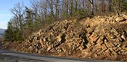
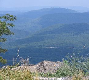
and becomes East Allegheny Street, running past more residences. The road heads back into North Woodbury Township, becoming unnamed as it runs through more open farmland with a few residences, passing through the community of Fredericksburg. PA 164 turns southeast and begins to ascend forested Tussey Mountain
, curving northeast. At the summit of the mountain, the route heads into Liberty Township
in Bedford County
and becomes Cove Mountain Road, turning south to descend the mountain. PA 164 continues to the base of the mountain, reaching its eastern terminus at an intersection with PA 26
.
State highway
State highway, state road or state route can refer to one of three related concepts, two of them related to a state or provincial government in a country that is divided into states or provinces :#A...
located in Cambria
Cambria County, Pennsylvania
Cambria County is a county located in the U.S. state of Pennsylvania. It comprises the Johnstown, Pennsylvania, Metropolitan Statistical Area. As of 2010, the population was 143,679....
, Blair
Blair County, Pennsylvania
-Significant Topographic Features:*Brush Mountain*Logan Valley*Morrison Cove*Tussey Mountain-Demographics:As of the census of 2000, there were 129,144 people, 51,518 households, and 34,877 families residing in the county. The population density was 246 people per square mile . There were 55,061...
, Bedford
Bedford County, Pennsylvania
Bedford County is a county located in the U.S. state of Pennsylvania. As of the 2010 census, the population was 49,762. The county seat is Bedford. It is part of the Altoona, Pennsylvania, Metropolitan Statistical Area.- History :...
counties in Pennsylvania
Pennsylvania
The Commonwealth of Pennsylvania is a U.S. state that is located in the Northeastern and Mid-Atlantic regions of the United States. The state borders Delaware and Maryland to the south, West Virginia to the southwest, Ohio to the west, New York and Ontario, Canada, to the north, and New Jersey to...
. The western terminus is at an interchange with US 22
U.S. Route 22
U.S. Route 22 is a west–east route and is one of the original United States highways of 1926, running from Cincinnati, Ohio, at US 27, US 42, US 127, and US 52 to Newark, New Jersey, at U.S. Route 1/9 near the Newark Liberty International Airport.US 22 also carries the names of the William...
(William Penn Highway) in Munster Township
Munster Township, Pennsylvania
Munster Township is a township in Cambria County, Pennsylvania, United States. The population was 675 at the 2000 census. It is part of the Johnstown, Pennsylvania Metropolitan Statistical Area.It was named after the province of Munster in Ireland....
. The eastern terminus is at PA 26
Pennsylvania Route 26
Pennsylvania Route 26 is a highway in the south-central area of Pennsylvania. Its northern terminus is at Pennsylvania Route 150 northwest of Howard, Pennsylvania; its southern terminus is at the Maryland state line near Barnes Gap in Union Township...
near Raystown Lake
Raystown Lake
Raystown Lake is a reservoir in Huntingdon County, Pennsylvania. The largest lake that is entirely within Pennsylvania, it was created by the United States Army Corps of Engineers around 1913 by the damming of the Raystown Branch Juniata River which created a shallow lake in the river valley. ...
.
Cambria County
U.S. Route 22 in Pennsylvania
U.S. Route 22 is an east–west route stretching from Cincinnati, Ohio in the west to Newark, New Jersey in the east. In Pennsylvania, the route runs for between the West Virginia state line at Washington County, where it is a limited-access expressway-grade route through the western suburbs...
in Munster Township
Munster Township, Pennsylvania
Munster Township is a township in Cambria County, Pennsylvania, United States. The population was 675 at the 2000 census. It is part of the Johnstown, Pennsylvania Metropolitan Statistical Area.It was named after the province of Munster in Ireland....
, Cambria County
Cambria County, Pennsylvania
Cambria County is a county located in the U.S. state of Pennsylvania. It comprises the Johnstown, Pennsylvania, Metropolitan Statistical Area. As of 2010, the population was 143,679....
, heading southwest on two-lane undivided Munster Road. The road runs through a mix of farmland and woodland with some homes, turning more to the south. The route heads southwest into agricultural areas, curving south to head into Portage Township
Portage Township, Cambria County, Pennsylvania
Portage Township is a township in Cambria County, Pennsylvania, United States which geographically includes Portage borough. The population was 3,906 at the 2000 census...
. PA 164 runs through more farm fields and woods with occasional residences, turning southeast. The road turns south through residential areas before coming to an intersection with PA 53
Pennsylvania Route 53
Pennsylvania Route 53 is an long state highway located in central Pennsylvania. The southern terminus of the route is at U.S. Route 219 in the borough of Summerhill...
. At this point, PA 164 turns west to form a concurrency
Concurrency (road)
A concurrency, overlap, or coincidence in a road network is an instance of one physical road bearing two or more different highway, motorway, or other route numbers...
with PA 53 on Portage Street, a three-lane road with a center left-turn lane that passes businesses and becomes the border between Portage Township to the north and Portage
Portage, Pennsylvania
Portage is a borough within Portage Township in Cambria County, Pennsylvania, southeast of Ebensburg and west-southwest of Altoona. It is part of the Johnstown, Pennsylvania Metropolitan Statistical Area. Coal mining was the lifeblood of Portage. In 1900, 816 people lived there, and in 1910,...
to the south. Upon splitting from PA 53, PA 164 heads south on three-lane Main Street, passing homes and narrowing to two lanes as it crosses under a Norfolk Southern railroad line. The route heads into the center of Portage and passes more residences and businesses, crossing another Norfolk Southern railroad line. The road passes more developed areas before crossing back into Portage Township and heading southeast on Puritan Road. PA 164 continues into forested areas, passing through the communities of Puritan and Martindale.
Blair and Bedford counties
Juniata Township, Blair County, Pennsylvania
Juniata Township is a township in Blair County, Pennsylvania, United States. It is part of the Altoona, PA Metropolitan Statistical Area. The population was 1,115 at the 2000 census.-Geography:...
in Blair County
Blair County, Pennsylvania
-Significant Topographic Features:*Brush Mountain*Logan Valley*Morrison Cove*Tussey Mountain-Demographics:As of the census of 2000, there were 129,144 people, 51,518 households, and 34,877 families residing in the county. The population density was 246 people per square mile . There were 55,061...
and heads east on Johnstown Road, heading from forests into a mix of farmland and woodland with some homes, passing through Blue Knob. The road heads into more forested areas with some fields as it continues into Freedom Township
Freedom Township, Blair County, Pennsylvania
Freedom Township is a township in Blair County, Pennsylvania, United States. It is part of the Altoona, PA Metropolitan Statistical Area. The population was 3,261 at the 2000 census.-Geography:...
. Farther east, the route heads through farmland with some homes, crossing under I-99
Interstate 99
Interstate 99 is an intrastate Interstate Highway located in central Pennsylvania in the United States. The southern terminus of the route is at exit 146 of the Pennsylvania Turnpike north of Bedford, where the road continues south as U.S. Route 220 . The northern terminus is at...
/US 220 before entering the residential community of East Freedom. Here, PA 164 comes to an intersection with US 220 Business and turns north to join that route on Dunnings Highway, running to the west of an Everett Railroad
Everett Railroad
The Everett Railroad is a short-line railroad that operates ex-Pennsylvania Railroad trackage in the Hollidaysburg area of the U.S. state of Pennsylvania. It runs freight trains over two separate lines, one from Brooks Mill and Sproul, and the other, owned by the Morrison's Cove Railroad, from...
line. The road heads into commercial areas farther from the railroad tracks before it comes to a ramp that provides access to I-99/US 220. At this point, PA 164 splits from US 220 Business by turning southeast onto an unnamed four-lane divided highway
Divided Highway
Divided Highway is a compilation album by American rock band The Doobie Brothers, released in 2003. . All tracks are taken from the albums Cycles and Brotherhood .-Track listing:...
, crossing the Frankstown Branch Juniata River
Frankstown Branch Juniata River
The Frankstown Branch Juniata River is a tributary of the Juniata River in Blair County, Pennsylvania, in the United States.The headwater tributaries of the Frankstown Branch rise on the slopes of the Allegheny Front south of Altoona...
. A short distance later, the route comes to an intersection with PA 36
Pennsylvania Route 36
Pennsylvania Route 36 is a long state highway located in the U.S. state of Pennsylvania. The southern terminus is at Pennsylvania Route 26 near the Hopewell Township community of Yellow Creek...
at which point that route joins PA 164. The road narrows into a three-lane road with a center left-turn lane and passes over a Hollidaysburg and Roaring Spring Railroad line. PA 36/PA 164 continues through areas of homes and businesses in McKee, crossing another Hollidaysburg and Roaring Spring Railroad line before crossing Halter Creek into Blair Township
Blair Township, Pennsylvania
Blair Township is a township in Blair County, Pennsylvania, United States. The population was 4,587 at the 2000 census.-General information:*ZIP Codes: 16635, 16648, 16665*Area Code: 814*Local Phone Exchanges: 693, 695, 696-Geography:...
. The road runs through forested areas between Dunnings Mountain to the south and Short Mountain to the north along with the railroad line and the creek, heading into Taylor Township
Taylor Township, Blair County, Pennsylvania
Taylor Township is a township in Blair County, Pennsylvania, United States. It is part of the Altoona, PA Metropolitan Statistical Area. The population was 2,239 at the 2000 census.-Geography:...
. PA 36/PA 164 turns south and passes between the railroad line and woods to the west and the creek and a quarry to the east, coming to an intersection with the northern terminus of PA 867
Pennsylvania Route 867
Pennsylvania Route 867 is a long state highway located in Bedford and Blair counties in Pennsylvania. The southern terminus is at PA 869 in South Woodbury Township...
. At this point, the two routes continues east and cross into Roaring Spring
Roaring Spring, Pennsylvania
Roaring Spring in Morrisons Cove, is a borough Blair County, Pennsylvania, United States. The population was 2,418 at the 2000 census. It is part of the Altoona, PA Metropolitan Statistical Area-History:...
, passing businesses. The road turns south near Nason Hospital, with PA 164 splitting from PA 136 by heading east onto two-lane East Main Street.
Here, the road passes homes as it forms the border between Taylor Township to the north and Roaring Spring to the south. The route fully enters Taylor Township again and becomes an unnamed road, heading southeast into open agricultural areas with occasional residences, passing through East Sharpsburg. The road passes more farmland as it heads into North Woodbury Township
North Woodbury Township, Pennsylvania
North Woodbury Township is a township in Blair County, Pennsylvania, United States. It is part of the Altoona, PA Metropolitan Statistical Area...
. PA 164 heads into Martinsburg
Martinsburg, Pennsylvania
Martinsburg, in Morrisons Cove, is a borough in Blair County, Pennsylvania, United States. The population was 2,236 at the 2000 census. It is part of the Altoona, PA Metropolitan Statistical Area.-Geography:Martinsburg is located at ....
and becomes West Allegheny Street, passing homes. In the center of town, the route crosses PA 866
Pennsylvania Route 866
Pennsylvania Route 866 is an long state highway located in Bedford and Blair counties. The southern terminus is at PA 36 in Woodbury. The northern terminus is at US 22 in Frankstown Township...
and becomes East Allegheny Street, running past more residences. The road heads back into North Woodbury Township, becoming unnamed as it runs through more open farmland with a few residences, passing through the community of Fredericksburg. PA 164 turns southeast and begins to ascend forested Tussey Mountain
Tussey Mountain
]Tussey Mountain is a stratigraphic ridge in central Pennsylvania, United States, trending east of the Bald Eagle, Brush, Dunning and Evitts Mountain ridges...
, curving northeast. At the summit of the mountain, the route heads into Liberty Township
Liberty Township, Bedford County, Pennsylvania
Liberty Township is a township in Bedford County, Pennsylvania, United States. The population was 1,477 at the 2000 census. Warriors Path State Park is a Pennsylvania State Park in Liberty Township.-Geography:...
in Bedford County
Bedford County, Pennsylvania
Bedford County is a county located in the U.S. state of Pennsylvania. As of the 2010 census, the population was 49,762. The county seat is Bedford. It is part of the Altoona, Pennsylvania, Metropolitan Statistical Area.- History :...
and becomes Cove Mountain Road, turning south to descend the mountain. PA 164 continues to the base of the mountain, reaching its eastern terminus at an intersection with PA 26
Pennsylvania Route 26
Pennsylvania Route 26 is a highway in the south-central area of Pennsylvania. Its northern terminus is at Pennsylvania Route 150 northwest of Howard, Pennsylvania; its southern terminus is at the Maryland state line near Barnes Gap in Union Township...
.