
Pennsylvania Route 160
Encyclopedia
Pennsylvania Route 160 is a north–south state route located in Western Pennsylvania
. Its southern terminus is at the Mason-Dixon line
south of Wellersburg
, and its northern terminus is at West High Street (formerly US 219) in Ebensburg
.
Along its route, PA 160 crosses the Eastern Continental Divide
and passes over CSX Transportation
's Sand Patch Tunnel
.
border in Wellersburg
, Somerset County
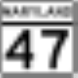
, where the road continues south into that state as MD 47
. From the state line, the route heads north-northwest on two-lane undivided Main Street, passing through wooded areas of homes. The road turns north and enters Southampton Township
, becoming Cumberland Highway and heading through forested areas with some residences. PA 160 curves northwest and heads west through more wooded areas with some fields and homes, passing through Pleasant Union. The road continues into Larimer Township
and turns northwest into open agricultural areas with some woods and residences, forming the border between Larimer Township to the southwest and Callimont
to the northeast again before fully entering Larimer Township again and passing southwest of Wittenberg. The route forms the border between Larimer Township and Callimont on two more occasions before heading into more forested areas of Larimer Township and passes over CSX's Sand Patch Tunnel. PA 160 turns north-northeast and runs through woods with some fields and homes, passing through Northampton Township
before heading north into Brothersvalley Township
. The road heads through farmland with some woodland and residences, reaching Berlin
. At this point, the route becomes Cumberland Street, passing homes and turning northeast onto Main Street. PA 160 curves east and passes through more residential areas before turning northeast onto Huckleberry Highway and crossing back into Brothersvalley Township. The road heads through open agricultural areas with some woodland and homes, coming to an intersection with PA 31
in Roxbury. At this point, the route crosses into Stonycreek Township
and continues through more rural areas, passing through Downey and passing under I-70
/I-76 (Pennsylvania Turnpike
). PA 160 heads north-northeast through more farmland and woodland with some homes, passing through Glade. The road passes to the east of Indian Lake
prior to coming to an intersection with US 30
in Reels Corners, at which point it crosses into Shade Township
.
Here, the route becomes Rock Cut Road and heads north through wooded areas with some residences, curving to the north-northeast. PA 160 turns to the east and enters Central City
, becoming Lambert Street and heading east past homes. The route turns north onto Central Avenue before turning northeast onto Sunshine Avenue and crossing a Norfolk Southern railroad line as it heads into the commercial downtown of Central City. PA 160 turns northwest onto Main Street and passes through more residential areas before crossing back into Shade Township. At this point, the road becomes Dark Shade Drive and heads north into wooded areas with some homes to the east of Dark Shade Creek
, passing through Cairnbrook and Rockingham. The route heads into forested areas and crosses Clear Shade Creek into Ogle Township
, turning northwest and heading into Paint Township
. PA 160 turns north away from Shade Creek and heads through more woods with some development. The road curves to the north-northwest and heads into open farmland with some trees and homes, turning north. The route heads into rural residential areas and turns east onto Pomroys Drive, curving northeast through woods with some residential and commercial development and heading north into Windber
. PA 160 comes to an intersection with PA 56
and becomes 21st Street, crossing a B&E Railroad line and turning northeast into residential areas. The route turns northwest onto Graham Avenue and passes homes and businesses, crossing the railroad tracks and Paint Creek into the commercial downtown of Windber. PA 160 crosses a Norfolk Southern railroad line and heads into residential areas, turning northeast onto 9th Street.
in Cambria County
, becoming Forest Hills Drive and heading into wooded areas with some fields and homes, turning to the north. The road crosses a Norfolk Southern railroad line and continues into forested areas to the west of the railroad tracks, curving to the northeast. The route crosses into Adams Township
and intersects the eastern terminus of PA 756
in the community of Elton. PA 160 continues northeast through a mix of farmland and woodland with some residences, turning north and east as it runs through the residential community of Salix. The road turns north through more rural areas, coming to an intersection with PA 869
. At this point, PA 160 turns east to form a concurrency
with PA 869, crossing a Norfolk Southern railroad line prior to crossing the South Fork Little Conemaugh River
into Croyle Township
. Here, the road becomes Mill Road passes through Lovett. PA 869 splits from PA 160 by heading southeast onto Beaver Run Avenue, and PA 160 heads east through woods with some fields. The road turns to the northwest and becomes Fairview Avenue, heading through areas of farms and woods with some homes. After a curve to the northeast, the route enters Summerhill Township
and turns west onto Fieldstone Avenue before heading north onto Springside Avenue. PA 160 heads through more rural areas with some development before crossing into Wilmore
, where it crosses Little Conemaugh River and passes under a Norfolk Southern railroad line. The road heads into residential areas and crosses PA 53
, becoming Evergreen Road.
The route continues back into Summerhill Township and runs northeast through farms and woods with some homes before heading north into forested areas. PA 160 heads into Cambria Township
and becomes Wilmore Road, turning west onto Fairlane Road and heading through more woods with some homes, curving to the west-northwest. The route turns northeast onto New Germany Road and runs through more woodland with some fields and devlopment, curving to the north. PA 160 heads into residential areas and turns northeast, passing to the southeast of the Ebensburg Center. The road passes under US 22
and becomes the border between Cambria Township to the west and Ebensburg
to the east, turning north. PA 160 comes to its northern terminus at an intersection with West High Street.
Pennsylvania
The Commonwealth of Pennsylvania is a U.S. state that is located in the Northeastern and Mid-Atlantic regions of the United States. The state borders Delaware and Maryland to the south, West Virginia to the southwest, Ohio to the west, New York and Ontario, Canada, to the north, and New Jersey to...
. Its southern terminus is at the Mason-Dixon line
Mason-Dixon line
The Mason–Dixon Line was surveyed between 1763 and 1767 by Charles Mason and Jeremiah Dixon in the resolution of a border dispute between British colonies in Colonial America. It forms a demarcation line among four U.S. states, forming part of the borders of Pennsylvania, Maryland, Delaware, and...
south of Wellersburg
Wellersburg, Pennsylvania
Wellersburg is a borough in Somerset County, Pennsylvania, United States. It is part of the Johnstown, Pennsylvania Metropolitan Statistical Area...
, and its northern terminus is at West High Street (formerly US 219) in Ebensburg
Ebensburg, Pennsylvania
Ebensburg is a borough located in, and is the seat of, Cambria County, Pennsylvania, west of Altoona and surrounded by Cambria Township. It is situated in the Alleghenies about 2025 feet above sea level. Ebensburg is located in a rich bituminous coal region. In the past, saw mills, tanneries,...
.
Along its route, PA 160 crosses the Eastern Continental Divide
Eastern Continental Divide
The Eastern Continental Divide, in conjunction with other continental divides of North America, demarcates two watersheds of the Atlantic Ocean: the Gulf of Mexico watershed and the Atlantic Seaboard watershed. Prior to 1760, the divide represented the boundary between British and French colonial...
and passes over CSX Transportation
CSX Transportation
CSX Transportation operates a Class I railroad in the United States known as the CSX Railroad. It is the main subsidiary of the CSX Corporation. The company is headquartered in Jacksonville, Florida, and owns approximately 21,000 route miles...
's Sand Patch Tunnel
Keystone Subdivision
The Keystone Subdivision is a railroad line owned and operated by CSX Transportation in the U.S. states of Maryland and Pennsylvania. The line runs from Cumberland, Maryland west to McKeesport, Pennsylvania along a former Baltimore and Ohio Railroad line...
.
Somerset County
PA 160 begins at the MarylandMaryland
Maryland is a U.S. state located in the Mid Atlantic region of the United States, bordering Virginia, West Virginia, and the District of Columbia to its south and west; Pennsylvania to its north; and Delaware to its east...
border in Wellersburg
Wellersburg, Pennsylvania
Wellersburg is a borough in Somerset County, Pennsylvania, United States. It is part of the Johnstown, Pennsylvania Metropolitan Statistical Area...
, Somerset County
Somerset County, Pennsylvania
Somerset County is a county located in the state of Pennsylvania. As of 2010, the population was 77,742. Somerset County was created on April 17, 1795, from part of Bedford County and named for Somerset, United Kingdom. Its county seat is Somerset. It is part of the Johnstown, Pennsylvania,...
, where the road continues south into that state as MD 47
Maryland Route 47
Maryland Route 47 is a state highway in the U.S. state of Maryland. Known as Barrelville Road, the state highway runs from MD 36 in Barrelville north to the Pennsylvania state line, where the highway continues north as Pennsylvania Route 160 . While it is a minor route today, MD 47 was once...
. From the state line, the route heads north-northwest on two-lane undivided Main Street, passing through wooded areas of homes. The road turns north and enters Southampton Township
Southampton Township, Somerset County, Pennsylvania
Southampton Township is a township in Somerset County, Pennsylvania, United States. The population was 655 at the 2000 census. It is part of the Johnstown, Pennsylvania Metropolitan Statistical Area.-Geography:...
, becoming Cumberland Highway and heading through forested areas with some residences. PA 160 curves northwest and heads west through more wooded areas with some fields and homes, passing through Pleasant Union. The road continues into Larimer Township
Larimer Township, Pennsylvania
Larimer Township is a township in Somerset County, Pennsylvania, United States. The population was 590 at the 2000 census. It is part of the Johnstown, Pennsylvania Metropolitan Statistical Area.-Geography:It is located approximately at 39.8015 by -78.9488...
and turns northwest into open agricultural areas with some woods and residences, forming the border between Larimer Township to the southwest and Callimont
Callimont, Pennsylvania
Callimont is a borough in Somerset County, Pennsylvania, United States. The population was 51 at the 2000 census. It is part of the Johnstown, Pennsylvania Metropolitan Statistical Area.-Geography:...
to the northeast again before fully entering Larimer Township again and passing southwest of Wittenberg. The route forms the border between Larimer Township and Callimont on two more occasions before heading into more forested areas of Larimer Township and passes over CSX's Sand Patch Tunnel. PA 160 turns north-northeast and runs through woods with some fields and homes, passing through Northampton Township
Northampton Township, Somerset County, Pennsylvania
Northampton Township is a township in Somerset County, Pennsylvania, United States. The population was 366 at the 2000 census. It is part of the Johnstown, Pennsylvania Metropolitan Statistical Area.-Geography:...
before heading north into Brothersvalley Township
Brothersvalley Township, Pennsylvania
Brothersvalley Township is a township in Somerset County, Pennsylvania, United States. The population was 4,184 at the 2000 census. It is part of the Johnstown, Pennsylvania Metropolitan Statistical Area.-Geography:...
. The road heads through farmland with some woodland and residences, reaching Berlin
Berlin, Pennsylvania
Berlin, a borough located approximately 75 miles southeast of Pittsburgh in Somerset County, Pennsylvania, United States, was laid out in 1784 and incorporated on February 7, 1833. The population was 2,192 at the 2000 census...
. At this point, the route becomes Cumberland Street, passing homes and turning northeast onto Main Street. PA 160 curves east and passes through more residential areas before turning northeast onto Huckleberry Highway and crossing back into Brothersvalley Township. The road heads through open agricultural areas with some woodland and homes, coming to an intersection with PA 31
Pennsylvania Route 31
Pennsylvania Route 31 is a long state highway located in Western Pennsylvania, paralleling U.S. Route 30 and the Pennsylvania Turnpike for most of its length. The designation begins at PA 136 near West Newton and ends at US 30 near Bedford....
in Roxbury. At this point, the route crosses into Stonycreek Township
Stonycreek Township, Somerset County, Pennsylvania
Stonycreek Township is a township in Somerset County, Pennsylvania, United States. The population was 2,221 at the 2000 census. It is part of the Johnstown, Pennsylvania Metropolitan Statistical Area.-History:...
and continues through more rural areas, passing through Downey and passing under I-70
Interstate 70 in Pennsylvania
In the U.S. state of Pennsylvania, Interstate 70 runs east–west across the southwest part of the state serving the southern half of the Pittsburgh metropolitan area. About half of the route is concurrent with Interstate 76 along the Pennsylvania Turnpike...
/I-76 (Pennsylvania Turnpike
Pennsylvania Turnpike
The Pennsylvania Turnpike is a toll highway system operated by the Pennsylvania Turnpike Commission in the Commonwealth of Pennsylvania, United States. The three sections of the turnpike system total . The main section extends from Ohio to New Jersey and is long...
). PA 160 heads north-northeast through more farmland and woodland with some homes, passing through Glade. The road passes to the east of Indian Lake
Indian Lake, Pennsylvania
Indian Lake is a borough in Somerset County, Pennsylvania. It is part of the Johnstown, Pennsylvania Metropolitan Statistical Area. The population was 394 at the 2010 census, down from 450 in 2000...
prior to coming to an intersection with US 30
U.S. Route 30 in Pennsylvania
In the U.S. state of Pennsylvania, U.S. Route 30 runs east–west across the southern part of the state, passing through Pittsburgh and Philadelphia on its way from the West Virginia state line east to the Benjamin Franklin Bridge over the Delaware River into New Jersey...
in Reels Corners, at which point it crosses into Shade Township
Shade Township, Pennsylvania
Shade Township is a township in Somerset County, Pennsylvania, United States. The population was 2,886 at the 2000 census. It is part of the Johnstown, Pennsylvania Metropolitan Statistical Area. Shade township was incorporated in 1816. The township was first settled in 1772 and was formed from...
.
Here, the route becomes Rock Cut Road and heads north through wooded areas with some residences, curving to the north-northeast. PA 160 turns to the east and enters Central City
Central City, Pennsylvania
Central City is a borough in Somerset County, Pennsylvania, United States. The population was 1,258 at the 2000 census. It is part of the Johnstown, Pennsylvania Metropolitan Statistical Area...
, becoming Lambert Street and heading east past homes. The route turns north onto Central Avenue before turning northeast onto Sunshine Avenue and crossing a Norfolk Southern railroad line as it heads into the commercial downtown of Central City. PA 160 turns northwest onto Main Street and passes through more residential areas before crossing back into Shade Township. At this point, the road becomes Dark Shade Drive and heads north into wooded areas with some homes to the east of Dark Shade Creek
Shade Creek
Shade Creek is a tributary of Stony Creek in Somerset County, Pennsylvania in the United States.Shade Creek, formed by the confluence of Dark Shade and Clear Shade creeks approximately 1.9 miles downstream of the community of Cairnbrook, flows for 9.5 miles to join Stony Creek at the...
, passing through Cairnbrook and Rockingham. The route heads into forested areas and crosses Clear Shade Creek into Ogle Township
Ogle Township, Pennsylvania
Ogle Township is a township in Somerset County, Pennsylvania, United States. The population was 588 at the 2000 census. It is part of the Johnstown, Pennsylvania Metropolitan Statistical Area.-Geography:...
, turning northwest and heading into Paint Township
Paint Township, Somerset County, Pennsylvania
Paint Township is a township in Somerset County, Pennsylvania, United States. The population was 3,300 at the 2000 census. It is part of the Johnstown, Pennsylvania Metropolitan Statistical Area.-Geography:...
. PA 160 turns north away from Shade Creek and heads through more woods with some development. The road curves to the north-northwest and heads into open farmland with some trees and homes, turning north. The route heads into rural residential areas and turns east onto Pomroys Drive, curving northeast through woods with some residential and commercial development and heading north into Windber
Windber, Pennsylvania
Windber is a borough in Somerset County, Pennsylvania, eight miles south of Johnstown. It was at one time a place of industrial activities which included coal mining, lumbering, and the manufacture of fire brick. In 1897, the community was founded by coal barons Charles and Edward Julius Berwind...
. PA 160 comes to an intersection with PA 56
Pennsylvania Route 56
Pennsylvania Route 56 is a major long state highway located in central Pennsylvania. Its western terminus is at the eastern approach to the C.L. Schmitt Bridge in New Kensington. Its eastern terminus is U.S. Route 30 west of Bedford.- Route description :...
and becomes 21st Street, crossing a B&E Railroad line and turning northeast into residential areas. The route turns northwest onto Graham Avenue and passes homes and businesses, crossing the railroad tracks and Paint Creek into the commercial downtown of Windber. PA 160 crosses a Norfolk Southern railroad line and heads into residential areas, turning northeast onto 9th Street.
Cambria County
PA 403 enters Richland TownshipRichland Township, Cambria County, Pennsylvania
Richland Township is a township in Cambria County, Pennsylvania, United States. The population was 12,598 at the 2000 census. It is part of the Johnstown, Pennsylvania Metropolitan Statistical Area.-Geography:...
in Cambria County
Cambria County, Pennsylvania
Cambria County is a county located in the U.S. state of Pennsylvania. It comprises the Johnstown, Pennsylvania, Metropolitan Statistical Area. As of 2010, the population was 143,679....
, becoming Forest Hills Drive and heading into wooded areas with some fields and homes, turning to the north. The road crosses a Norfolk Southern railroad line and continues into forested areas to the west of the railroad tracks, curving to the northeast. The route crosses into Adams Township
Adams Township, Cambria County, Pennsylvania
Adams Township is a township in Cambria County, Pennsylvania, United States. It is part of the Johnstown, Pennsylvania Metropolitan Statistical Area. The population was 6,495 at the 2000 census.-Geography:Adams Township is located at...
and intersects the eastern terminus of PA 756
Pennsylvania Route 756
Pennsylvania Route 756 is an east–west state route located in Cambria County Pennsylvania. Its western terminus is Pennsylvania Route 403 in the Moxham section of Johnstown, and its eastern terminus is Pennsylvania Route 160 in Elton, Adams Township....
in the community of Elton. PA 160 continues northeast through a mix of farmland and woodland with some residences, turning north and east as it runs through the residential community of Salix. The road turns north through more rural areas, coming to an intersection with PA 869
Pennsylvania Route 869
Pennsylvania Route 869 is an east–west state route located in Western Pennsylvania. Its western terminus is at Ragers Hill Road just west of US 219 in St...
. At this point, PA 160 turns east to form a concurrency
Concurrency (road)
A concurrency, overlap, or coincidence in a road network is an instance of one physical road bearing two or more different highway, motorway, or other route numbers...
with PA 869, crossing a Norfolk Southern railroad line prior to crossing the South Fork Little Conemaugh River
Little Conemaugh River
The Little Conemaugh River is a tributary of the Conemaugh River, approximately 30 mi long, in western Pennsylvania in the United States....
into Croyle Township
Croyle Township, Pennsylvania
Croyle Township is a township in Cambria County, Pennsylvania, United States. It is part of the Johnstown, Pennsylvania Metropolitan Statistical Area...
. Here, the road becomes Mill Road passes through Lovett. PA 869 splits from PA 160 by heading southeast onto Beaver Run Avenue, and PA 160 heads east through woods with some fields. The road turns to the northwest and becomes Fairview Avenue, heading through areas of farms and woods with some homes. After a curve to the northeast, the route enters Summerhill Township
Summerhill Township, Cambria County, Pennsylvania
Summerhill Township is a township in Cambria County, Pennsylvania, United States. The population was 2,724 at the 2000 census. It is part of the Johnstown, Pennsylvania Metropolitan Statistical Area.-Geography:...
and turns west onto Fieldstone Avenue before heading north onto Springside Avenue. PA 160 heads through more rural areas with some development before crossing into Wilmore
Wilmore, Pennsylvania
Wilmore is a borough in Cambria County, Pennsylvania, United States. It is part of the Johnstown, Pennsylvania Metropolitan Statistical Area. The population was 252 at the 2000 census.-Geography:...
, where it crosses Little Conemaugh River and passes under a Norfolk Southern railroad line. The road heads into residential areas and crosses PA 53
Pennsylvania Route 53
Pennsylvania Route 53 is an long state highway located in central Pennsylvania. The southern terminus of the route is at U.S. Route 219 in the borough of Summerhill...
, becoming Evergreen Road.
The route continues back into Summerhill Township and runs northeast through farms and woods with some homes before heading north into forested areas. PA 160 heads into Cambria Township
Cambria Township, Pennsylvania
Cambria Township is a township in Cambria County, Pennsylvania, United States. The population was 6,323 at the 2000 census. It is part of the Johnstown, Pennsylvania Metropolitan Statistical Area and geographically surrounds the Borough of Ebensburg....
and becomes Wilmore Road, turning west onto Fairlane Road and heading through more woods with some homes, curving to the west-northwest. The route turns northeast onto New Germany Road and runs through more woodland with some fields and devlopment, curving to the north. PA 160 heads into residential areas and turns northeast, passing to the southeast of the Ebensburg Center. The road passes under US 22
U.S. Route 22 in Pennsylvania
U.S. Route 22 is an east–west route stretching from Cincinnati, Ohio in the west to Newark, New Jersey in the east. In Pennsylvania, the route runs for between the West Virginia state line at Washington County, where it is a limited-access expressway-grade route through the western suburbs...
and becomes the border between Cambria Township to the west and Ebensburg
Ebensburg, Pennsylvania
Ebensburg is a borough located in, and is the seat of, Cambria County, Pennsylvania, west of Altoona and surrounded by Cambria Township. It is situated in the Alleghenies about 2025 feet above sea level. Ebensburg is located in a rich bituminous coal region. In the past, saw mills, tanneries,...
to the east, turning north. PA 160 comes to its northern terminus at an intersection with West High Street.