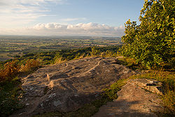
Peckforton Hills
Encyclopedia


Sandstone
Sandstone is a sedimentary rock composed mainly of sand-sized minerals or rock grains.Most sandstone is composed of quartz and/or feldspar because these are the most common minerals in the Earth's crust. Like sand, sandstone may be any colour, but the most common colours are tan, brown, yellow,...
ridge running broadly northeast–southwest in the west of the English
England
England is a country that is part of the United Kingdom. It shares land borders with Scotland to the north and Wales to the west; the Irish Sea is to the north west, the Celtic Sea to the south west, with the North Sea to the east and the English Channel to the south separating it from continental...
county of Cheshire
Cheshire
Cheshire is a ceremonial county in North West England. Cheshire's county town is the city of Chester, although its largest town is Warrington. Other major towns include Widnes, Congleton, Crewe, Ellesmere Port, Runcorn, Macclesfield, Winsford, Northwich, and Wilmslow...
. They form a significant part of the longer Mid Cheshire Ridge
Mid Cheshire Ridge
The Mid Cheshire Ridge is a range of low sandstone hills which stretch north to south through Cheshire in North West England. The ridge is discontinuous, with the hills forming two main blocks, north and south of the "Beeston Gap"...
which extends southwards from Frodsham
Frodsham
Frodsham is a market town and civil parish in the unitary authority of Cheshire West and Chester and the ceremonial county of Cheshire, England. Its population is 8,982. It is approximately south of Runcorn, 16 miles south of Liverpool, and approximately south-west of Manchester...
towards Malpas
Malpas, Cheshire
Malpas is a large village which used to be a market town, and it is also a civil parish in the unitary authority of Cheshire West and Chester and the ceremonial county of Cheshire, England. The parish lies on the border with Shropshire and Wales...
.
Bulkeley Hill stands at the south end, and the ridge is continued southwards by Bickerton Hill
Bickerton Hill
Bickerton Hill refers to two low red sandstone hills that form the southern end of the Mid Cheshire Ridge in Cheshire, north-west England. The high point, Raw Head, lies on the northerly hill and has an elevation of 227 metres...
. The high points are Peckforton Point , immediately north of Bulkeley Hill, and Stanner Nab , towards the northern end of the ridge.
Settlements around the hills include Burwardsley
Burwardsley
Burwardsley is a village and civil parish the unitary authority of Cheshire West and Chester and the ceremonial county of Cheshire, England. The parish also includes the small villages of Burwardsley, Burwardsley Hill, Higher Burwardsley. The parish also includes Burwardsley Hall and is part of...
to the west, Beeston
Beeston, Cheshire
Beeston is a village and civil parish in the unitary authority of Cheshire West and Chester and the ceremonial county of Cheshire in the north of England. It is south of Tarporley, and close to the Shropshire Union Canal. Beeston Castle nearby is a spectacular clifftop ruin in the care of English...
to the north, Peckforton
Peckforton
Peckforton is a scattered settlement and civil parish in the unitary authority of Cheshire East and the ceremonial county of Cheshire, England. The settlement is located to the north east of Malpas and miles to the west of Nantwich. The total population of the civil parish is somewhat over 100...
and Bunbury
Bunbury
- Places :* Bunbury, Cheshire, England* Bunbury, Western Australia, the third largest city in the state** City of Bunbury, the local government area covering Bunbury's central and southern suburbs...
to the east and Bulkeley
Bulkeley
Bulkeley is a village and civil parish in the unitary authority of Cheshire East and the ceremonial county of Cheshire, England. The village is situated at on the A534 about 9 miles west of Nantwich. The civil parish also includes the small settlement of Bulkelehay at , with a total population...
to the south. On Ascension Day the parishioners of St Boniface, Bunbury walk to the 200m summit of Stanner Nab for a service as the sun sets.
Features
The Sandstone TrailSandstone Trail
The Sandstone Trail is a long-distance walkers' path, following sandstone ridges running north–south from Frodsham in central Cheshire to Whitchurch just over the Shropshire border. The path was created in 1974 and extended in the 1990s...
long-distance footpath runs along the ridge, and the hills are the source of both the River Weaver
River Weaver
The River Weaver is a river, navigable in its lower reaches, running in a curving route anti-clockwise across west Cheshire, northern England. Improvements to the river to make it navigable were authorised in 1720 and the work, which included eleven locks, was completed in 1732...
and the River Gowy
River Gowy
The River Gowy is a river in Cheshire, England and a tributary of the River Mersey.It rises in western Cheshire in the hills near Peckforton Castle, very close to the source of the River Weaver. While the Weaver flows south initially, the Gowy flows north and for several miles provides the valley...
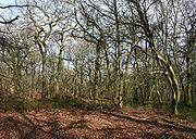
. A 57.88 hectares area of Peckforton Woods has been designated a Site of Special Scientific Interest
Site of Special Scientific Interest
A Site of Special Scientific Interest is a conservation designation denoting a protected area in the United Kingdom. SSSIs are the basic building block of site-based nature conservation legislation and most other legal nature/geological conservation designations in Great Britain are based upon...
. Bulkeley Hill is owned by the National Trust
National Trust for Places of Historic Interest or Natural Beauty
The National Trust for Places of Historic Interest or Natural Beauty, usually known as the National Trust, is a conservation organisation in England, Wales and Northern Ireland...
, and its wooded slopes include 12 acres (5 hectares) of semi-natural ancient woodland. Peckforton and Bulkeley Hills have also both been designated county sites of biological importance for their woodland and grassland habitats.
Peckforton Castle
Peckforton Castle
Peckforton Castle is a country house built in the style of a medieval castle. It stands in woodland at the north end of Peckforton Hills northwest of the village of Peckforton, Cheshire, England. It has been designated by English Heritage as a Grade I listed building...
, a Victorian mansion built in the style of a medieval castle, stands at the northern end of the Peckforton ridge.

