

Otowa, Aichi
Encyclopedia
Towns of Japan
A town is a local administrative unit in Japan. It is a local public body along with prefecture , city , and village...
located in Hoi District
Hoi District, Aichi
is a former rural district located in eastern Aichi Prefecture, Japan.As of 2008 , the district had an estimated population of 21,766 and a population density of 2194 persons per km². Its total area was 9.92 km².-History:...
, Aichi
Aichi Prefecture
is a prefecture of Japan located in the Chūbu region. The region of Aichi is also known as the Tōkai region. The capital is Nagoya. It is the focus of the Chūkyō Metropolitan Area.- History :...
, Japan
Japan
Japan is an island nation in East Asia. Located in the Pacific Ocean, it lies to the east of the Sea of Japan, China, North Korea, South Korea and Russia, stretching from the Sea of Okhotsk in the north to the East China Sea and Taiwan in the south...
. On January 15, 2008 Otowa was merged
Merger and dissolution of municipalities of Japan
Municipal mergers and dissolutions carried out in Japan can take place within one municipality or between multiple municipalities and are required to be based upon consensus.- Merger policy:...
with the city of Toyokawa
Toyokawa, Aichi
is a medium-sized city of about 180,000 people located in the eastern part of Aichi Prefecture, Japan. The city, founded on June 1, 1943, originally comprised the three formerly independent Hoi-gun towns of Toyokawa , Ko , Ushikubo , and the village of Yawata...
.
As of November 1, 2007 (the last census data prior to the merger) , the town had an estimated population
Population
A population is all the organisms that both belong to the same group or species and live in the same geographical area. The area that is used to define a sexual population is such that inter-breeding is possible between any pair within the area and more probable than cross-breeding with individuals...
of 8,870 and a population density
Population density
Population density is a measurement of population per unit area or unit volume. It is frequently applied to living organisms, and particularly to humans...
of 299.15 persons per km². The total area was 29.65 km².
Geography
- Principal mountains: Kyōgamine (京ヶ峰), Mt. Miyaji (宮路山), Shiro-yama (城山), Mt. Kan'non (観音山)
- Principal rivers: Otowa River (音羽川), Yamakage River (山陰川)
History
- June 23, 1894 - Akasaka Village changed over to Akasaka Town (赤坂町).
- April 1, 1955 - Otowa was founded by the unification of Akasaka Town, Nagasawa Village (長沢村) and Hagi Village (萩村).
- 1981 - Otowa Town Office was moved. Symbol of Otowa was established.
- 1986 - Tōmei ExpresswayTomei ExpresswayThe is a national expressway on the island of Honshū in Japan. It is operated by Central Nippon Expressway Company. It is a part of Asian Highway Network -Naming:The word Tōmei is an acronym consisting of two kanji characters...
Otowa-Gamagori Interchange opened. - 1987 - The rezoning of Akasaka was carried. ( - 1993)
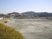
- 1992 - Otowa Town Field Park (音羽町運動公園) was completed.
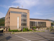
- 1999 - Otowa Town Office was moved. New office and Cultural Hall ("Windia Hall") was completed.
- 2000 - Otowa Town Library and Akasaka Community Center was completed.
- 2002 - Akasaka Rest House (赤坂休憩所), commonly called "Yoramaikan (よらまいかん)" was completed.
- 2005 - Ceremony to celebrate the 50th anniversary of the founding Otowa Town was held.
- January 15, 2008 - Otowa Town was incorporated into Toyokawa CityToyokawa, Aichiis a medium-sized city of about 180,000 people located in the eastern part of Aichi Prefecture, Japan. The city, founded on June 1, 1943, originally comprised the three formerly independent Hoi-gun towns of Toyokawa , Ko , Ushikubo , and the village of Yawata...
.
Successive mayors
| # | Name | Kanji | Took Office | Left Office |
| 1 | Watanabe Ryūji | 渡邉 隆次 | April 30, 1955 | April 29, 1959 |
| 2 | Sakakibara Buntarō | 榊原 文太郎 | April 30, 1959 | June 10, 1962 |
| 3 | Uebayashi Tahē | 上林 多兵惠 | July 29, 1962 | December 18, 1963 |
| 4 | Iyoda Isamu | 伊與田 勇 | January 21, 1964 | January 20, 1968 |
| 5-8 | Horiuchi Shigeaki | 堀内 重昭 | January 21, 1968 | January 20, 1984 |
| 9-12 | Nakamori Kōichi | 中森 幸一 | January 21, 1984 | January 20, 2000 |
| 13-14 | Utsuno Takeshi | 宇都野 武 | January 21, 2000 | January 14, 2008 |
Region
.jpg)
Community centers
- Akasaka Community Center
- Nagasawa Community Center
- Hagi Community Center
- Akasakadai Community Center
Railway
- Meitetsu Nagoya Main Line - Meiden-Akasaka StationMeiden-Akasaka Stationis a train station on the Meitetsu Nagoya Main Line locatedin Toyokawa, Aichi, Japan. It is located 12.5 kilometers from the junction of the Nagoya Main Line at .-History:...
, Meiden-Nagasawa StationMeiden-Nagasawa Stationis a train station on the Meitetsu Nagoya Main Line located in Toyokawa, Aichi, Japan. It is located 15.0 kilometers from the junction of the Nagoya Main Line at .-History:...
Toll road
- Toll road - Otowa-Gamagori Toll Road, commonly called "Mikawa Bay Orange Road (三河湾オレンジロード)"
National highway
- National highwayNational highways of JapanJapan has a nationwide system of distinct from the expressways. The Ministry of Land, Infrastructure and Transport and other government agencies administer the national highways. Beginning in 1952, Japan classified these as Class 1 or Class 2. Class 1 highways had one- or two-digit numbers, while...
- Route 1Route 1 (Japan)National Route 1 is a major highway on the island of Honshū in Japan. It connects Chūō, Tokyo in the Kantō region with the city of Osaka, Osaka Prefecture in the Kansai region, passing through the Chūbu region en route. It follows the old Tōkaidō westward from Tokyo to Kyoto, and the old Kyo Kaidō...
Local attractions
- Akasaka-jukuAkasaka-juku (Tokaido)was the thirty-sixth of the fifty-three stations of the Tōkaidō. It is located in present-day Toyokawa, Aichi Prefecture, Japan. It was only from Goyu-juku, the preceding post station.-History:...
(赤坂宿) - The thirty-sixth of the fifty-three stations53 Stations of the TokaidoThe are the rest areas along the Tōkaidō, which was a coastal route that ran from Nihonbashi in Edo to Sanjō Ōhashi in Kyoto.-Stations of the Tōkaidō:...
of the TōkaidōTokaido (road)The ' was the most important of the Five Routes of the Edo period, connecting Edo to Kyoto in Japan. Unlike the inland and less heavily travelled Nakasendō, the Tōkaidō travelled along the sea coast of eastern Honshū, hence the route's name....
. - Mt. Miyaji (宮路山 Miyaji-san) - It is said that Empress JitōEmpress Jitowas the 41st emperor of Japan, according to the traditional order of succession.Jitō's reign spanned the years from 686 through 697.In the history of Japan, Jitō was the third of eight women to take on the role of empress regnant. The two female monarchs before Jitō were Suiko and Kōgyoku/Saimei...
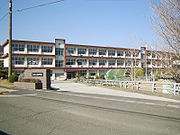
visited this mountain. In the autumn, maple leaves turnes red. - Ruins of the Nagasawa Castle (長沢城址) - Today, The Nagasawa Primary School and the residential area of Kojō (古城団地 Kojō Danchi) is located in this site. The word "Kojō" means "old castle".
- Ceremony to pray for rain (雨乞い祭り amagoi matsuri) - A ceremony held in every August.
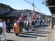
- Ceremony of the Sugimori Hachimansha (杉森八幡社祭礼) - A ceremony held in every October. In this ceremony, the daimyo's procession is reappeared.