
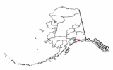
Orca Inlet
Encyclopedia
Prince William Sound
Prince William Sound is a sound off the Gulf of Alaska on the south coast of the U.S. state of Alaska. It is located on the east side of the Kenai Peninsula. Its largest port is Valdez, at the southern terminus of the Trans-Alaska Pipeline System...
in southern Alaska
Alaska
Alaska is the largest state in the United States by area. It is situated in the northwest extremity of the North American continent, with Canada to the east, the Arctic Ocean to the north, and the Pacific Ocean to the west and south, with Russia further west across the Bering Strait...
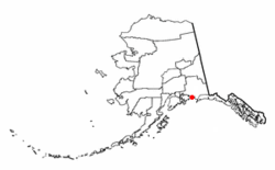
. The town of Cordova
Cordova, Alaska
As of the census of 2000, there were 2,454 people, 958 households, and 597 families residing in the city. The population density was 40.0 per square mile . There are 1,099 housing units at an average density of 17.9 per square mile...
was founded on its coast in 1906. All marine traffic reaches the town through Orca Inlet.
Geography
Orca Inlet lies south and east of Hawkins IslandHawkins Island (Alaska)
Hawkins Island is an island in the northern part of the Gulf of Alaska in the state of Alaska, USA. It lies just west of the city of Cordova, between that city and the further offshore Hinchinbrook Island. Prince William Sound lies to the north side of the island, while Orca Inlet and the main body...
at 60°31′25"N 145°52′46"W. The Inlet is about 16 miles (25.7 km) long running southwest and about 3 miles (4.8 km) wide at its widest point. The south end opens into the Gulf of Alaska
Gulf of Alaska
The Gulf of Alaska is an arm of the Pacific Ocean defined by the curve of the southern coast of Alaska, stretching from the Alaska Peninsula and Kodiak Island in the west to the Alexander Archipelago in the east, where Glacier Bay and the Inside Passage are found.The entire shoreline of the Gulf is...
while the north end joins with Orca Bay
Orca Bay, Alaska
Orca Bay is a bay in Prince William Sound, Alaska.Orca Bay is on the north west and west sides of Hawkins Island, extending westward to Johnstone Point of Hinchenbrook Island. Its northwestern corner is demarcated by Knowles Head, between Port Gravina and Fidalgo Bay on the mainland. Its eastern...
.
The city of Cordova, Alaska
Cordova, Alaska
As of the census of 2000, there were 2,454 people, 958 households, and 597 families residing in the city. The population density was 40.0 per square mile . There are 1,099 housing units at an average density of 17.9 per square mile...
is situated on the southeast shore of Orca Inlet.
History
Orca Inlet was listed in the Geographic Dictionary of Alaska in 1906, citing J.F. Moser's report from 1897. The Orca Cannery operated on the south shore of the inlet; there was a post office at that location from 1894. The Odiak Cannery was located 3 miles southwest of Orca, at the present location of Cordova.There were once large Razor Clam
Razor clam
Razor clam may refer to clams in the genus Ensis or Siliqua, including:*Ensis directus, Atlantic jackknife clam*Ensis arcuatus, razor shell*Siliqua patula, Pacific razor clam...
beds in the intertidal zones of Orca Inlet which were harvested and shipped out of Cordova. Harvests reached 3.5 million pounds at its peak. Populations began to decline in the late 1950s. When the 1964 Good Friday Earthquake
Good Friday Earthquake
The 1964 Alaska earthquake, also known as the Great Alaskan Earthquake, the Portage Earthquake and the Good Friday Earthquake, was a megathrust earthquake that began at 5:36 P.M. AST on Good Friday, March 27, 1964...
struck the clam beds were uplifted around 6 feet (1.8 m) exposing them out of the intertidal zone. This led to moderate mortality and eventually the industry crashed.
Geology and Currents
Like other arms of Prince William Sound, Orca Inlet is a fjordFjord
Geologically, a fjord is a long, narrow inlet with steep sides or cliffs, created in a valley carved by glacial activity.-Formation:A fjord is formed when a glacier cuts a U-shaped valley by abrasion of the surrounding bedrock. Glacial melting is accompanied by rebound of Earth's crust as the ice...
. There are large areas on its coast with large rounded rocks as well as many cirques and hanging valleys. Glacial erosion created steep walls on the sides of the fjord. In one area the elevation rises to 1600 feet (487.7 m) within 1/2 mi of the coastline. The southern and central areas are filled with sediment making the area very shallow. These deposits resulted from the receded glacier that once filled the fjord as well as current inflow through the seaward end of the inlet from the Copper River
Copper River (Alaska)
The Copper River or Ahtna River is a 300-mile river in south-central Alaska in the United States. It drains a large region of the Wrangell Mountains and Chugach Mountains into the Gulf of Alaska...
and other smaller glacial streams. These deposits drift westward along the coast until they reach the entrance of Orca Inlet. Orca Inlet can serve as an entrance to Prince William Sound from the Gulf of Alaska but the shallow water limits the size of vessels that can use the route. In 1914, the southern rds of the inlet was generally 12 feet (3.7 m) deep or less with a few, discontinuous channels, while the north part was 90 to 228 ft (27.4 to 69.5 ) deep.
Copper
Copper
Copper is a chemical element with the symbol Cu and atomic number 29. It is a ductile metal with very high thermal and electrical conductivity. Pure copper is soft and malleable; an exposed surface has a reddish-orange tarnish...
ore has been found in the area around Orca Inlet but there has been little development to mine it.
The tidal current flows southward on the flood and northward on the ebb. Mean velocity at the peak of the flood is 1.5 knot (0.8166 m/s) and 0.8 knot (0.43552 m/s) at the peak of the ebb.