
Old Loggers Path
Encyclopedia
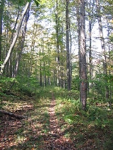
The Old Loggers Path is a 27.1 mile (43.6 km) loop hiking
trail
in Lycoming County
in north central Pennsylvania
in the United States
. Marked with international orange
blazes
, the Old Loggers Path is located entirely within the Loyalsock State Forest
. Most hikers take two and a half to three days and two nights to complete the Old Loggers Path, making it popular for weekend hikes. Highlights of the trail include waterfalls, several scenic streams and creeks (most of which do not have bridges), and panoramic vistas.
The land the Old Loggers Path is on was initially owned and clear-cut
by the Union Tanning Company, followed by the Central Pennsylvania Lumber Company. The trail chiefly follows the grades of abandoned logging roads and railroads, and its trailhead is the lumber ghost town
of Masten
. Parts of the trail were made by the Civilian Conservation Corps
, which operated a camp in the area from 1933 to 1941.
was founded as a lumber
mill town in 1905 by Charles W. Sones. Sones owned the mill and town and worked under a contract with the Union Tanning Company, which needed hemlock
bark for tanning
leather and also sold hardwood
s from the area. The village was served by two railroad lines: the Susquehanna and New York Railroad
and the Susquehanna and Eagles Mere Railroad
. The railroads passed through many cuts and fills, and the grades built at the height of the lumber era in Pennsylvania today carry the Old Loggers Path.
In April 1917 the contract with Sones expired and the mill, town, and railroads were purchased by the Central Pennsylvania Lumber Company. The mill was in operation from 1905 to September 18, 1930, when the last log was cut. After the mill closed, many of the houses were torn down and their lumber sold and the Susquehanna and Eagles Mere Railroad was abandoned. On May 6, 1933, Civilian Conservation Corps
"State Forest Camp" S-80-Pa was established at the site of Masten, and some of the remaining houses were demolished to make room for the camp. The CCC built some 30 miles (48 km) of roads and 40 miles (64 km) of trails. The camp closed in 1940. Some families had stayed after the mill closed and during the CCC era, but in 1941 the last family left Masten. The Old Loggers Trail was established after the Second World War. Today, few buildings remain, which are now hunting camps, but there are many foundations throughout the area, and a smokestack.
Office and online. Most hikers completing the whole trail start at the trailhead in Masten and head north (as this makes some of the steeper grades descents rather than climbs). The Old Loggers Path is blazed in international orange, with double blazes and/or arrows to mark a change in direction.
Leaving Masten, the trail crosses Hoghouse Run, one of many streams along the path. It follows parts of several old roads and grades, and modern hiking and cross-country skiing
trails, including the Sharp Shinned Ski Trail. At just over 6 miles (10 km) the trail reaches Rock Run, which has worn a series of pools into the rock near a camping area. Another camping area used for the first night stop is at Doe Run, 10 miles (16 km) along the trail. There are picturesque views of the McIntyre Wild Area of the Loyalsock State Forest across Rock Run. The Old Loggers Path next reaches Buck Run, then climbs Sullivan Mountain and reaches Pleasant Stream, a tributary of Lycoming Creek
. The road along Pleasant Stream is the old Susquehanna and New York Railroad bed, and the trail crosses the stream at 16.6 miles (26.7 km) - there is no bridge. Tom Thwaites writes of Sharp Top Vista, at 18.9 miles (30.4 km): "I find it hard to understand why this view isn't famous. In front of you the world drops away to reveal a broad wooded valley surrounded by mountains." A good camping site for the second day is at the East Branch of Wallis Run
, a tributary of Loyalsock Creek
, at 20 miles (32 km). The last section of the trail has Sprout Point Vista, which has a similar view. At 23.3 miles (37.5 km) the Hillsgrove Road is reached, which is the old Susquehanna and Eagles Mere Railroad bed. The trail follows Burnetts Ridge and Bear Run back to the Pleasant Stream valley, eventually returning to the trailhead at Masten.
Hiking
Hiking is an outdoor activity which consists of walking in natural environments, often in mountainous or other scenic terrain. People often hike on hiking trails. It is such a popular activity that there are numerous hiking organizations worldwide. The health benefits of different types of hiking...
trail
Trail
A trail is a path with a rough beaten or dirt/stone surface used for travel. Trails may be for use only by walkers and in some places are the main access route to remote settlements...
in Lycoming County
Lycoming County, Pennsylvania
-Appalachian Mountains and Allegheny Plateau:Lycoming County is divided between the Appalachian Mountains in the south, the dissected Allegheny Plateau in the north and east, and the valley of the West Branch Susquehanna River between these.-West Branch Susquehanna River:The West Branch of the...
in north central Pennsylvania
Pennsylvania
The Commonwealth of Pennsylvania is a U.S. state that is located in the Northeastern and Mid-Atlantic regions of the United States. The state borders Delaware and Maryland to the south, West Virginia to the southwest, Ohio to the west, New York and Ontario, Canada, to the north, and New Jersey to...
in the United States
United States
The United States of America is a federal constitutional republic comprising fifty states and a federal district...
. Marked with international orange
International orange
International orange is a color used in the aerospace industry to set things apart from their surroundings, similar to safety orange, but deeper and with a more reddish tone.-International orange :...
blazes
Trail blazing
Trail blazing, or trailblazing, is the practice of marking paths in outdoor recreational areas with blazes, markings that follow each other at certain — though not necessarily exactly defined — distances and mark the direction of the trail...
, the Old Loggers Path is located entirely within the Loyalsock State Forest
Loyalsock State Forest
Loyalsock State Forest is a Pennsylvania state forest in Pennsylvania Bureau of Forestry District #20. On July 1, 2005, a reorganization of Pennsylvania State Forests in eastern Pennsylvania resulted in the creation of the "Loyalsock State Forest" and the elimination of the name Wyoming State...
. Most hikers take two and a half to three days and two nights to complete the Old Loggers Path, making it popular for weekend hikes. Highlights of the trail include waterfalls, several scenic streams and creeks (most of which do not have bridges), and panoramic vistas.
The land the Old Loggers Path is on was initially owned and clear-cut
Clearcutting
Clearcutting, or clearfelling, is a controversial forestry/logging practice in which most or all trees in an area are uniformly cut down. Clearcutting, along with shelterwood and seed tree harvests, is used by foresters to create certain types of forest ecosystems and to promote select species that...
by the Union Tanning Company, followed by the Central Pennsylvania Lumber Company. The trail chiefly follows the grades of abandoned logging roads and railroads, and its trailhead is the lumber ghost town
Ghost town
A ghost town is an abandoned town or city. A town often becomes a ghost town because the economic activity that supported it has failed, or due to natural or human-caused disasters such as floods, government actions, uncontrolled lawlessness, war, or nuclear disasters...
of Masten
Masten, Pennsylvania
Masten is a ghost town in Cascade and McNett Townships in Lycoming County, Pennsylvania, United States. It was a lumber mill company town from 1905 to 1930, served as the site of a Civilian Conservation Corps camp from 1933 to 1940, and the last family left it in 1941...
. Parts of the trail were made by the Civilian Conservation Corps
Civilian Conservation Corps
The Civilian Conservation Corps was a public work relief program that operated from 1933 to 1942 in the United States for unemployed, unmarried men from relief families, ages 18–25. A part of the New Deal of President Franklin D...
, which operated a camp in the area from 1933 to 1941.
History
MastenMasten, Pennsylvania
Masten is a ghost town in Cascade and McNett Townships in Lycoming County, Pennsylvania, United States. It was a lumber mill company town from 1905 to 1930, served as the site of a Civilian Conservation Corps camp from 1933 to 1940, and the last family left it in 1941...
was founded as a lumber
Lumber
Lumber or timber is wood in any of its stages from felling through readiness for use as structural material for construction, or wood pulp for paper production....
mill town in 1905 by Charles W. Sones. Sones owned the mill and town and worked under a contract with the Union Tanning Company, which needed hemlock
Tsuga
Tsuga is a genus of conifers in the family Pinaceae. The common name hemlock is derived from a perceived similarity in the smell of its crushed foliage to that of the unrelated plant poison hemlock....
bark for tanning
Tanning
Tanning is the making of leather from the skins of animals which does not easily decompose. Traditionally, tanning used tannin, an acidic chemical compound from which the tanning process draws its name . Coloring may occur during tanning...
leather and also sold hardwood
Hardwood
Hardwood is wood from angiosperm trees . It may also be used for those trees themselves: these are usually broad-leaved; in temperate and boreal latitudes they are mostly deciduous, but in tropics and subtropics mostly evergreen.Hardwood contrasts with softwood...
s from the area. The village was served by two railroad lines: the Susquehanna and New York Railroad
Susquehanna and New York Railroad
The Susquehanna and New York Railroad was a short-line railroad connecting the Lehigh Valley Railroad at Towanda, Pennsylvania with the Pennsylvania Railroad at Marsh Hill Junction...
and the Susquehanna and Eagles Mere Railroad
Susquehanna and Eagles Mere Railroad
The Susquehanna and Eagles Mere Railroad was a logging railroad operating from 1902 to 1930 in Sullivan and Lycoming Counties in Pennsylvania in the United States....
. The railroads passed through many cuts and fills, and the grades built at the height of the lumber era in Pennsylvania today carry the Old Loggers Path.
In April 1917 the contract with Sones expired and the mill, town, and railroads were purchased by the Central Pennsylvania Lumber Company. The mill was in operation from 1905 to September 18, 1930, when the last log was cut. After the mill closed, many of the houses were torn down and their lumber sold and the Susquehanna and Eagles Mere Railroad was abandoned. On May 6, 1933, Civilian Conservation Corps
Civilian Conservation Corps
The Civilian Conservation Corps was a public work relief program that operated from 1933 to 1942 in the United States for unemployed, unmarried men from relief families, ages 18–25. A part of the New Deal of President Franklin D...
"State Forest Camp" S-80-Pa was established at the site of Masten, and some of the remaining houses were demolished to make room for the camp. The CCC built some 30 miles (48 km) of roads and 40 miles (64 km) of trails. The camp closed in 1940. Some families had stayed after the mill closed and during the CCC era, but in 1941 the last family left Masten. The Old Loggers Trail was established after the Second World War. Today, few buildings remain, which are now hunting camps, but there are many foundations throughout the area, and a smokestack.
Trail
A free map of the Old Loggers Path is available from the Loyalsock State ForestLoyalsock State Forest
Loyalsock State Forest is a Pennsylvania state forest in Pennsylvania Bureau of Forestry District #20. On July 1, 2005, a reorganization of Pennsylvania State Forests in eastern Pennsylvania resulted in the creation of the "Loyalsock State Forest" and the elimination of the name Wyoming State...
Office and online. Most hikers completing the whole trail start at the trailhead in Masten and head north (as this makes some of the steeper grades descents rather than climbs). The Old Loggers Path is blazed in international orange, with double blazes and/or arrows to mark a change in direction.
Leaving Masten, the trail crosses Hoghouse Run, one of many streams along the path. It follows parts of several old roads and grades, and modern hiking and cross-country skiing
Cross-country skiing
Cross-country skiing is a winter sport in which participants propel themselves across snow-covered terrain using skis and poles...
trails, including the Sharp Shinned Ski Trail. At just over 6 miles (10 km) the trail reaches Rock Run, which has worn a series of pools into the rock near a camping area. Another camping area used for the first night stop is at Doe Run, 10 miles (16 km) along the trail. There are picturesque views of the McIntyre Wild Area of the Loyalsock State Forest across Rock Run. The Old Loggers Path next reaches Buck Run, then climbs Sullivan Mountain and reaches Pleasant Stream, a tributary of Lycoming Creek
Lycoming Creek
Lycoming Creek is a tributary of the West Branch Susquehanna River located in Tioga and Lycoming counties in Pennsylvania in the United States.-Geography:...
. The road along Pleasant Stream is the old Susquehanna and New York Railroad bed, and the trail crosses the stream at 16.6 miles (26.7 km) - there is no bridge. Tom Thwaites writes of Sharp Top Vista, at 18.9 miles (30.4 km): "I find it hard to understand why this view isn't famous. In front of you the world drops away to reveal a broad wooded valley surrounded by mountains." A good camping site for the second day is at the East Branch of Wallis Run
Wallis Run
Wallis Run is a tributary of Loyalsock Creek in Lycoming County, Pennsylvania, in the United States. It gives its name to the community of Wallis Run, located along the stream where it turns from southward to westward.-References:...
, a tributary of Loyalsock Creek
Loyalsock Creek
Loyalsock Creek is a tributary of the West Branch Susquehanna River located chiefly in Sullivan and Lycoming counties in Pennsylvania in the United States...
, at 20 miles (32 km). The last section of the trail has Sprout Point Vista, which has a similar view. At 23.3 miles (37.5 km) the Hillsgrove Road is reached, which is the old Susquehanna and Eagles Mere Railroad bed. The trail follows Burnetts Ridge and Bear Run back to the Pleasant Stream valley, eventually returning to the trailhead at Masten.