
Ohio State Route 762
Encyclopedia
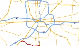
State Route 762 is an east–west state highway
in central Ohio
, a U.S. state
. The highway has its western terminus at a signalized intersection with the duplex of U.S. Route 62 and State Route 3 just 0.25 mile (0.402335 km) south of the village limits of Harrisburg
. State Route 762's eastern terminus is at a signalized intersection with U.S. Route 23 approximately 3.25 miles (5.2 km) east of Commercial Point
.
. No section of this highway is included as a part of the National Highway System
, a system of routes deemed to be most important for the country's economy, mobility and defense.
between the U.S. Route 62/State Route 3 duplex and U.S. Route 23 that it utilizes today. No changes of major significance have taken place to the routing of State Route 762 since it was created.
State highway
State highway, state road or state route can refer to one of three related concepts, two of them related to a state or provincial government in a country that is divided into states or provinces :#A...
in central Ohio
Ohio
Ohio is a Midwestern state in the United States. The 34th largest state by area in the U.S.,it is the 7th‑most populous with over 11.5 million residents, containing several major American cities and seven metropolitan areas with populations of 500,000 or more.The state's capital is Columbus...
, a U.S. state
U.S. state
A U.S. state is any one of the 50 federated states of the United States of America that share sovereignty with the federal government. Because of this shared sovereignty, an American is a citizen both of the federal entity and of his or her state of domicile. Four states use the official title of...
. The highway has its western terminus at a signalized intersection with the duplex of U.S. Route 62 and State Route 3 just 0.25 mile (0.402335 km) south of the village limits of Harrisburg
Harrisburg, Ohio
Harrisburg is a village in Franklin and Pickaway counties in the U.S. state of Ohio. The population was 332 at the 2000 census.-History:Harrisburg was founded in 1836 by Joseph Chenowith and surveyed and platted by Frederick Cole...
. State Route 762's eastern terminus is at a signalized intersection with U.S. Route 23 approximately 3.25 miles (5.2 km) east of Commercial Point
Commercial Point, Ohio
Commercial Point is a village in Pickaway County, Ohio, United States. The population was 776 at the 2000 census.-Geography:Commercial Point is located at ....
.
Route description
State Route 762 is located in the northern portion of Pickaway CountyPickaway County, Ohio
As of the census of 2000, there were 52,727 people, 17,599 households, and 13,287 families residing in the county. The population density was 105 people per square mile . There were 18,596 housing units at an average density of 37 per square mile...
. No section of this highway is included as a part of the National Highway System
National Highway System (United States)
The National Highway System is a network of strategic highways within the United States, including the Interstate Highway System and other roads serving major airports, ports, rail or truck terminals, railway stations, pipeline terminals and other strategic transport facilities.Individual states...
, a system of routes deemed to be most important for the country's economy, mobility and defense.
History
The State Route 762 designation made its debut in 1937. It was established on the same alignment through northern Pickaway CountyPickaway County, Ohio
As of the census of 2000, there were 52,727 people, 17,599 households, and 13,287 families residing in the county. The population density was 105 people per square mile . There were 18,596 housing units at an average density of 37 per square mile...
between the U.S. Route 62/State Route 3 duplex and U.S. Route 23 that it utilizes today. No changes of major significance have taken place to the routing of State Route 762 since it was created.