
Ohio State Route 601
Encyclopedia
Ohio State Route 601 is a north–south state highway
in North Central Ohio
. A de facto two-lane eastern bypass of Norwalk
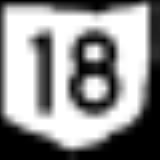
, OH 601 has its southern terminus at OH 18 southeast of Norwalk, adjacent to Summit Motorsports Park
. The northern terminus of OH 601 is at OH 113 in downtown Milan, less than 0.25 mile (0.402335 km) east of the junction of OH 113 and the US 250
/OH 13 duplex.
in northern Huron County
. Heading north from there, along the west side of OH 601 is Summit Motorsports Park
, and immediately to the north of that, Norwalk-Huron County Airport. The east side of OH 601 has more of a rural feel to it. North of the airport, OH 601 intersects US 20. After straddling the boundary between Norwalk Township
and Townsend Township
up to a point north of the US 20 intersection, OH 601 starts to bend to the northwest, entirely into Norwalk Township. Through this stretch, the two-lane highway encounters a blend of farmland, occasional homes and even a few businesses. OH 601 passes through an intersection with Gibbs Road, then continues on to its junction with OH 61
, which is a signalized intersection.
Continuing northwest of OH 61, the setting that OH 601 passes through remains unchanged up through the intersection from which Perrin Road heads northeasterly, and Old State Road goes southward. Passing through that intersection, OH 601 encounters one subdivision on each side of the roadway, then promptly crosses into Erie County
, and correspondingly, the village of Milan
. Through Milan, OH 601 is routed along Main Street, and passes through a primarily residential portion of the community. OH 601 intersects Lockwood Road, then continues for another three blocks to its junction with OH 113. This downtown Milan intersection, which is controlled by mast-arm traffic signals, marks the endpoint of OH 601, and is located just a few blocks to the east of the duplex of US 250 and OH 13.
State highway
State highway, state road or state route can refer to one of three related concepts, two of them related to a state or provincial government in a country that is divided into states or provinces :#A...
in North Central Ohio
Ohio
Ohio is a Midwestern state in the United States. The 34th largest state by area in the U.S.,it is the 7th‑most populous with over 11.5 million residents, containing several major American cities and seven metropolitan areas with populations of 500,000 or more.The state's capital is Columbus...
. A de facto two-lane eastern bypass of Norwalk
Norwalk, Ohio
At the 2000 census, there were 16,238 people, 6,377 households and 4,234 families residing in the city. The population density was 1,950.3 per square mile . There were 6,687 housing units at an average density of 803.1 per square mile...
, OH 601 has its southern terminus at OH 18 southeast of Norwalk, adjacent to Summit Motorsports Park
Summit Motorsports Park
Summit Motorsports Park, formerly Norwalk Raceway Park and Norwalk Dragway, is a drag racing facility located on State Route 18 near Norwalk, Ohio...
. The northern terminus of OH 601 is at OH 113 in downtown Milan, less than 0.25 mile (0.402335 km) east of the junction of OH 113 and the US 250
U.S. Route 250
U.S. Route 250 is a route of the United States Numbered Highway System, and is a spur of U.S. Route 50. It currently runs for from Sandusky, Ohio to Richmond, Virginia. It passes through the states of Virginia, West Virginia, and Ohio. It goes through the cities of Richmond, Virginia,...
/OH 13 duplex.
Route description
OH 601 starts at the intersection of OH 18 and Greenwich-Milan Town Line Road southeast of NorwalkNorwalk, Ohio
At the 2000 census, there were 16,238 people, 6,377 households and 4,234 families residing in the city. The population density was 1,950.3 per square mile . There were 6,687 housing units at an average density of 803.1 per square mile...
in northern Huron County
Huron County, Ohio
As of the census of 2000, there were 59,487 people, 22,307 households, and 16,217 families residing in the county. The population density was 121 people per square mile . There were 23,594 housing units at an average density of 48 per square mile...
. Heading north from there, along the west side of OH 601 is Summit Motorsports Park
Summit Motorsports Park
Summit Motorsports Park, formerly Norwalk Raceway Park and Norwalk Dragway, is a drag racing facility located on State Route 18 near Norwalk, Ohio...
, and immediately to the north of that, Norwalk-Huron County Airport. The east side of OH 601 has more of a rural feel to it. North of the airport, OH 601 intersects US 20. After straddling the boundary between Norwalk Township
Norwalk Township, Huron County, Ohio
Norwalk Township is one of the nineteen townships of Huron County, Ohio, United States. The 2000 census found 3,685 people in the township, 3,265 of whom lived in the unincorporated portions of the township.-Geography:...
and Townsend Township
Townsend Township, Huron County, Ohio
Townsend Township is one of the nineteen townships of Huron County, Ohio, United States. The 2000 census found 1,567 people in the township.-Geography:Located on the northern edge of the county, it borders the following townships:...
up to a point north of the US 20 intersection, OH 601 starts to bend to the northwest, entirely into Norwalk Township. Through this stretch, the two-lane highway encounters a blend of farmland, occasional homes and even a few businesses. OH 601 passes through an intersection with Gibbs Road, then continues on to its junction with OH 61
Ohio State Route 61
State Route 61 is a north–south state highway in the northern portion of the U.S. state of Ohio. Its southern terminus is at the U.S. Route 36/State Route 3 concurrency in Sunbury, and its northern terminus is at U.S. Route 6 east of Huron, at the southern-most point of Lake Erie...
, which is a signalized intersection.
Continuing northwest of OH 61, the setting that OH 601 passes through remains unchanged up through the intersection from which Perrin Road heads northeasterly, and Old State Road goes southward. Passing through that intersection, OH 601 encounters one subdivision on each side of the roadway, then promptly crosses into Erie County
Erie County, Ohio
As of the census of 2000, there were 79,551 people, 31,727 households, and 21,764 families residing in the county. The population density was 312 people per square mile . There were 35,909 housing units at an average density of 141 per square mile...
, and correspondingly, the village of Milan
Milan, Ohio
Milan is a village in Erie and Huron counties in the U.S. state of Ohio. The population was 1,445 at the 2000 census.The Erie County portion of Milan is part of the Sandusky Metropolitan Statistical Area, while the Huron County portion is part of the Norwalk Micropolitan Statistical Area.-History...
. Through Milan, OH 601 is routed along Main Street, and passes through a primarily residential portion of the community. OH 601 intersects Lockwood Road, then continues for another three blocks to its junction with OH 113. This downtown Milan intersection, which is controlled by mast-arm traffic signals, marks the endpoint of OH 601, and is located just a few blocks to the east of the duplex of US 250 and OH 13.