

Ohio State Route 558
Encyclopedia
State highway
State highway, state road or state route can refer to one of three related concepts, two of them related to a state or provincial government in a country that is divided into states or provinces :#A...
located entirely in Columbiana County
Columbiana County, Ohio
Columbiana County is a county located in the U.S. state of Ohio. As of 2010, the population was 107,841. It is named for Christopher Columbus and the county seat is Lisbon....
in northeast Ohio
Ohio
Ohio is a Midwestern state in the United States. The 34th largest state by area in the U.S.,it is the 7th‑most populous with over 11.5 million residents, containing several major American cities and seven metropolitan areas with populations of 500,000 or more.The state's capital is Columbus...
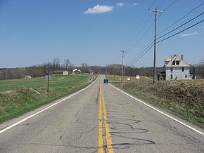
. The route runs through primarily rural sections of east-central Columbiana County. The western terminus is at State Route 45
Ohio State Route 45
State Route 45 is a north–south state highway in the northeastern portion of the U.S. state of Ohio. Its southern terminus is at the State Route 7/State Route 39 concurrency in Wellsville, and its northern terminus is at State Route 531 about west of Ashtabula.-History:*1924 – Original...
between Salem
Salem, Ohio
Salem is a city in northern Columbiana County and extreme southern Mahoning County, Ohio, United States. At the 2000 census, the city's population was 12,197....
and Lisbon
Lisbon, Ohio
Lisbon is a village in Center Township, Columbiana County, Ohio, United States. The population was 2,788 at the 2000 census. It is the county seat of Columbiana County.-History:...
, and the eastern terminus at State Route 170
Ohio State Route 170
State Route 170 is a north–south running state route located in Mahoning and Columbiana counties in northeast Ohio. It runs within a few miles of the Pennsylvania border for much of its route as it passes though the eastern parts of the two counties. The southern terminus is at an...
in East Palestine
East Palestine, Ohio
East Palestine is a city in Unity Township, Columbiana County, Ohio, United States, near the border with Pennsylvania. The population was 4,917 at the 2000 census....
. The eastern terminus is also the southern terminus of State Route 46
Ohio State Route 46
State Route 46 is a north–south state highway in the northeastern portion of the U.S. state of Ohio. Its southern terminus is at State Route 170 in East Palestine , and its northern terminus is at State Route 11 several miles south of State Route 531 in Ashtabula...
.
Major intersections
History
- 1938 – Original route established; Originally routed from Salem to East Palestine along current Route 344Ohio State Route 344State Route 344 is an east-west state highway lying entirely in Columbiana County, Ohio. Its western terminus is at State Route 14 and State Route 9 in downtown Salem, and its eastern terminus is along a concurrency with State Route 164 in downtown Columbiana....
from Salem to 3 miles (4.8 km) east of Salem, an unnumbered road from 3 miles (4.8 km) east of Salem to 4 miles (6.4 km) east of Salem, and Route 558 from 4 miles (6.4 km) east of Salem to East Palestine. - 1946 – Truncated at 3 miles (4.8 km) west of East Palestine.
- 1947 - Extended to East Palestine along Route 46Ohio State Route 46State Route 46 is a north–south state highway in the northeastern portion of the U.S. state of Ohio. Its southern terminus is at State Route 170 in East Palestine , and its northern terminus is at State Route 11 several miles south of State Route 531 in Ashtabula...
. - 1981 - Rerouted from 3 miles (4.8 km) east of Salem to 6 miles (9.7 km) north of Lisbon along previous Route 344Ohio State Route 344State Route 344 is an east-west state highway lying entirely in Columbiana County, Ohio. Its western terminus is at State Route 14 and State Route 9 in downtown Salem, and its eastern terminus is along a concurrency with State Route 164 in downtown Columbiana....
.