
Nova América
Encyclopedia
| Pilar de Goiás | |
|---|---|
| State | Goiás Goiás Goiás is a state of Brazil, located in the central part of the country. The name Goiás comes from the name of an indigenous community... |
| Area: | 212 km² |
| Population: | 2,200 (IBGE 2007) |
| Elevation: | 796 m above sea level |
| Postcode (CEP): | 76345-000 |
| Became a city: | 1958 |
| Microregion: | Ceres Ceres Microregion The Ceres Microregion is located in north-central Goiás state, Brazil. It includes 22 cities with a total population of 215,820 inhabitants . The total area is 13,224.40 km² and the population density is 16.32 inhab/km². The most important cities are Ceres and Goianésia.The most populous... |
| Mayor: | Eurípedes Miguel Manso |
| Distance to Goiânia Goiânia -Climate:The city has a tropical wet and dry climate with an average temperature of . There's a wet season, from October to April, and a dry one, from May to September. Annual rainfall is around 1,520 mm.... : |
256 km |
| Website: | none |

Town
A town is a human settlement larger than a village but smaller than a city. The size a settlement must be in order to be called a "town" varies considerably in different parts of the world, so that, for example, many American "small towns" seem to British people to be no more than villages, while...
and municipality
Municipality
A municipality is essentially an urban administrative division having corporate status and usually powers of self-government. It can also be used to mean the governing body of a municipality. A municipality is a general-purpose administrative subdivision, as opposed to a special-purpose district...
in northeastern Goiás
Goiás
Goiás is a state of Brazil, located in the central part of the country. The name Goiás comes from the name of an indigenous community...
state, Brazil
Brazil
Brazil , officially the Federative Republic of Brazil , is the largest country in South America. It is the world's fifth largest country, both by geographical area and by population with over 192 million people...
.
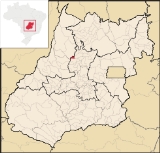
Location
Nova América is located 71 km. east of CeresCeres, Goiás
Ceres is a small city and municipality in central Goiás state, Brazil. It was the first agricultural colony built in the state of Goiás.-Geography:...
and the important BR-153 highway. Nearby towns are Rubiataba, 21 km., Crixás, 55 km., and Nova Glória, 45 km.
- Distance to GoiâniaGoiânia-Climate:The city has a tropical wet and dry climate with an average temperature of . There's a wet season, from October to April, and a dry one, from May to September. Annual rainfall is around 1,520 mm....
: 256 km. - Highway connections: GO-080 / NerópolisNerópolisNerópolis is a small city and municipality in central Goiás state, Brazil.-Location:The municipality is part of the metropolitan region of Goiânia, which is 42 kilometers to the west. It is nationally known as the city of garlic and sweets...
/ São Francisco de GoiásSão Francisco de GoiásSão Francisco de Goiás is a small town and municipality in central Goiás state, Brazil.Municipal boundaries:*North: Jaraguá*South: Petrolina de Goiás*East: Pirenópolis*West: Jesúpolis and Jaraguá...
/ BR-153 / RialmaRialmaRialma is a small city and municipality in north-central Goiás state, Brazil.-Location and Geography:Rialma is located across the Rio das Almas from Ceres on the important interstate highway BR-153, which links Anápolis to Belém. It was created as part of the urban area of Ceres, which was also...
/ GO-434 / RubiatabaRubiatabaRubiataba is a small city and municipality in northeastern Goiás state, Brazil.-Location and Geography:Rubiataba is located in the north of the state, south of the source of the Crixás River. It is 235 kilometres to the state capital of Goiânia. Other distances are:*Nova América: 21 km. to the...
. See Seplan
Neighboring municipalities: Rubiataba
Rubiataba
Rubiataba is a small city and municipality in northeastern Goiás state, Brazil.-Location and Geography:Rubiataba is located in the north of the state, south of the source of the Crixás River. It is 235 kilometres to the state capital of Goiânia. Other distances are:*Nova América: 21 km. to the...
, Itapaci
Itapaci
Itapaci is a small town and municipality in northern Goiás state, Brazil. The population was 16,003 in 2007 . The total area of the municipality was 956.1 km² .-Geography:...
, Crixás
Crixás
Crixás is a small city and municipality in northwestern Goiás state, Brazil. The population was 14,547 in a total area of 4,661.5 km². Crixás was a major gold producing area but is now gradually losing population....
, and Mozarlândia
Mozarlândia
Mozarlândia is a small city and municipality in north-central Goiás state, Brazil.It is located in the Valley of the Araguaia River, 300 kilometers from the state capital, Goiânia, and is served by highways GO-164 and GO-334....
Demographics
In 2007 the population density of the municipality was 10.38 inhab/km². The urban population was 1,532 and the rural population was 668.The geometric growth rate was 0.07% for the period 1996/2007.
History
Nova América began in 1944 on the banks of the Baunilha River. The first settler was José Jeremias do Couto who raised cattle. In 1952 he divided part of his land into lots and donated them to settlers. The first name was "Baunilha", after the river. In 1952 it was raised to a district belonging to ItapaciItapaci
Itapaci is a small town and municipality in northern Goiás state, Brazil. The population was 16,003 in 2007 . The total area of the municipality was 956.1 km² .-Geography:...
with the name "América", after the wife of its founder, América do Couto. In 1958 it was dismembered to become a municipality.
The economy
The economy is based on modest agriculture, cattle raising, services, and public employment. In 2007 there were only 2 industrial units and 14 retail units in the town. There were no financial institutions. In 2007 there were 258 automobiles.There were 269 farms in 2006 with a total area of 21,804 hectares, of which 800 hectares were cropland and 16,400 hectares were pasture. In 2006 there were 21,000 head of cattle and a modest number of poultry and swine. The main agricultural products were rice, sugarcane, and corn, none surpassing 500 hectares in planted area.
Health and education
In 2007 there was only 1 walk-in health clinic in the town. In 2000 the infant mortality rate was 26.46, below the national average of 35.0.In 2006 the school system had 4 schools, 19 classrooms, 54 teachers, and 794 students. In 2000 the adult literacy rate was 82.4%, which was below the national average of 86.4%.
Ranking on the Municipal Human Development Index
Human Development Index
The Human Development Index is a composite statistic used to rank countries by level of "human development" and separate "very high human development", "high human development", "medium human development", and "low human development" countries...
- MHDI: 0.715
- State ranking: 183 (out of 242 municipalities)
- National ranking: 2,704 (out of 5,507 municipalities)
For the complete list see frigoletto.com.br