
North Norfolk Coastal Path
Encyclopedia
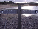
The Norfolk Coast Path is a long distance footpath in Norfolk
, running 45 miles (72 km) from Hunstanton
to Cromer
. It was opened in 1986 and covers the North Norfolk Coast AONB (Area of Outstanding Natural Beauty
).
It links with the Peddars Way
at Holme-next-the-Sea
, and the two in combination form the Peddars Way & Norfolk Coast Path National Trail, one of 15 National Trails in England and Wales
. At Cromer
it links to the Weavers Way
.
The Norfolk Coast Path passes through or near:-
Norfolk
Norfolk is a low-lying county in the East of England. It has borders with Lincolnshire to the west, Cambridgeshire to the west and southwest and Suffolk to the south. Its northern and eastern boundaries are the North Sea coast and to the north-west the county is bordered by The Wash. The county...
, running 45 miles (72 km) from Hunstanton
Hunstanton
Hunstanton, often pronounced by locals as and known colloquially as 'Sunny Hunny', is a seaside town in Norfolk, England, facing The Wash....
to Cromer
Cromer
Cromer is a coastal town and civil parish in north Norfolk, England. The local government authority is North Norfolk District Council, whose headquarters is in Holt Road in the town. The town is situated 23 miles north of the county town, Norwich, and is 4 miles east of Sheringham...
. It was opened in 1986 and covers the North Norfolk Coast AONB (Area of Outstanding Natural Beauty
Area of Outstanding Natural Beauty
An Area of Outstanding Natural Beauty is an area of countryside considered to have significant landscape value in England, Wales or Northern Ireland, that has been specially designated by the Countryside Agency on behalf of the United Kingdom government; the Countryside Council for Wales on...
).
It links with the Peddars Way
Peddars Way
The Peddars Way is a long distance footpath in Norfolk, England. It is 46 miles long and follows the route of a Roman road. It has been suggested by more than one writer that it was not created by the Romans but was an ancient trackway, a branch or extension of the Icknield Way, used and...
at Holme-next-the-Sea
Holme-next-the-Sea
Holme-next-the-Sea is a small village and civil parish in the English county of Norfolk. It is situated on the north Norfolk coast some 5 km north-east of the seaside resort of Hunstanton, 30 km north of the town of King's Lynn and 70 km north-west of the city of Norwich.The civil...
, and the two in combination form the Peddars Way & Norfolk Coast Path National Trail, one of 15 National Trails in England and Wales
Wales
Wales is a country that is part of the United Kingdom and the island of Great Britain, bordered by England to its east and the Atlantic Ocean and Irish Sea to its west. It has a population of three million, and a total area of 20,779 km²...
. At Cromer
Cromer
Cromer is a coastal town and civil parish in north Norfolk, England. The local government authority is North Norfolk District Council, whose headquarters is in Holt Road in the town. The town is situated 23 miles north of the county town, Norwich, and is 4 miles east of Sheringham...
it links to the Weavers Way
Weavers Way
For the Philadelphia co-op see Weavers Way Co-opThe Weavers' Way is a long distance footpath in Norfolk, England. It is 56 miles long and runs from Cromer to Great Yarmouth...
.
The Norfolk Coast Path passes through or near:-
- HunstantonHunstantonHunstanton, often pronounced by locals as and known colloquially as 'Sunny Hunny', is a seaside town in Norfolk, England, facing The Wash....
- Holme-next-the-SeaHolme-next-the-SeaHolme-next-the-Sea is a small village and civil parish in the English county of Norfolk. It is situated on the north Norfolk coast some 5 km north-east of the seaside resort of Hunstanton, 30 km north of the town of King's Lynn and 70 km north-west of the city of Norwich.The civil...
- ThornhamThornham, NorfolkThornham is a village and civil parish in the English county of Norfolk. It is situated on the north Norfolk coast some north-east of the seaside resort of Hunstanton, north of the town of King's Lynn and north-west of the city of Norwich....
- TitchwellTitchwellTitchwell is a village and civil parish in the English county of Norfolk. It is situated on the north Norfolk coast some west of the village of Brancaster, north-east of the seaside resort of Hunstanton, north of the town of King's Lynn and north-west of the city of Norwich.The civil parish has...
- BrancasterBrancasterBrancaster is a village and civil parish on the north coast of the English county of Norfolk. The civil parish of Brancaster comprises Brancaster itself, together with Brancaster Staithe and Burnham Deepdale...
- Burnham Deepdale
- Burnham Overy Staithe
- Wells-next-the-SeaWells-next-the-SeaWells-next-the-Sea, known locally simply as Wells, is a town, civil parish and seaport situated on the North Norfolk coast in England.The civil parish has an area of and in the 2001 census had a population of 2,451 in 1,205 households...
- MorstonMorstonMorston is a village and civil parish in the English county of Norfolk.It covers an area of and had a population of 86 in 42 households as of the 2001 census.For the purposes of local government, it falls within the district of North Norfolk....
- BlakeneyBlakeney, NorfolkBlakeney is a coastal village and civil parish in the English county of Norfolk. Blakeney lies within the Norfolk Coast AONB and the North Norfolk Heritage Coast. The North Norfolk Coastal Path passes through the village...
- Cley next the SeaCley next the SeaCley next the Sea is a village on the River Glaven in Norfolk, England, 4 miles north-west of Holt and east of Blakeney. The main A149 coast road runs through the centre of the village, causing congestion in the summer months due to the tight, narrow streets. It lies within the Norfolk Coast AONB...
- SalthouseSalthouseSalthouse is a village and a civil parish in the English county of Norfolk. It is situated on the salt marshes of North Norfolk. It is north of Holt, west of Sheringham and north of Norwich. The village is on the A149 coast road between King's Lynn and Great Yarmouth. The nearest railway station...
- KellingKellingKelling is a village and a civil parish in the English county of Norfolk. The village is west of Cromer, north of Norwich and north-east of London. The village straddles the A149 Coast road between Kings Lynn and Great Yarmouth...
- WeybourneWeybourneWeybourne is a fishing resort on the North Norfolk and has the postcode prefix of NR25. The village straddles the A149 coast road and is three miles west of Sheringham, within the Norfolk Coast AONB. Weybourne is mentioned in the Domesday book and in that survey it is called Wabrume...
- SheringhamSheringhamSheringham is a seaside town in Norfolk, England, west of Cromer.The motto of the town, granted in 1953 to the Sheringham Urban District Council, is Mare Ditat Pinusque Decorat, Latin for "The sea enriches and the pine adorns"....
- Beeston Regis
- East RuntonEast RuntonEast Runton is a small village in Norfolk, England situated close to the North Sea. It was once a traditional fishing village outside Cromer but is now a popular holiday destination for camping and caravan holidays. The village is within the parish of Runton that also includes West Runton. The...
- CromerCromerCromer is a coastal town and civil parish in north Norfolk, England. The local government authority is North Norfolk District Council, whose headquarters is in Holt Road in the town. The town is situated 23 miles north of the county town, Norwich, and is 4 miles east of Sheringham...