

Noroton River
Encyclopedia
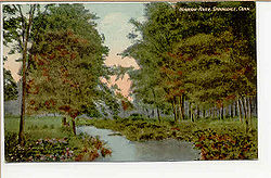
Stamford, Connecticut
Stamford is a city in Fairfield County, Connecticut, United States. According to the 2010 census, the population of the city is 122,643, making it the fourth largest city in the state and the eighth largest city in New England...
and Darien
Darien, Connecticut
Darien is a town in Fairfield County, Connecticut, United States. A relatively small community on Connecticut's "Gold Coast", the population was 20,732 at the 2010 census. Darien was listed at #9 at CNN Money's list of "top-earning towns" in the United States as of 2011...
, Connecticut
Connecticut
Connecticut is a state in the New England region of the northeastern United States. It is bordered by Rhode Island to the east, Massachusetts to the north, and the state of New York to the west and the south .Connecticut is named for the Connecticut River, the major U.S. river that approximately...
, USA. The river's headwaters are in New Canaan
New Canaan, Connecticut
New Canaan is a town in Fairfield County, Connecticut, United States, northeast of Stamford, on the Fivemile River. The population was 19,738 according to the 2010 census.The town is one of the most affluent communities in the United States...
, Connecticut. It is the largest flowing body of water between Mill River/Rippowam River
Rippowam River
The Rippowam River is a river in Fairfield County, Connecticut. It drains a watershed area of and flows for from Ridgefield to Long Island Sound, which it enters in Stamford's harbor....
to the west and Five Mile River
Five Mile River
The Five Mile River is a river approximately long, located in Connecticut's Northeast Corner. The original Nipmuc name was Assawaga, meaning "place between" or "halfway place." The Assawaga received its English name from the fact that the first land laid out upon it was "supposed to be about five...
to the east, although Stony Brook and the Goodwives River in Darien are not much smaller.
Pollution runoff from Interstate 95 flows down the Noroton River into Holly Pond. In 2009, the Stamford and Darien local governments asked the federal government for an $11.7 million grant (to fund 65 percent of an $18 million project) for "dredging and ecosystem restoration" in the pond and river, including "construction of wetlands, bioswales and other restoration structures".
Two restaurants are located at the mouth of the river, where U.S. Route 1 (known as the Boston Post Road on the Darien side and East Main Street on the Stamford side) crosses it. Both feature windows offering diners a view of the river. The restaurant on the north side is in Stamford. On the south side, the current Giovanni's II Steakhouse is the most recent business to occupy a lot where restaurants have been sited since the early 20th century.
Geography
To the west of the river is the Glenbrook and Springdale sections of Stamford; to the east are the Noroton and Noroton Heights sections of Darien. At its southern end, the stream forms a small valley between Noroton Hill to the west and Hollow Tree Ridge to the east. Farther north, in New Canaan, Ponus Ridge is to the east.Crossings
North from the mouth of the river (Stamford-Darien border):- U.S. Route 1U.S. Route 1U.S. Route 1 is a major north–south U.S. Highway that serves the East Coast of the United States. It runs 2,377 miles from Fort Kent, Maine at the Canadian border south to Key West, Florida. U.S. 1 generally parallels Interstate 95, though it is significantly farther west between...
-- Boston Post RoadBoston Post RoadThe Boston Post Road was a system of mail-delivery routes between New York City and Boston, Massachusetts that evolved into the first major highways in the United States.The three major alignments were the Lower Post Road The Boston Post Road was a system of mail-delivery routes between New York...
(in Darien), East Main Street (in Stamford) - Interstate 95Interstate 95 in ConnecticutInterstate 95, the main north–south Interstate Highway on the East Coast of the United States, runs in a general east–west compass direction for 111.57 miles in Connecticut from the Rhode Island state line to the New York State line. I-95 Southbound from East Lyme to the New York State...
- Maple Tree Avenue (Stamford)/West Avenue (Darien)
- Connecticut Route 106Connecticut Route 106Route 106 is a state highway in southwestern Connecticut, running from Stamford to Wilton.-Route description:Route 106 begins at a junction with I-95 and US 1 in the East Side of Stamford as Courtland Avenue then turning right on Glenbrook Road...
-- Glenbrook Road (Stamford)/Middlesex Road (Darien) - Camp Avenue
- Woodway Road
In New Canaan:
- U.S. Route 15U.S. Route 15U.S. Route 15 is a -long United States highway, designated along South Carolina, North Carolina, Virginia, Maryland, Pennsylvania, and New York. The route is signed north–south, from U.S. Route 17 Alternate in Walterboro, South Carolina to Interstate 86 and NY 17 in Painted Post, New York.US...
-- Merritt ParkwayMerritt ParkwayThe Merritt Parkway is a historic limited-access parkway in Fairfield County, Connecticut. The parkway is known for its scenic layout, its uniquely styled signage, and the architecturally elaborate overpasses along the route. It is designated as a National Scenic Byway and is also listed in the... - Jelliff Mill Road (named after Jelliff Mill, where a dam of the river creates Jelliff Mill Pond
- Indian Waters Drive
- Frogtown Road
- Wahackme Road (where the river goes through a bird sanctuary)
- Greenley Road
- West Road
- Country Club Road
Before the 20th century
The SiwanoySiwanoy
The Native American Siwanoy or Sinanoy were a band of Algonquian-speaking people, the Wappinger, in what is now the New York City area. By the mid-17th century, when their territory became hotly contested between Dutch and English colonial interests, the Siwanoy were settled along the East River...
sachendom of the Wappinger
Wappinger
The Wappinger were an American tribe native to eastern New York. The term "Wappinger" may also refer to:* Wappinger, New York, the Town of Wappinger named for the tribe...
tribe had settled the area before the English came. At the mouth of the river, Indians had a village named "Noroaton".
The area surrounding the river became part of Stamford in the 17th century. In the 1680s, one of the earliest settlements of the English in Darien was founded near the east side of the river, on "Noroton Cove" (the former name of Holly Pond). The settlement included a sawmill built by a dam on the river, just north of where Interstate 95 now crosses it.
During the Revolutionary War
American Revolution
The American Revolution was the political upheaval during the last half of the 18th century in which thirteen colonies in North America joined together to break free from the British Empire, combining to become the United States of America...
, Stephen Weed was released from the infamous Sugar House Prison in New York City in a prisoner exchange. The New Canaan resident then built a stone fort near his home on the east side of the stream, just south of where Frogtown Road crosses the Noroton. "He steadily insisted that the British would raid the parish and that this line of march would be up the Noroton River valley," according to Charles P. Morton's Landmarks of New Canaan, published by the New Canaan Historical Society in 1951. To the south, Middlesex Parish (which later became the town of Darien) had been raided several times during the Revolution. Weed manned the fort as a precaution against a possible attack for nine years, long after the war was over.
On August 10, 1889, a resident clamming near the mouth of the river reported an encounter with a sea serpent, which he said lifted its head right alongside his boat. He described the beast (in the words of a Boston Daily Globe report) as having "a large black head and its back was a copper color. It ran a big red tongue out of its mouth and emitted a hissing sound." Various other people along the shore said they, too, saw the creature at the same time and described it as "very long". According to the Globe, "It was seen by over a dozen reputable people and is confirmed by three or four women who got a glance of it and then ran screaming into the woods." For the next week, people hunted the purported creature up and down the river, but it was never found. "All sorts of things come up the Noroton from time to time," according to the Globe article. "Last year a shark was killed at almost the identical spot where the sea serpent was seen this time."
20th century
In 1912, a New York Times article on recreational summer streetcar trips recommended taking in the view at the Noroton River bridge:-
- Stand on the bridge over the Noroton at Stamford and take in the first of a series of beautiful pictures that everywhere meet the tourist's gaze. Here is historic interest again, many Revolutionary incidents having taken place around the neighborhood.
The "Revolutionary incidents" in Noroton during the American Revolution were raids by Tories based on Long Island, across the sound, sometimes resulting in fatalities—the incidents that terrified Stephen Weed in the late 18th century. The trolley stopped at the Noroton River, where passengers needed to disembark, walk across the bridge and take another trolley car because there was no through connection at the time. In December 1914, the Darien and Stamford governments agreed to help finance a widening of the bridge taking the Post Road over the Noroton River so that an electric streetcar line could operate over it. The gap in streetcar service was the last one between New York City and Boston.
The Phillips family, heirs of Charles Henry Phillips
Charles Henry Phillips
Charles Henry Phillips was an English pharmacist who is universally known for his invention Phillips Milk of Magnesia.-Early days:He moved to an estate at 666 Hope St...
, who created Phillips Milk of Magnesia, long had a Tudor-style mansion on a four-acre lot along the Noroton River in Glenbrook (where the first Milk of Magnesia factory was located). In the mid-1980s, the property was converted into a condominium development called "River Walk".
Frank Lloyd Wright
Frank Lloyd Wright
Frank Lloyd Wright was an American architect, interior designer, writer and educator, who designed more than 1,000 structures and completed 500 works. Wright believed in designing structures which were in harmony with humanity and its environment, a philosophy he called organic architecture...
, working with a landscape architect, Frank Okamura, reshaped a portion of the river running through a 13-acre New Canaan estate for which Wright designed the Rayward-Shepherd House
Rayward-Shepherd House
The Rayward-Shepherd House, also known as Tirranna and as the John L. Rayward House, was designed by renowned architect Frank Lloyd Wright and built in New Canaan, Connecticut in 1955 for Joyce and John Rayward. Although commissioned by the Raywards, Herman R. Shepherd completed the design after...
(built between 1956 and 1968).
Flooding on August 19, 1955, caused seven Darien families to be evacuated from their homes along the river. On October 16, two days of heavy rain caused the river to again flood, weakening the roadbed of the New Haven Line and causing 20 cars of a freight train (but not the engine) to derail on the Stamford side of the river just after midnight. None of the six-member crew was hurt. After the flooding, one of a number of floods in the Northeastern United States caused by the same rains, the river "twisted madly through a 120-foot gap in the roadbed" of the New Haven Line near Glenbrook.
In 1960, Peter Franchina owned the restaurant (then called "Franchina's") on the west side of the river where East Main Street crosses the Noroton. At the time, Franchina wanted to build a hotel behind the restaurant and sought a zoning change to allow for parking. Residents on Brookside Drive, parallel to the river on the Darien side, objected, telling the Stamford Planning and Zoning Commission that the property would become an eyesore, and the change might interfere with sewer and water easements. The motel was never built.