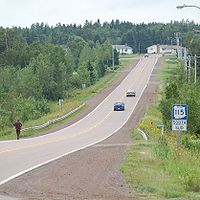
New Brunswick Route 115
Encyclopedia
Route 115 is a highway
in New Brunswick
, Canada
; running from a junction with Route 134
in the Lewisville neighbourhood of Moncton
to Route 134
in Saint-François-de-Kent (near Bouctouche
, a distance of 44 kilometres.
 In Moncton, Route 115 follows Elmwood Drive, a suburban arterial running due north from the city through the neighbourhood of Sunny Brae. The route continues north to the community of Irishtown, then northeast to Notre-Dame
. From Notre-Dame, Route 115 turns north to the village of Saint-Antoine, New Brunswick
, then follows the south bank of the Little Bouctouche River to Saint-François-de-Kent.
Route 115 came into existence in 1965 as a renumbering of Route 31, during a mass redesignation of provincial highways. Until the late 1970s, Route 115 was routed from Notre-Dame eastward along present-day Route 535 to its former northern terminus in Cocagne
.
Highway
A highway is any public road. In American English, the term is common and almost always designates major roads. In British English, the term designates any road open to the public. Any interconnected set of highways can be variously referred to as a "highway system", a "highway network", or a...
in New Brunswick
New Brunswick
New Brunswick is one of Canada's three Maritime provinces and is the only province in the federation that is constitutionally bilingual . The provincial capital is Fredericton and Saint John is the most populous city. Greater Moncton is the largest Census Metropolitan Area...
, Canada
Canada
Canada is a North American country consisting of ten provinces and three territories. Located in the northern part of the continent, it extends from the Atlantic Ocean in the east to the Pacific Ocean in the west, and northward into the Arctic Ocean...
; running from a junction with Route 134
New Brunswick Route 134
Route 134 is a Canadian secondary highway in northeast New Brunswick. The highway is actually divided by Northumberland County into a northern and southern section....
in the Lewisville neighbourhood of Moncton
Moncton, New Brunswick
Moncton is a Canadian city, located in Westmorland County, New Brunswick. The city is situated in southeastern New Brunswick, within the Petitcodiac River Valley, and lies at the geographic centre of the Maritime Provinces...
to Route 134
New Brunswick Route 134
Route 134 is a Canadian secondary highway in northeast New Brunswick. The highway is actually divided by Northumberland County into a northern and southern section....
in Saint-François-de-Kent (near Bouctouche
Bouctouche, New Brunswick
Bouctouche is a Canadian town in Kent County, New Brunswick and in 2006 Census the population was 2,383.The town is located at the mouth of the Bouctouche River on the coast of the Northumberland Strait, approximately 40 kilometres northeast of Moncton....
, a distance of 44 kilometres.

Notre-Dame, New Brunswick
Notre-Dame is a settlement in New Brunswick....
. From Notre-Dame, Route 115 turns north to the village of Saint-Antoine, New Brunswick
Saint-Antoine, New Brunswick
Saint-Antoine is a village in Kent County, New Brunswick, Canada. It is 35 km north of Moncton and 18km Southwest of Bouctouche. Saint-Antoine's residents are Acadian; most speak French in its local variant, Chiac....
, then follows the south bank of the Little Bouctouche River to Saint-François-de-Kent.
Route 115 came into existence in 1965 as a renumbering of Route 31, during a mass redesignation of provincial highways. Until the late 1970s, Route 115 was routed from Notre-Dame eastward along present-day Route 535 to its former northern terminus in Cocagne
Cocagne, New Brunswick
Cocagne is a Canadian community in Kent County, New Brunswick.It is located at the mouth of the Cocagne River on the Northumberland Strait....
.

