Nevada State Route 147
Encyclopedia
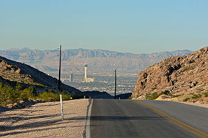
State Route 147 is a short distance state highway located southern Nevada
. It is signed as Lake Mead Boulevard and runs from Interstate 15 in North Las Vegas
east to the border of the Lake Mead National Recreation Area
.
Lake Mead Boulevard became a state highway in 1978, but the highway never had markers posted to identify it as a state highway.
 SR 147 first appears on the official Nevada state highway map in 1978-9 as a semi-circular route. The route was: Lake Mead Blvd. (which was previously unnumbered) eastward from North Las Vegas to North Shore Rd. in the Lake Mead National Recreation Area; south on North Shore Rd. (replacing SR 41A) to Lakeshore Rd.; then west on Lakeshore Rd. (later Lake Mead Dr., now Lake Mead Parkway), replacing part of SR 41. The terminus was at Lakeshore Rd. and Boulder Highway (then US 93/US 95, now SR 582
). The highway continued west of Boulder Highway as SR 146
.
The northern section along Lake Mead Blvd. lacks the SR 147 designator on the 1983-4 and 1985-6 maps. However, it is back on the 1987-88 map, so it is unclear whether this was a map error or possibly a planned decommissioning that wasn’t carried out.
On the 1998-9 map, the southern section of SR 147 (along Lake Mead Dr.) is replaced by an eastward extension of SR 146
(now SR 564
). The entire length of SR 147 is now on Lake Mead Blvd. with the eastern terminus truncated to the northern border of the Lake Mead National Recreation Area.
Route 210 functions on this road.
.
{|class=wikitable
!Location
!Mile
!Destination
!Notes
|-
|rowspan=3|North Las Vegas
|
|Lake Mead Boulevard
|Continuation beyond I-15
|-
|
| – Salt Lake City
, Los Angeles
|Interchange
|-
|
|Las Vegas Boulevard
(SR 604
)
|Former US 91
|-
|rowspan=2|Sunrise Manor
(unincorporated Las Vegas)
|
|Lamb Boulevard
|
|-
|
|Nellis Boulevard (SR 612
)
|
|-
|
|
|Lake Mead Boulevard
|Continuation beyond the Lake Mead NRA
northern boundary
Nevada
Nevada is a state in the western, mountain west, and southwestern regions of the United States. With an area of and a population of about 2.7 million, it is the 7th-largest and 35th-most populous state. Over two-thirds of Nevada's people live in the Las Vegas metropolitan area, which contains its...
. It is signed as Lake Mead Boulevard and runs from Interstate 15 in North Las Vegas
North Las Vegas, Nevada
North Las Vegas is a city in Clark County, Nevada, United States, located in the Las Vegas metropolitan area. The city was incorporated on May 16, 1946.-Geography:...
east to the border of the Lake Mead National Recreation Area
Lake Mead National Recreation Area
Lake Mead National Recreation Area is located in southern Nevada and northwestern Arizona. The centerpieces of the National Recreation Area are its two large reservoirs: Lake Mead and Lake Mohave. These lakes cater to boaters, swimmers, sunbathers, and fishermen while the surrounding desert rewards...
.
Lake Mead Boulevard became a state highway in 1978, but the highway never had markers posted to identify it as a state highway.
History

Nevada State Route 582
State Route 582 is a major highway in the Las Vegas valley. It connects Downtown Las Vegas with Henderson and Boulder City to the southeast. The highway is primarily known as Boulder Highway, but is named Fremont Street within the Las Vegas city limits. The highway is the former route of U.S....
). The highway continued west of Boulder Highway as SR 146
Nevada State Route 146
State Route 146 is a major east–west route in Southern Nevada. It begins at the Exit 27 interchange on Interstate 15 south of the Las Vegas Strip and ends at the Pecos Road interchange on Interstate 215 in Henderson...
.
The northern section along Lake Mead Blvd. lacks the SR 147 designator on the 1983-4 and 1985-6 maps. However, it is back on the 1987-88 map, so it is unclear whether this was a map error or possibly a planned decommissioning that wasn’t carried out.
On the 1998-9 map, the southern section of SR 147 (along Lake Mead Dr.) is replaced by an eastward extension of SR 146
Nevada State Route 146
State Route 146 is a major east–west route in Southern Nevada. It begins at the Exit 27 interchange on Interstate 15 south of the Las Vegas Strip and ends at the Pecos Road interchange on Interstate 215 in Henderson...
(now SR 564
Nevada State Route 564
State Route 564 is an east–west highway in Henderson, Nevada connecting the southern Las Vegas area to Lake Mead. The route is known as Lake Mead Parkway.-Route description:...
). The entire length of SR 147 is now on Lake Mead Blvd. with the eastern terminus truncated to the northern border of the Lake Mead National Recreation Area.
Public transport
Citizens Area TransitCurrent Citizens Area Transit Routes
Current RTC Transit routes in the Las Vegas metropolitan area.-101 - Rainbow Blvd.:Route 101 runs from Oquendo Rd. & Rainbow Blvd. in southwest Las Vegas, to Lone Mountain Rd. & Rainbow Blvd. in Northwest Las Vegas. In northwest Las Vegas, the 101 interlines with route 219 during certain daytime...
Route 210 functions on this road.
Major intersections
The entire route is in Clark CountyClark County, Nevada
-Demographics:As of the census of 2000, there were 1,375,765 people, 512,253 households, and 339,693 families residing within the MSA. The racial makeup of the MSA was 71.6% White , 9.1% Black, 5.7% Asian, 0.8% American Indian and 12.8% of other or mixed race. 22.0% were Hispanic of any race...
.
{|class=wikitable
!Location
!Mile
!Destination
!Notes
|-
|rowspan=3|North Las Vegas
North Las Vegas, Nevada
North Las Vegas is a city in Clark County, Nevada, United States, located in the Las Vegas metropolitan area. The city was incorporated on May 16, 1946.-Geography:...
|
|Lake Mead Boulevard
|Continuation beyond I-15
|-
|
| – Salt Lake City
Salt Lake City, Utah
Salt Lake City is the capital and the most populous city of the U.S. state of Utah. The name of the city is often shortened to Salt Lake or SLC. With a population of 186,440 as of the 2010 Census, the city lies in the Salt Lake City metropolitan area, which has a total population of 1,124,197...
, Los Angeles
Los Angeles, California
Los Angeles , with a population at the 2010 United States Census of 3,792,621, is the most populous city in California, USA and the second most populous in the United States, after New York City. It has an area of , and is located in Southern California...
|Interchange
|-
|
|Las Vegas Boulevard
Las Vegas Boulevard
State Route 604 is the route number designation for parts of Las Vegas Boulevard, a major north–south road in the Las Vegas metropolitan area of Nevada in the United States best known for the Las Vegas Strip and its casinos. Formerly carrying U.S...
(SR 604
Nevada State Route 604
Las Vegas Boulevard is a major road in Las Vegas Valley of Nevada, best known for the Las Vegas Strip and its casinos. Formerly carrying US 91, the main highway between Los Angeles and Salt Lake City, it has been bypassed by Interstate 15, and serves mainly local traffic with some sections...
)
|Former US 91
|-
|rowspan=2|Sunrise Manor
Sunrise Manor, Nevada
Sunrise Manor is an unincorporated town in Clark County, Nevada, United States, located on the western base of Frenchman Mountain, east of Las Vegas. The population was 189,372 at the 2010 census...
(unincorporated Las Vegas)
|
|Lamb Boulevard
|
|-
|
|Nellis Boulevard (SR 612
Nevada State Route 612
State Route 612 is a state highway in Clark County, Nevada. It comprises about miles of the major north–south section line arterial Nellis Boulevard in the eastern Las Vegas Valley.-Route description:...
)
|
|-
|
|
|Lake Mead Boulevard
|Continuation beyond the Lake Mead NRA
Lake Mead National Recreation Area
Lake Mead National Recreation Area is located in southern Nevada and northwestern Arizona. The centerpieces of the National Recreation Area are its two large reservoirs: Lake Mead and Lake Mohave. These lakes cater to boaters, swimmers, sunbathers, and fishermen while the surrounding desert rewards...
northern boundary

