

National Register of Historic Places listings in Nome Census Area, Alaska
Encyclopedia
This is intended to be a complete list of the properties and districts on the National Register of Historic Places
National Register of Historic Places
The National Register of Historic Places is the United States government's official list of districts, sites, buildings, structures, and objects deemed worthy of preservation...
in Nome Census Area
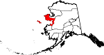
Nome Census Area, Alaska
Nome Census Area is a census area located in the state of Alaska, United States. As of the 2000 census, the population was 9,196. It is part of the unorganized borough and therefore has no borough seat. Its largest community by far is the city of Nome....
, Alaska
Alaska
Alaska is the largest state in the United States by area. It is situated in the northwest extremity of the North American continent, with Canada to the east, the Arctic Ocean to the north, and the Pacific Ocean to the west and south, with Russia further west across the Bering Strait...
, United States
United States
The United States of America is a federal constitutional republic comprising fifty states and a federal district...
. The locations of National Register properties and districts for which the latitude and longitude coordinates are included below, may be seen in a Google map.
There are 21 properties and districts listed on the National Register in the census area, including three National Historic Landmark
National Historic Landmark
A National Historic Landmark is a building, site, structure, object, or district, that is officially recognized by the United States government for its historical significance...
s.
| Landmark name | Image | Date listed | Location | Community | Summary | |
|---|---|---|---|---|---|---|
| 1 | Anvil Creek Gold Discovery Site | 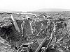 |
4.25 miles north of Nome on the Seward Peninsula Seward Peninsula The Seward Peninsula is a large peninsula on the western coast of the U.S. state of Alaska. It projects about into the Bering Sea between Norton Sound, the Bering Strait, the Chukchi Sea, and Kotzebue Sound, just below the Arctic Circle... at Anvil Creek |
Nome Nome, Alaska Nome is a city in the Nome Census Area in the Unorganized Borough of the U.S. state of Alaska, located on the southern Seward Peninsula coast on Norton Sound of the Bering Sea. According to the 2010 Census, the city population was 3,598. Nome was incorporated on April 9, 1901, and was once the... |
||
| 2 | Jacob Berger House | 1st Ave. 64°30′2"N 165°24′33"W |
Nome Nome, Alaska Nome is a city in the Nome Census Area in the Unorganized Borough of the U.S. state of Alaska, located on the southern Seward Peninsula coast on Norton Sound of the Bering Sea. According to the 2010 Census, the city population was 3,598. Nome was incorporated on April 9, 1901, and was once the... |
|||
| 3 | Bureau of Indian Affairs Unalakleet School | Unalakleet spit at the mouth of the Unalakleet River Unalakleet River The Unalakleet River in the U.S. state of Alaska flows from the Kaltag Mountains into Norton Sound, adjacent to the town of Unalakleet.... 63°52′17"N 160°47′4"W |
Unalakleet Unalakleet, Alaska Unalakleet is a city in Nome Census Area, Alaska, United States, in the western part of the state. At the 2000 census the population was 747. Unalakleet is known in the region and around Alaska for its salmon and king crab harvests; the residents rely heavily on caribou, ptarmigan, oogruk , and... |
|||
| 4 | Cape Nome Mining District Discovery Sites Cape Nome Mining District Discovery Sites Cape Nome Mining District Discovery Sites is a National Historic Landmark located in Nome, Alaska. It was named a National Historic Landmark in 1978. It is significant for its role in the history of gold mining in Alaska.... |
Address unknown 64°32′57"N 165°24′22"W |
Nome Nome, Alaska Nome is a city in the Nome Census Area in the Unorganized Borough of the U.S. state of Alaska, located on the southern Seward Peninsula coast on Norton Sound of the Bering Sea. According to the 2010 Census, the city population was 3,598. Nome was incorporated on April 9, 1901, and was once the... |
|||
| 5 | Cape Nome Roadhouse | East of Nome at mile 14 of the Nome-Council Highway 64°26′37"N 164°58′28"W |
Nome Nome, Alaska Nome is a city in the Nome Census Area in the Unorganized Borough of the U.S. state of Alaska, located on the southern Seward Peninsula coast on Norton Sound of the Bering Sea. According to the 2010 Census, the city population was 3,598. Nome was incorporated on April 9, 1901, and was once the... |
|||
| 6 | Council City and Solomon River Railroad | Mile 31 of the Nome-Council Highway 64°32′46"N 164°25′58"W |
Solomon | |||
| 7 | Discovery Saloon | 1st and D Sts. 65°23′55"N 165°24′18"W |
Nome Nome, Alaska Nome is a city in the Nome Census Area in the Unorganized Borough of the U.S. state of Alaska, located on the southern Seward Peninsula coast on Norton Sound of the Bering Sea. According to the 2010 Census, the city population was 3,598. Nome was incorporated on April 9, 1901, and was once the... |
|||
| 8 | Fairhaven Ditch | Address Restricted | Deering Deering, Alaska Deering is a city in the Northwest Arctic Borough in the U.S. state of Alaska. It is located on a sandy spit on the Seward Peninsula where the Inmachuk River flows into Kotzebue Sound, southwest of Kotzebue.... |
|||
| 9 | Fort St. Michael | At St. Michael Bay 63°28′41"N 162°2′12"W |
St. Michael St. Michael, Alaska St. Michael is a city in Nome Census Area, Alaska, United States. At the 2000 census the population was 368.-Geography:St. Michael is located at on the east side of St... |
|||
| 10 | Gambell Sites Gambell Sites The Gambell Sites are five archeological sites which established a chronology of over 2000 years of human habitation on St. Lawrence Island near Gambell, Alaska.... |
 |
Address Restricted | St. Lawrence Island St. Lawrence Island St. Lawrence Island is located west of mainland Alaska in the Bering Sea, just south of the Bering Strait, at about 63°30' North 173°20' West. The village of Gambell is located on the northwest cape, from the Chukchi Peninsula in the Russian Far East. The island is part of Alaska, but closer to... |
||
| 11 | Iyatayet Site Iyatayet Site Iyatayet Site is an archaeological site located on the northwest shore of Cape Denbigh on Norton Bay in Nome Census Area, Alaska. It shows evidence of several separate cultures, dating back as far as 6000 B.C. It was excavated starting in 1948 by J L Giddings.... |
 |
On the northwest shore of Cape Denbigh Cape Denbigh Cape Denbigh is part of the Seward Peninsula in Eastern Norton Sound in Alaska. It is notable for the Iyatayet Site, an Archaic Stage hunter gather archaeological site.... on Norton Bay |
Cape Denbigh Peninsula Cape Denbigh Cape Denbigh is part of the Seward Peninsula in Eastern Norton Sound in Alaska. It is notable for the Iyatayet Site, an Archaic Stage hunter gather archaeological site.... |
||
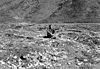
| 12 | Erik Lindblom Placer Claim | North of Nome 64°35′10"N 165°25′49"W |
Nome Nome, Alaska Nome is a city in the Nome Census Area in the Unorganized Borough of the U.S. state of Alaska, located on the southern Seward Peninsula coast on Norton Sound of the Bering Sea. According to the 2010 Census, the city population was 3,598. Nome was incorporated on April 9, 1901, and was once the... |
|||
| 13 | Norge Storage Site | Grantley Harbor | Teller Teller, Alaska Teller is a city in Nome Census Area, Alaska, United States. At the 2000 census the population was 268. According to a 2009 estimate, the population had increased by exactly one person.... |
|||
| 14 | Old St. Joseph's Catholic Church | Bering and Seppala Sts. 64°30′2"N 135°24′18"W |
Nome Nome, Alaska Nome is a city in the Nome Census Area in the Unorganized Borough of the U.S. state of Alaska, located on the southern Seward Peninsula coast on Norton Sound of the Bering Sea. According to the 2010 Census, the city population was 3,598. Nome was incorporated on April 9, 1901, and was once the... |
|||
| 15 | Pilgrim Hot Springs | East of Teller on Kugarock Rd. 65°5′22"N 164°55′16"W |
Teller Teller, Alaska Teller is a city in Nome Census Area, Alaska, United States. At the 2000 census the population was 268. According to a 2009 estimate, the population had increased by exactly one person.... |
|||
| 16 | St. Michael Redoubt Site | Address Restricted | St. Michael St. Michael, Alaska St. Michael is a city in Nome Census Area, Alaska, United States. At the 2000 census the population was 368.-Geography:St. Michael is located at on the east side of St... |
|||
| 17 | Snow Creek Placer Claim No. 1 | North of Nome at Snow Gulch 64°35′50"N 165°24′11"W |
Nome Nome, Alaska Nome is a city in the Nome Census Area in the Unorganized Borough of the U.S. state of Alaska, located on the southern Seward Peninsula coast on Norton Sound of the Bering Sea. According to the 2010 Census, the city population was 3,598. Nome was incorporated on April 9, 1901, and was once the... |
|||
| 18 | Solomon Roadhouse | Nome-Council Highway 64°33′34"N 164°26′22"W |
Solomon | |||
| 19 | Swanberg Dredge | Mile 1 of the Nome-Council Highway 64°29′32"N 165°21′37"W |
Nome Nome, Alaska Nome is a city in the Nome Census Area in the Unorganized Borough of the U.S. state of Alaska, located on the southern Seward Peninsula coast on Norton Sound of the Bering Sea. According to the 2010 Census, the city population was 3,598. Nome was incorporated on April 9, 1901, and was once the... |
|||
| 20 | Teller Mission Orphanage | Junction of Shelman Creek Rd. and Mission St. 65°20′0"N 166°28′59"W |
Brevig Mission Brevig Mission, Alaska Brevig Mission is a city in Nome Census Area, Alaska. The population was 276 at the 2000 census.-Geography:Brevig Mission is located at .... |
|||
| 21 | Wales Site Wales Site The Wales Site is a well-documented archeological site on the Cape Prince of Wales, near Wales, Alaska. It is a pre contact site for the indigenous population which can help illuminate non-industrial whaling practices from the 9th century through the early 19th century.... s |
 |
Address Restricted | Wales Wales, Alaska Wales is a town in the Nome Census Area, Alaska, United States. At the 2000 census the population was 152. It is the westernmost town on the American mainland.-Geography:... |
See also
- List of National Historic Landmarks in Alaska
- National Register of Historic Places listings in Alaska